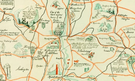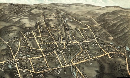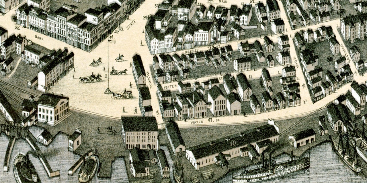
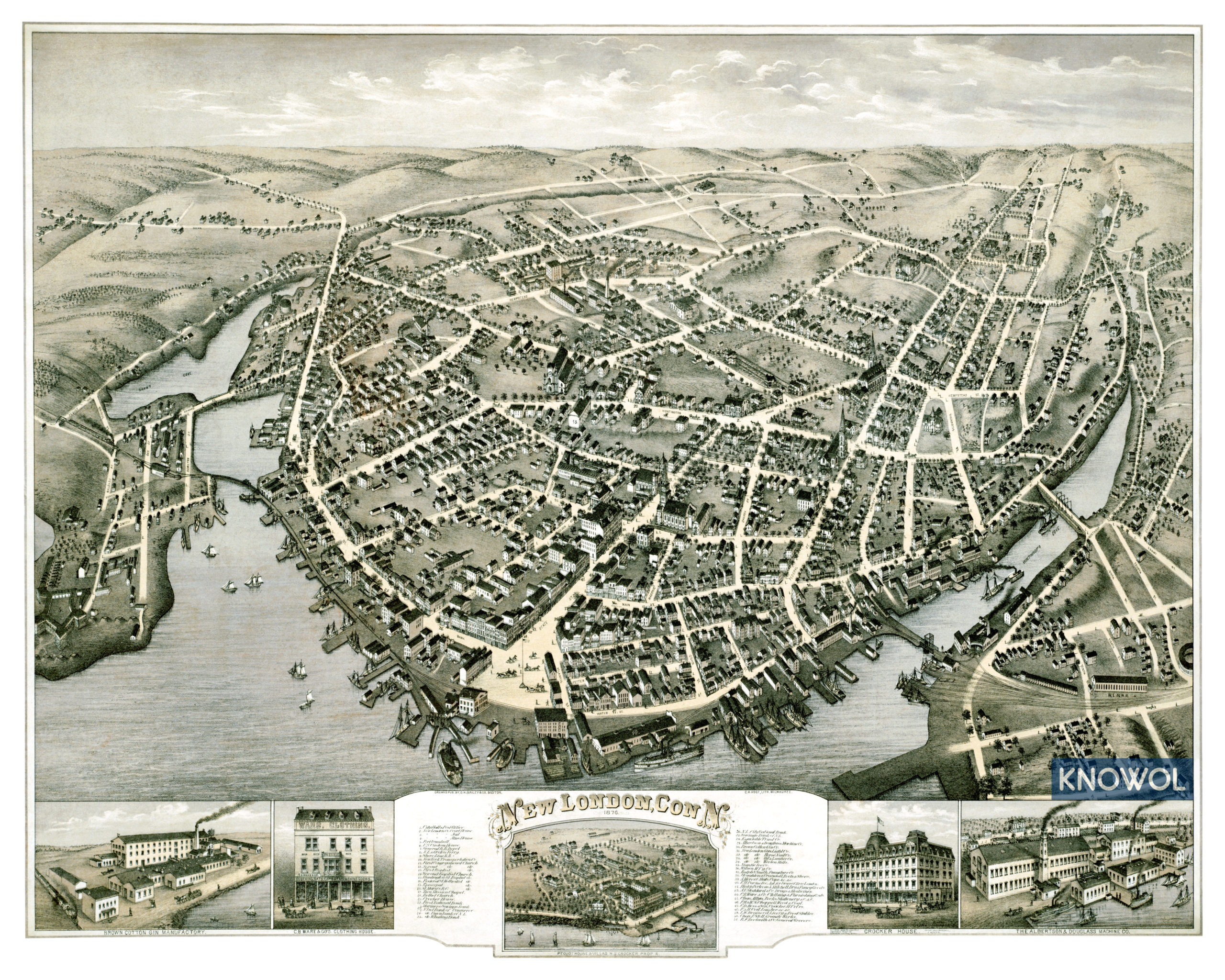
This vintage map of New London, Connecticut was created in 1876 by O.H. Bailey, a prominent 19th century map publisher. The map shows a bird’s eye view of New London as it once was, including street names and old landmarks.
Historic New London landmarks on the map include Fort Trumbull, New London & Groton Ferry, Shore Line Railroad, Crocker House, National Whaling Bank, Brown Cotton Gin Company, Niantic Ice Co., Wilson Manufacturing, The Albertson & Douglass Machine Company, City Hall, Public Library, and more.
This historic map of New London was restored by KNOWOL. Reproductions of the restored map are available here.
Vintage Map of New London, CT 1876
This beautifully restored map of New London will make an attractive addition to your office, library, or den and can even be used to teach children the geography and history of the area. When you’re done exploring, click here to get your copy of the restored map.