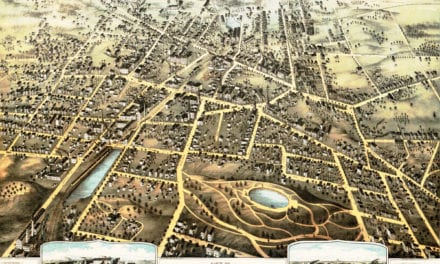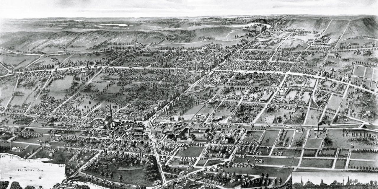
This map of Wallingford, Connecticut was created in 1905 by Hughes & Bailey, a prominent publishing duo from the early 20th century. The map shows a detailed bird’s eye view of Wallingford including street names and landmarks.
Wallingford landmarks on the map include Community Lake, Wallingford Public Library, International Silver, Masonic Home, First National Bank, Hotel Wallingford, Pryor Building, Scranton Carriages & Wagons and more.
This historic map of Wallingford has been restored by KNOWOL. Reproductions of the map are available here.
Bird’s Eye View of Wallingford, Connecticut in 1905
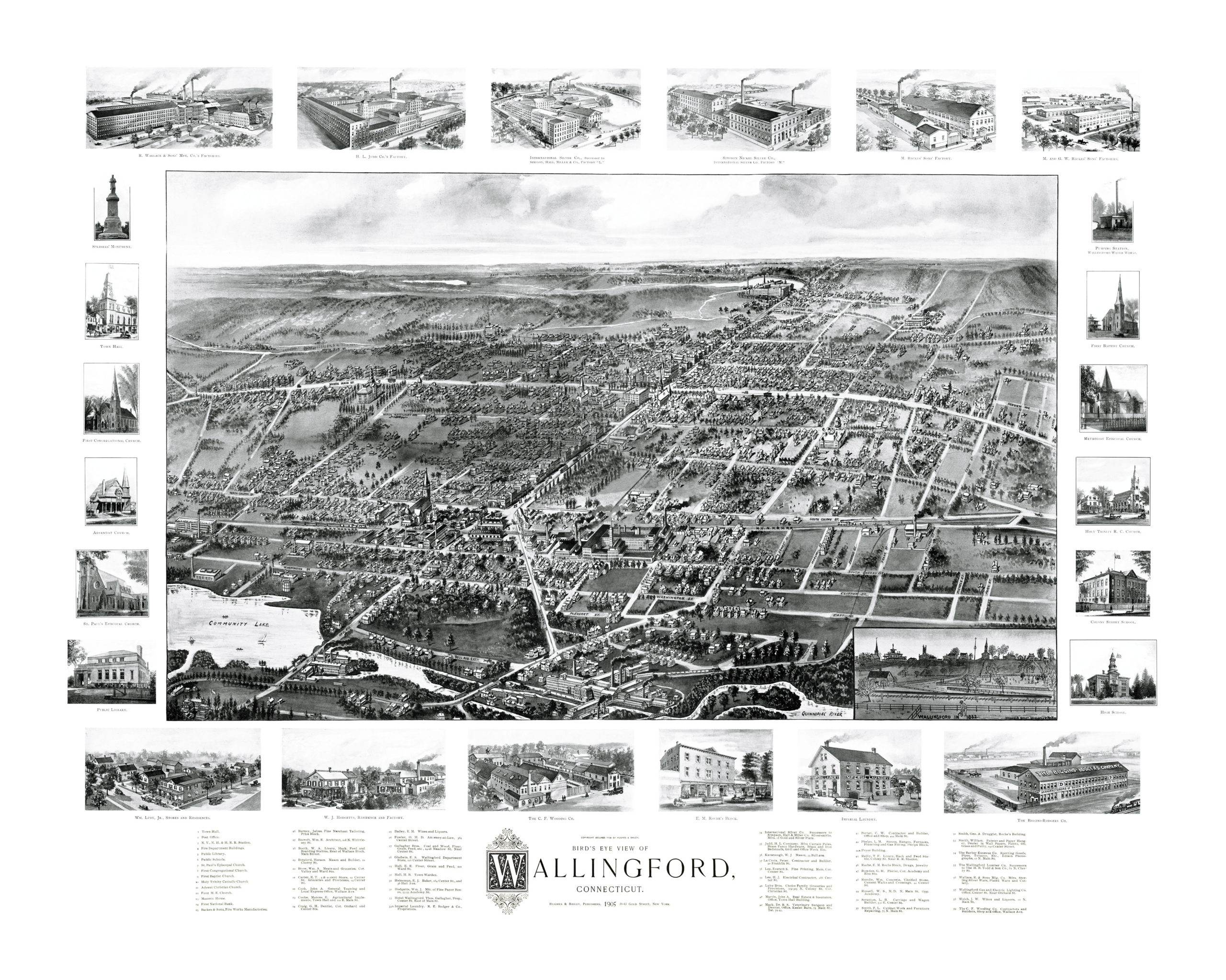
This map of Wallingford will make an attractive addition to your office, library, or den, and can even be used to teach children the geography and history of the area. When you’re done exploring, click here to get your copy.