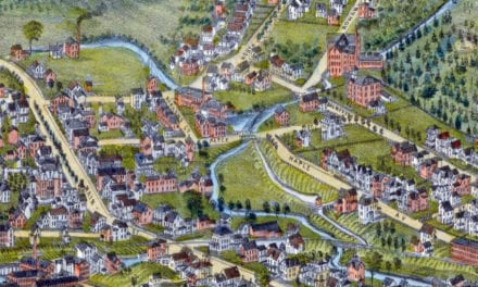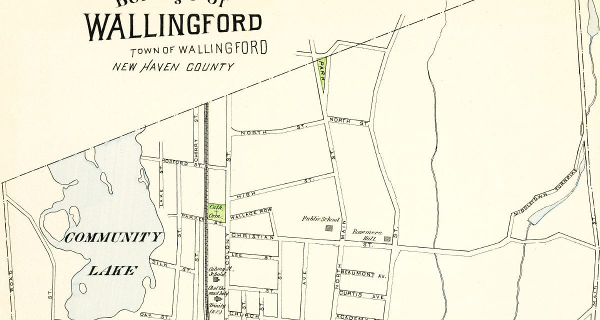
This old map of Wallingford, CT is a hand colored lithograph from 1893. The map was created by D.H. Hurd & Company and printed in Boston, Massachusetts as part of an atlas book depicting each town in the state.
The mapmaker used government surveys, county records and in person visits to create this detailed depiction of what Wallingford, Connecticut looked like in the 19th century.
The map shows many Wallingford landmarks that remain today including Community Lake, Wallingford Cemetary and the Wallingford train station. Many of the streets remain, and Choate Rosemary Hall can be seen listed as “Rosemere Hall”. Reproductions of the map are available here.
Click here to see the full map.
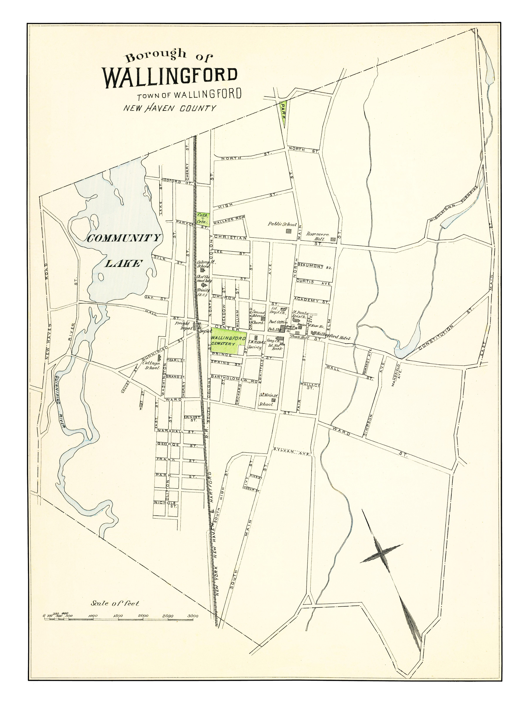
This old map of Wallingford will make an attractive addition to your office, library, or den, and can even be used to teach children the geography and history of their city. When you’re done exploring, click here to buy a copy of the map!