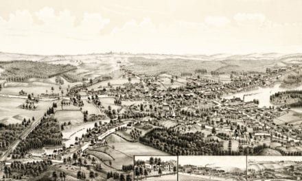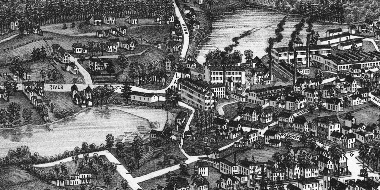
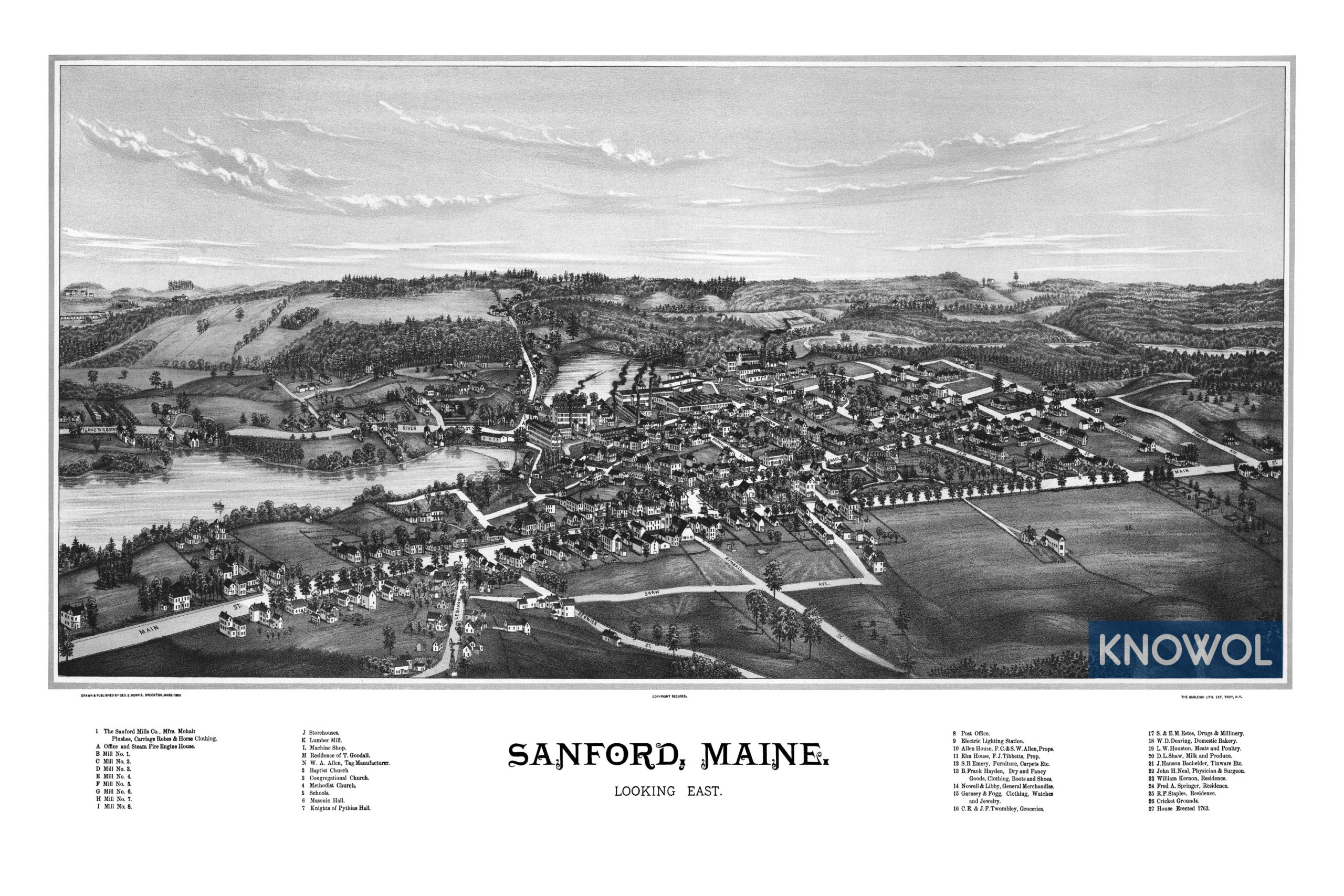
This historic map of Sanford, Maine was created in 1889 by George E. Norris, a prominent 19th century map maker. The map shows a bird’s eye view of the area as it used to be, including street names and old landmarks.
Landmarks on the map include The Sanford Mills Company, Sanford Fire House, Sanford Machine Shop, Sanford Lumber Mill, Masonic Hall, Knights of Pythias Hall, Nowell & Libby General Merchandise, Electric Lighting Station, Twombley Groceries, Estes Drugs & Millinery, Dearing Domestic Bakery, Houston Meats and Poultry, Cricket Grounds, and more.
This historic map of Sanford has been restored by KNOWOL. Reproductions of the restored map are available here.
Historic Old Map of Sanford, Maine from 1889
This vintage map of Sanford makes an attractive addition to your office, library, or den, and can even be used to teach children the geography and history of the area. When you’re done exploring, click here to get your copy of the restored map.