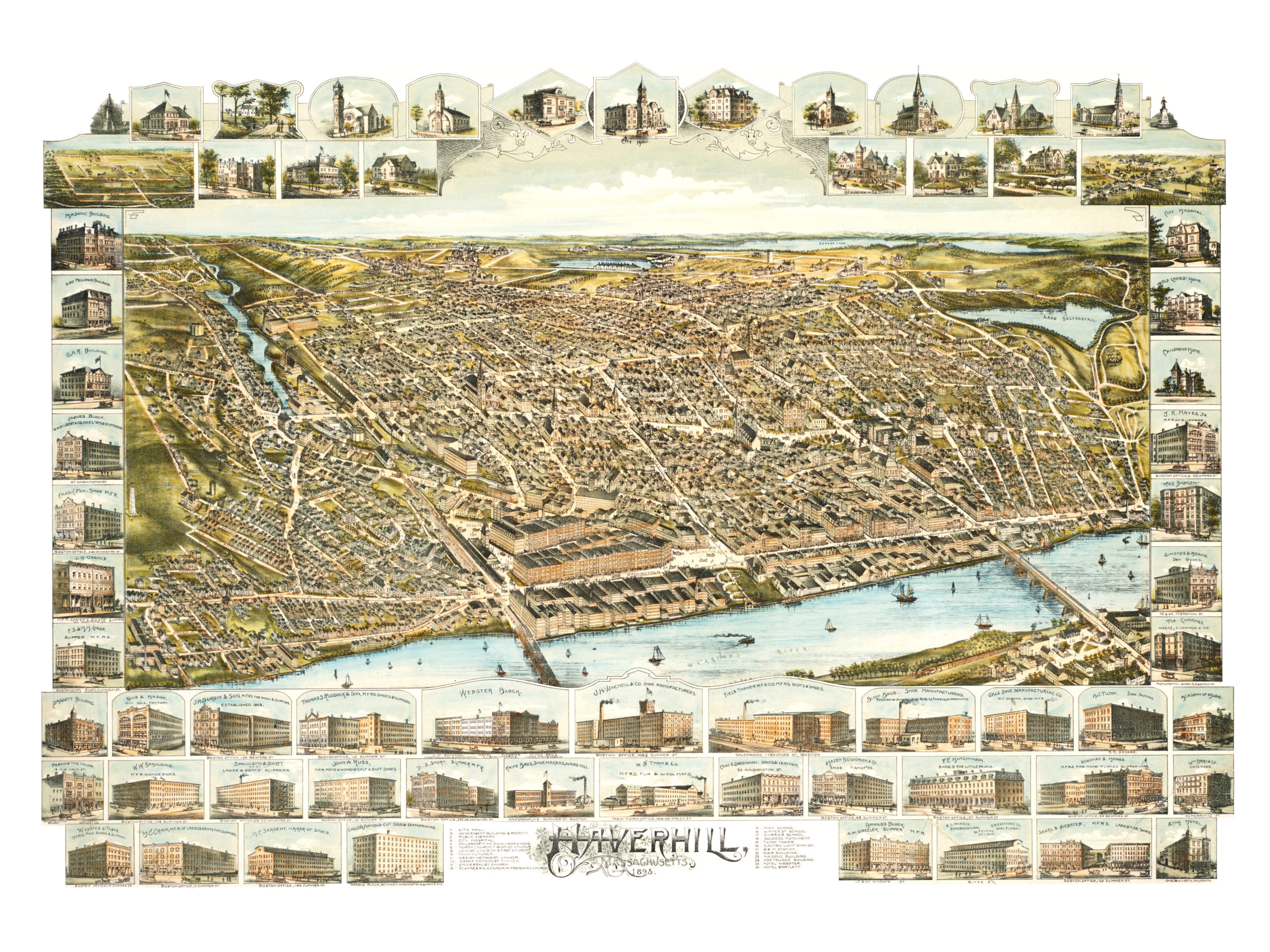
This map of Haverhill, Massachusetts was created in 1893 and provides a colorful bird’s eye view of the city. The map primarily focuses on the waterfront and the city’s business district. At the time only 30,000 people lived in Haverhill.
The map includes Haverhill landmarks including the Masonic Building, W.W. Spaulding Shoe Manufacturers, City Hall, City Hospital, Trinity Church, and Haverhill High School. The map was created by O.H. Bailey & Co. and restored by KNOWOL. Reproductions are available here.
Click here to see a high resolution scan of the map.