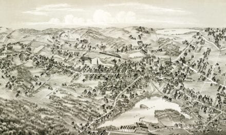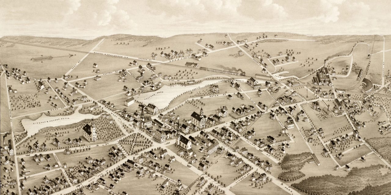
This old map of Mansfield, Massachusetts was created in 1879 by O.H. Bailey and J.C. Hazen, two of the most prolific map publishers of the 19th century. At the time this map was created, only 2,700 people lived in Mansfield.
The map shows a bird’s eye view of Mansfield, Mass as it looked at the end of the 19th century. Old landmarks on the map include The Mansfield Iron Foundry, Mansfield Spindle Works, Kingman & Hodges Imitation Rubber Goods and Gold Plated Jewelry, Hodges Baskets, and Mansfield Hotel.
This historic map of Mansfield was restored by KNOWOL. Reproductions of the restored map are available here.
Click here to see Mansfield, Massachusetts in 1879.
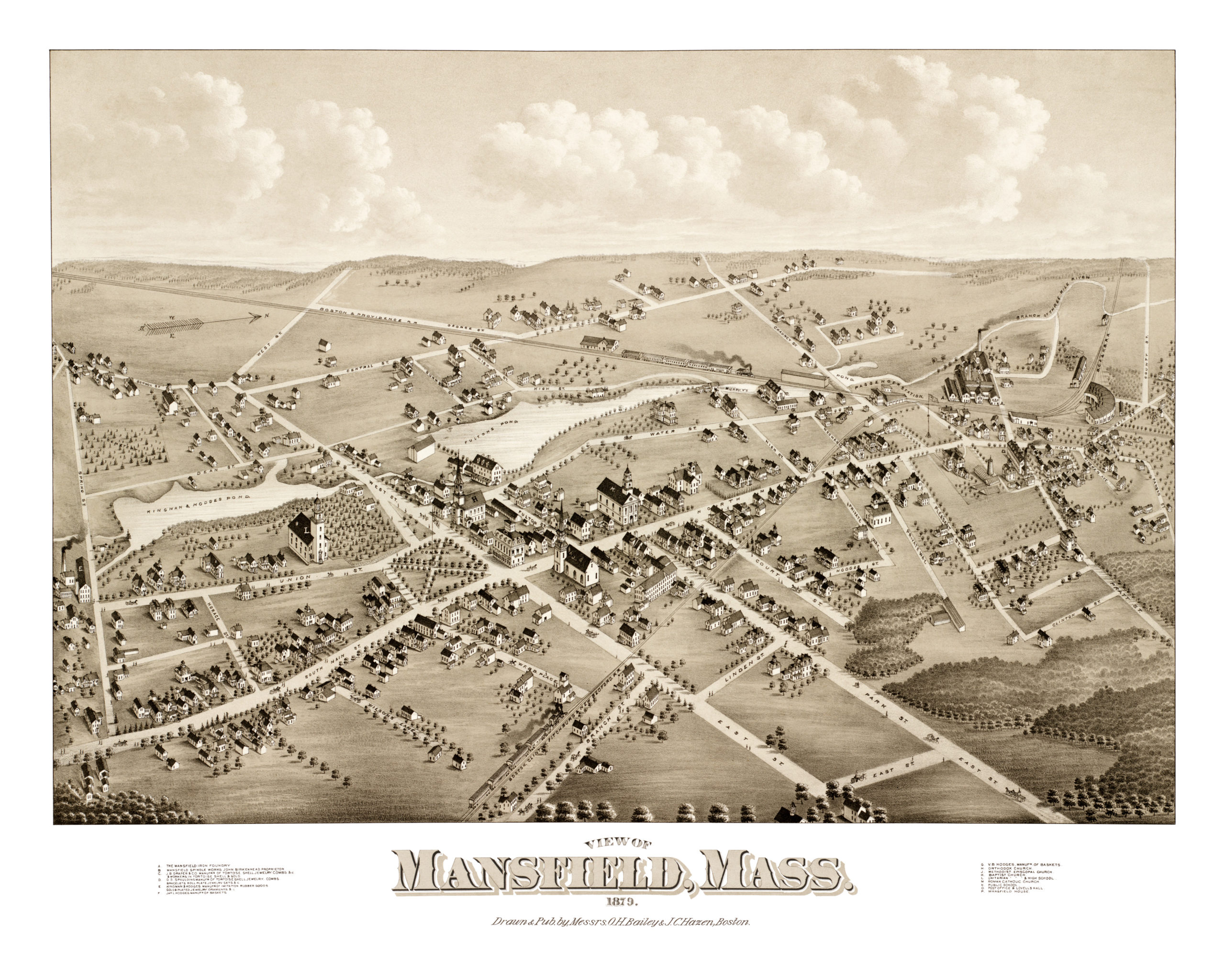
This old map of Mansfield has been lovingly restored by the team at KNOWOL. Reproductions of the restored map are available on museum quality, archival paper to ensure that this piece of Massachusetts history can be passed on to the next generation. Click here to get a copy of the map.