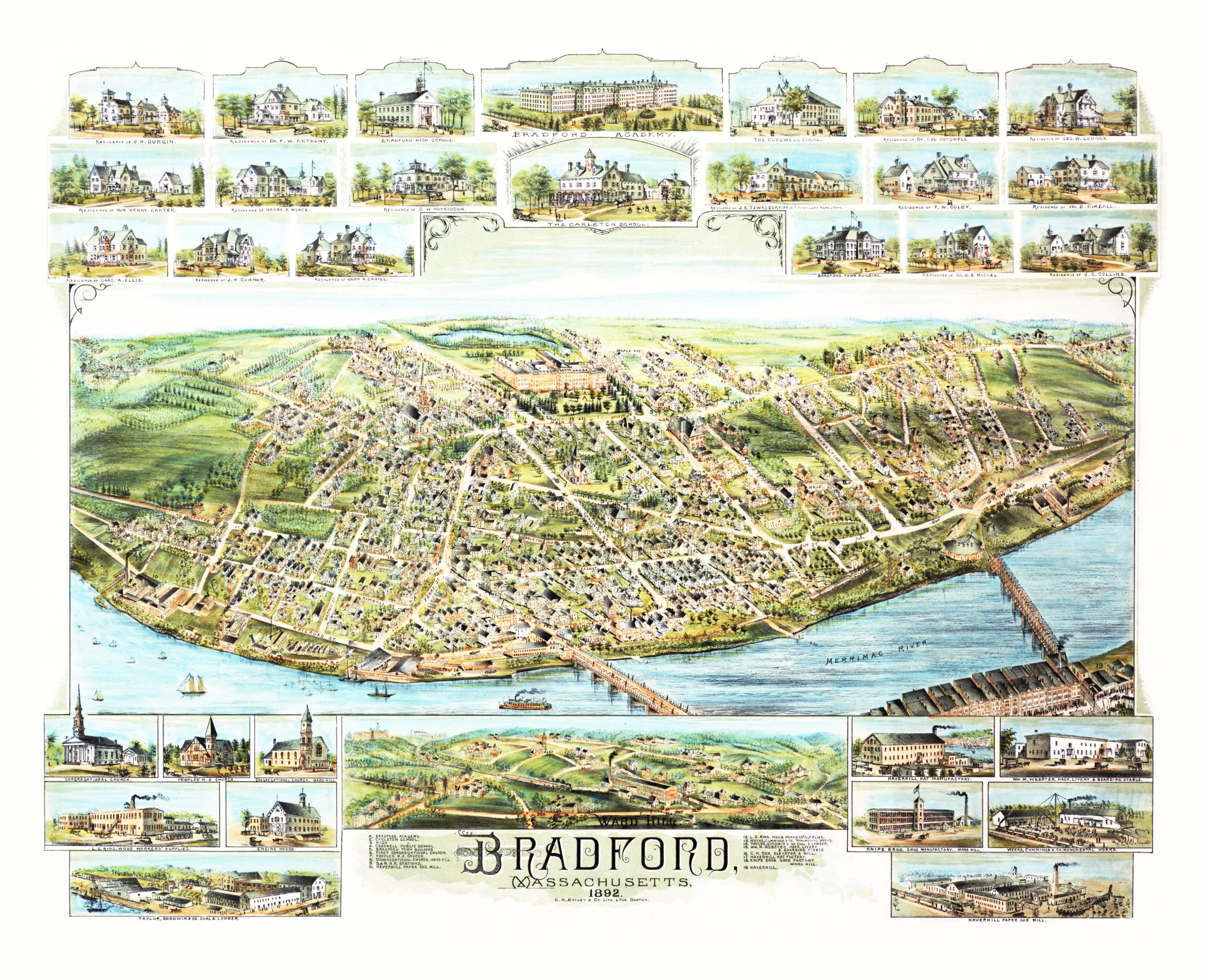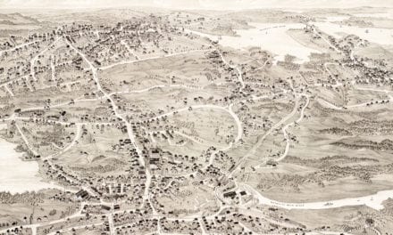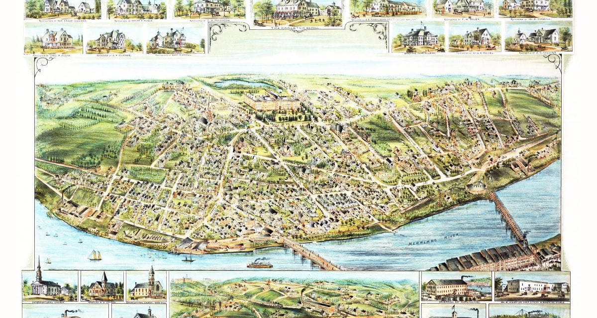
This map shows Bradford, Massachusetts as it looked in 1892. Bradford is a former town and current village in Essex County Massachusetts that was incorporated in 1672 and annexed to the city of Haverhill in 1897. At the time this map was created approximately 4,000 people lived in Bradford.
The map shows old Bradford landmarks such as Bradford Academy, Carleton School, Cogswell Public School, Bradford Town Hall, Haverhill Hat Factory and Knipe Brothers Shoe Factory. This colorful old map of Bradford was created by O.H. Bailey and Co. and restored by KNOWOL. Posters of this vintage map of Bradford are available here for only $20.
Click here to see a high resolution scan of the map.