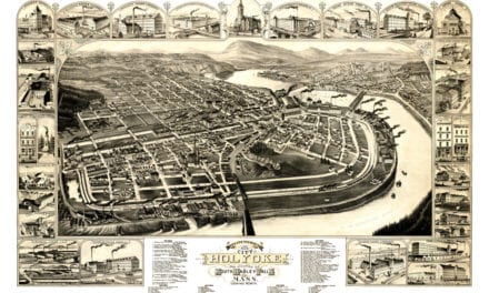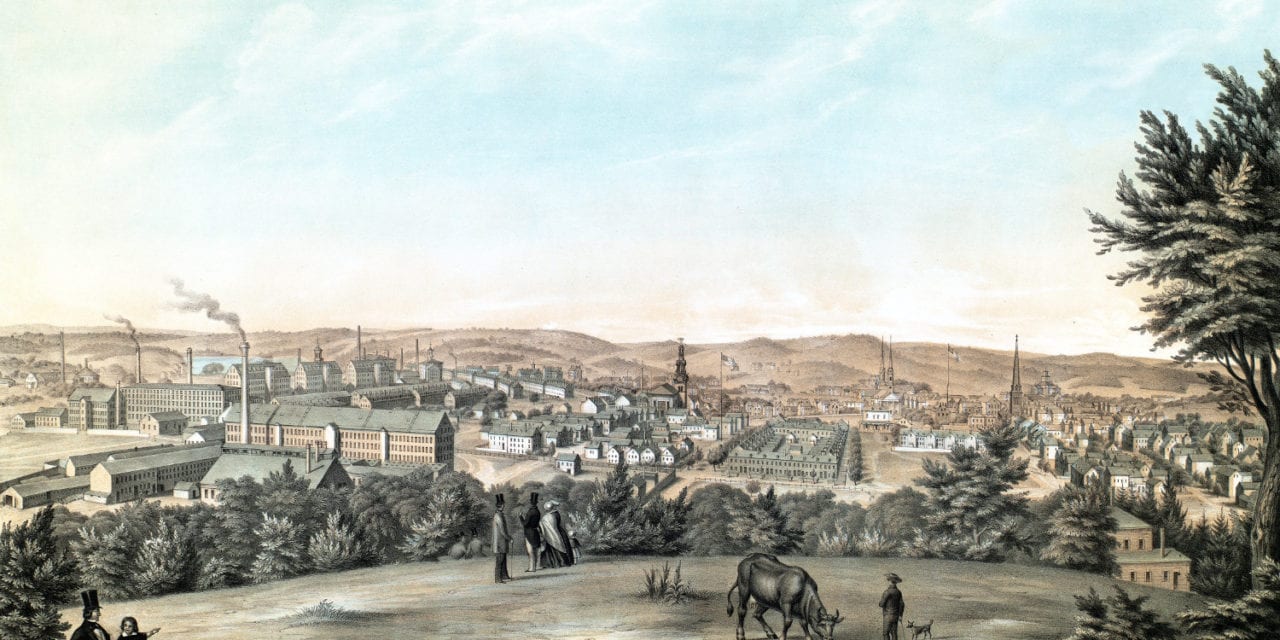
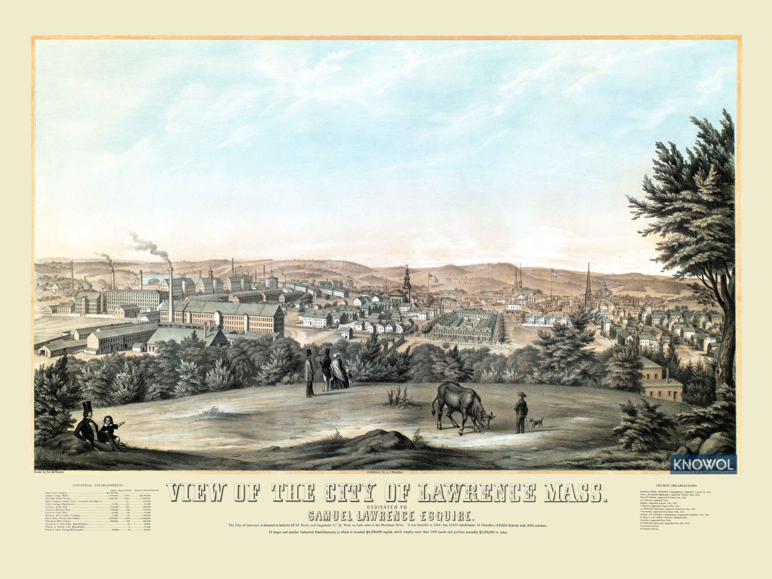
This view of Lawrence, Massachusetts was created in 1854 by Ed Hoffman, A.J. Wandra, and the S.W. Chandler & Bro. Litography Company of Boston. The image shows a bird’s eye view of Lawrence from Prospect Hill.
The print is titled “View of the City of Lawrence Mass. Dedicated to Samuel Lawrence Esquire. ” It includes a description of the city which reads as follows:
“The City of Lawrence is situated in latitude 42° 43′ North, and longitude 71 9 1/2 West, on both sides of the Merrimac River.
It was founded in 1845: has 15,000 inhabitants, 14 Churches, 14 Public Schools with 2000 scholars; 15 larger and smaller Industrial Establishments, in which is invested $6,500,000 capital, which employ more than 7000 hands and produce annually $7,500,000 in value.
A directory under the drawing lists 14 of Lawrence’s major companies at the time (including the Pemberton Mill), and 14 churches along with their date of organization.
This historic map of Lawrence has been restored by KNOWOL. Reproductions of the map are available here.
Click here to see Lawrence, Massachusetts in 1854
This map of Lawrence will make an attractive addition to your office, library, or den and can even be used to teach children the geography and history of the area. When you’re done exploring, click here to get your copy.