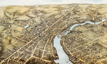
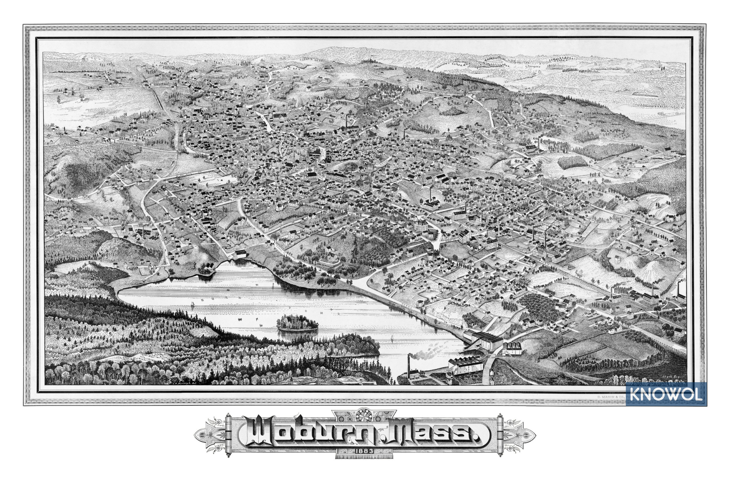
This historic map of Woburn, Massachusetts was created in 1883 by Lucien Burleigh, a prominent 19th century cartographer. The map shows a bird’s eye view of the city as it used to be, including street names and old landmarks.
Woburn was first settled in 1640 near Horn Pond, a primary source of the Mystic River. Woburn was incorporated in 1642 and included the present day towns of Burlington, Winchester, and parts of Stoneham and Wilmington. At the time this map was created approximately 10,000 people lived in the area.
This historic map of Woburn has been restored by KNOWOL. Reproductions of the restored map are available here.
Historic Old Map of Woburn, Massachusetts from 1883
This vintage map of Woburn makes an attractive addition to your office, library, or den, and can even be used to teach children the geography and history of the area. When you’re done exploring, click here to get your copy of the restored map.