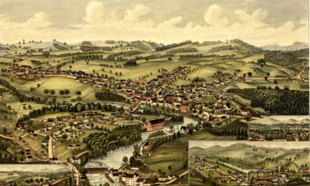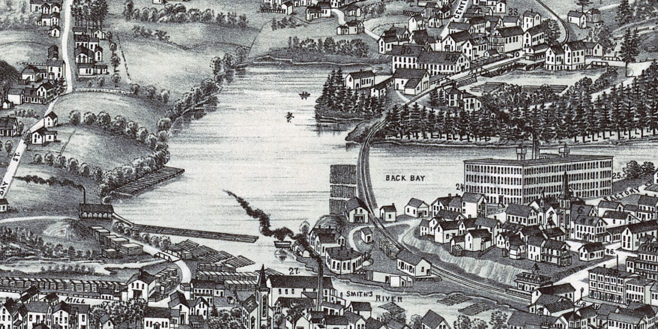
This historic map of Wolfeboro, New Hampshire was created in 1889 by George E. Norris, a 19th century map maker. The map shows a bird’s eye view of the area as it used to be, including street names and old landmarks.
Landmarks on the map include Brewster Free Academy, Granite State News, Wolfeborough Savings Bank, Pavilion Hotel, Bellvue Hotel, Welton’s Fruit, Confectionary, Tobacco & Cigars, Hicks Drug Store, Haley’s Market, Hodgkins Variety Store, and more.
This historic map of Wolfeborough has been restored by KNOWOL. Reproductions of the restored map are available here.
Historic Old Map of Wolfeborough, NH from 1889
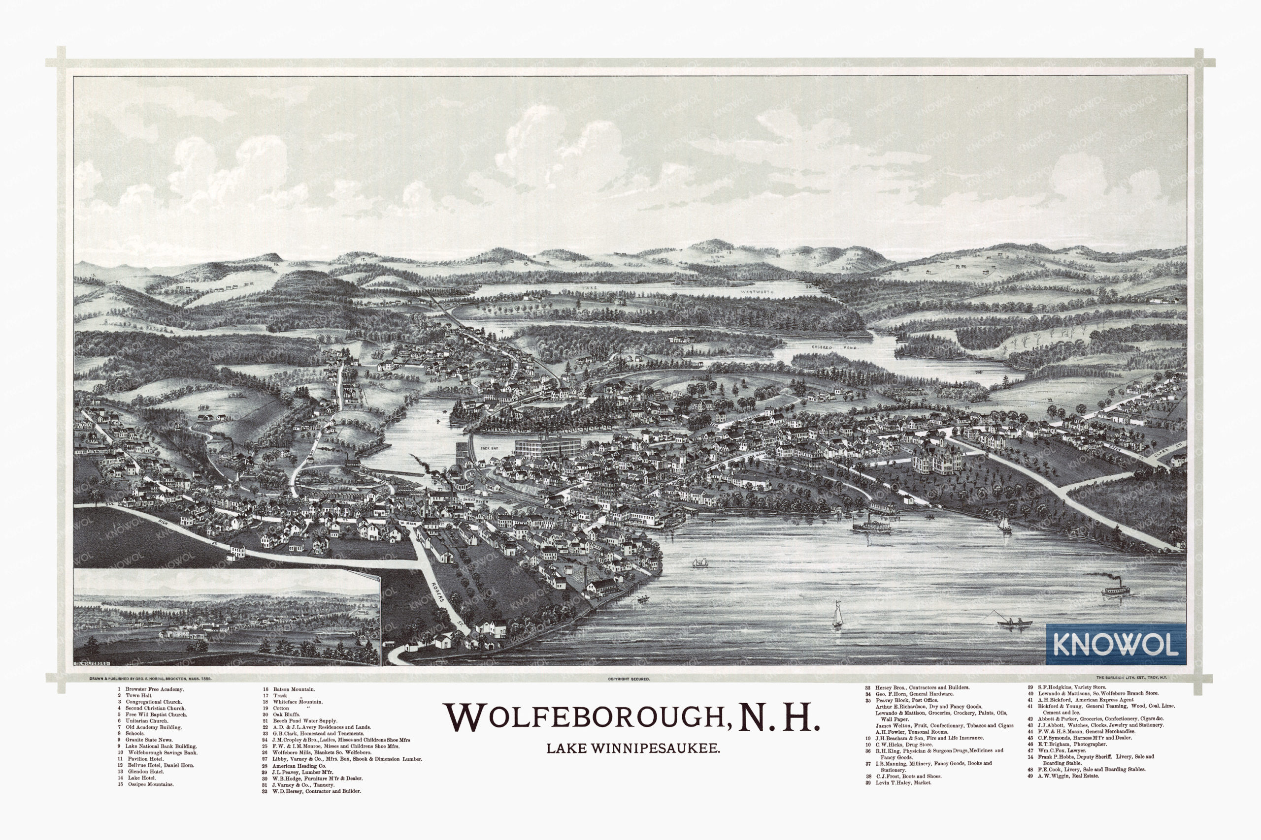
This vintage map of Wolfeborough makes an attractive addition to your office, library, or den, and can even be used to teach children the geography and history of the area. When you’re done exploring, click here to get your copy of the restored map.