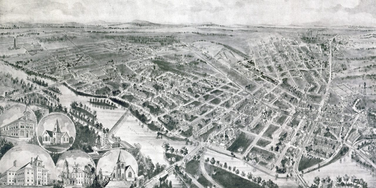
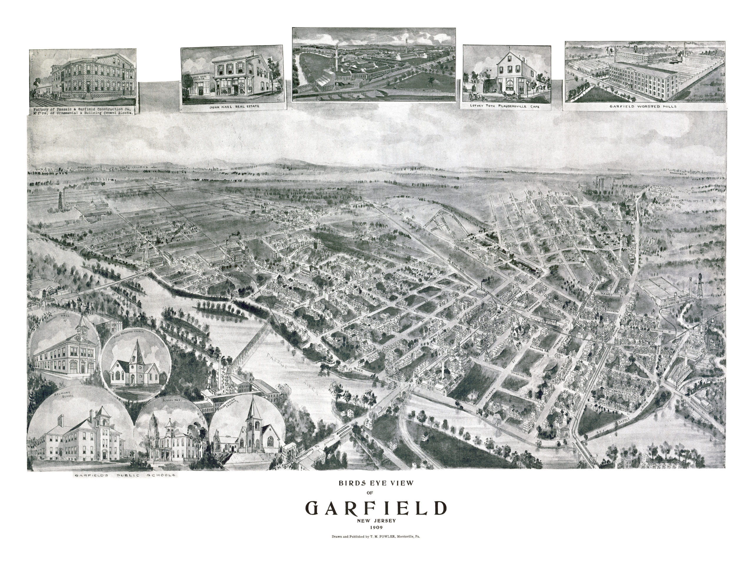
This old map of Garfield, New Jersey was published in 1909 by Thaddeus Mortimer Fowler. T.M. Fowler was one of the most prominent map publishers of the 19th century and spent a majority of his life traveling around the country creating panoramic maps of American towns.
The map shows a bird’s eye view of Garfield, NJ as it looked at the beginning of the 20th century. Landmarks on the map include Lotsey Toth Plaudersville Cafe, Garfield Public Schools, Passaic River, Saddle River, Garfield Worsted Mills, Passaic & Garfield Construction Company and more.
Click here to see Garfield, New Jersey in 1909.
Reproductions of the restored map are available here.
This old map of Garfield, NJ has been lovingly restored by the team at KNOWOL. Reproductions of the restored map are available on museum quality, archival paper to ensure that this piece of New Jersey history can be passed on to the next generation. Click here to get a copy of the map.