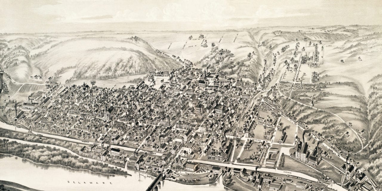
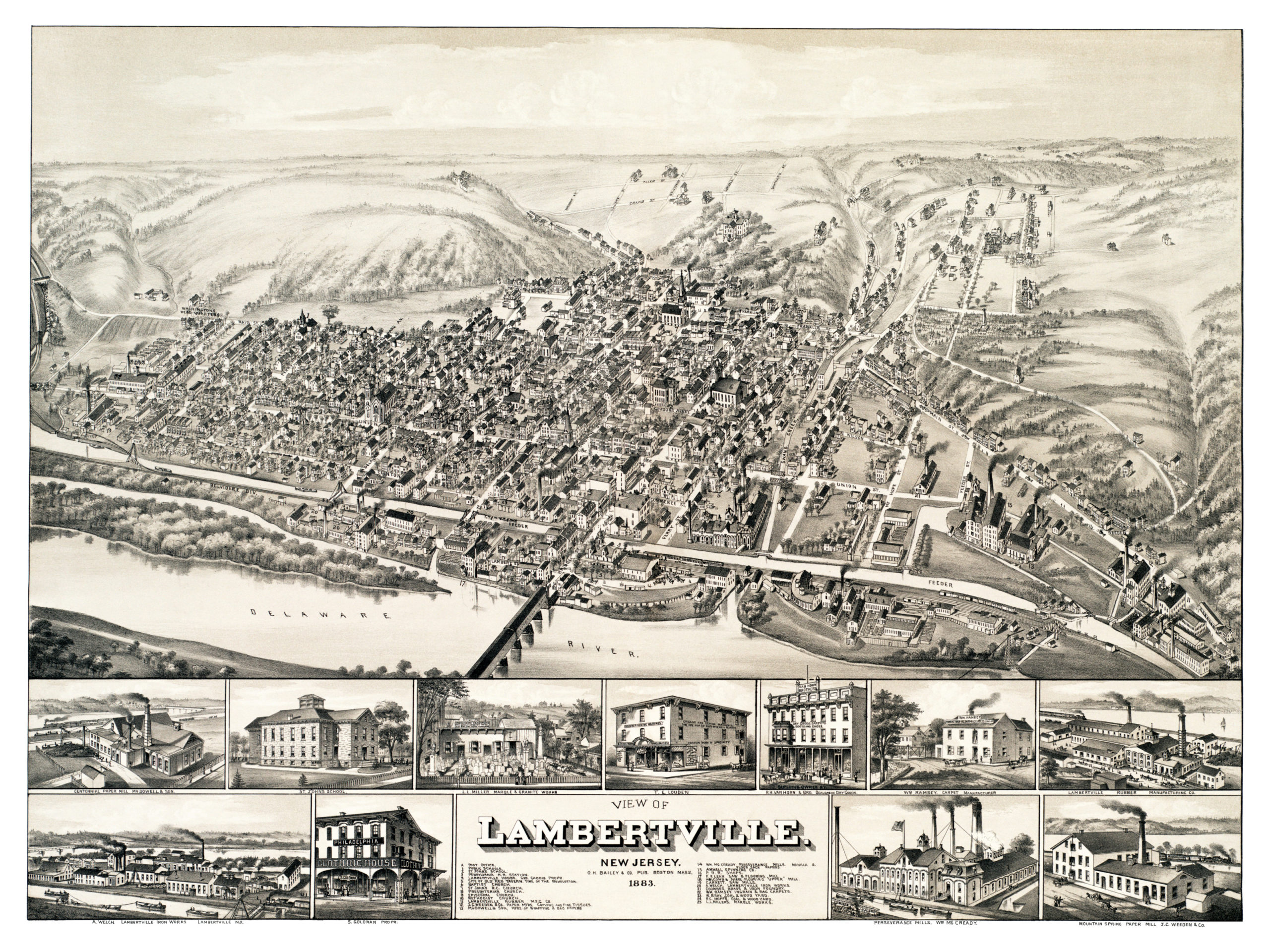
This old map of Lambertville, New Jersey was first published in 1883 by Oakley Hoops Bailey, one of the most prolific map publishers of the 19th century. O.H. Bailey spent a majority of his life traveling the country creating beautiful hand drawn maps of American towns.
This vintage map of Lambertville, NJ shows locations such as the old post office, the public schools, St. Johns school, Pennsylvania Railroad Station, Lambertville House, site of old Red Tavern at the time of the American Revolution, the Baptist Church, St. Johns school, the Presbyterian Church, Episcopal Church, Methodist Church, and a variety of manufacturing companies.
Click here to see Lambertville, New Jersey in 1883.
Reproductions of the restored map are available here.
This old map of Lambertville has been lovingly restored by the team at KNOWOL. Reproductions of the restored map are available on museum quality, archival paper to ensure that this piece of New Jersey history can be passed on to the next generation. Click here to get a copy of the map.