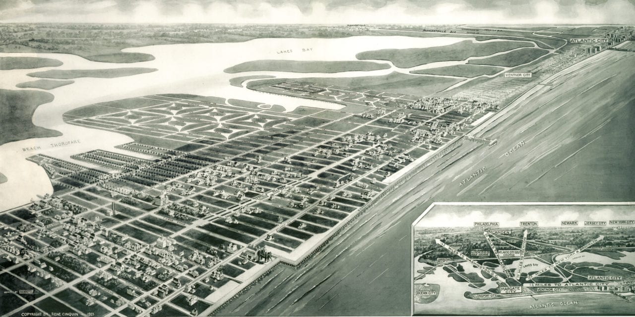
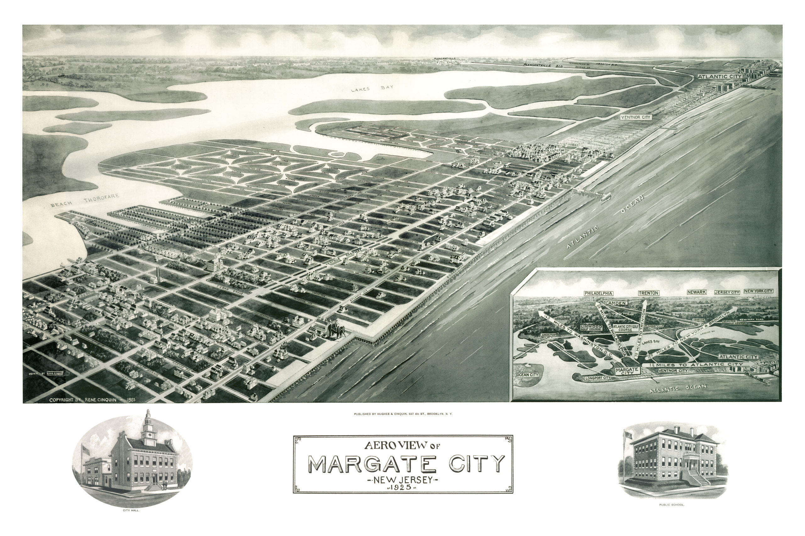
This map of Margate City, New Jersey was created in 1925 by Rene Cinquin, a prominent 20th century illustrator. The hand drawn map shows a bird’s eye view of Margate including street names and historic landmarks.
Landmarks on the map include the boardwalk, Lucy the Elephant, City Hall and the “Engler’s Pier”. The map also features a compass showing the distance from Margate to Philadelphia, Washington D.C., Trenton, Newark, Jersey City, New York, Brooklyn, and Atlantic City.
This historic map of Margate was restored by KNOWOL. Reproductions of the restored map are available here.
Bird’s Eye View of Margate, New Jersey in 1925
This old map of Margate, New Jersey will make an attractive addition to your office, library, or den, and can even be used to teach children the geography and history of their city. When you’re done exploring, click here to get your copy.