
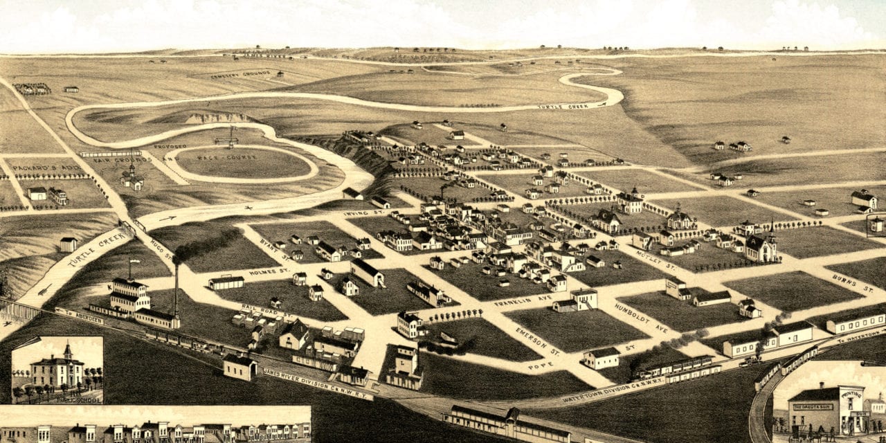
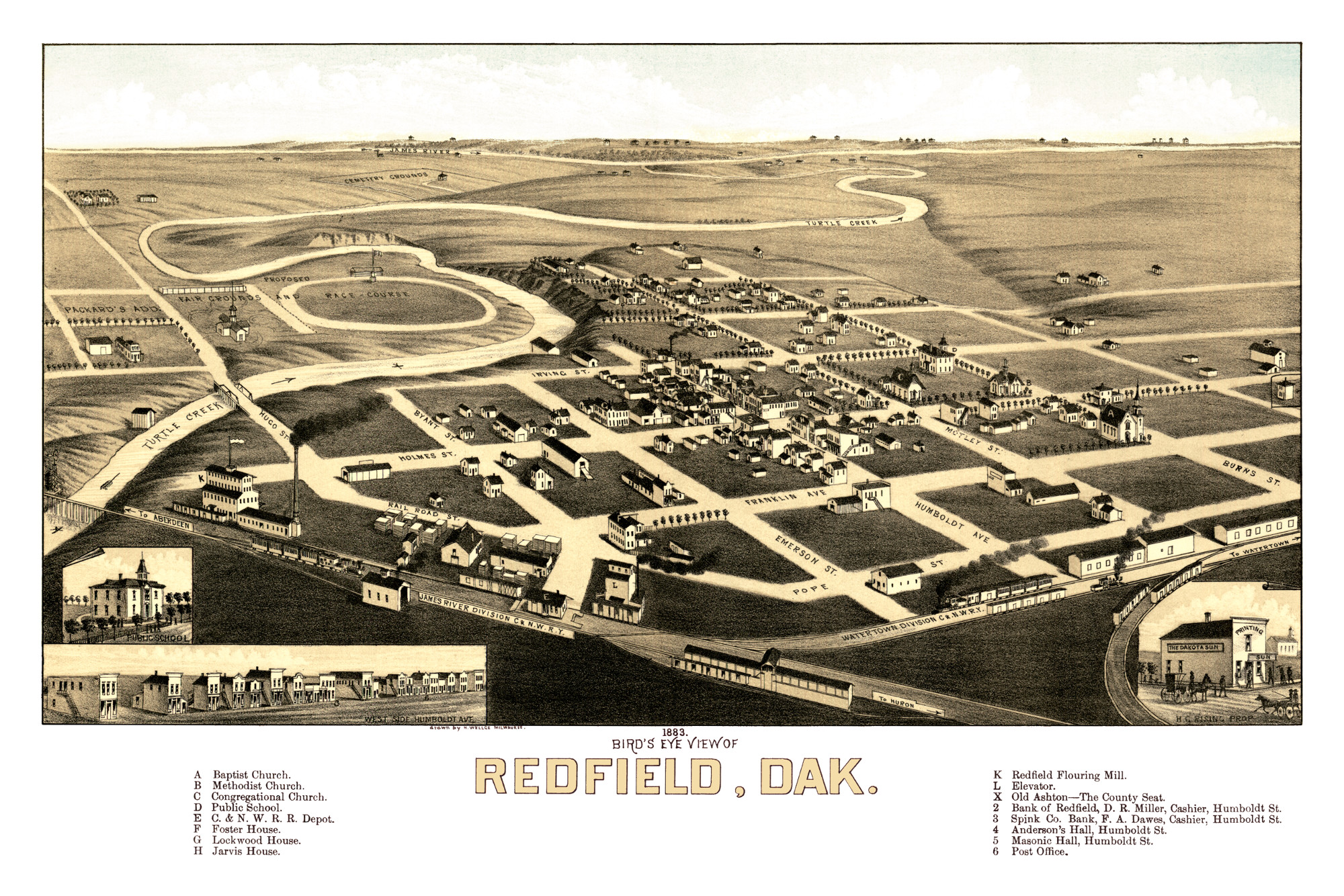
This old map of Redfield, South Dakota was first published in 1883 by Henry Wellge of Milwaukee, one of the most prolific map publishers of the 19th century. Wellge spent more than 30 years of his life traveling the United States and created 150+ panoramic maps of American towns.
The map shows a bird’s eye view of Redfield, SD as it looked toward the end of the 19th century. Landmarks on the map include Turtle Creek, James River, The Dakota Sun, Masonic Hall, Redfield Flouring Mill, Old Ashton, and a proposed fair grounds and race course.
Click here to see Redfield, South Dakota in 1883.
Reproductions of the restored map are available here.
This old map of Redfield has been lovingly restored by the team at KNOWOL. Reproductions of the restored map are available on museum quality, archival paper to ensure that this piece of South Dakota history can be passed on to the next generation. Click here to get a copy of the map.


