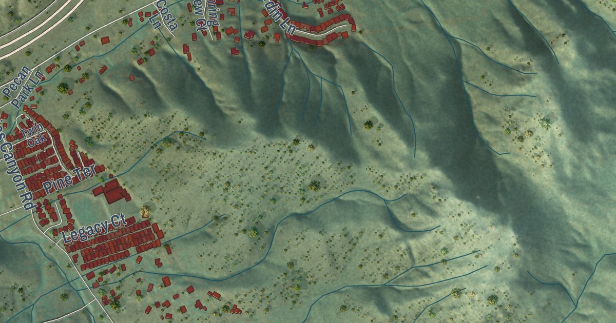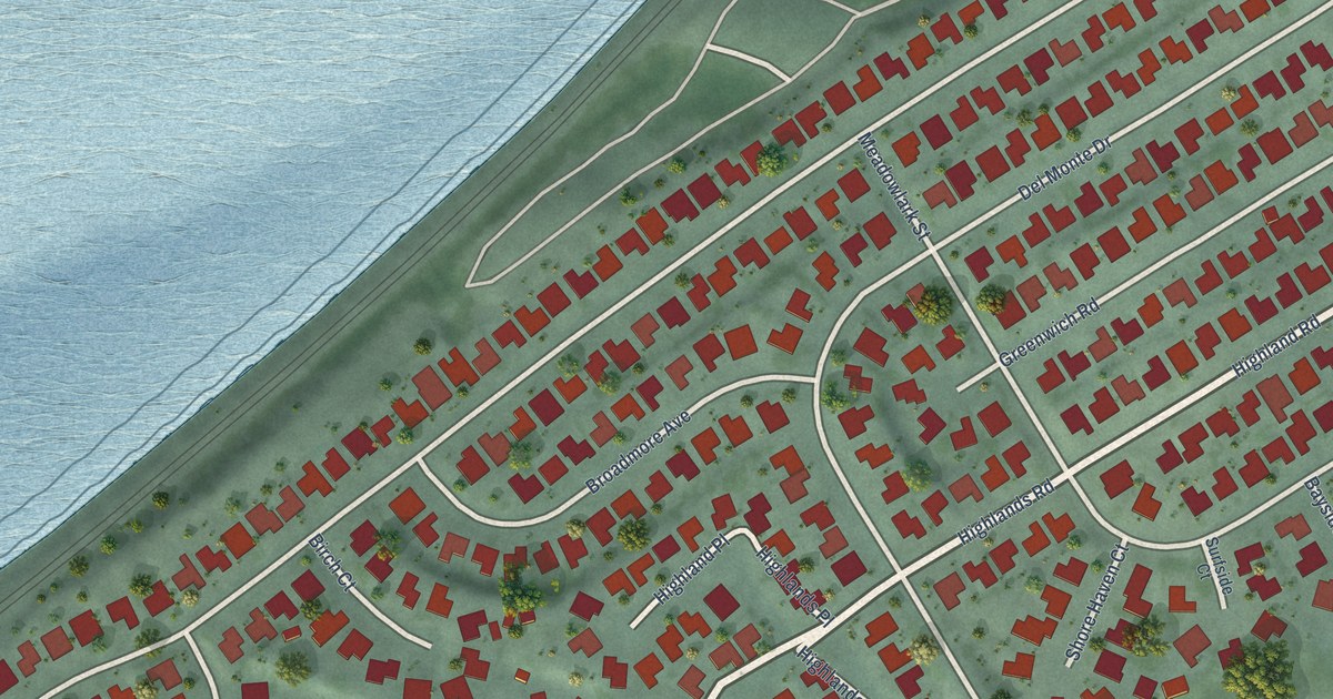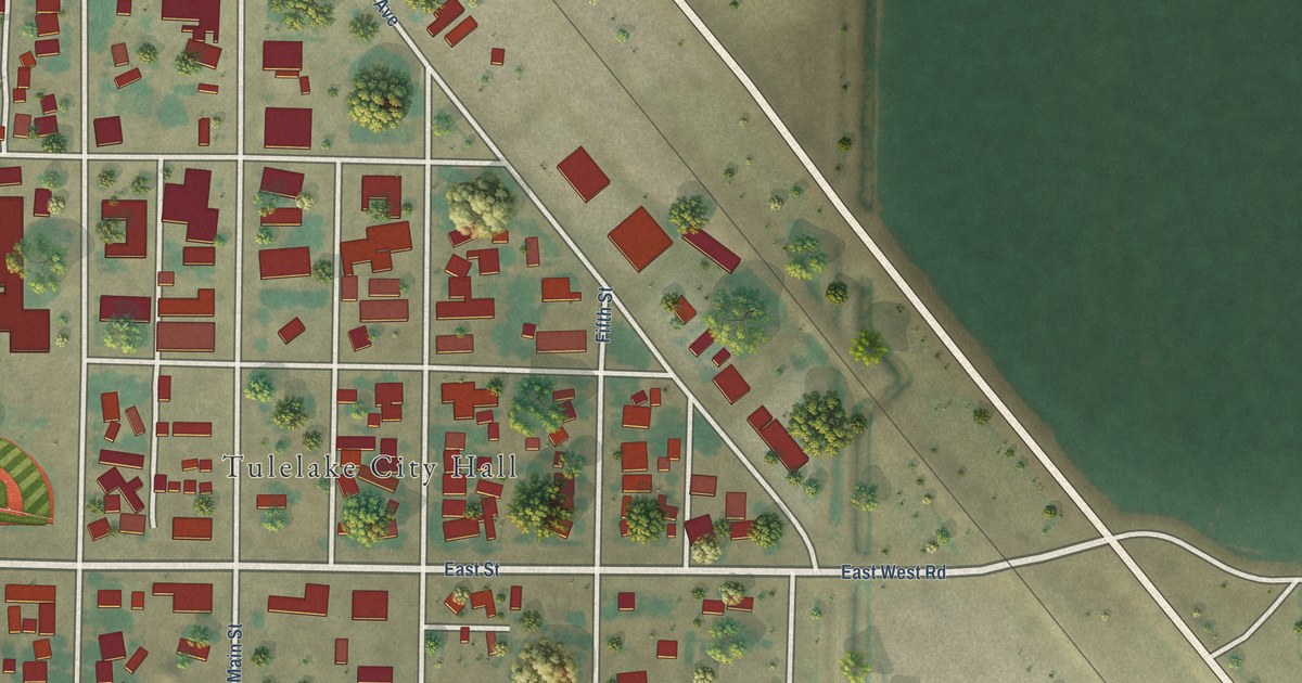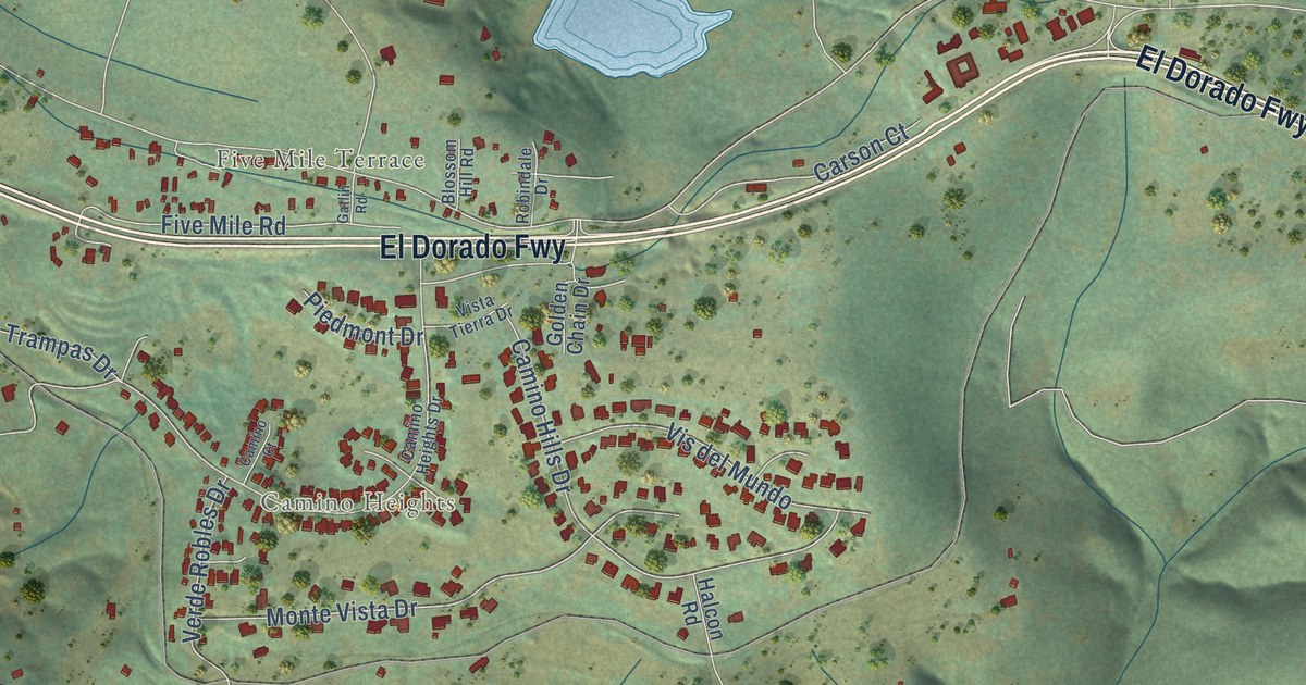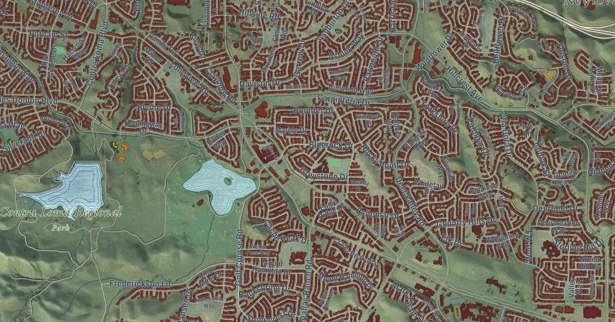
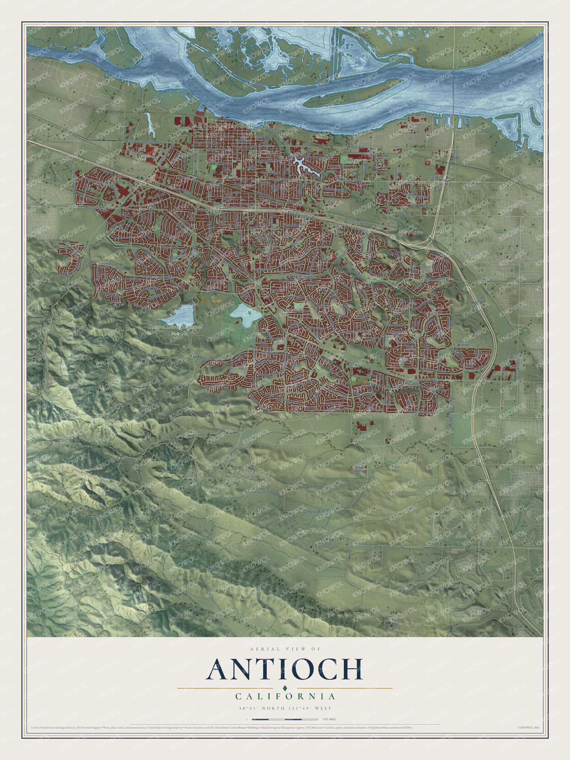
This beautifully detailed map of Antioch, California was created in 2026 using aerial imagery combined with modern topographical, census, street and landmark data. It’s a one-of-a-kind view of Antioch that combines accurate data with a vintage aesthetic. The map shows every building in its true location, many of the roads carry their names, and the shaded topographic relief shows the shape of the land.
Explore an aerial view of Antioch, California
On the map you’ll find Antioch City Hall, Bridgehead, West Hartley, Contra Loma Regional Park, Deer Valley, Neroly, and Newlove, along with Frederickson Lane, Bluerock Drive, Golf Course Road, East 18th Street, Yorkshire Drive, and more. If you look closely you can even find your house accurately drawn in its correct location. Zoom in on the preview to look for yours.
Did you know this piece of Antioch, California history?
From the California A Guide to the Golden State: "Antioch's first settlers were twin brothers, Joseph H. and W. W. Smith, both carpenters and ordained ministers, who arrived here from Boston with their families on the schooner Rialto in July 1849 and took up quarter-sections of land."
Take a closer look at the Antioch map
Street and place names on the Antioch, California map
These names are printed on the map of Antioch, California.
Places: Antioch City Hall, Bridgehead, West Hartley, Contra Loma Regional Park, Deer Valley, Neroly and Newlove.
Streets and roads: Frederickson Lane, Bluerock Drive, Golf Course Road, East 18th Street, Yorkshire Drive, Somersville Road, Horseshoe Circle, Lone Tree Way, James Donlon Boulevard, Putnam Street, Pittsburg-Antioch Highway, Braemar Street.
More street names, A to Z
Alcala Street, Almondridge Drive, Almond Street, Alpha Way, Arabian Way, Ashburton Drive, Ashley Way, Asilomar Drive, Aster Drive, Auburn Lane, Badger Pass Way, Banbury Way, Barmouth Drive, Bart Avenue, Baywood Circle, Belle Court, Belle Drive, Bellflower Drive, Belshaw Street, Benton Street, Biglow Drive, Bison Way, Blossom Drive, Bluebell Circle, Bluejay Drive, Blythe Drive, Boulder Drive, Brazil Drive, Bridgehead Road, Brookside Drive, Buchanan Road, Buckeye Way, Burwood Way, Cache Peak Drive, Caldera Way, Cambridge Drive, Camby Road, Canada Valley Road, Candlestick Drive, Carob Street, Carpinteria Drive, Cataline Avenue, Catanzaro Way, Cathy Court, Cavallo Road, Cherry Street, Claire Drive, Clayburn Road, Contra Loma Boulevard, Cordoba Way, Country Hills Drive, Covelite Way, Crater Peak Way, Crestview Drive, Crown Peak Way, Dallas Ranch Road, Danridge Court, Davison Drive, Deerfield Drive, Deer Hill Lane, Deermeadow Way, Deerspring Way, Deer Valley Road, Delta Fair Boulevard, Desrys Boulevard, Dimaggio Way, Donlan Boulevard, Doolittle Way, Drake Street, Drive in Way, Dunes Way, Eagle Ridge Drive, East 13th Street, East 16th Street, East 19th Street, East Lake Drive, East Madill Street, East Sixth Street, East Street, East Tregallas Road, Elizabeth Lane, Elk Drive, Elmo Road, El Rey Street, Empire Avenue, Empire Mine Road, Empire Road, Enea Way, Entrada Circle, Fairview Drive, Fallow Way, Faria Street, Feather Way, Filbert Street, Fire Lane, Fitzuren Road, Flintrock Drive, Folsom Drive, Forty Niner Way, Foxford Way, Freedom Way, Fulton Shipyard Road, Galenez Way, Galileo Drive, Gallagher Circle, Garrow Drive, Gary Avenue, Gatter Drive, Geneva Lane, Gentrytown Drive, Glade Court, Golden Bear Drive, Goode Street, Grass Valley Way, Green Hill Circle, Greystone Drive, Grimsby Drive, Hacienda Way, Half Dome Street, Hansen Drive, Harbour Drive, Hargrove Street, Harris Drive, Heidorn Ranch Road, Hemingway Drive, Hidden Glen Drive, Hillcrest Avenue, Hillcrest Crossroads, Hill Drive, Hillside Road, Holub Lane, Honeysuckle Circle, Horse Valley Road, Imperial Street, Indian Hill Drive, Ivy Lane, Jacobsen Street, Johnson Drive, Johns Way, Judsonville Drive, Kodiak Street, Kushner Way, Lair Way, Larch Way, Larkspur Drive, Laurel Road, Lawton Street, Le Conte Circle, Lefebvre Way, Leitrim Way, Leo Lane, Lindley Drive, Lipton Street, Longview Road, Lovebird Way, Lucena Way, Mahogany Way, Main Street, Mallard Way, Mammoth Way, Marble Drive, Marie Avenue, Markley Creek Drive, Mark Twain Drive, Meadow Lake Street, Mead Street, Merrill Drive, Mesa Ridge Drive, Metcalf Street, Milner Road, Minaker Drive, Minta Lane, Mission Drive, Mohican Way, Mojave Way, Mokelumne Drive, Montara Drive, Monterey Drive, Mountaire Drive, Mount Hamilton Drive, Navajo Way, Noia Avenue, North Lake Drive, Nortonville Way, Null Drive, Oak Haven Way, Oakley Road, Observation Way, Osprey Drive, Palisades Way, Palomar Drive, Palomino Way, Palo Verde Way, Park Lane, Paso Corto Road, Pinnacle View Way, Pintail Drive, Pioneer Way, Piper Way, Prairie Way, Prewett Ranch Drive, Prewett Ranch Road, Redwood Drive, Reimche Drive, Renwick Lane, Reseda Way, Ridgeline Drive, Ridgeview Drive, Rio Grande Drive, Robles Drive, Rockspring Drive, Rocky Point Drive, Roosevelt Lane, Rubye Drive, Sagebrush Drive, Sandy Way, Sanger Peak Way, San Jose Drive, Santa Fe Avenue, Sequoia Drive, Seville Circle, Shaddick Drive, Shady Lane, Shelbourne Way, Silverado Drive, Slatten Ranch Road, South Lake Drive, Southwood Way, Spaulding Street, Standard Oil Avenue, Sterling Hill Drive, Stonecrest Drive, Summerfield Drive, Summit Way, Sunflower Drive, Sunset Drive, Sunset Lane, Sunview Way, Sycamore Drive, Tabora Drive, Taylor Way, Terrace Drive, Texas Street, Tioga Pass Way, Tour Way, Toyon Way, Union Mine Drive, Valley Way, Ventry Way, Verne Roberts Circle, Via Dora Drive, Victory Highway, Viera Avenue, View Drive, Vine Lane, Vineyard Drive, Vista Grande Drive, Vista Way, Warbler Drive, West 14th Street, West 15th Street, West 16th Street, West 18th Street, West 20th Street, West Eighth Street, West Eleventh Street, West Fifth Street, West Madill Street, West Ninth Street, West Seventh Street, West Sixth Street, West Tenth Street, Wexler Peak Way, Whitetail Drive, Wilbur Avenue, Wilbur Lane, Wildflower Drive, Wild Horse Road, William Reed Drive, Williamson Ranch Drive, Willow Avenue, Wolf Way, Wolverine Way, Woodbridge Way, Woodland Drive, Worrell Road, Wymore Way, Yellowstone Drive.
See the Antioch, California map on a wall
The Antioch map as an 18 x 24 inch print in a black frame.

This beautifully detailed map of Antioch makes an attractive addition to your office, library, or den, and it can even be used to teach children the geography and history of the area. It also makes a great gift for someone who left Antioch and still calls it home. When you’re done exploring, click here to get your copy of the Antioch map.