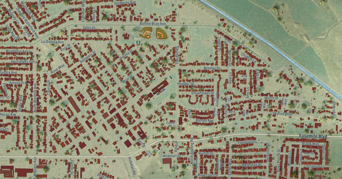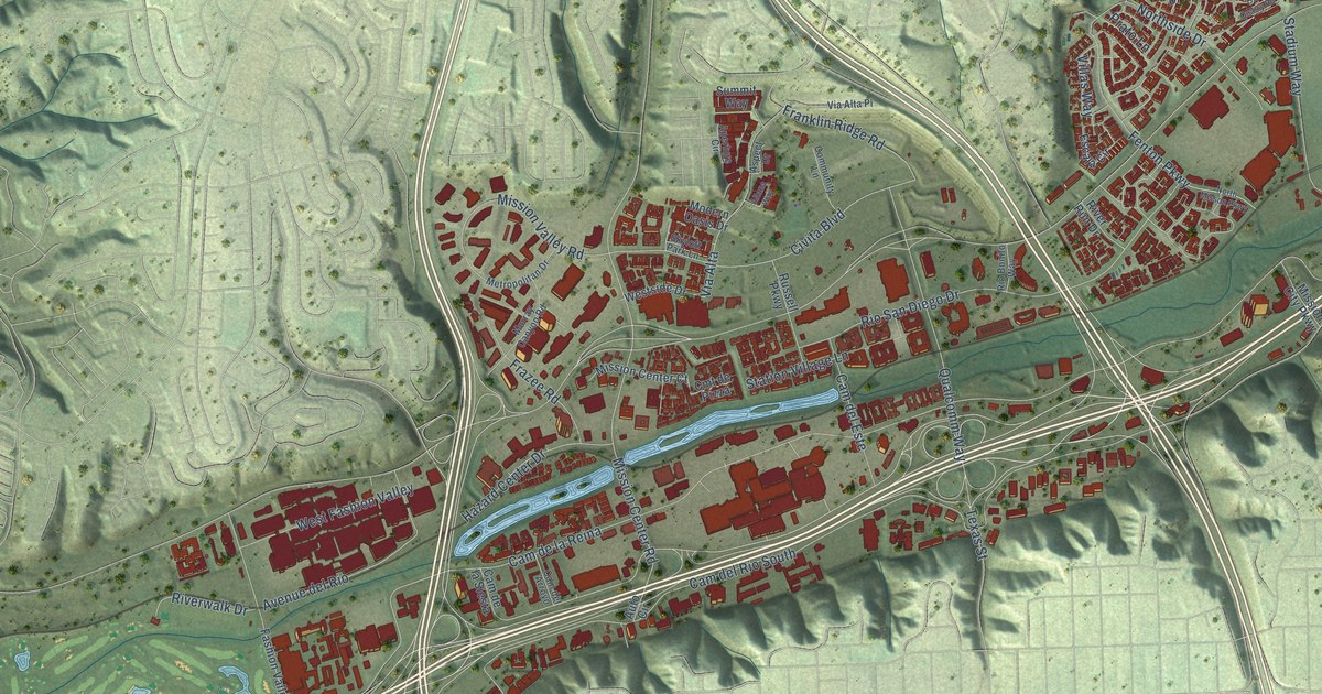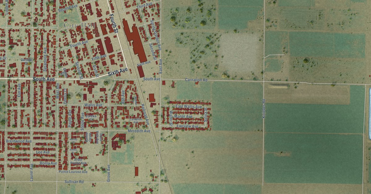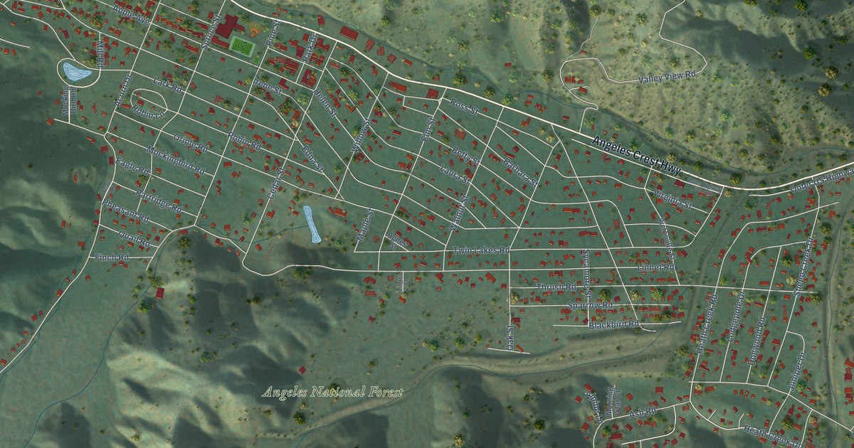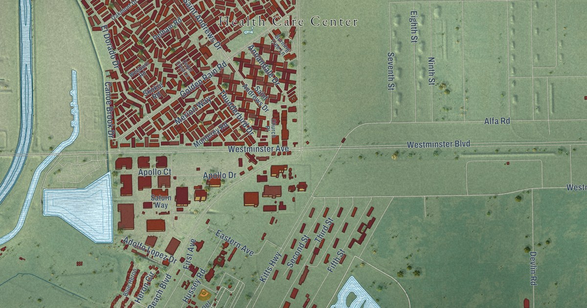
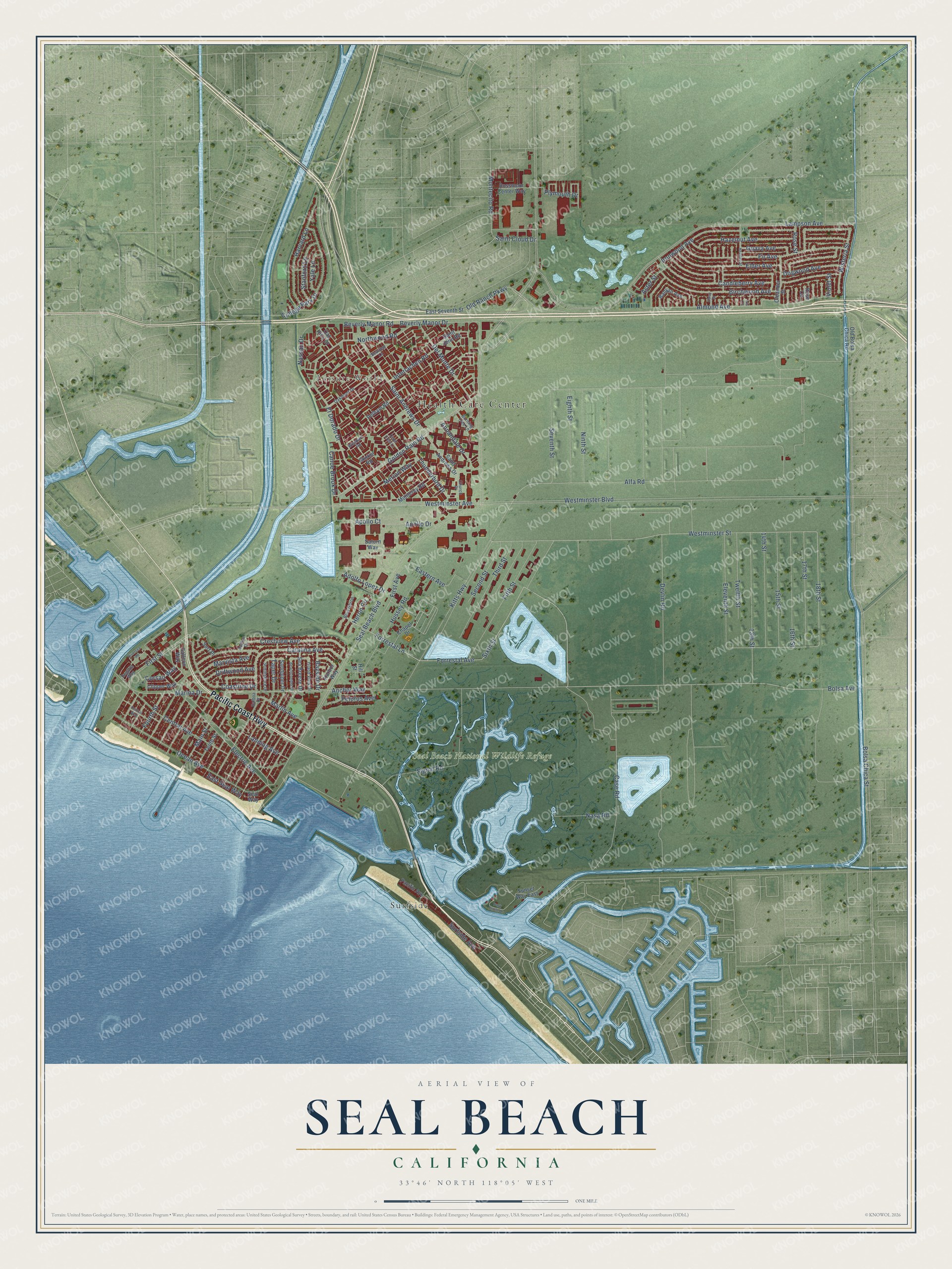
This beautifully detailed map of Seal Beach, California was created in 2026 using aerial imagery combined with modern topographical, census, street and landmark data. It's a modern aerial view of Seal Beach in Orange County, California, that combines modern data with a vintage aesthetic. The roads feature printed names, and if you look closely you can find your exact house accurately shown in its correct location.
Explore an aerial view of Seal Beach, California
On this map you'll find Health Care Center, Leisure World, Seal Beach National Wildlife Refuge, Surfside, Pacific Coast Highway, Case Road, Sixth Street, Forrestal Lane, Forrestal Avenue, Old Ranch Parkway, Saint Cloud Drive, Corsair Way, and more. Each red shape is a building, so zoom in on the preview and look for yours.
Every town has a first chapter, and Seal Beach is no exception. The record at ohp.parks.ca.gov puts it this way: "Soon after the founding of the Mother Colony at Anaheim in 1857, the Anaheim Landing Company established Anaheim Landing as a port for the Santa Ana Valley."
Seal Beach is a city in Orange County. The Census Bureau counted 25,242 people here in 2020.
Take a closer look at the Seal Beach map
Names on this map
These names are printed on this map.
Places: Health Care Center, Leisure World, Seal Beach National Wildlife Refuge and Surfside.
Streets and roads: Pacific Coast Highway, Case Road, Sixth Street, Forrestal Lane, Forrestal Avenue, Old Ranch Parkway, Saint Cloud Drive, Corsair Way, Bolsa Avenue, 18th Street, Main Street, Westminster Street.
More street names, A to Z
13th Street, 14th Street, 15th Street, 16th Street, 17th Street, Adolfo Lopez Drive, Alfa Road, Almond Avenue, Anchor Way, Annandale Drive, Apollo Court, Apollo Drive, Aster Street, Avalon Drive, Balboa Drive, Banyan Avenue, Bayside Drive, Beachcomber Drive, Beverly Manor Drive, Beverly Manor Road, Birchwood Avenue, Blue Heron, Bolsa Chica Street, Burning Tree Lane, Candleberry Avenue, Canoe Brook Drive, Catalina Avenue, Cedar Crest Lane, Central Avenue, Central Way, Chapel Drive, Church Place, Clipper Way, Coastline Drive, College Park Drive, Crestview Avenue, Daisy Street, Del Monte Drive, Devlin Road, Dogwood Avenue, Driftwood Avenue, Eastern Avenue, East Seal Way, East Seventh Street, Eighth Street, Elder Avenue, El Dorado Drive, Electric Avenue, Eleventh Street, Fifth Street, Fir Avenue, First Avenue, First Street, Fourth Street, Galleon Way, Golden Rain Road, Guava Avenue, Harbor Way, Harvard Lane, Hazelnut Avenue, Heather Street, Heron Circle, Hill Street, Hussey Road, Interlachen Road, Iris Circle, Ironwood Avenue, Island View Drive, Kitts Highway, Lampson Avenue, Landing Avenue, Marina Drive, Marlin Avenue, Marvista Avenue, Merion Way, Montecito Road, Monterey Road, Nasa Road, Nassau Drive, Ninth Street, Northwood Road, Oak Hills Drive, Oakmont Drive, Ocean Avenue, Old Bolsa Chica Road, Oleander Street, Pacific Avenue, Park Circle Drive, Pelham Road, Pelorus Avenue, Plymouth Drive, Regatta Way, Riversea Road, Rose Circle, Rose Street, Rossmoor Center Way, Saint Andrews Drive, Saint John Road, Sandpiper Drive, Saturn Way, Sea Breeze Drive, Seal Beach Boulevard, Seal Way, Seaview Lane, Second Street, Seventh Street, Signal Road, Skokie Road, Southshore Drive, Stanford Lane, Sunset Way East, Surf Place, Surfside Avenue, Taper Drive, Tenth Street, Third Street, Thunderbird Drive, Twelfth Street, Violet Street, Weeburn Road, Westminster Avenue, Westminster Boulevard, Wisteria Street, Yale Lane.
Created by KNOWOL in 2026. The buildings are small red shapes, the roads carry their printed names, and shaded relief shows the shape of the land. The title panel reads "AERIAL VIEW OF SEAL BEACH CALIFORNIA" with 33°46' NORTH 118°05' WEST.
Hang it in the hallway, the office or the cabin, or give it to someone who left Seal Beach and still calls it home. Open the preview and look for a street you know. See sizes and frames for the Seal Beach map.