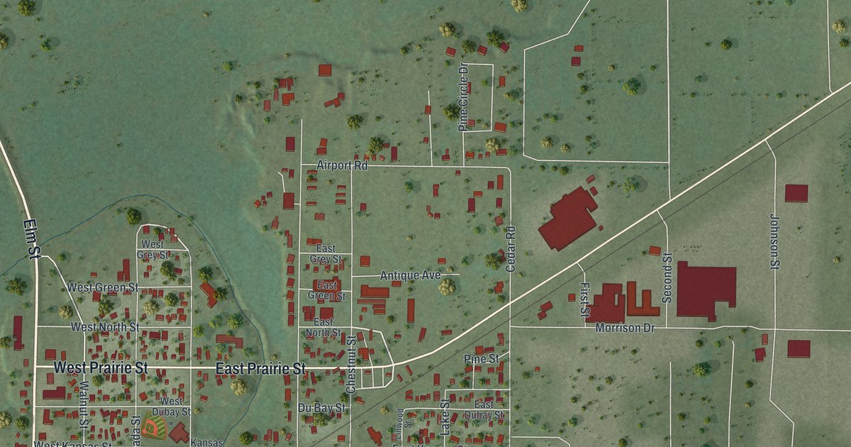
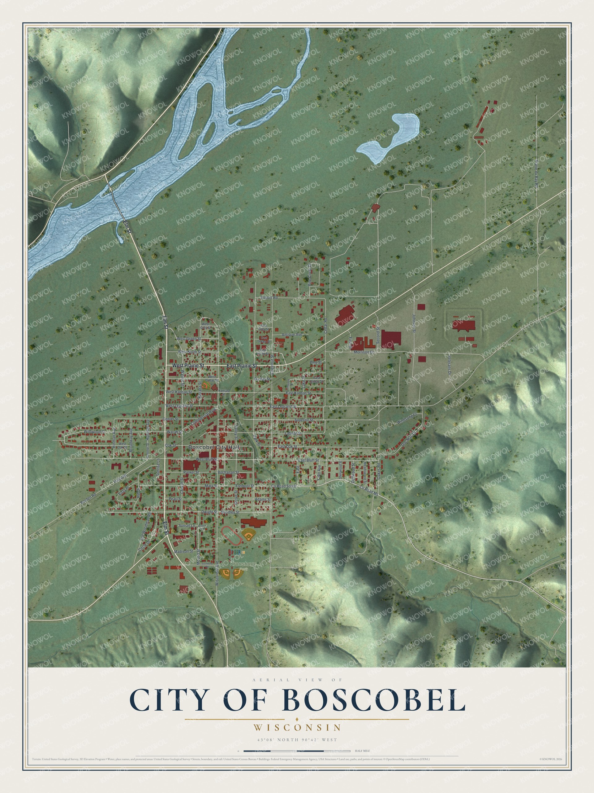
This beautifully detailed map of Boscobel, Wisconsin was created in 2026 using aerial imagery combined with modern topographical, census, street and landmark data. It’s a one-of-a-kind view of Boscobel that combines accurate data with a vintage aesthetic. The map shows every building in its true location, many of the roads carry their names, and the shaded topographic relief shows the shape of the land.
Explore an aerial view of Boscobel, Wisconsin
On the map you’ll find Boscobel City Hall, Kronshage Park, and Railroad, along with Elm Street, East Prairie Street, West Prairie Street, Cedar Road, Fremont Street, County Road MS, East Bluff Street, West Bluff Street, and more. If you look closely you can even find your house accurately drawn in its correct location. Zoom in on the preview to look for yours.
Did you know this piece of Boscobel, Wisconsin history?
From the History of Grant County: "Boscobel was platted early in 1856, and the lots put on sale this year. The site, now so densely populated, was originally a portion of farms owned by Joshua Brindley and A. E. Hall, and did duty as a corn-field, the street now known as Wisconsin avenue having been laid out through it in 1856."
Take a closer look at the Boscobel map
Street and place names on the Boscobel, Wisconsin map
These names are printed on the map of Boscobel, Wisconsin.
Places: Boscobel City Hall and Kronshage Park.
Streets and roads: Elm Street, East Prairie Street, West Prairie Street, Cedar Road, County Road South, Fremont Street, County Road Ms, East Bluff Street, West Bluff Street, Railroad, Borden Road, Walnut Street.
More street names, A to Z
Adams Street, Airport Road, Antique Avenue, Arizona Circle, Brindley Street, Broadway Avenue, Buchanan Street, Center Street, Chestnut Street, Church Street, Circle Drive, Commercial Row, Dellwood Street, Doc Mac Drive, Du Bay Street, Dwight Street, East, East Dubay Street, East Green Street, East Grey Street, East Kansas Street, East Legrand Street, East North Street, East Oak Street, First Street, Glenwood Street, Grove Street, Hill Drive, Hinman Avenue, Hummel Avenue, Hummel Street, Johnson Street, Kansas Street, Labelle Street, Lake Street, Linwood Street, Madison Street, Mary Street, Meadowood Street, Morrison Drive, Mound Street, Nevada Street, Oakes Road, Oak Street, Old Woodman Road, Parker Street, Park Street, Pearl Street, Pine Circle Drive, Pine Street, Prarie du Bay Road, Second Street, Southview Road, Sunrise Lane, Sunset Lane, Superior Street, Valley Street, Veterans Drive, Vista Place, Warah Street, West Dubay Street, West Green Street, West Grey Street, West Kansas Street, West Legrand Street, West North Street, West Oak Street, Wildwood Court, Windsong Court, Wisconsin Avenue, Yahn Avenue.
See the Boscobel, Wisconsin map on a wall
The Boscobel map as an 18 x 24 inch print in a black frame.

This beautifully detailed map of Boscobel makes an attractive addition to your office, library, or den, and it can even be used to teach children the geography and history of the area. It also makes a great gift for someone who left Boscobel and still calls it home. When you’re done exploring, click here to get your copy of the Boscobel map.