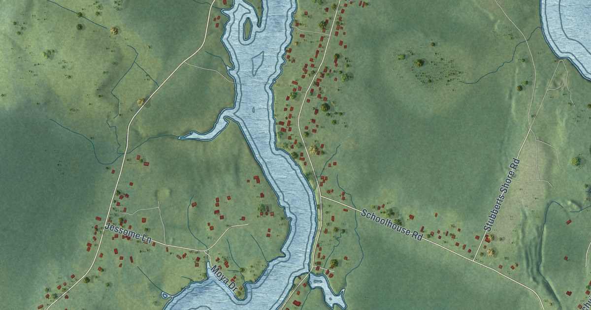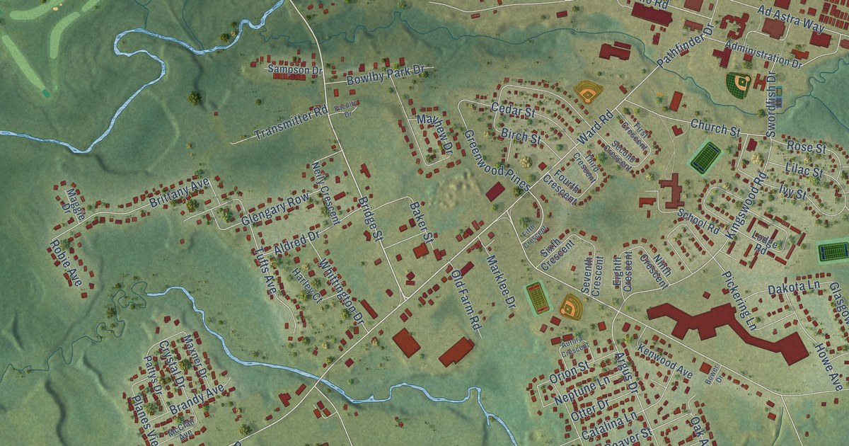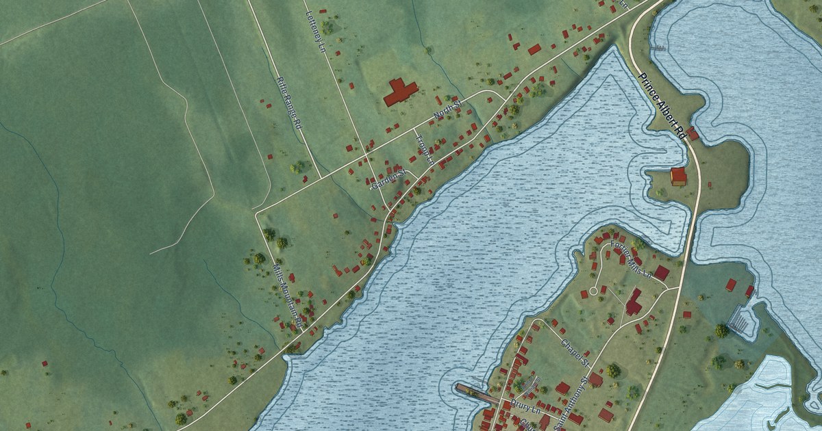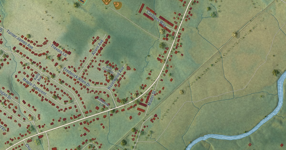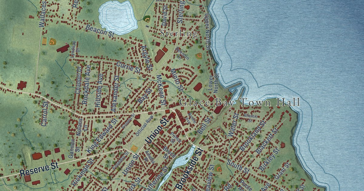
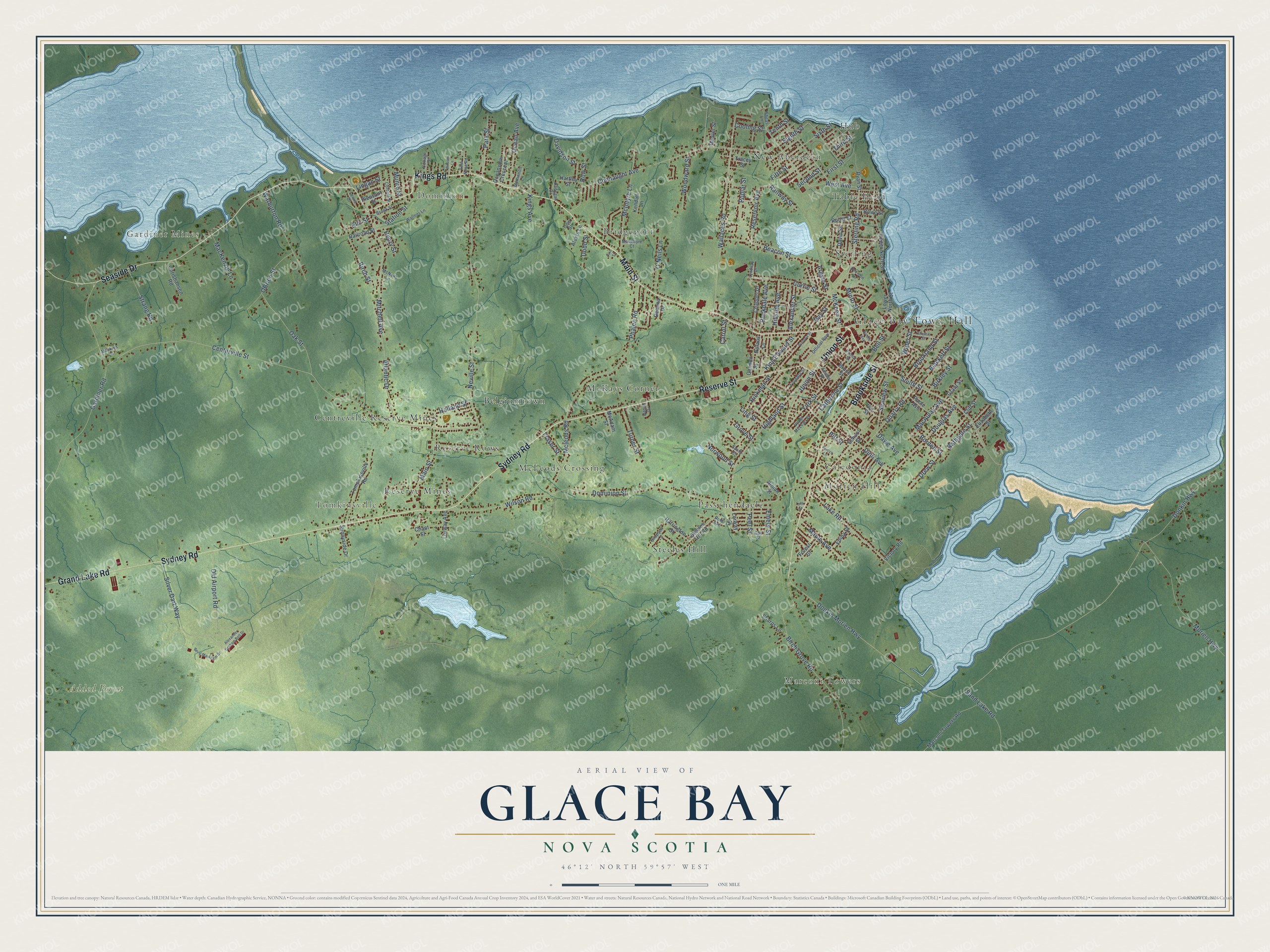
This beautifully detailed map of Glace Bay, Nova Scotia was created in 2026 using aerial imagery combined with modern topographical, census, street and landmark data. It’s a one-of-a-kind view of Glace Bay that combines accurate data with a vintage aesthetic. The map shows every building in its true location, many of the roads carry their names, and the shaded topographic relief shows the shape of the land.
Explore an aerial view of Glace Bay, Nova Scotia
On the map you’ll find Glace Bay Town Hall, Gardiner Mines, Marconi Towers, Tomkinsville, Hub, Dominion, Added Forest, McLeods Crossing, Morien Hill, Bridgeport, Centreville Reserve Mines, McKays Corner, and more. If you look closely you can even find your house accurately drawn in its correct location. Zoom in on the preview to look for yours.
Take a closer look at the Glace Bay map
Names on this map
These names are printed on this map.
Places: Glace Bay Town Hall, Gardiner Mines, Marconi Towers, Tomkinsville, Hub, Dominion, Added Forest, McLeods Crossing, Morien Hill, Bridgeport, Centreville Reserve Mines, McKays Corner, Steeles Hill, Passchendaele, Sterling, Reserve Mines, Belgiumtown, Caledonia, Reserve Rows, Table Head and New Aberdeen.
Streets and roads: Main Street, Kings Road, Reserve Street, Brookside Street, Sydney Road, Union Street, Seaside Drive, Grand Lake Road, King Edward Street, Sterling Road, South Street, Park Street.
More street names, A to Z
Alexander Graham Bell Drive, Alexander Street, Alexis Lane, Amelia Street, Argyle Street, Atlantic Drive, Atlantic Street, Bathgate Street, Bay Street, Beacon Street, Bell Street, Beryl Markham Drive, Birch Grove Road, Birch Street, Birkley Street, Blackett Street, Borden Street, Brodie Avenue, Brookland Street, Brook Street, Bruce Street, Cadegan Drive, Carrol Street, Catherine Street, Centerville Street, Chant Street, Chappel Drive, Christiansen Road, Cliff Street, Connaught Avenue, Cooling Street, Corbett Street, Cottage Street, Currie Street, Daniel Drive, Davidson Street, David Street, Dawe Avenue, Deanna Drive, Denver Street, Devison Lane, Dinn Avenue, Dodd Street, Dominion Street, Donkin Highway, Donkin Morien Highway, Douglas Avenue, Drew Street, Edina Street, Eighth Street, Elizabeth Street, Elm Street, Emery Street, Fifth Street, First Street, Forest Street, Foundry Street, Fraser Street, Gannon Street, Gardiner Road, Grant Street, Grove Street, Guy Street, Harrington Street, Hartley Street, Henry Street, Hickman Street, Highland Street, Hillside Avenue, Holland Street, Howe Street, Kendall Lane, Kings Avenue, Lake Road, Lewis Drive, Lingan Street, Ling Street, Lorway Avenue, Lorway Street, Lower North Street, Lyndsay Drive, Lynk Street, MacAulay Avenue, MacIntyre Court, MacKenzie Lane, Mackies Lane, Maple Avenue, Marconi Towers Road, McAdam Street, McIntyre Lane, McKeen Street, McKinnon Lane, Mcleods Road, McNeils Lane, Minto Street, Mitchell Avenue, Morien Highway, Munro Street, Neville Street, Ninian Street, Nolans Lane, Norwood Street, O'Neils Lane, Oak Street, OBrien Street, Ocean Avenue, Oceanview Crescent, Official Row, Old Airport Road, Peel Street, Percys Lane, Phalen Road, Pine Street, Pitt Street, Pleasant Street, Poole Avenue, Poplar Street, Prince Street, Quarry Road, Railroad Street, Railway Street, Reid Avenue, Reservoir Avenue, Rockdale Avenue, Roost Street, Row Street, Ryan Street, Sand Lake Road, School Street, Seaview Street, Second Street, Sharps Lane, Sheas Lane, Silver Dart Way, Simpson Lane, Sixth Street, Smith Street, Station Street, Steeles Hill Road, Strang Road, Sunnyside Drive, Tenth Street, Third Street, Tompkinsville Road, Tracey Street, Tulip Street, Turner Street, Upper McLean Street, Upper North Street, Vet Street, Victoria Street, Victory Road, Villa Nova Road, Wallaces Road, Wallner Lane, Warburton Road, Water Street, West Avenue, Wilson Road, Wilsons Lane, Woodward Street, York Street.
See it on a wall
The Glace Bay map as an 18 x 24 inch print in a black frame.

This beautifully detailed map of Glace Bay makes an attractive addition to your office, library, or den, and it can even be used to teach children the geography and history of the area. It also makes a great gift for anyone with Glace Bay roots. When you’re done exploring, click here to get your copy of the Glace Bay map.