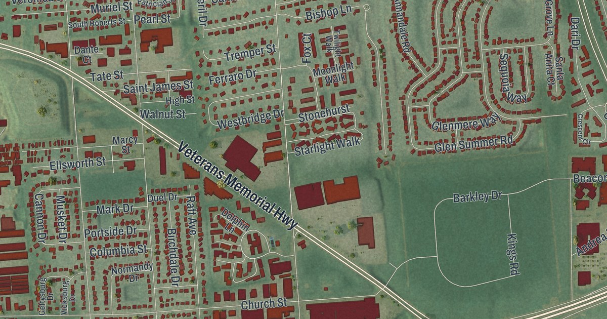
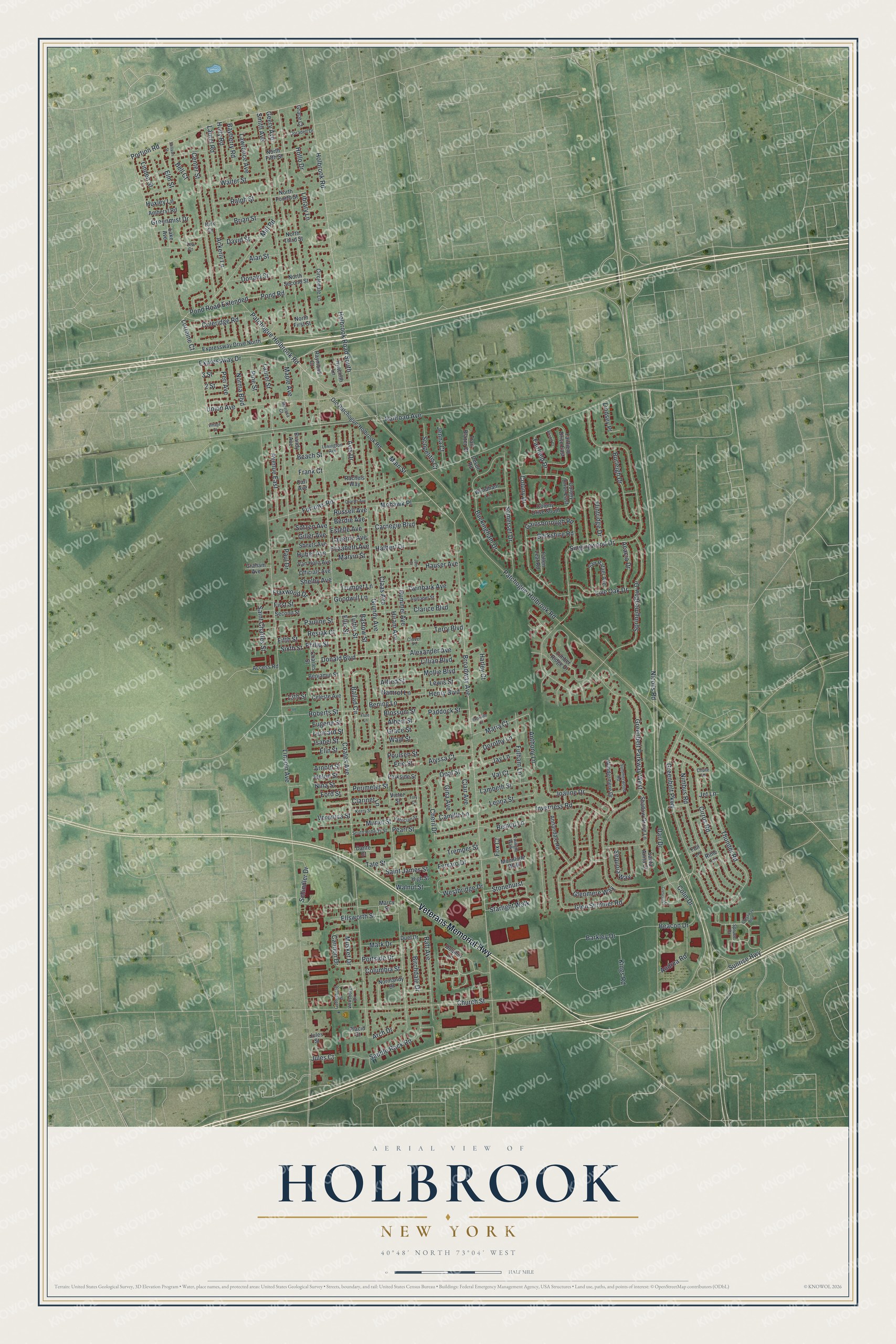
This beautifully detailed map of Holbrook, New York was created in 2026 using aerial imagery combined with modern topographical, census, street and landmark data. It’s a one-of-a-kind view of Holbrook that combines accurate data with a vintage aesthetic. The map shows every building in its true location, many of the roads carry their names, and the shaded topographic relief shows the shape of the land.
Explore an aerial view of Holbrook, New York
On the map you’ll find Veterans Memorial Highway, Nicolls Road, Maria Court, Smith Avenue, Carnegie Boulevard, and more. If you look closely you can even find your house accurately drawn in its correct location. Zoom in on the preview to look for yours.
Did You Know?
Holbrook stayed mostly rural until 1848. That year Alexander McCotter bought 5,000 acres and laid out the community, four years after the Long Island Rail Road arrived. St. John’s Lutheran Church, built in 1863, is the oldest building left from that era.
Take a closer look at the Holbrook map
Names on this map
These names are printed on this map.
Streets and roads: Veterans Memorial Highway, Nicolls Road, Maria Court, Smith Avenue, Carnegie Boulevard, Lorraine Court, Railroad Avenue, Coates Avenue, Lincoln Avenue, Grundy Avenue, Broadway Avenue, Sunrise Highway.
More street names, A to Z
2 Street, 3 Street, 13th Street, Acacia Drive, Access Road, Ackerly Lane, Alan Street, Albert Street, Alexander Avenue, Alfred Street, Alphabet Street, Alyssa Court, Amherst Road, Andrea Road, Annandale Road, Anthony Lane, Arch Drive, Arnold Street, Avenue East, Avis Drive, Ballad Circle, Barkley Drive, Bastow Street, Bayberry Road, Beach Street, Beacon Drive, Bell Court, Bening Lane, Benjamin Street, Berdie Avenue, Berkshire Road, Birchdale Drive, Bishop Lane, Blossom Street, Bookville Court, Brandy Avenue, Brian Street, Bristol Court, Buckingham Drive, Burleigh Drive, Camille Lane, Cannon Drive, Carl Avenue, Celeste Avenue, Center Street, Charles Avenue, Charles Street, Cheril Drive, Church Street, Chute Lane, Circledale Lane, Cirrus Road, Claas Avenue, Clair Avenue, Clarice Boulevard, Clarinet Lane, Clover Place, Coleridge Road, Colin Drive, Colony Drive, Colony Drive East, Colony Drive South, Columbia Street, Crescent Circle, Crossway Boulevard, Dante Court, Dari Drive, David Street, Devon Road, Dolphin Lane, Donald Boulevard, Donald Street, Doradell Drive, Dorothy Lane, Duel Drive, Elin Street, Elizabeth Avenue, Ellis Street, Ellsworth Street, Elm Street, Erie Street, Estelle Avenue, Eugene Street, Expressway Drive, Expressway Drive North, Fairfield Drive, Fairfield Drive East, Fallen Leaf Road, Ferraro Drive, Fifth Street, First Street, Flaxwood Drive, Flintridge Drive, Flute Lane, Foil Lane, Ford Street, Fox Court, Frank Court, Fulham Lane, Furrows Road, Gainsborough Road, Geery Avenue, Gettysburg Drive, Giller Avenue, Gina Avenue, Glenmere Way, Glen Summer Road, Goodwill Lane, Grace Court, Grace Street, Graham Avenue, Greenbelt Parkway, Greenbelt Parkway West, Greenmist Drive, Halbert Drive, Harley Court, Hauser Avenue, Helen Street, Henry Boulevard, High Street, Hiram Avenue, Holbrook Road, Holbrook Road South, Hollo Drive, Holly Road, Huber Avenue, Hummel Avenue, Huxley Lane, Hyacinth Lane, Inverness Road, Isabel Street, Jay Lane, Jem Court, Jenna Court, Jet Lane, Joanne Drive, Jules Court, Jules Street, Kerry Street, Kings Road, Kirk Drive, Lake Avenue, Lambeth Street, Laurel Road, Laurel Street, Laverne Avenue, Lawrence Avenue, Leonard Street, Leona Street, Lew Court, Lewis Street, Lexington Avenue, Library Lane, Lillian Boulevard, Linden Street, Lindsey Place, Live Oak Drive, Main Street, Maple Avenue, Marcy Street, Marissa Court, Mark Drive, Marvin Street, Mill Road, Mohawk Place, Mollie Boulevard, Moonlight Walk, Muriel Street, Musket Drive, Namrof Lane, Nimbus Road, Nina Street, Norma Boulevard, Normandy Drive, North Fifth Street, North First Street, North Fourth Street, North Second Street, North Third Street, Officials Avenue, Old Patchogue-Holbrook Road, Opal Street, Paddock Street, Parkside Street, Patchogue-Holbrook Road, Patchogue Holbrook Road, Patrician Street, Paul Drive, Pauline Street, Pearl Street, Peri Avenue, Perimeter Street, Philip Street, Pine Street, Placid Court, Pond Road, Pond Road Extended, Portion Road, Portside Drive, Poulsen Street, Rachels Way, Raft Avenue, Ralph Street, Raymond Court, Resiak Court, Rime Lane, Roberts Street, Russell Avenue, Saddle Rock Road, Saint Charles Street, Saint James Street, San Rafael Avenue, Santa Anita Court, Schindler Drive, Scopelitis Court, Second Street, Sequoia Way, Shadow Grove Lane, Sheets Avenue, Shelby Avenue, Singingwood Drive, Sixth Street, Somerset Drive, Sotzen Avenue, South Roberts Street, Springmeadow Drive, Spruce Drive, Starlight Walk, Stonehurst, Sullivan Street, Summerwood Road, Tate Street, Terry Boulevard, Thunder Road, Timber Ridge Drive, Tory Court, Trail Blazer Court, Tremper Street, Trumpet Lane, Tuttle Street, Twilight Walk, Twinbark Avenue, Union Avenue, Val Court, Van Horn Avenue, Veronica Street, Vicksburg Drive, Victor Street, Village Street, Wald Street, Walnut Street, Walter Street, Westbridge Drive, Windermere Drive, Wyndham Lane.
See it on a wall
The Holbrook map as a framed print. Swipe for more.


This beautifully detailed map of Holbrook makes an attractive addition to your office, library, or den, and it can even be used to teach children the geography and history of the area. It also makes a great gift for anyone with Holbrook roots. When you’re done exploring, click here to get your copy of the Holbrook map.