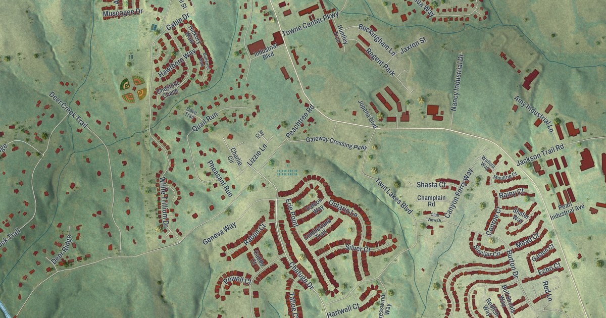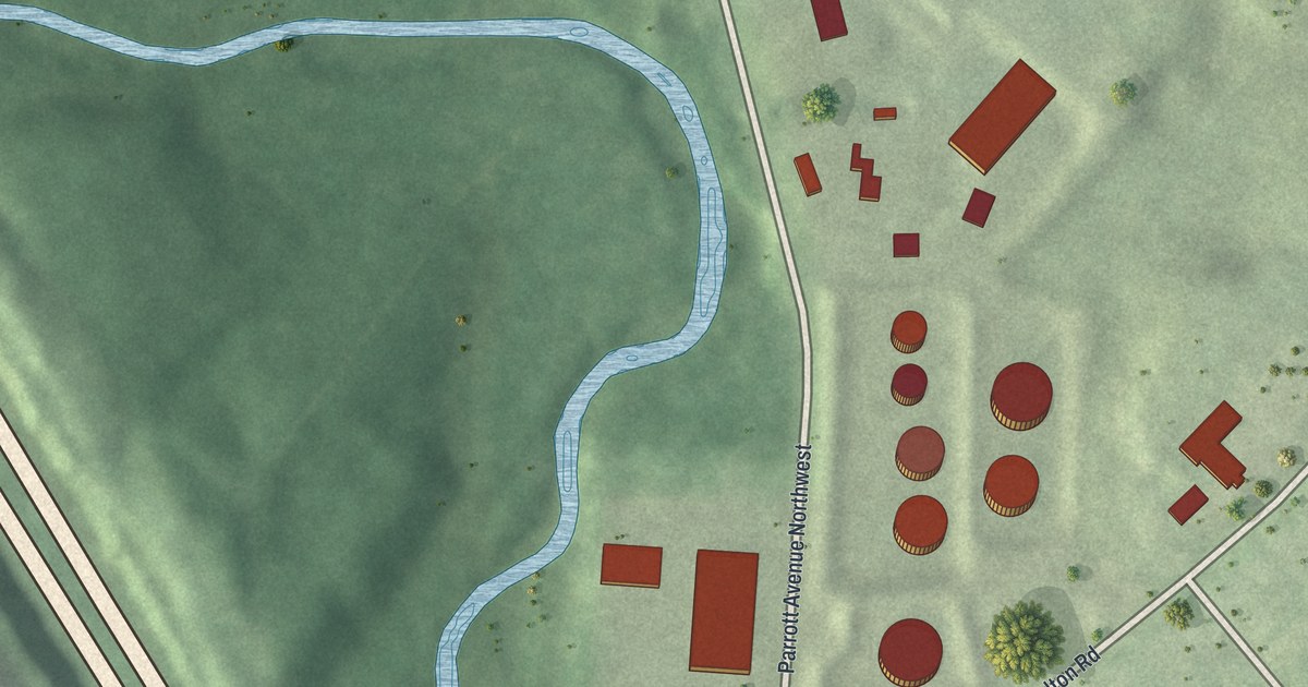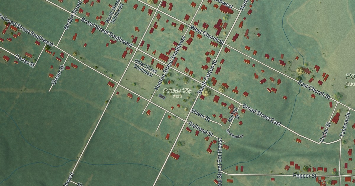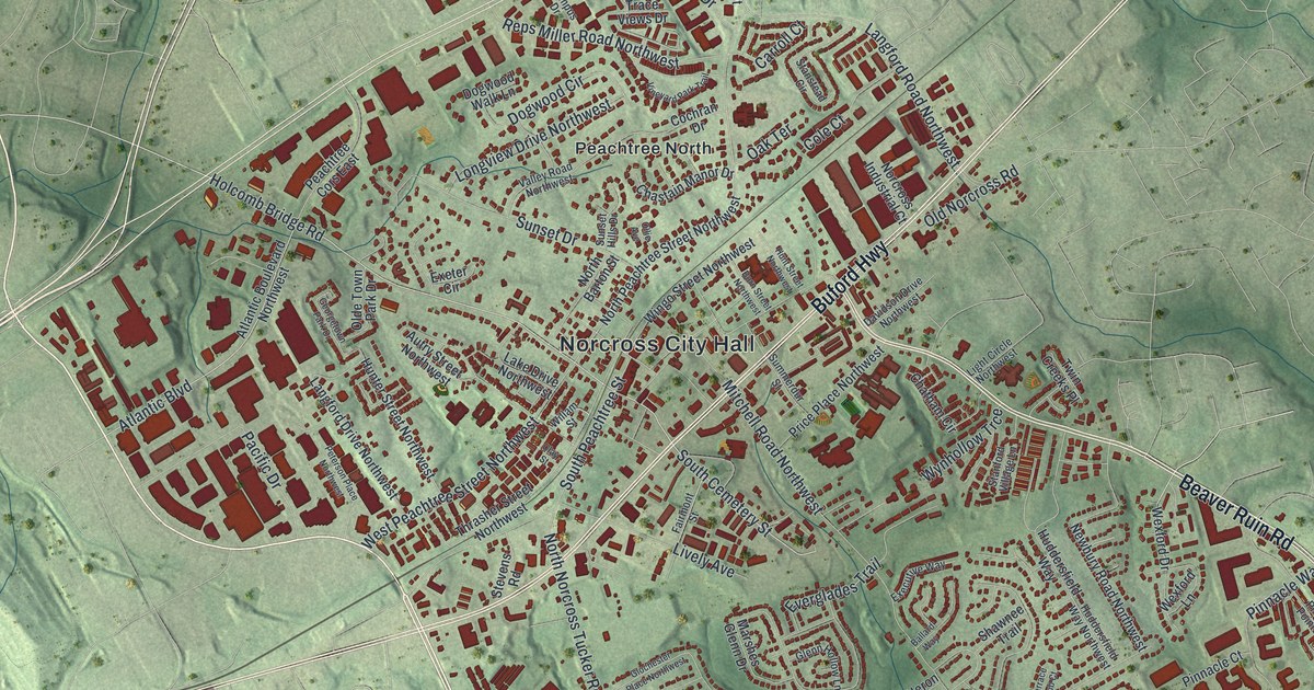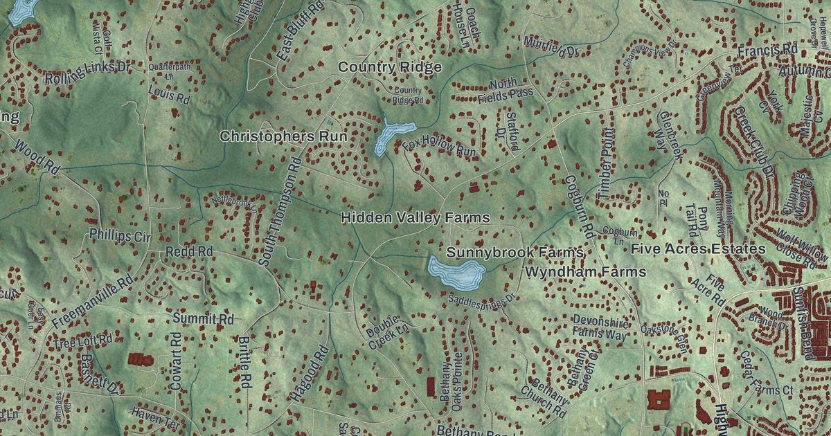
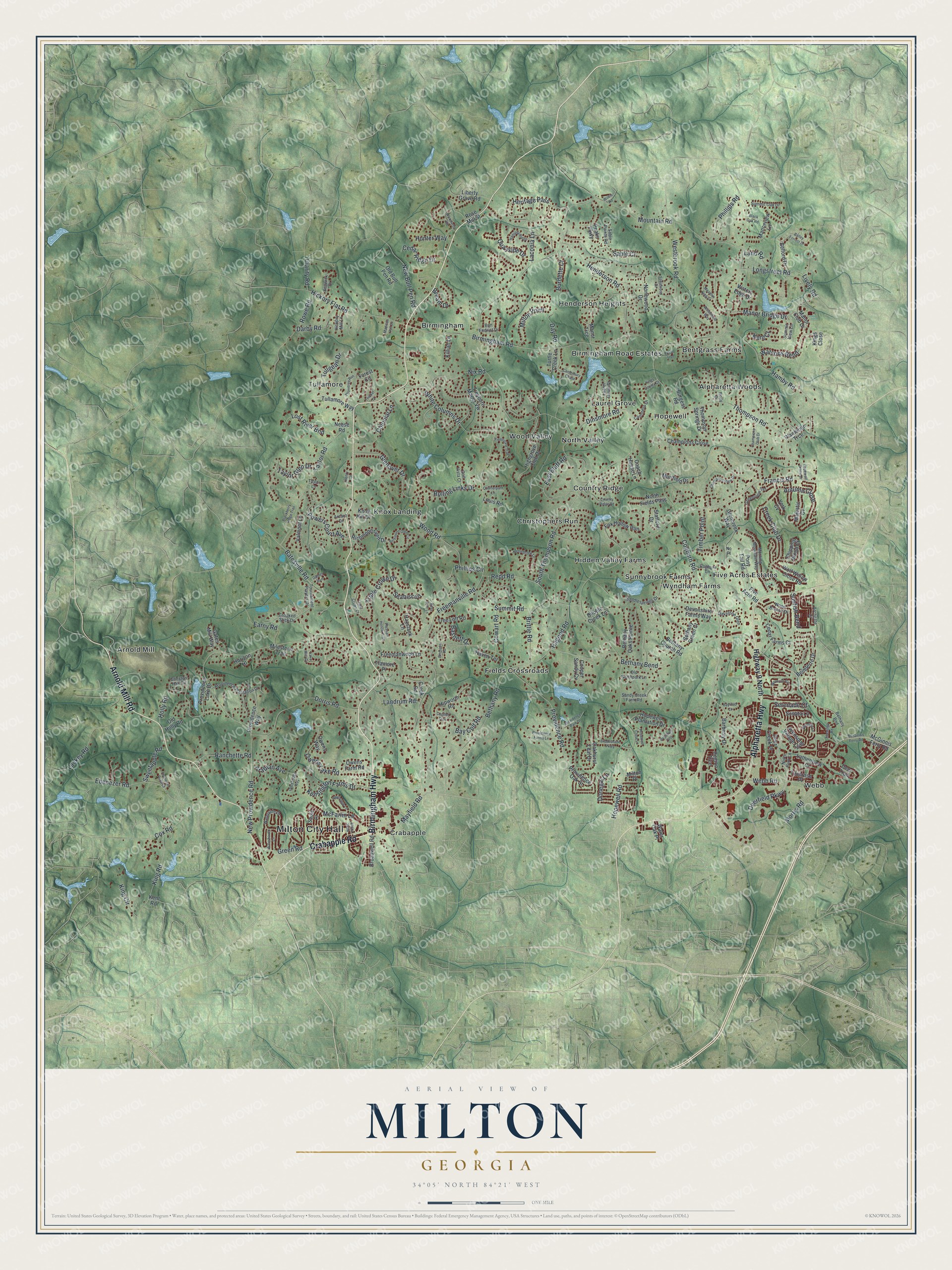
This beautifully detailed map of Milton, Georgia was created in 2026 using aerial imagery combined with modern topographical, census, street and landmark data. It’s a one-of-a-kind view of Milton that combines accurate data with a vintage aesthetic. The map shows every building in its true location, many of the roads carry their names, and the shaded topographic relief shows the shape of the land.
Explore an aerial view of Milton, Georgia
On the map you’ll find Milton City Hall, Alpharetta Woods, Arnold Mill, Bentgrass Farms, Birmingham, and Christophers Run, along with Birmingham Highway, Arnold Mill Road, Crabapple Road, Alpharetta Highway, and more. If you look closely you can even find your house accurately drawn in its correct location. Zoom in on the preview to look for yours.
Did You Know?
Milton is named for John Milton, a hero of the Revolutionary War. He was also the namesake of Milton County, created in 1857, which included the area. The Great Depression, the boll weevil and a long drought left that county in deep financial trouble. Its land was then absorbed into Fulton County.
Take a closer look at the Milton map
Names on this map
These names are printed on this map.
Places: Milton City Hall, Alpharetta Woods, Arnold Mill, Bentgrass Farms, Birmingham, Birmingham Road Estates, Christophers Run, Country Ridge, Crabapple, Fields Crossroads, Five Acres Estates, Henderson Heights, Hidden Valley Farms, Hopewell, Knox Landing, Laurel Grove, North Valley, Sunnybrook Farms, Tullamore, Webb, Wood Valley and Wyndham Farms.
Streets and roads: Birmingham Highway, Arnold Mill Road, Crabapple Road, Alpharetta Highway, Deerfield Parkway, Cogburn Road, Francis Road, Mayfield Road, Hopewell Road, Freemanville Road, Bethany Road, New Providence Road.
More street names, A to Z
Arabian Avenue, Arcaro Drive, Archgate Court, Autumn Close, Avensong Village Circle, Aventide Lane, Balley Forrest Drive, Barberry Drive, Basnett Drive, Batesville Road, Bay Colt Road, Bayfield Court, Belford Drive, Belleterre Drive, Bethany Bend, Bethany Bnd, Bethany Church Road, Bethany Green Court, Bethany Oaks Pointe, Birmingham Road, Blackberry Ridge Trail, Black Oak Road, Bon Endriot Drive, Bream Drive, Brittle Road, Broadwell Road, Brookshade Parkway, Burdette Court, Burgess Road, Canonero Drive, Canterbury Chase, Cedar Farms Court, Cedar Ridge Drive, Champions Close, Champions Club Drive, Champions View Drive, Chipping Wood Court, Clarity Road, Coach House Lane, Cogburn Lane, Cogdell Trail, Colonial Lane, Cooper Sandy Cv, Country Ridge Road, Cowart Road, Cox Road, Creek Club Drive, Creek Road, Crooked Stick Drive, Darby Road, Day Road, Deer Creek Place, Deer Trail, Devonshire Farms Way, Dinsmore Road, Dockbridge Way, Donegal Lane, Dorris Road, Double Creek Lane, Earny Road, East Bluff Road, Easy Goer Lane, Ebenezer Pond Court, Ebenezer Road, Emmaus Road, Fieldstone Trail, Five Acre Road, Flamingo Road, Forest Circle, Fossil Trce, Fox Hollow Run, Freemanwood Lane, Gables Run, Gates Mill Way, Glencreek Way, Glenover Drive, Golf Vista Court, Green Road, Greenview Terrace, Gunston Hall Circle, Hagood Road, Hamby Road, Hamiota Ridge, Haven Terrace, Haystack Lane, Henderson Road, Henry Lane, Heritage Pass, Heybridge Lane, Hickory Flat Road, Hickory Mill Lane, Highgrove Club Drive, Highway 9 North, Hipworth Road, Holly Road, Hopewell Close Lane, Hopewell Crst, Hopewell Grove Drive, Hopewell Plantation Drive, Horizon Hl, Hunter Way, Itaska Walk, Kensington Farms Drive, Kent Court, Kent Road, Killian Lane, King Circle, King Road, Kings Close, Kings County Court, Knox Hill Drive, Lackey Road, Laconia Lane, Lake Mist Cv, Land Road, Landrum Road, Lathenview Court, Laurel Grove Drive, Liberty Grove Road, Lively Road, Longstreet Road, Lost River Bnd, Louis Road, Madison Hall Lane, Majestic Cv, Manor Bridge Drive, Manor Club Drive, Manor Trce, Manorview Lane, McFarlin Lane, McGinnis Ferry Road, Mc Ginnis Ferry Road, Meadow King Court, Milestone Trail, Milton Place, Milton Point, Morning Mountain Way, Morris Road, Mountain Road, Muirfield Drive, Neese Road, Nettlebrook Lane, New Bull Pen Road, Nix Road, No Place, North Fields Pass, North Park Lane, Northwood Drive, Oakhurst Leaf Drive, Oakstone Glen, Old Bull Pen Road, Old Holly Road, Old Northpark Lane, Owens Farm Road, Owens Lake Road, Owens Way, Peaks Parkway, Phillips Circle, Phillips Road, Plantation Trce, Pleasant Hollow Trail, Pony Tail Road, Powers Court Avenue, Providence Farms Lane, Providence Lake Drive, Providence Oak Street, Providence Park Drive, Providence Plantation Drive, Providence Road, Providence Way, Quarterpath Lane, Quayside Drive, Ranchette Road, Redd Road, Region Trce, Richmond Glen Circle, Richmond Glen Drive, Rolling Links Drive, Rolly Drive, Rose Mill Street, Rowe Road, Sable Court, Sable Pointe Road, Sablewood Drive, Saddlesprings Drive, Sandy Creek Farm Road, Sauls Place, Seabiscuit, Segwick Drive, Serenade Court, Sonata Lane, South Thompson Road, Stafford Drive, Summit Oak Drive, Summit Road, Summit View Lane, Sunfish Bend, Sweetapple Road, Taylor Glen Drive, Taylor Lane, Taylor Road, Thicket Court, Thompson Road, Thompson Springs Drive, Thorntree Run, Timber Point, Tournament Players Drive, Tramore Place, Tree Loft Road, Treyburn Manor Vw, Triple Crown Court, Triple Crown Drive, Tullamore Way, Tullgean Drive, Turtle Creek Lane, Twinrose Place, Valmont Lane, Waterhaven Lane, Water Oak Place, Waters Edge Drive, Waterside Drive, Watsons Bend, Waxmyrtle Road, Webb Road, Westbrook Road, Weycroft Circle, White Columns Drive, Wilkie Road, Winterfield Way, Wolf Willow Close Road, Wood Branch Drive, Wood Road, York Cv.
See it on a wall
The Milton map as a framed print. Swipe for more.


This beautifully detailed map of Milton makes an attractive addition to your office, library, or den, and it can even be used to teach children the geography and history of the area. It also makes a great gift for anyone who grew up in Milton or moved away. When you’re done exploring, click here to get your copy of the Milton map.