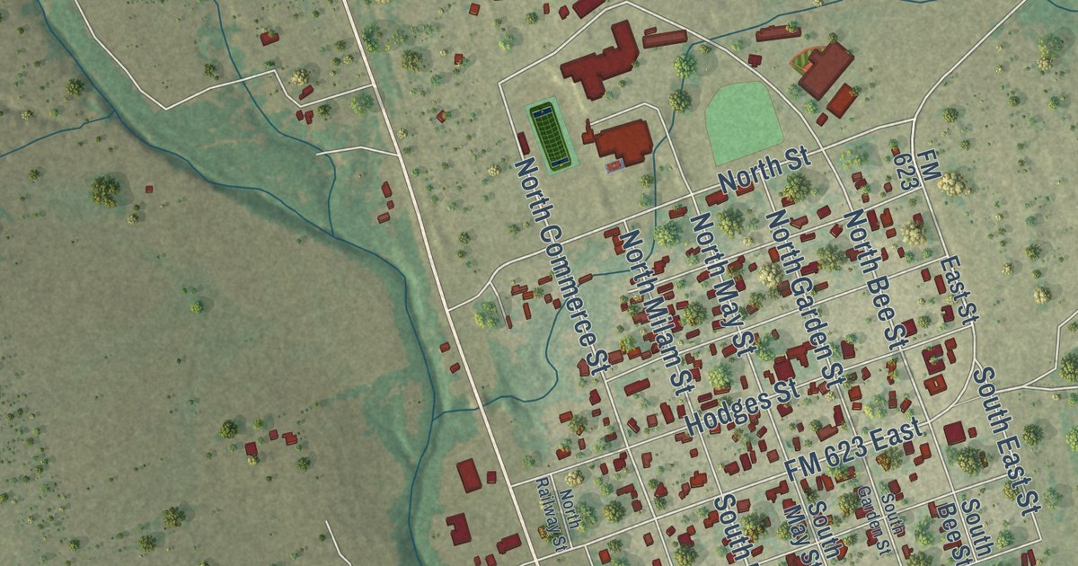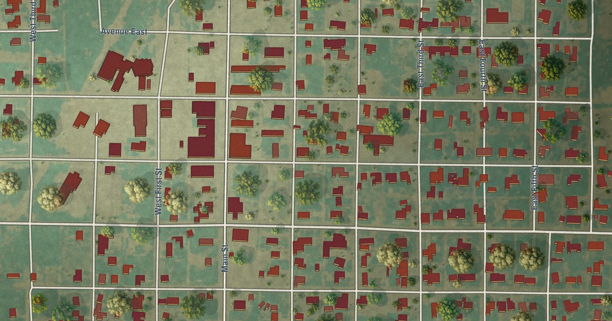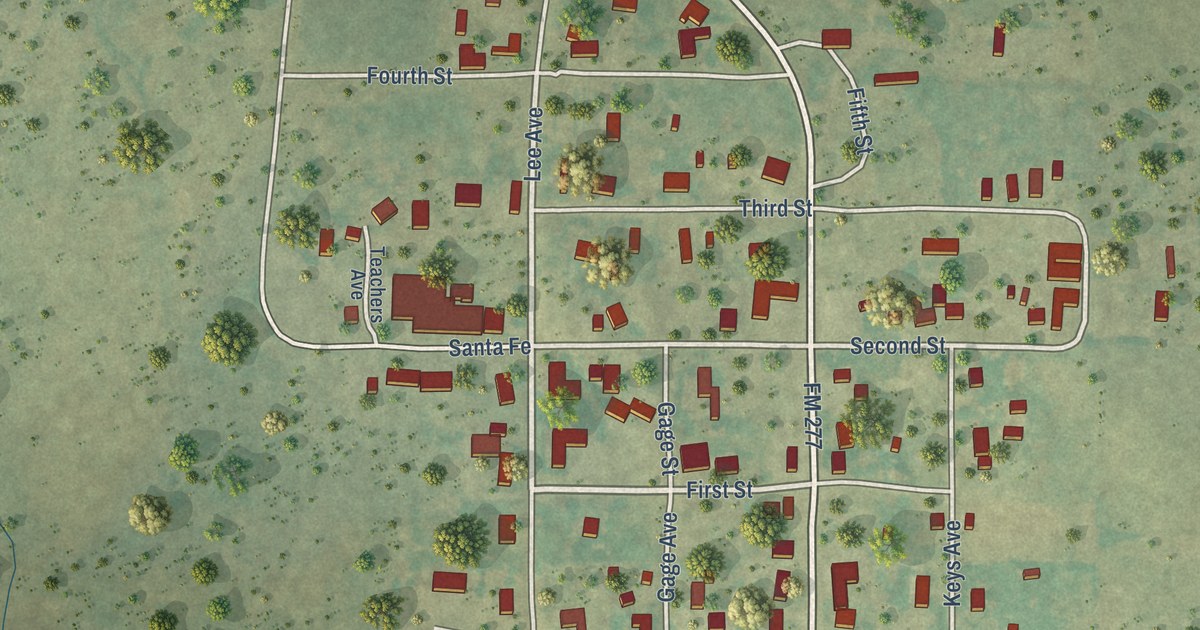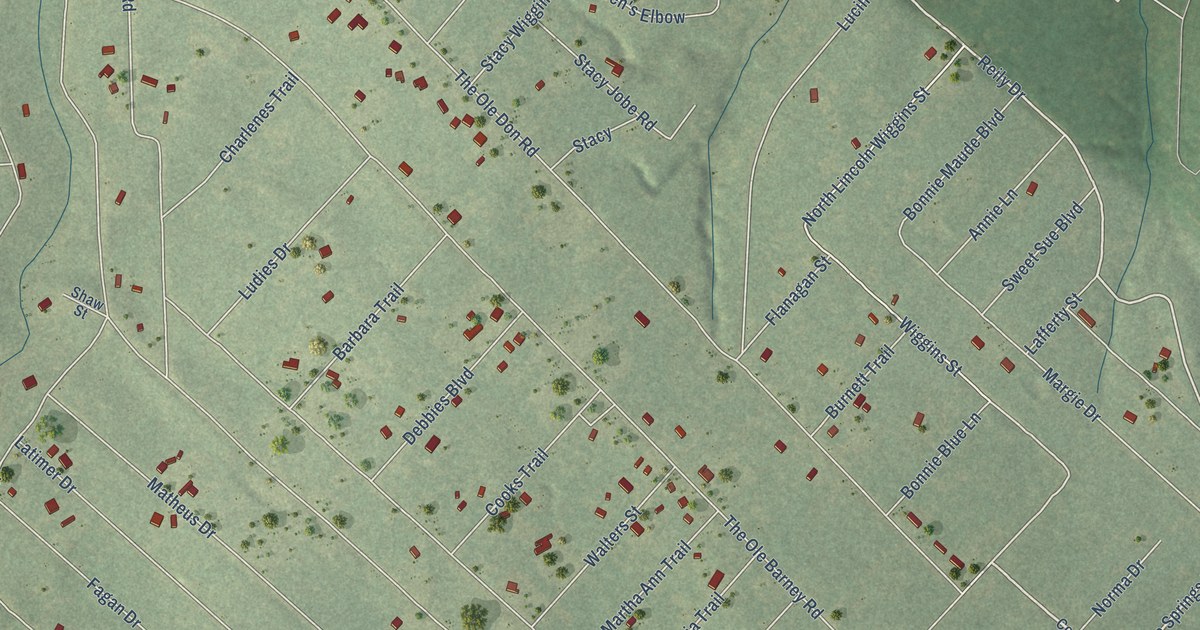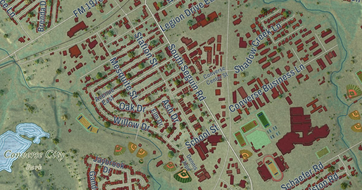
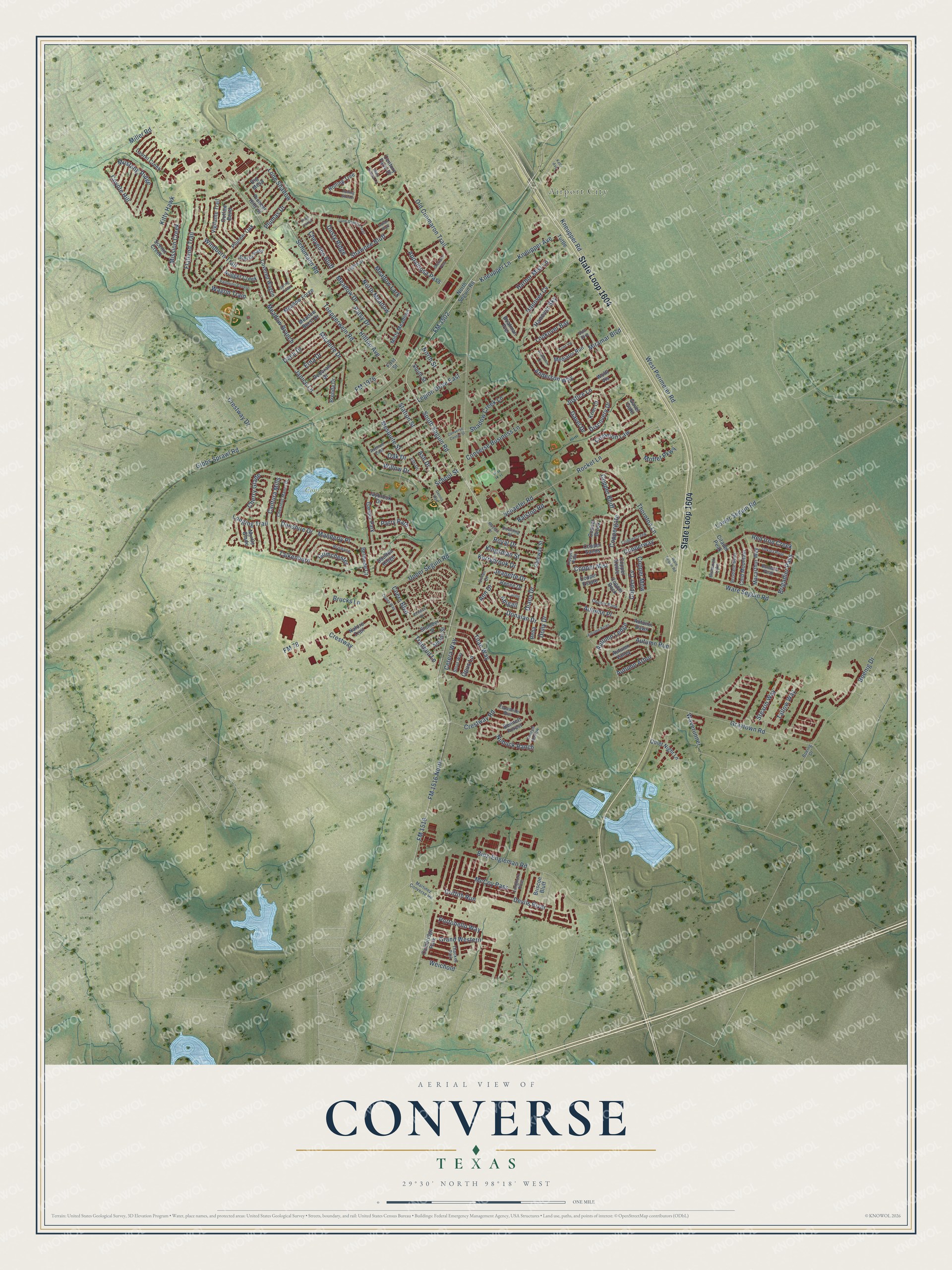
This beautifully detailed map of Converse, Texas was created in 2026 using aerial imagery combined with modern topographical, census, street and landmark data. It’s a one-of-a-kind view of Converse that combines accurate data with a vintage aesthetic. The map shows every building in its true location, many of the roads carry their names, and the shaded topographic relief shows the shape of the land.
Explore an aerial view of Converse, Texas
On the map you’ll find Airport City, Converse City Park, Talkenhorn, and Cherry Glade, along with State Loop 1604, FM 1516, South Seguin Road, Kneupper Road, FM 3502, Kneupper Avenue, Kneupper Lane, Anderson Way, and more. If you look closely you can even find your house accurately drawn in its correct location. Zoom in on the preview to look for yours.
Did you know this piece of Converse, Texas history?
From the Handbook of Texas: "A post office was established in 1878, and by 1885 a population of thirty was reported."
Take a closer look at the Converse map
Street and place names on the Converse, Texas map
These names are printed on the map of Converse, Texas.
Places: Airport City, Converse City Park, Cambridge Park, Gander Park, Thackes Park and Bismarck Lake.
Streets and roads: State Loop 1604, FM 1516, South Seguin Road, Kneupper Road, FM 3502, Talkenhorn, Cherry Glade, Kneupper Avenue, Kneupper Lane, Anderson Way, Copper Cv, Tranquil Lane.
More street names, A to Z
Abigail, Anderson Court, Ann Drive, Appaloosa Pass, Ash Drive, Autumn Acres, Autumn Arbor, Autumn Dawn, Autumn Ledge, Autumn Place, Autumn Run, Autumn Valley, Avenue East, Belmede Court, Bennett Forest, Big Mesa, Binz-Engleman Road, Boatman Pier, Boeing Drive, Boenig Drive, Brenda Drive, Brigadier Pass, Brisbane, Brisbane Bend, Briscoe Bluff, Brucks Lane, Bulwark Peak, Cantura Mills, Century Farm Drive, Cetera Way, Chestnut Manor Drive, Cheyenne Bluff, Citadel Peak, Coers Boulevard, Cold Mountain, Colina Way, Common Law, Converse Business Lane, Converse Center Street, Copper Bluff, Copper Brook, Coppercreek, Copper Estate, Coppergate, Copper Kettle, Copper Mdw, Copper Mist, Copper Palm, Copper Rock, Copper Rose, Copper Sands, Copperway, Covered Wagon, Coyote Hill, Crestway, Crestway Drive, Crestway Road, Dakota River, Dana Drive, Daulton Ridge, Deborah Drive, Dennis Jupe, Devils River, Diana Drive, Discovery Drive, Dolly Drive, Donalan Drive, Donshire Drive, Downing Street, Dusty Ridge, Eighth Street, Elm Drive, Erna Drive, Espadrille Run, First Street, Flatland Trail, FM 78, FM 1516 North, FM 1976, Gateway Street, Gavel Drive, Gavel Gate, Gibbs Sprawl Road, Grand Western, Graytown Road, Griffith Run, Grimchester, Hanover Cv, Hanover Sky, Harbor Mist Lane, Hilltop Avenue, Indian Bluff, Janice Lane, Jaybrook Drive, Jeanette Drive, Justice Lane, Kelly Avenue, Kerrybrook Drive, Kingsman Street, Kitty Hawk, Krier Court, Krier Vw, Laurel Creek, Legion Drive East, Lone Shadow, Lone Shadow Trail, Longhorn River, Longing Trail, Lookover Bay, Lower Seguin Road, Lucille, Macarthur Way, Manderly Place, Martinez Converse Road, Mary Scheel Lane, Mayfair Drive, McCoy Pass, Meadow Branch, Meadow Burst Drive, Meadow Drive, Meadow Forge, Meadow Lark, Mediator Run, Mesquite Street, Michelle Drive, Miller Road, Miramar Boulevard, Mission Creek, Misty Meadows, Moffet Parkway, Mustang Ridge, Myrtle Glade, Nature Trail, North Meadow, North Seguin Road, North Street, Nubuck Ranch, Nugget Creek, Oak Drive, Old Cimmaron Trail, Opus Lane, Outlaw Bend, Palomino Canyon, Parry Path, Patsy Drive, Pensive Drive, Pioneer Hills Street, Pioneer Oak, Plumas Drive, Pony Corral, Portobello Way, Quiet Night Lane, Ralston Road, Reba, Red Iron Creek, Renee Drive, Rocket Lane, Rolling Stream, Rolling Tree, Royal Drive, Scenic Creek, Schaefer Road, School Street, Schumann Road, Shadow Creek Lane, Shawnee Bluff, Shetland Pass, Sierra Pass, Sleepy Street, Slumber Street, South Street, Spring Town, Station Street, Stearin Way, Stout Way, Tallow Way, Thornton Lane, Thorpe Hollow, Titan Way, Toepperwein Road, Tuttle, Upper Seguin Road, Vigilante Trail, Vivian Drive, Voir Dire, Wagon Train, Ware Seguin Road, Ware Sequin Road, Waverunner, Weichold, West Perimeter Road, Willow Drive, Windburn Trail, Wolff Vis.
See the Converse, Texas map on a wall
The Converse map as an 18 x 24 inch print in a black frame.

This beautifully detailed map of Converse makes an attractive addition to your office, library, or den, and it can even be used to teach children the geography and history of the area. It also makes a great gift for anyone with Converse roots. When you’re done exploring, click here to get your copy of the Converse map.