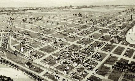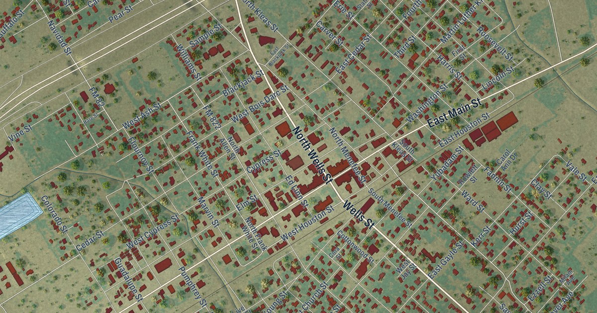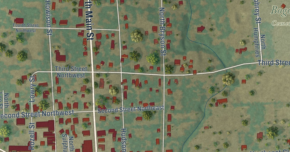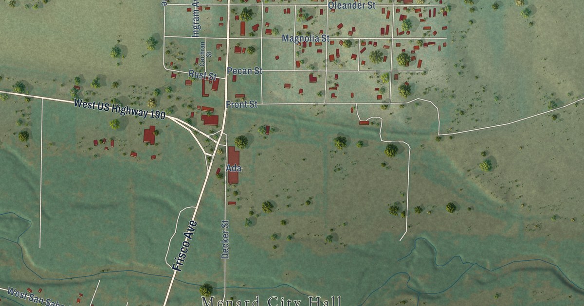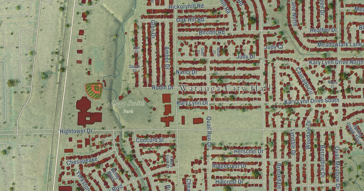
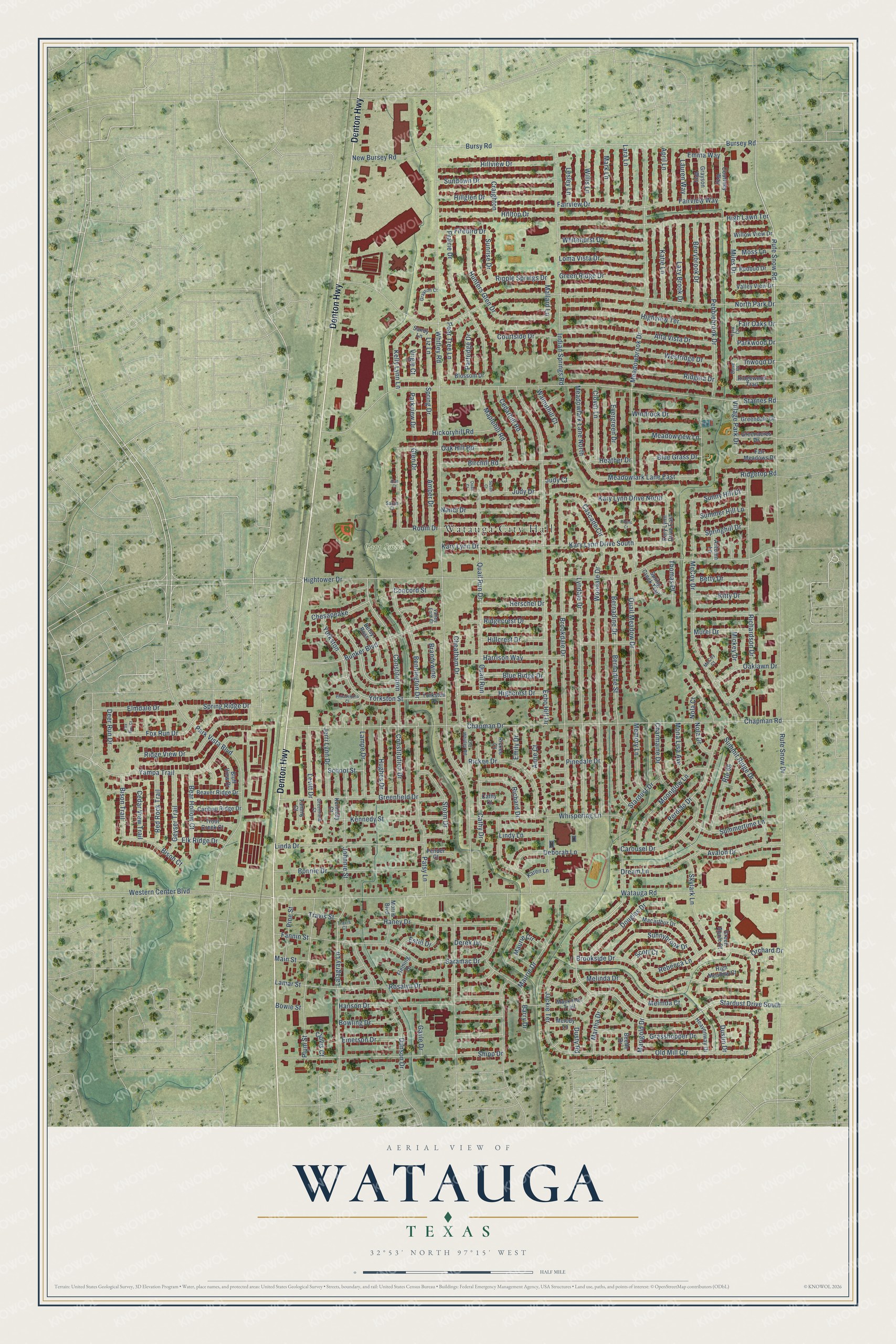
This beautifully detailed map of Watauga, Texas was created in 2026 using aerial imagery combined with modern topographical, census, street and landmark data. It’s a one-of-a-kind view of Watauga that combines accurate data with a vintage aesthetic. The map shows every building in its true location, many of the roads carry their names, and the shaded topographic relief shows the shape of the land.
Explore an aerial view of Watauga, Texas
On the map you’ll find Watauga City Hall and Capp Smith Park, along with Denton Highway, Rufe Snow Drive, Quail Run Drive, Rufe Snow Road, Whitley Road, Watauga Road, Chapman Road, Hightower Drive, Starnes Road, North Park Drive, and more. If you look closely you can even find your house accurately drawn in its correct location. Zoom in on the preview to look for yours.
Did you know this about Watauga, Texas?
From the Handbook of Texas: "The first permanent residents arrived after the Civil War. Settlers transported the name Watauga from Cherokee settlements in Tennessee."
Take a closer look at the Watauga map
Street and place names on the Watauga, Texas map
These names are printed on the map of Watauga, Texas.
Places: Watauga City Hall and Capp Smith Park.
Streets and roads: Denton Highway, Rufe Snow Drive, Quail Run Drive, Stardust Drive South, Rufe Snow Road, Whitley Road, Watauga Road, Chapman Road, Hightower Drive, Starnes Road, North Park Drive, Meadowbrook Drive.
More street names, A to Z
Alan Court, Alta Vista Drive, Amber Drive, Anne Court, April Lane, Autumn Lane, Avalon Drive, Barry Drive, Bear Hollow Court, Beaver Ridge Drive, Beetle Drive, Bennington Drive, Bernadine Drive, Bernadine Street, Berrybrook Drive, Betsy Ross, Betty Drive, Birchill Road, Bison Court, Bison Trail, Blossom Drive, Blue Grass Drive, Blue Ridge Drive, Bluff View Drive, Bonnie Drive, Bowie Street, Bowling Drive, Brandywine, Brookdale Drive, Brookside Drive, Bunker Boulevard, Bursey Road, Bursy Road, Caribou Ridge Drive, Carousel Drive, Cascade Circle, Cathy Court, Cathy Drive, Cedarhill Road, Cedar View Trail, Chapman Drive, Charmaine Drive, Cheatham Drive, Chesapeake, Clover Lane, Clovis Court, Concord Street, Constitution, Constitution Drive, Courtney Way, Courtside Drive, Craighton, Deborah Lane, Deer Run Drive, Derek Drive, Douglas Drive, Dove Court, Dream Lane, Dunson Drive, Dustin Drive, Dusty Road, Echo Hill Drive, Elk Ridge Drive, Elmdale Drive, Emerson Drive, Emily Drive, Emma Way, Estill Drive, Evergreen Drive, Fair Meadows Drive, Fair Oaks Drive, Fairview Drive, Fairview Way, Fannin Street, Fender Court, Firebird Drive, Fleming Drive, Fox Run Court, Fox Run Drive, Gayle Drive, Geyser Trail, Glen Drive, Grasshopper Drive, Grayson Court, Grayson Way, Greenacres Drive, Green Apple Court, Greendale Drive, Greenfield Court, Greenfield Drive, Green Ridge Drive, Haney Drive, Hanson Drive, Harrison Way, Heather Drive, Heavenway Drive, Herschel Drive, Hickoryhill Road, Highcrest Drive, High Lawn Terrace, High Meadow Court, Highview Terrace, Hillcrest Drive, Hillglen Drive, Hilltop Drive, Hillview Drive, Hughes Drive, Hunters Glen Drive, Indian Springs Road, Inwood Drive, Jackie Terrace, Jerri Lynn Drive, Johnnie Street, Judy Court, Judy Drive, Karen Lane, Kary Lynn Drive, Kary Lynn Drive East, Kary Lynn Drive North, Kary Lynn Drive South, Katie Lane, Kelly Lynn Lane, Kennedy Court, Kennedy Street, Kitty Drive, Lalagray Lane, Lamar Street, Lampe Drive, Lara Lane, Lauren Way, Lazy Brook Drive, Lesley Lane, Levitt Drive, Linda Drive, Lindy Lane, Liz Lane, Loma Vista Drive, Lyndale Drive, Macarthur Drive, Mackneal Trail, Main Street, Mallard Lane, Maplehill Road, Marigold Drive, Mark Lane, Martha Drive, Maurie Circle, Maurie Drive, McCoy Court, McCoy Drive, Meadowlark Lane East, Meadowlark Lane North, Meadowview Lane, Melinda Court, Melinda Drive, Melody Lane, Memory Lane, Mickey Drive, Miles Drive, Mona Lisa Avenue, Moonglow Lane, Morris Boulevard, Moss Lane, Murel Drive, Nanci Drive, New Bursey Road, Nola Court, Nola Drive, Oak Hill Road, Oaklawn Drive, Old Mill Circle, Old Whitley Road, Orchard Drive, Parkview Drive, Park Vista Boulevard, Parkwood Drive, Partridge Drive, Patino Court, Patsy Lane, Pear Tree Lane, Pebblebrook Drive, Perdido Drive, Philadelphia Court, Pinedale Drive, Pine Street, Plum Street, Prairie Drive, Quail Court, Quail Meadow Drive, Quail Run, Rebecca Lane, Redbud Drive, Red Rock Trail, Richard Drive, Richardson Drive, Rickee Court, Rickee Drive, Ridgecrest Drive, Ridgetop Road, Ridge View Drive, Ridgewood Trail, Ridglea Drive, Ripple Springs Drive, Robin Drive, Rosalyn Drive, Route 66, Sandy Lane, Sarah Court, Saramac Drive, School Street, Scott Court, Shipp Drive, Skylark Lane, Spring Creek Trail, Spring Drive, Springhill Drive, Spring Ridge Drive, Stardust Drive, Storm Drive, Summer Hill Lane, Summertime Lane, Summit Ridge Drive, Sundown Drive, Sunnybrook Drive, Sunny Hill Drive, Sunrise Drive, Susan Court, Tammy Court, Thomas Place, Travis Court, Travis Street, Trout Creek Court, Tyra Court, Valley Ford Court, Valley View Drive, Village Park Drive, Virgie Court, Walnuthill Court, Western Center Boulevard, Westridge Drive, Whispering Lane, Whitehurst Drive, Willis Lane, Willow View Drive, Windrock Drive, Woodale Drive, Yampa Trail, Yorkston, Yorkston Drive, Yorkston Street.
See the Watauga, Texas map on a wall
The Watauga map as an 18 x 24 inch print in a black frame.

This beautifully detailed map of Watauga makes an attractive addition to your office, library, or den, and it can even be used to teach children the geography and history of the area. It also makes a great gift for anyone who grew up in Watauga or moved away. When you’re done exploring, click here to get your copy of the Watauga map.