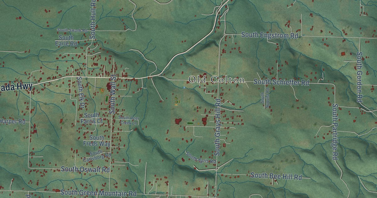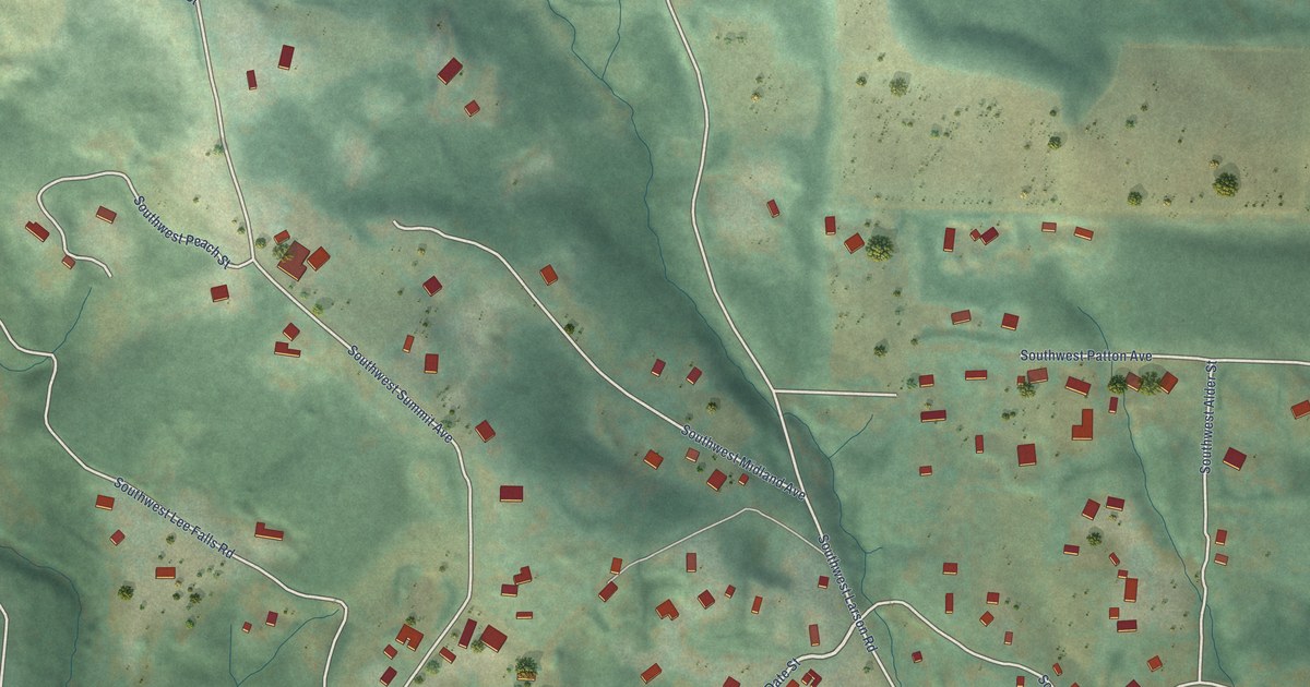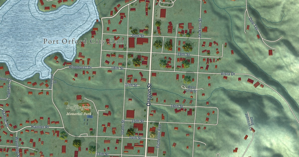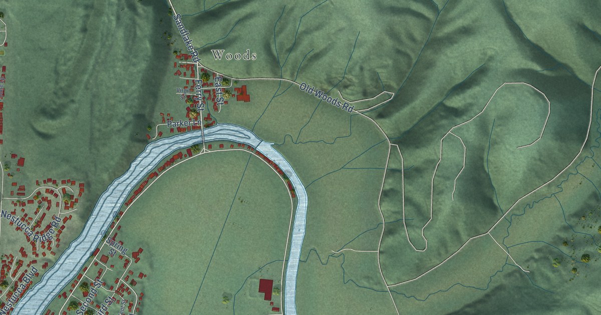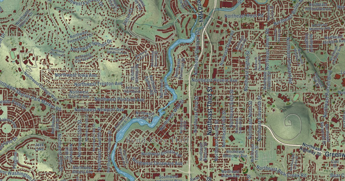
This beautifully detailed map of Bend, Oregon was created in 2026 using aerial imagery combined with modern topographical, census, street and landmark data. It’s a one-of-a-kind view of Bend that combines accurate data with a vintage aesthetic. The map shows every building in its true location, many of the roads carry their names, and the shaded topographic relief shows the shape of the land.
Explore an aerial view of Bend, Oregon
On the map you’ll find Bend City Hall and Awbrey Butte, along with The Dalles-California Highway, McKenzie-bend Highway, North Highway 97, Greenwood Avenue, Third Street, Southwest Century Drive, Southeast Third Street, Central Oregon Highway, Northeast Third Street, Highway 20, and more. If you look closely you can even find your house accurately drawn in its correct location. Zoom in on the preview to look for yours.
Did you know this piece of Bend, Oregon history?
From the Upper Deschutes Watershed Council: "Bend was platted by the Pilot Butte Development Company, and the plat was filed for record on June 7, 1904. The new town soon had a hotel and some mercantile stores."
Bend is a city in Deschutes County.
Take a closer look at the Bend map
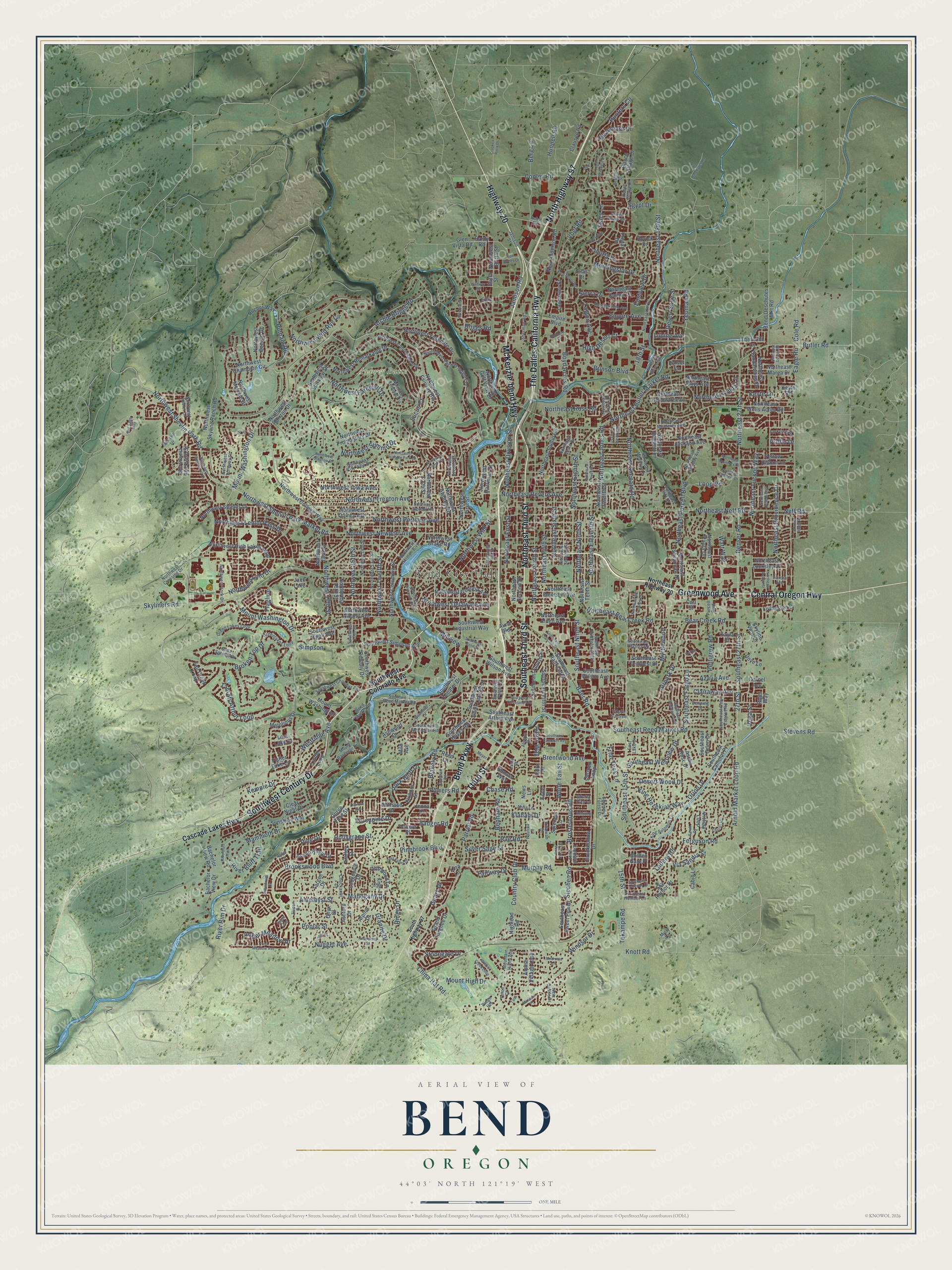
Street and place names on the Bend, Oregon map
These names are printed on the map of Bend, Oregon.
Places: Bend City Hall, Awbrey Butte and Jack Lake.
Streets and roads: The Dalles-California Highway, McKenzie-bend Highway, North Highway 97, Greenwood Avenue, Third Street, Southwest Century Drive, Southeast Third Street, Central Oregon Highway, Northeast Third Street, Highway 20, Bend Parkway, Mount Washington Drive.
More street names, A to Z
15th Street, 18th Street, 27th Street, Aaron Way, Ahha Lane, Airpark Drive, Alpine Drive, Alpine Village Loop, Alstrup Road, Amber Meadow Drive, Ambrosia Lane, Amethyst Street, Archie Briggs Road, Arnold Market Loop Road, Ascha Rose Court, Ashford Drive, Ashwood Drive, Aspen Ridge Drive, Aster Lane, Aune Road, Aurora Avenue, Azalia Avenue, Bachelor View Drive, Bachelor View Road, Badger Road, Baer Road, Bear Creek Road, Beaumont Drive, Bend-Deschutes Mkt Road, Benham Road, Berg Lane, Big Sage Way, Blakely Road, Boulderfield Avenue, Boyd Acres Road, Brahma Court, Brentwood Avenue, Briggs Road, Brinson Boulevard, Britta Street, Broken Top Drive, Brookhollow Drive, Brookswood Boulevard, Brosterhous Road, Builders Court, Butler Road, Cabin Lane, Carl Street, Carmen Loop, Cascade Lakes Highway, Charity Lane, Chase Road, Cherry Tree Lane, China Hat Road, Chuckanut Drive, Clairaway Avenue, Clausen Road, Clear Night Drive, Cliffrose Drive, Cole Road, Colt Lane, Cone Flower Street, Cooley Road, Country Club Drive, Crooked Rock Drive, Darnel Avenue, Deer Valley Drive, Denning Drive, Denser Road, Desert Sage Street, Desert Wood Drive, Dove Lane, Driftwood Lane, Duncan Lane, Eagle Road, East Lake Drive, Eastview Drive, Edro Place, Egypt Drive, Elkhorn Street, Ellie Lane, Empire Avenue, Empire Boulevard, Fairway Drive, Fall Creek Loop, Ferguson Road, Fisher Lake Lane, Flagline, Fred Meyer Road, Friar Tuck Lane, Geary Drive, Glacier Ridge Road, Glen Vista Road, Golden Gate Place, Gorge View Street, Grand Targhee Drive, Granite Drive, Green Lakes Loop, Greenlakes Loop, Halfway Road, Halley Street, Hardy Road, Harley Lane, High Desert Court, Highlead Road, High Standard Drive, Hollygrape Street, Hunnell Road, Hunters Circle, Jamison Road, Jamison Street, Jenna Drive, Kayla Court, Kemple Drive, Kenzie Avenue, Keyte Lane, Keyte Road, Killowan Drive, King Hezekiah Way, Kings Lane, King Solomon Lane, Klahani Drive, Knott Road, Kobe Street, Ladera Road, Lamoine Lane, Lancaster Street, Larkspur Loop, Larkview Road, Layton Avenue, Liberty Lane, Linton Loop, Livingston Drive, Lodgepole Drive, Loop Road, Lora Lane, Lost Lake Drive, Lucia Street, Lucus Court, Lupine Avenue, Mahogany Drive, Mammoth Drive, Mazama Place, McClain Drive, Metolious Drive, Meyer Drive, Millview, Milo Avenue, Misty Lane, Morningstar Drive, Mountain High Loop, Mount Bachelor Drive, Mount High Drive, Mount Washington, Murphy Road, Myrtlewood, Neff Road, Nels Anderson Road, New Castle Drive, News Lane, Northeast 18th Street, North East 18th Street, Northeast 27th Street, Northeast Alden Avenue, Northeast Bear Creek Road, Northeast Billyeu Way, Northeast Butler Market Road, Northeast Cliff Drive, Northeast Comet Lane, Northeast Conners Drive, Northeast Courtney Drive, Northeast Daggett Lane, Northeast Dalton Street, Northeast Daniel Road, Northeast Diablo Way, Northeast Division Street, Northeast Eighth Street, Northeast Eleventh Place, Northeast Eleventh Street, Northeast Emerson Avenue, Northeast Fifth Street, Northeast First Street, Northeast Fourth Street, Northeast Harvey Lane, Northeast Highway 20, Northeast Holliday Avenue, Northeast Hollowtree Lane, Northeast Jackson Avenue, Northeast Jones Road, Northeast Keats Drive, Northeast Locksley Drive, Northeast Lotno Drive, Northeast Lynda Lane, Northeast Marea Drive, Northeast Mays Avenue, Northeast Mc Cartney Drive, Northeast Meadow Lane, Northeast Monterey Avenue, Northeast Neff Road, Northeast Ninth Street, Northeast Paula Drive, Northeast Providence Drive, Northeast Purcell Boulevard, Northeast Revere Avenue, Northeast Ross Road, Northeast Sandalwood Drive, Northeast Savannah Drive, Northeast Second Street, Northeast Seventh Street, Northeast Shepard Road, Northeast Sixth Street, Northeast Studio Road, Northeast Tenth Street, Northeast Tucson Way, Northeast Twelfth Street, Northeast Wells Acres Road, Northwest 13th Street, Northwest 14th Street, Northwest 15th Street, Northwest 16th Street, Northwest 17th Street, Northwest 18th Street, Northwest Albany Avenue, Northwest Awbrey Road, Northwest Brickyard Street, Northwest Britta Street, Northwest Champion Circle, Northwest City View Drive, Northwest College Way, Northwest Columbia Street, Northwest Conrad Drive, Northwest Constellation Drive, Northwest Crossing Drive, Northwest Delaware Avenue, Northwest Drake Road, Northwest Fairway Heights, North West Fairway Heights Drive, Northwest Farewell Drive, Northwest First Street, Northwest Georgia Avenue, Northwest Glassow Drive, Northwest Golf View Drive, Northwest Harmon Boulevard, Northwest Harriman Street, Northwest High Lakes Loop, Northwest Hillside Park Drive, Northwest Hill Street, Northwest Horizon Drive, Northwest Imbler Drive, Northwest Iowa Avenue, Northwest Lemhi Pass Drive, Northwest Lolo Drive, Northwest Melville Drive, Northwest Newport Avenue, Northwest Portland Avenue, Northwest Promontory Drive, Northwest Quincy Avenue, Northwest Redfield Circle, Northwest Remarkable Drive, Northwest Riverside Boulevard, Northwest Saginaw Avenue, Northwest Second Street, Northwest Shelvin Park Market Road, Northwest Shevlin Park Road, Northwest Shields Drive, Northwest Sixth Street, Northwest Skyline Ranch Road, Northwest Sonora Drive, Northwest Starview Drive, Northwest Summerhill Drive, Northwest Summit Drive, Northwest Torsway Street, Northwest Trenton Avenue, Northwest Twelfth Street, Northwest Wall Street, Northwest Wild Rye Circle, Northwest York Drive, Northwest Yosemite Drive, Nugget Avenue, Old Deschutes Road, Onyx Street, Opal Drive, Orion Drive, Parrell Road, Paulina Lane, Pettigrew Road, Pinebrook Boulevard, Pine Drive, Poe Sholes Drive, Ponderosa Street, Pond Meadow Avenue, Poplar Street, Porcupine Drive, Powers Road, Puffin Drive, Purcell Boulevard, Purser Lane, Putnam Road, Rae Road, Ranch Village Court, Ranch Village Drive, Redwing Lane, Reed Lane, Reed Market Road, Ridge Drive, Ridge Heights, Rigel Way, River Bluff Trail, Riverbluff Trail, River Rim Drive, Riverstone Drive, Robal Road, Rocher Way, Rock Bluff Lane, Rorick Drive, Sager Loop, Sarah Drive, Sherman Road, Sherwood Forest Drive, Sierra Drive, Silas Drive, Silver Sage Street, Simpson, Sipchen Road, Sky Harbor Drive, Skyliners Road, Skyline View Drive, Snowbrush Drive, Snow Peaks Drive, Soda Springs Drive, Sonata Way, Southeast 15th Street, Southeast 27th Street, Southeast Arthur Avenue, Southeast Bridgeford Boulevard, Southeast Camelot Place, Southeast Cameron Avenue, Southeast Cleveland Avenue, Southeast Daly Estates Road, Southeast Fargo Lane, Southeast Fifth Street, Southeast Fourth Street, Southeast Gateway Drive, Southeast Humber Lane, Southeast Logsden Street, Southeast Ninth Street, Southeast Orion Drive, Southeast Railroad Street, Southeast Reed Market Road, Southeast Shadowood Drive, Southeast Sweet Pea Drive, Southeast Tempest Drive, Southeast Virginia Road, Southeast Westview Drive, Southeast Wilson Avenue, South Highway 97, South Suntree, Southwest 15th Street, Southwest Bond Street, Southwest Chandler Avenue, Southwest Colorado Avenue, Southwest Hayes Road, Southwest Industrial Way, Southwest Knoll Avenue, Southwest McClellan Road, Southwest Pelton Place, Southwest Reed Market Road, Southwest Silver Lake Boulevard, Southwest Simpson Avenue, Southwest Theater Drive, Southwest Wilson Avenue, Splendor Lane, Stacy Lane, Stevens Road, Stonegate Drive, Sunshine Way, Tam McArthur Loop, Taos, Targee Drive, Tekampe Road, Teton Court, Thornhill Lane, Tristar Drive, Vega Street, Via Sandia Street, Victory Loop, Vogt Road, Voltera Place, Watt Way, Westridge Avenue, White Tail Street, Willow Creek Loop, Windsor Drive, Woodriver Lane, Yellow Ribbon Lane, Yeoman Road, Zircon Drive.
See the Bend, Oregon map on a wall
The Bend map as an 18 x 24 inch print in a black frame.

This beautifully detailed map of Bend makes an attractive addition to your office, library, or den, and it can even be used to teach children the geography and history of the area. It also makes a great gift for someone who left Bend and still calls it home. When you’re done exploring, click here to get your copy of the Bend map.