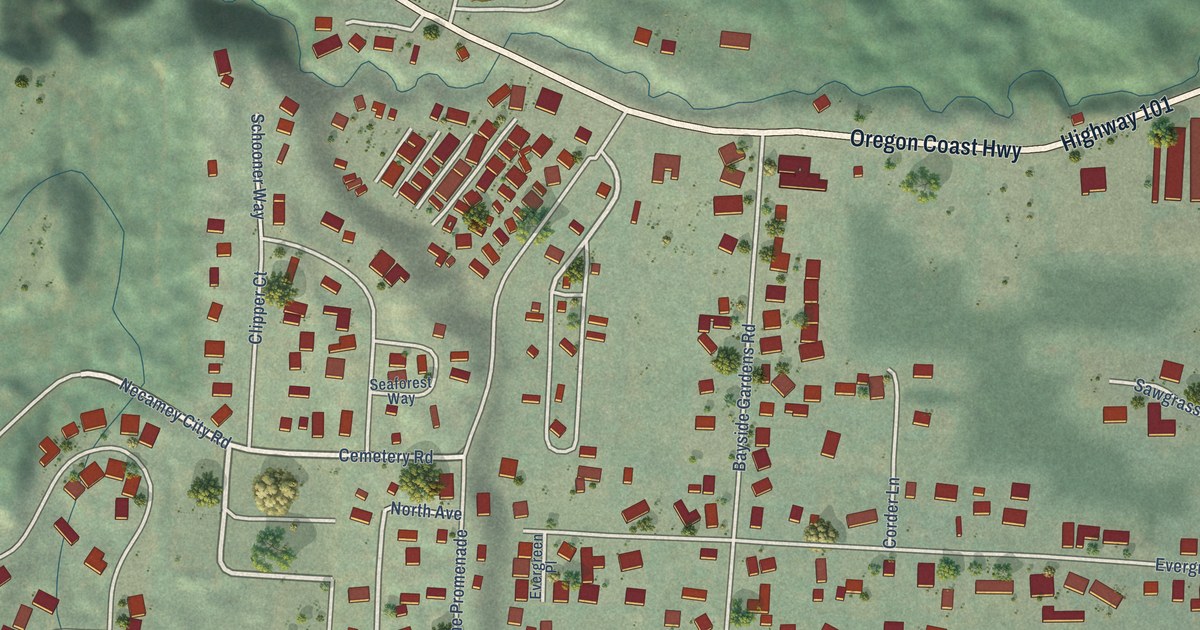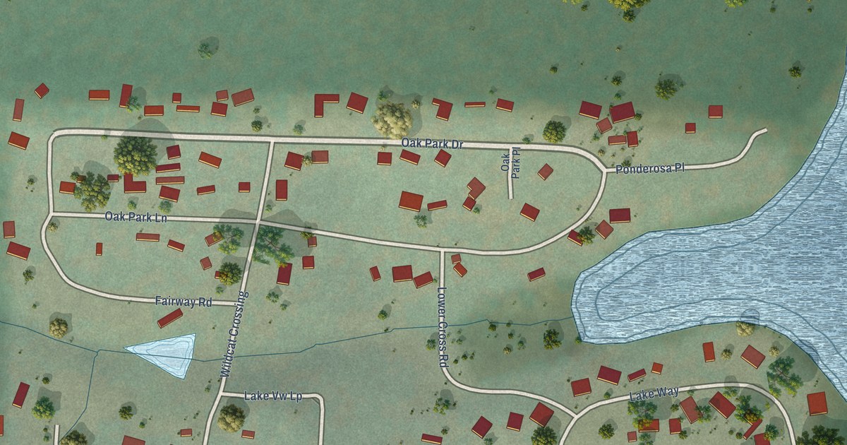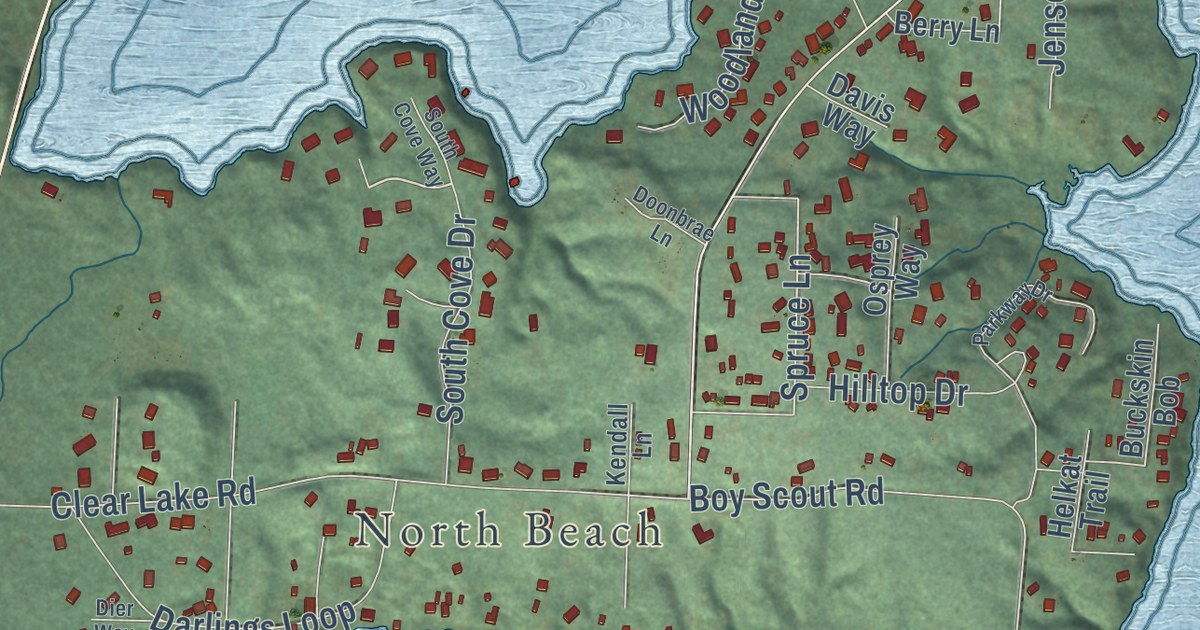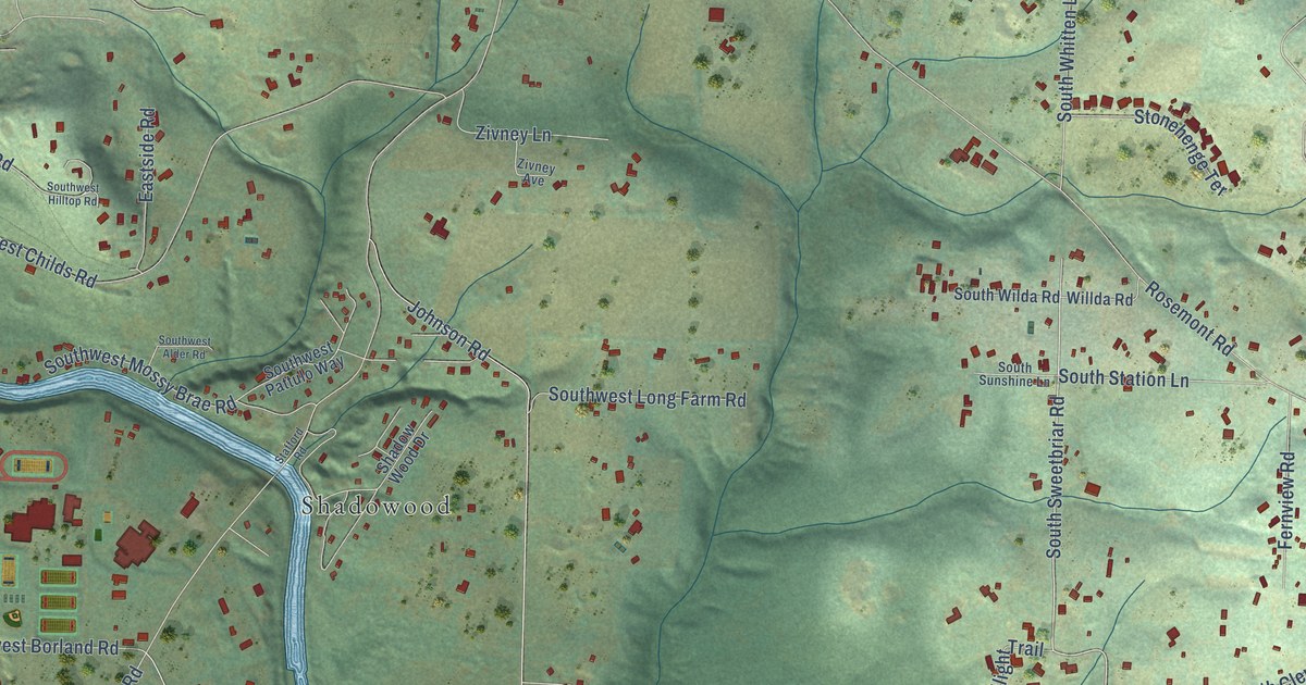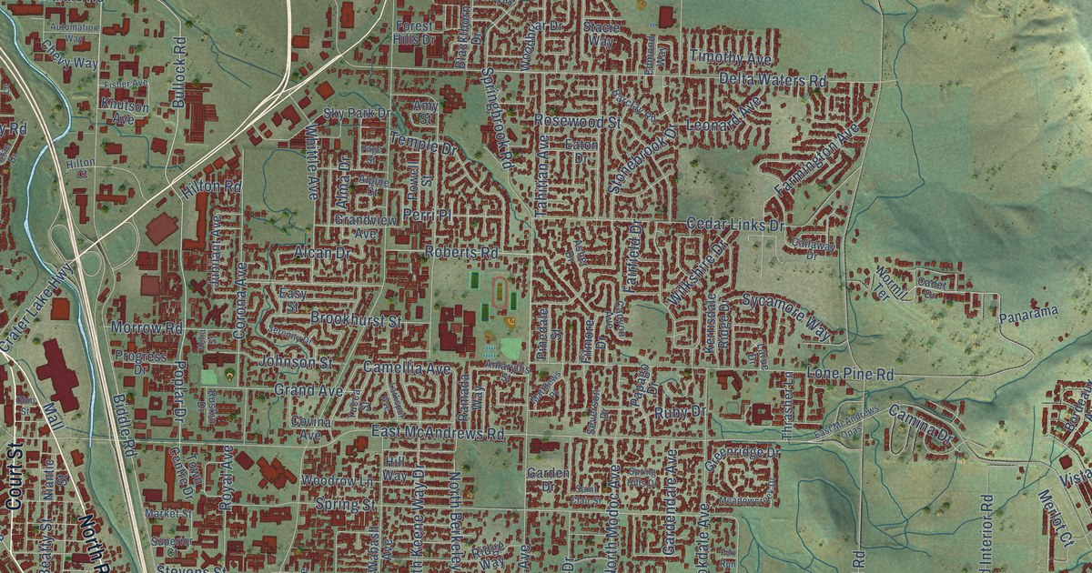
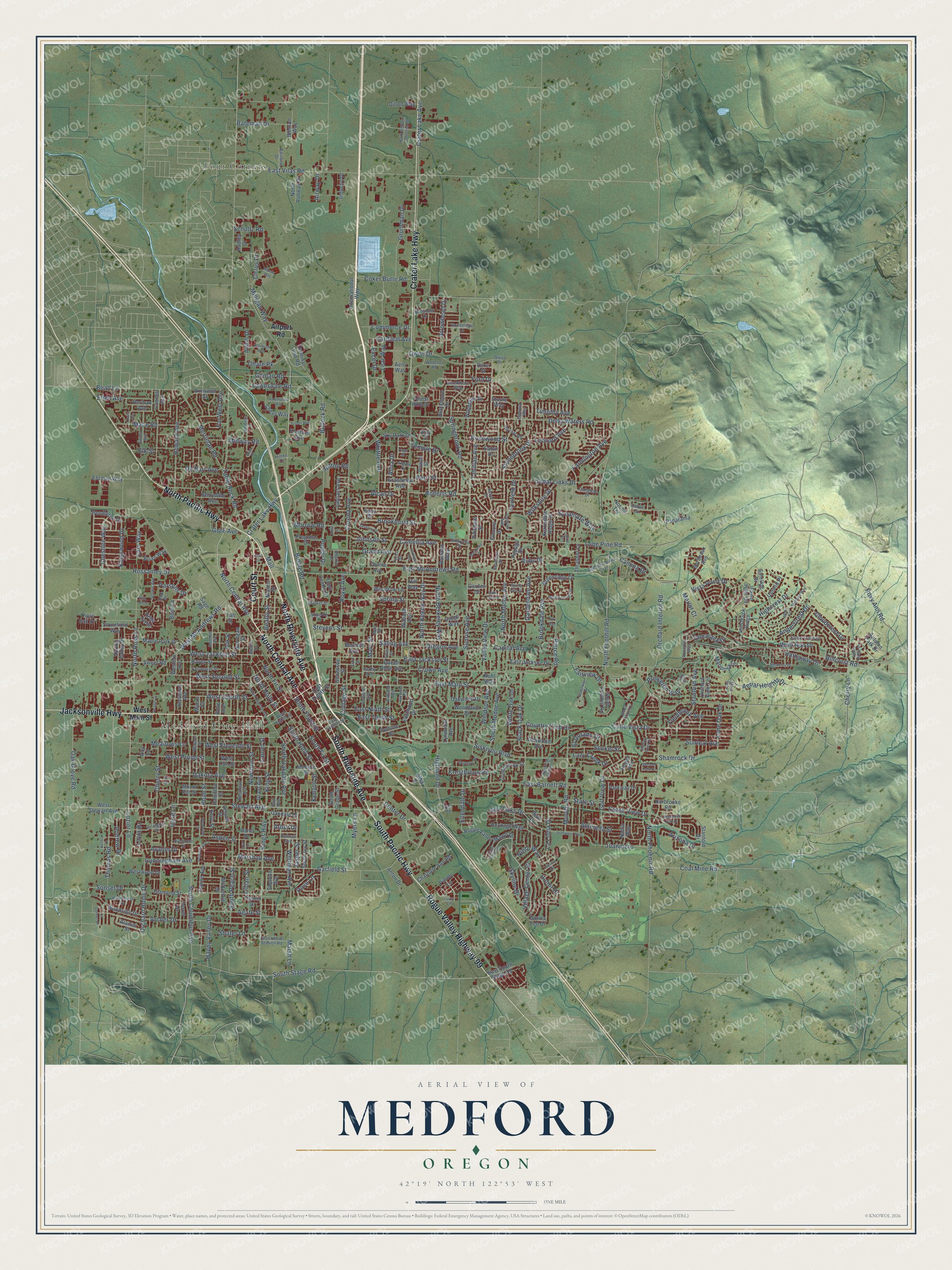
This beautifully detailed map of Medford, Oregon was created in 2026 using aerial imagery combined with modern topographical, census, street and landmark data. It’s a one-of-a-kind view of Medford that combines accurate data with a vintage aesthetic. The map shows every building in its true location, many of the roads carry their names, and the shaded topographic relief shows the shape of the land.
Explore an aerial view of Medford, Oregon
On the map you’ll find Medford City Hall, Bear Creek Park, and Four Corners, along with Crater Lake Highway, South Riverside Avenue, Rogue Valley Highway 99, North Riverside Avenue, North Central Avenue, Court Street, North Pacific Highway, South Pacific Highway, Jacksonville Highway, and more. If you look closely you can even find your house accurately drawn in its correct location. Zoom in on the preview to look for yours.
Did you know this piece of Medford, Oregon history?
From Oregonencyclopedia.org: "The Mail Tribune was created through a 1909 merger of the Medford Mail, a proponent of political reform first published in 1888, and the Medford Daily Tribune, which began publication in 1906."
Medford is a city in Jackson County.
Take a closer look at the Medford map
Street and place names on the Medford, Oregon map
These names are printed on the map of Medford, Oregon.
Places: Medford City Hall, Bear Creek Park and Four Corners.
Streets and roads: Crater Lake Highway, South Riverside Avenue, Rogue Valley Highway 99, North Riverside Avenue, North Central Avenue, Court Street, North Pacific Highway, South Pacific Highway, Jacksonville Highway, Bullock Road, Ellendale Drive, Stewart Avenue.
More street names, A to Z
Aerial Heights Drive, Aero Way, Agate Street, Airport Road, Airway Drive, Alamar Street, Alameda Street, Alba Drive, Alcan Drive, Alma Drive, Alpine Court, Amaryllis Street, Amy Street, Andrew Drive, Angel Crest Drive, Annettes Way, Anton Drive, Arbor Drive, Archer Drive, Arizona Drive, Arlington Drive, Arnwood Street, Arrowhead Drive, Asher Drive, Ashland Avenue, Aspen Street, Automation Way, Autumn Park Drive, Avalon Drive, Avion Drive, Barclay Road, Bateman Drive, Beall Lane, Beatty Street, Beekman Avenue, Bennett Avenue, Bens Lane, Benson Street, Berrydale Avenue, Biddle Road, Bierson Way, Black Oak Drive, Blackthorn Drive, Blackthorn Way, Bordeaux Avenue, Brae Drive, Brentcrest Drive, Brian Way, Britt Drive, Brookdale Avenue, Brookhurst Street, Cadet Drive, Callaway Drive, Calle Vista Drive, Camellia Avenue, Camina Drive, Canyon Avenue, Capital Avenue, Cardinal Avenue, Cedar Links Drive, Center Drive, Charlotte Ann Road, Cherry Lane, Cherry Street, Cheshire Way, Chevy Way, Cirrus Drive, Clearwater Drive, Cloudcrest Drive, Coal Mine Road, Coker Butte Road, Commerce Drive, Connell Avenue, Corona Avenue, Cottage Street, Country Club Drive, Covina Avenue, Crater Lake Avenue, Creek View Drive, Crestbrook Road, Crown Avenue, Cummings Lane, Cunningham Avenue, Dakota Avenue, Dane Drive, De Barr Avenue, Dellwood Avenue, Delta Waters Road, Diamond Street, Dillon Way, Disk Drive, Dixie Lane, Donna Lee Drive, Dove Lane, Duell Avenue, Duncan Drive, Durst Street, Dyer Road, Eagle Trace Drive, East Barnett Road, East Eighth Street, East Jackson Drive, East Jackson Street, East Main Street, East McAndrews Opas, East McAndrews Road, East Ninth Street, East South Stage Road, East Tenth Street, East Twelfth Street, East Vilas Road, Eastwood Drive, Easy Street, Eaton Drive, Edmond Way, Effie Street, Ehrman Way, El Dorado Drive, Elk Street, Ellen Avenue, Elliott Avenue, Excel Drive, Experiment Station Road, Fairfield Drive, Fairmount Street, Fairview Drive, Farmington Avenue, Far West Avenue, Fawn Hills Circle, Fieldbrook Avenue, Filmore Drive, Fisher Avenue, Florence Avenue, Ford Drive, Forest Hills Drive, Fortune Drive, Fox Run, Gardendale Avenue, Garden Drive, Garfield Street, Genessee Street, Gilman Road, Golf View Drive, Gore Avenue, Grand Avenue, Grandview Avenue, Grant Avenue, Greenbrook Street, Greenridge Drive, Greenway Drive, Grumman Drive, Hadley Drive, Hamilton Street, Happy Valley Drive, Harbrooke Road, Hathaway Drive, Haven Street, Heathrow Way, Hedy Jayne, Heritage Way, Herman Avenue, Highcrest Drive, Highland Drive, Hillcrest Road, Hill Way, Hilton Court, Hilton Road, Hogan Avenue, Hollyhock Drive, Holmes Avenue, Hondeleau Lane, Honor Drive, Howard Avenue, Industry Drive, Innsbruck Ridge, International Way, Island Pointe Drive, Jasper Street, Jessica Circle, Johnson Street, Juanipero, Juanipero Way, Jubilant Avenue, Kelly Street, Kenwood Avenue, Kenyon Street, Kerrisdale Ridge Drive, Key Drive, Kings Highway, King Street, Kingswood Drive, Knutson Avenue, La Conner Drive, La Loma Drive, Larkspur Avenue, Lars Way, Larue Drive, Laurel Street, Lawnsdale Road, Layla Drive, Lazy Creek Drive, Lear Way, Leland Street, Leonard Avenue, Lillian Street, Lone Oak Drive, Lone Pine Road, Louise Avenue, Lowry Lane, Lozier Lane, Lynwood Avenue, Mace Road, Mae Street, Mall, Maple Park Drive, Mariposa Terrace, Market Street, Marshall Avenue, Marsh Lane, Mary Bee Lane, Mary Street, Matthews Place, McKenzie Drive, Meadowcreek Drive, Meadows Lane, Medical Center Drive, Merlot Court, Merriman Road, Michael Park Drive, Midway Road, Milligan Way, Monroe Street, Monterey Drive, Moon Terrace, Morrow Road, Mount Pitt Street, Murphy Road, Myers Court, Myers Lane, Nadia Way, Narregan Street, Nebula Way, Newtown Street, Niantic Street, Nieto Way, Nita Lynne, Normil Terrace, North Berkeley Way, North Fir Street, North Foothill Road, North Holly Street, North Keene Way Drive, North Medford Industrial Road, North Modoc Avenue, North Oakdale Avenue, North Phoenix Road, North Ross Lane, North Runway Drive, Oakdale Drive, Oak Grove Road, Oak Street, Oakwood Drive, Ohare Pk, Ohio Street, Orchard Home Drive, Orchard Interior Road, Orchard View Terrace, Oregon Avenue, Owen Drive, Page Street, Panarama, Papago Drive, Park Avenue, Parkway Drive, Parsons Drive, Peachwood Court, Pendleton Drive, Perri Place, Pierce Road, Pinedale Street, Pinner Lane, Plum Street, Poplar Drive, Portland Avenue, Powell Street, Princeton Way, Progress Drive, Quail Point Circle, Queen Anne Avenue, Qwen Drive, Rainbow Drive, Ramada Way, Reager Street, Reddy Avenue, Ridge Way, Roberts Road, Rogue Valley Manor Drive, Rose Avenue, Rosewood Street, Rossanley Drive, Roxy Ann Road, Royal Avenue, Ruby Drive, Ruhl Way, Ruskin Drive, Ruth Drive, Saddle Ridge Drive, Sage Road, Saint Clair Street, Saling Avenue, Satellite Drive, Schultz Road, Seckel Street, Serenity Drive, Severson Drive, Shafer Lane, Shamrock Drive, Sheldon Avenue, Sherwood Park Drive, Siskiyou Boulevard, Skyline Drive, Sky Park Drive, South Columbus Avenue, South Fir Street, South Foothill Road, South Front Street, South Grape Street, South Holly Street, South Ivy Street, South Modoc Avenue, South Oakdale Avenue, South Peach Street, South Stage Road, Springbrook Road, Spring Hills Drive, Spring Street, Spring Valley Drive, Stacie Way, Stanford Avenue, Stanford Drive, Stardust Way, Stark Street, State Street, Sterling Point Drive, Stevens Street, Stonebrook Drive, Stonefield Way, Stowe Avenue, Summit Avenue, Sunleaf Avenue, Sun Oaks Drive, Sunrise Avenue, Sunset Drive, Superior Court, Sweet Road, Sycamore Way, Table Rock Road, Taft Street, Tahitian Avenue, Tamarack Drive, Tannin Drive, Temple Drive, Terminal Loop Road, Terrel Drive, Thomas Road, Thorn Oak Drive, Thrasher Lane, Timothy Avenue, Town Centre Drive, Upland Place, Valley View Drive, Velia Street, Vick Lane, Victory Lane, Village Center Drive, Vista Point Drive, Wabash Avenue, Webfoot Road, Welch Drive, West 13th Street, West Eighth Street, West Eleventh Street, Western Avenue, West Fourth Street, West Jackson Street, West Main Street, West McAndrews Road, West Prune Street, West Second Street, West Stewart Avenue, Westwood Drive, White Oak Drive, Whitman Avenue, Whittle Avenue, Wilkshire Drive, Willowbrook Drive, Windsor Avenue, Wolf Run Drive, Woodbriar Drive, Woodlawn Drive, Woodrow Lane, Woodside Drive, Yale Drive, Yucca Street.
See the Medford, Oregon map on a wall
The Medford map as an 18 x 24 inch print in a black frame.

This beautifully detailed map of Medford makes an attractive addition to your office, library, or den, and it can even be used to teach children the geography and history of the area. It also makes a great gift for anyone who grew up in Medford or moved away. When you’re done exploring, click here to get your copy of the Medford map.