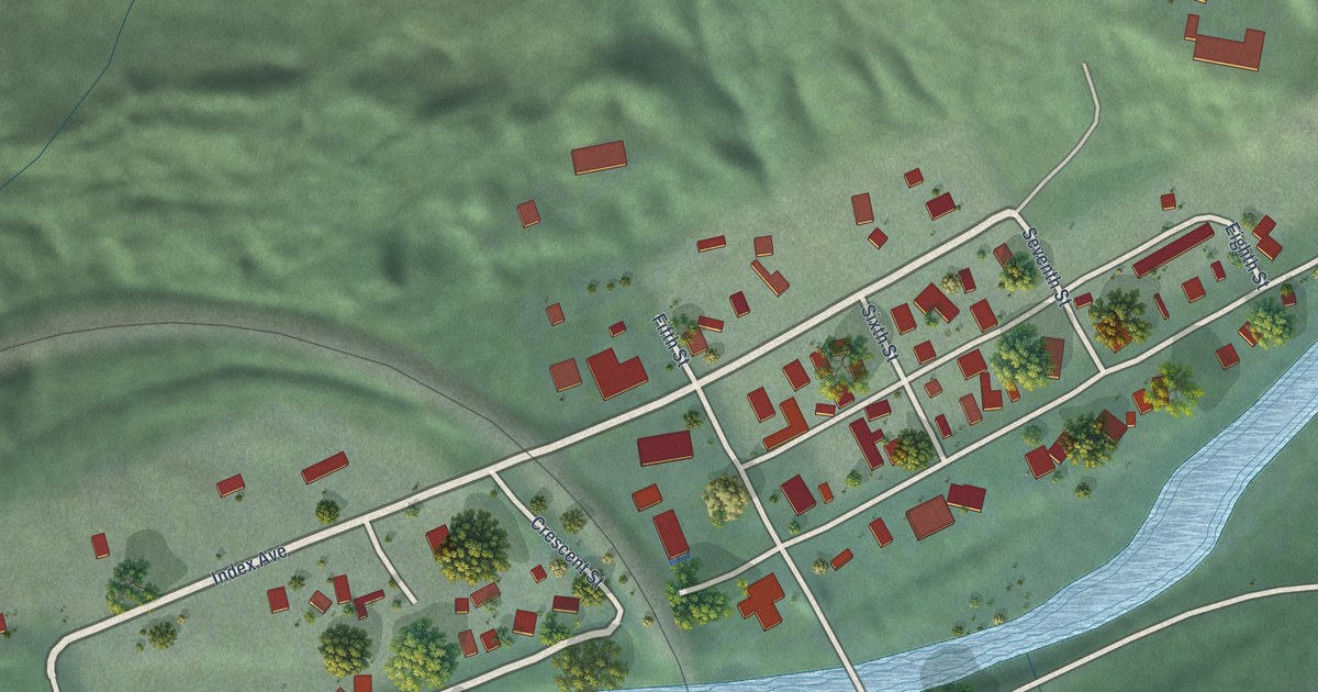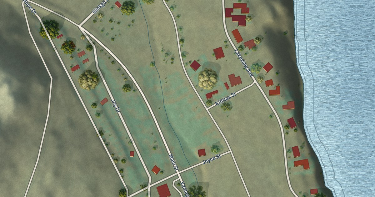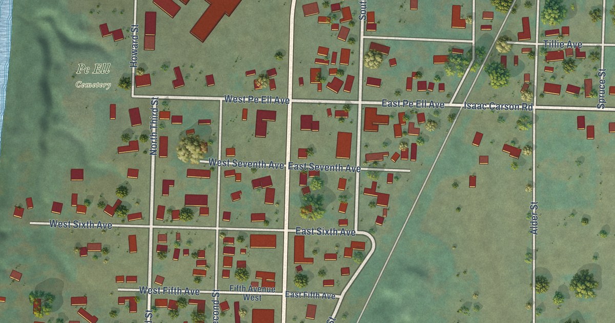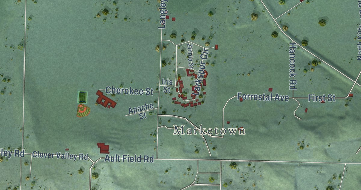
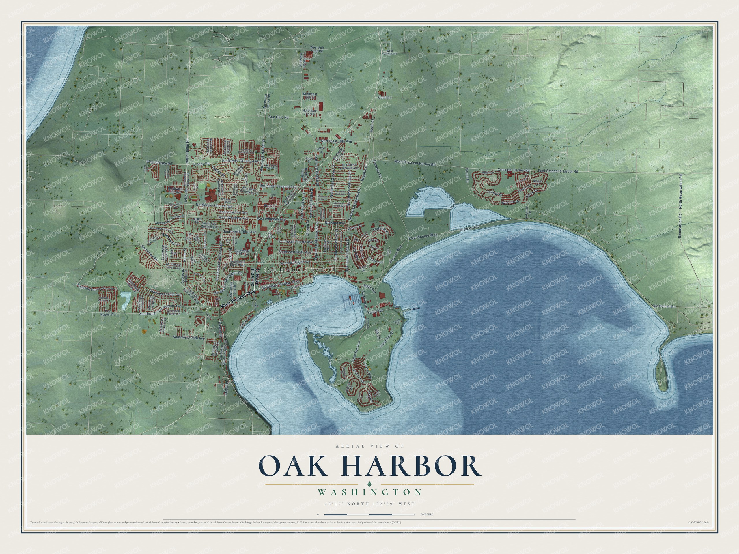
This beautifully detailed map of Oak Harbor, Washington was created in 2026 using aerial imagery combined with modern topographical, census, street and landmark data. It’s a one-of-a-kind view of Oak Harbor that combines accurate data with a vintage aesthetic. The map shows every building in its true location, many of the roads carry their names, and the shaded topographic relief shows the shape of the land.
Explore an aerial view of Oak Harbor, Washington
On the map you’ll find Oak Harbor City Hall and Freedom Park, along with West Pioneer Way, East Pioneer Way, East Crescent Harbor Road, Northeast Regatta Drive, East Whidbey Avenue, Heller Road, West Whidbey Avenue, West Crescent Harbor Road, Regatta Drive, Southeast Regatta Drive, and more. If you look closely you can even find your house accurately drawn in its correct location. Zoom in on the preview to look for yours.
Did you know this about Oak Harbor, Washington?
From HistoryLink.org: "Oak Harbor in Island County, located on Whidbey Island in Island County, existed for 90 years as a quiet, almost isolated, agricultural community from the arrival of the first American and Irish settlers in the 1850s through the influx of Dutch farmers from Michigan in the 1890s."
Take a closer look at the Oak Harbor map
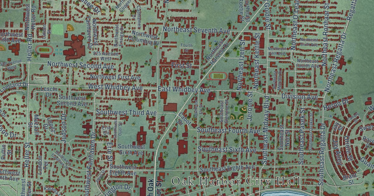
Street and place names on the Oak Harbor, Washington map
These names are printed on the map of Oak Harbor, Washington.
Places: Oak Harbor City Hall and Freedom Park.
Streets and roads: West Pioneer Way, East Pioneer Way, Northeast Goldie Street, Northeast Regatta Drive, East Whidbey Avenue, Heller Road, West Whidbey Avenue, Regatta Drive, Southeast Regatta Drive, Division Avenue, North Heller Road, Auvil Road.
More street names, A to Z
800 Avenue West, 825 Avenue West, Airline Way, Alder Lane, Balda Road, Barlow Street, Brant Street, Cabot Drive, Canary Street, Cascade Circle, Cascade Drive, Case Road, Catalina Drive, Catfish Lane, Cathlamet Drive, Central Drive, City Beach Street, Coral Sea Avenue, Coral Sea Drive, Crescent Harbor Road, Crosby Road, Dillard Lane, East Crescent Harbor Road, Eastern Drive, Easy Street, Elk Lane, Erie Circle, Erie Street, Fir, Fir Street, First Street, Fleet Street, Forest Drive, Fort Nugent Road, Fourth Street, Freund Street, Guam Avenue, Gun Club Road, Heller Street, Hemlock Circle, Heron Drive, Illahee Drive, Jay Alley, Jay Street, Jerome Street, Judson Drive, Kalama Loop, Lamms Lane, Larch Drive, Lateen Street, Leschi Drive, London Terrace, Lopez Drive, Maple Lane, Maui Avenue, Midway Boulevard, Mountain Circle, Muzzall Street, North 1190 West, Northeast 16th Avenue, Northeast 21st Court, Northeast 24th Lane, Northeast Eleventh Avenue, Northeast Fifth Avenue, Northeast Fourth Avenue, Northeast Halyard Lane, Northeast Harvest Drive, Northeast Izett Street, Northeast Kettle Street, Northeast Koetje Street, Northeast Melrose Drive, Northeast O'Leary Street, Northeast Oleary Street, Northeast Ronhaar Street, Northeast Seventh Avenue, Northeast Sixth Avenue, Northeast Tenth Avenue, North Oak Harbor Road, North Oak Harbor Street, North Reservation Road, Northwest Cherry Hill Loop, Northwest Clipper Drive, Northwest Columbia Drive, Northwest Crosby Avenue, Northwest Elwha Street, Northwest Ensign Drive, Northwest Fairhaven Drive, Northwest Fifth Avenue, Northwest First Avenue, Northwest Heller Road, Northwest Kathleen Drive, Northwest Second Avenue, Old Polnell Road, Oriole Street, Palmira Avenue, Pioneer Way, Puffin Street, Rainier Circle, Raven Drive, Reservation Road, Robertson Drive, Solomon Drive, South Beeksma Drive, Southeast Bayshore Drive, Southeast Catalina Drive, Southeast Eighth Avenue, Southeast Ely Street, Southeast Fourth Avenue, Southeast Glencoe Street, Southeast Midway Boulevard, Southeast Neil Street, Southeast Pasek Street, Southeast Pioneer Way, Southeast Quaker Street, Southeast Sixth Avenue, South Oak Harbor Street, Southwest 16th Avenue, Southwest 24th Avenue, Southwest Barrington Drive, Southwest Berwick Drive, Southwest Capital Drive, Southwest Castilian Drive, Southwest Dyer Street, Southwest Eighth Avenue, Southwest Erie Street, Southwest Fairhaven Drive, Southwest Fairway Point Drive, Southwest Fort Nugent Avenue, Southwest Heller Street, Southwest Loerland Drive, Southwest Putnam Drive, Southwest Regency Drive, Southwest Robertson Drive, Southwest Rosario Place, Southwest Scenic Heights Street, Southwest Second Avenue, Southwest Sixth Avenue, Southwest Stremler Drive, Southwest Swantown Avenue, Southwest Tahoe Street, Southwest Tenth Avenue, Southwest Third Avenue, Southwest Union Street, Southwest Xavier Drive, Stuart Lane, Swan Drive, Swantown Road, Torpedo Road, Tower Road, Tulag Avenue, Vista Loop, Vista Way, Wake Avenue, West Ault Field Road, West Crescent Harbor Road, West Crosby Road, Western Drive, West Fakkema Road.
See the Oak Harbor, Washington map on a wall
The Oak Harbor map as an 18 x 24 inch print in a black frame.

This beautifully detailed map of Oak Harbor makes an attractive addition to your office, library, or den, and it can even be used to teach children the geography and history of the area. It also makes a great gift for anyone who grew up in Oak Harbor or moved away. When you’re done exploring, click here to get your copy of the Oak Harbor map.