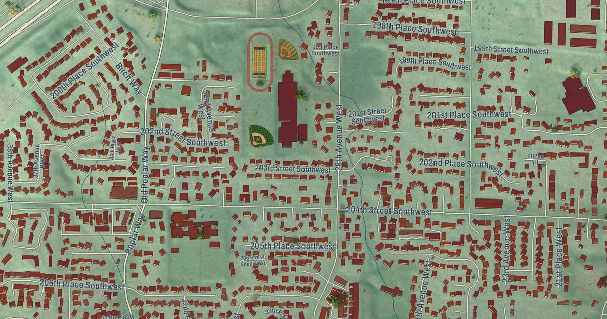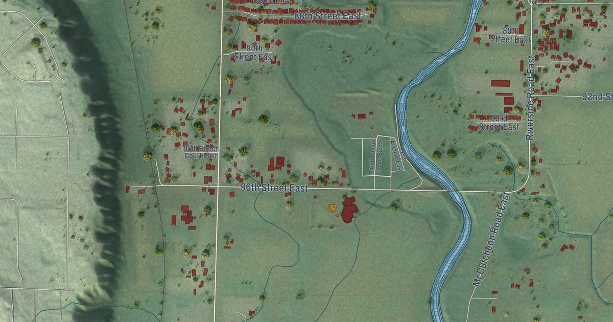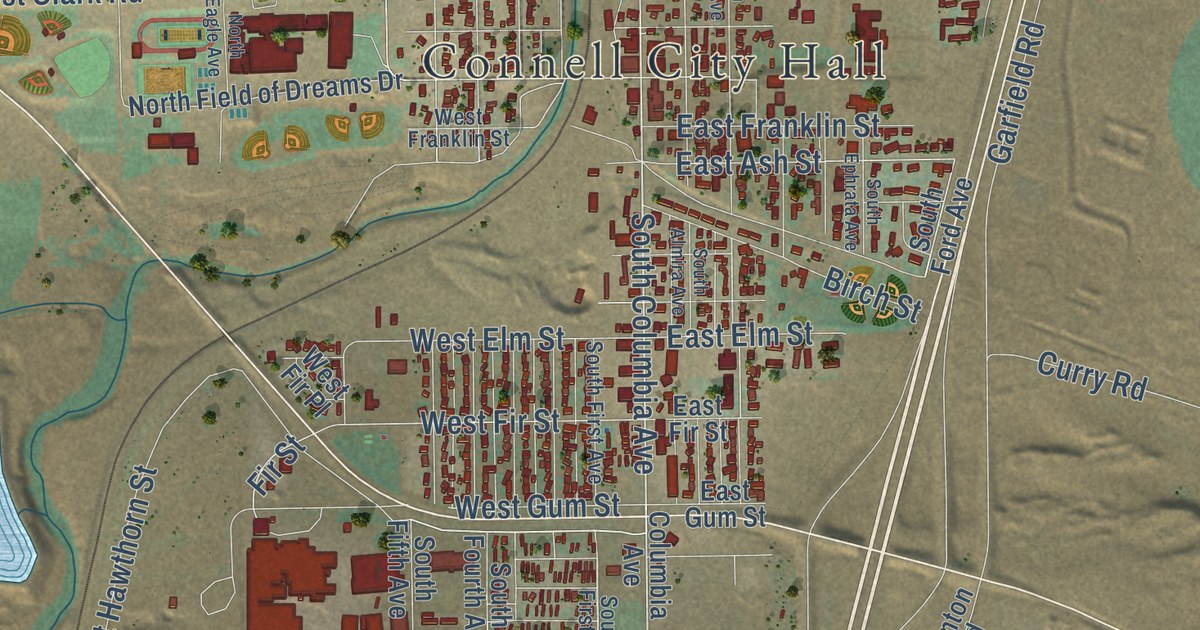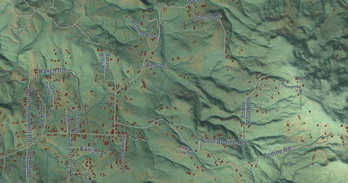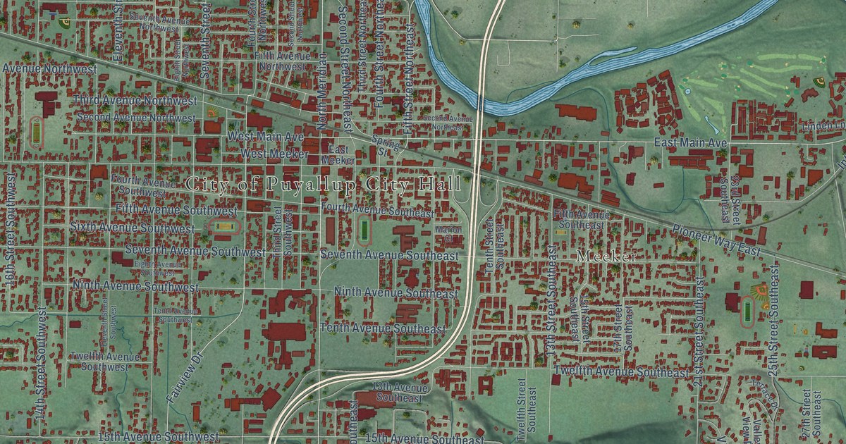
This beautifully detailed map of Puyallup, Washington was created in 2026 using aerial imagery combined with modern topographical, census, street and landmark data. It’s a one-of-a-kind view of Puyallup that combines accurate data with a vintage aesthetic. The map shows every building in its true location, many of the roads carry their names, and the shaded topographic relief shows the shape of the land.
Explore an aerial view of Puyallup, Washington
On the map you’ll find City of Puyallup City Hall, Meeker, Clark’s Creek Park, Van Lierop, Wildwood Park, Woodbine Cemetery, and South Meridian, along with North Meridian Avenue, River Road, East Meridian Avenue, Ninth Street Southwest, Fifth Street Southeast, and more. If you look closely you can even find your house accurately drawn in its correct location. Zoom in on the preview to look for yours.
Did you know this about Puyallup, Washington?
From HistoryLink.org: "Hops will grow in almost any climate, but they thrived in the Puyallup Valley, producing more quality hops per acre than in other hop-growing areas around the world."
Take a closer look at the Puyallup map
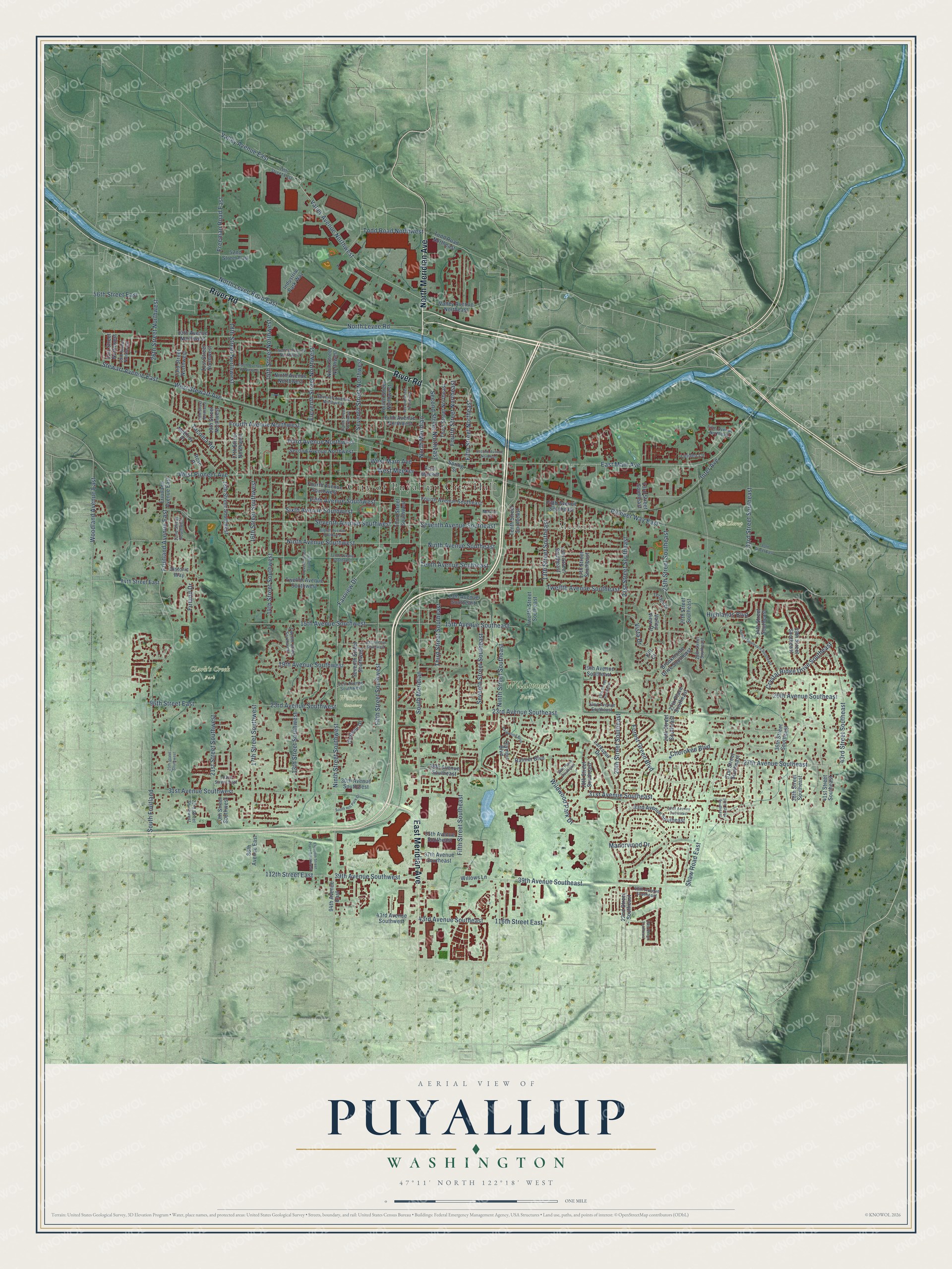
Street and place names on the Puyallup, Washington map
These names are printed on the map of Puyallup, Washington.
Places: City of Puyallup City Hall, Meeker, Clark's Creek Park, Van Lierop, Wildwood Park and Woodbine Cemetery.
Streets and roads: North Meridian Avenue, River Road, East Meridian Avenue, Ninth Street Southwest, Fifth Street Southeast, South Meridian, East Main Avenue, Valley Avenue Northwest, Fairview Drive, Fifth Street Northeast, North Meridian, Fifth Street Southwest.
More street names, A to Z
13th Avenue Northwest, 13th Avenue Southeast, 13th Street Southeast, 13th Street Southwest, 14th Street Southwest, 15th Avenue Southeast, 15th Avenue Southwest, 15th Street Northwest, 15th Street Southeast, 16th Street Southwest, 17th Avenue Southwest, 17th Street Northwest, 17th Street Southeast, 17th Street Southwest, 18th Street Northwest, 18th Street Southeast, 18th Street Southwest, 19th Avenue Southeast, 19th Avenue Southwest, 19th Street Northwest, 19th Street Southeast, 20th Avenue Southeast, 20th Street Northwest, 20th Street Southeast, 20th Street Southwest, 21st Avenue Southwest, 21st Street Northwest, 21st Street Southeast, 21st Street Southwest, 22nd Avenue Southeast, 22nd Street Southeast, 22nd Street Southwest, 23rd Avenue Southeast, 23rd Avenue Southwest, 23rd Street Northwest, 23rd Street Southeast, 23rd Street Southwest, 24th Street Southeast, 25th Street Southeast, 25th Street Southwest, 26th Street Northwest, 26th Street Southeast, 27th Avenue Southeast, 27th Place Southeast, 27th Street Southeast, 28th Avenue Southeast, 28th Place Southeast, 28th Street Southeast, 29th Street Northwest, 30th Avenue Southwest, 30th Street Southeast, 31st Avenue Southeast, 31st Avenue Southwest, 31st Street Northwest, 31st Street Southeast, 32nd Avenue Southeast, 33rd Avenue Southeast, 33rd Street Southeast, 34th Street Southeast, 35th Avenue Southeast, 36th Street Southeast, 37th Avenue Southeast, 38th Street Southeast, 39th Avenue Southeast, 39th Avenue Southwest, 39th Street Southeast, 40th Avenue Southeast, 41st Street Southeast, 43rd Avenue Southeast, 43rd Avenue Southwest, 43rd Street Southeast, 44th Street East, 52nd Street East, 56th Street East, 80th Street East, 84th Street East, 86th Avenue East, 94th Avenue East, 96th Street East, 103rd Street East, 112th Street East, 116th Street East, Amber Boulevard Southeast, Brookmonte Drive Southeast, Chateau Drive, Cherokee Boulevard, Crystal Ridge Drive Southeast, East Meeker, Eighth Avenue Southwest, Eighth Street Northwest, Eleventh Street Northwest, Eleventh Street Place Southwest, Eleventh Street Southwest, Fifth Avenue Northeast, Fifth Avenue Northwest, Fifth Avenue Southeast, Fifth Avenue Southwest, Firland Drive, Forest Green Boulevard, Fourth Avenue Northwest, Fourth Avenue Southeast, Fourth Avenue Southwest, Fourth Street Northeast, Fourth Street Northwest, Freeman Road East, Friutland Avenue East, Fruitland Avenue East, Highlands Boulevard, Historic Way, Industrial Park Way, Inter Avenue, Kilt Court, Larkspur Drive, Linden Lane, Manorwood Drive, Marion Court, McElroy Place, Ninth Avenue Northwest, Ninth Avenue Southeast, Ninth Avenue Southwest, Ninth Street Northwest, Ninth Street Southeast, North Levee Road, North Levee Road East, Olympic Boulevard, Parkwood Boulevard, Pioneer Way East, Rainier Boulevard, Rose Place, Second Avenue Northeast, Second Avenue Northwest, Second Street Northeast, Second Street Northwest, Seventh Avenue Northwest, Seventh Avenue Southeast, Seventh Avenue Southwest, Seventh Street Northwest, Seventh Street Southeast, Seventh Street Southwest, Shaw Road East, Sixth Avenue Southwest, South Fruitland, South Hill Park Drive, Spring Street, Stewart Avenue East, Tacoma Road, Tenth Avenue Northwest, Tenth Avenue Southeast, Tenth Avenue Southwest, Tenth Street Southeast, Terrace Drive, Third Avenue Northwest, Third Street Northeast, Third Street Southeast, Third Street Southwest, Todd Road Northeast, Todd Road Northwest, Twelfth Avenue Northwest, Twelfth Avenue Southeast, Twelfth Avenue Southwest, Twelfth Street Southeast, Twelfth Street Southwest, Valley Avenue East, Valley Avenue Northeast, Valley View Drive, Vista Drive, West Main Avenue, West Meeker, West Pioneer Avenue, West Stewart Avenue, Wildwood Park Drive, Willows Lane, Woodland Avenue East.
See the Puyallup, Washington map on a wall
The Puyallup map as an 18 x 24 inch print in a black frame.

This beautifully detailed map of Puyallup makes an attractive addition to your office, library, or den, and it can even be used to teach children the geography and history of the area. It also makes a great gift for anyone with Puyallup roots. When you’re done exploring, click here to get your copy of the Puyallup map.