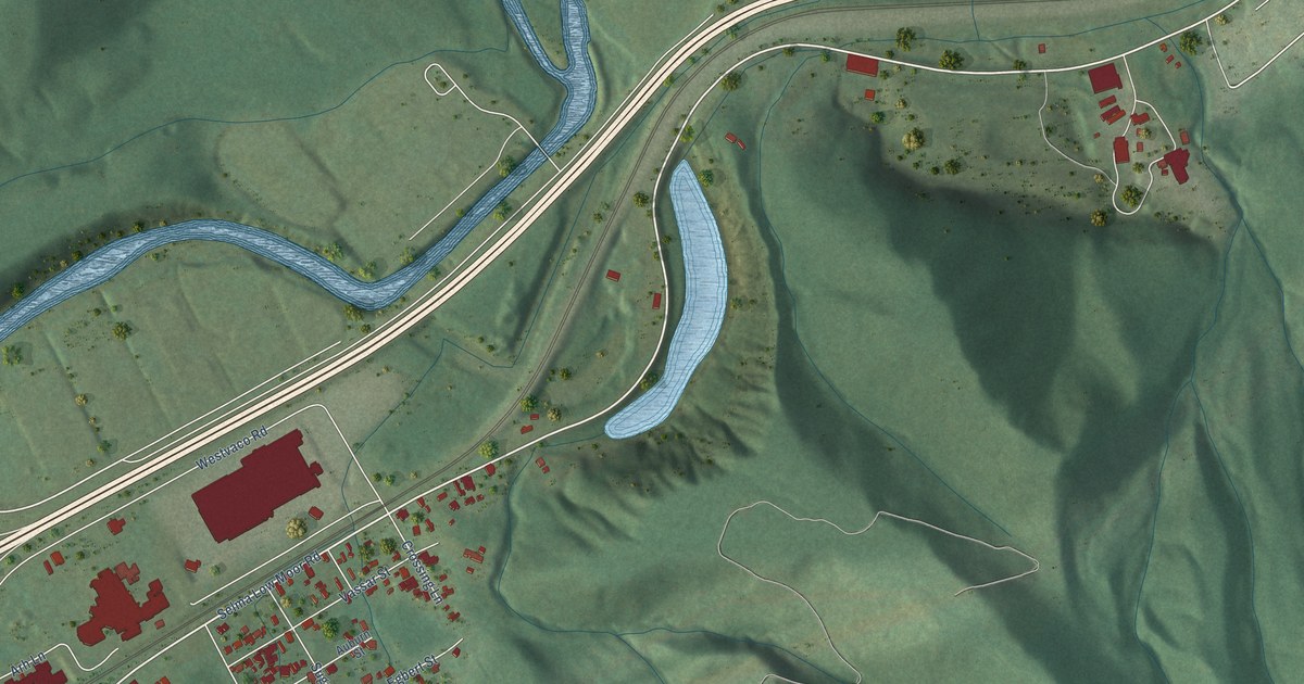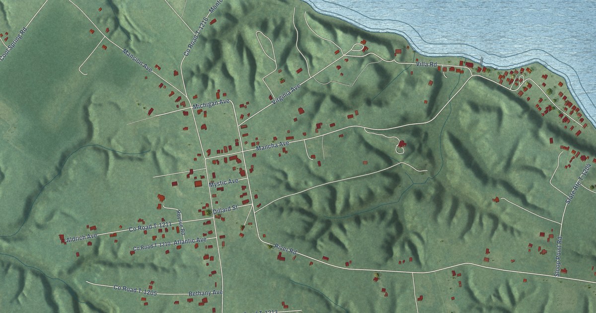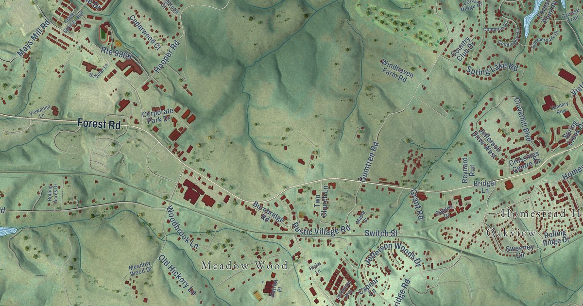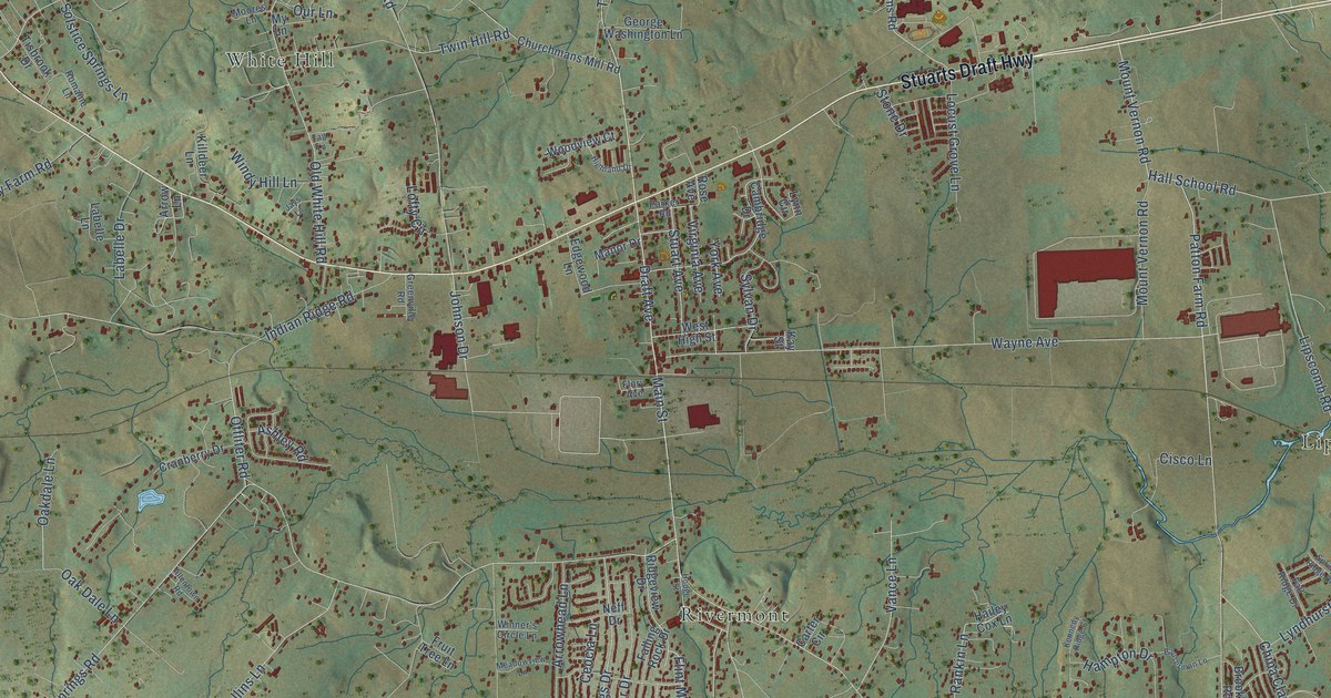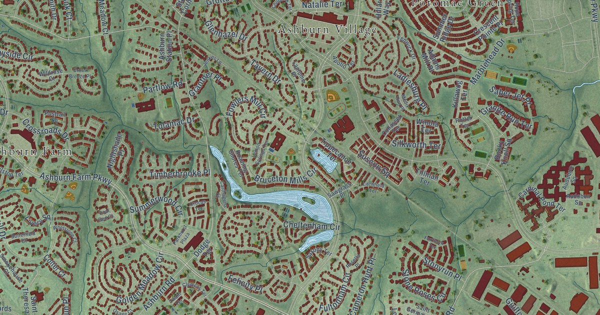
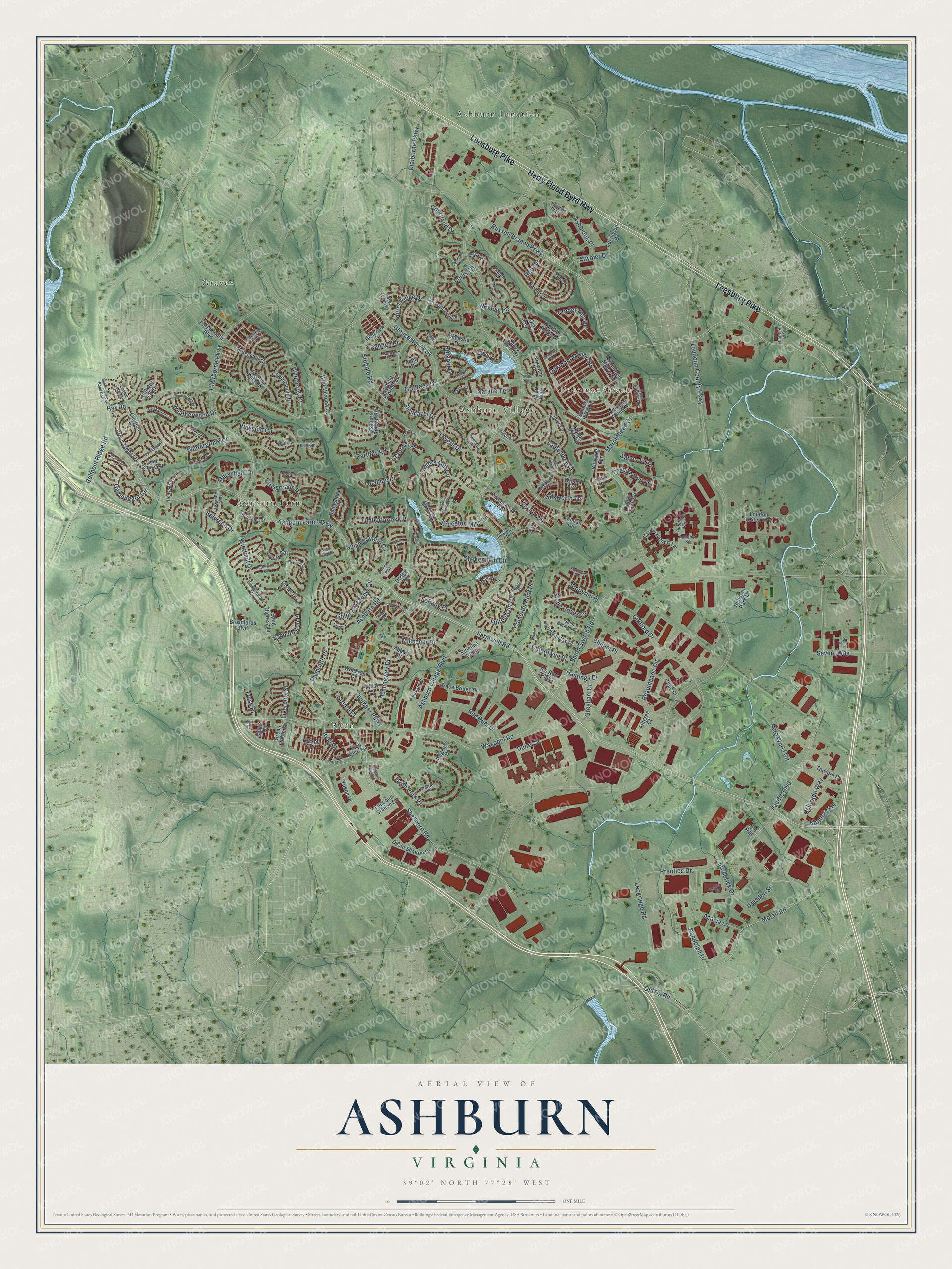
This beautifully detailed map of Ashburn, Virginia was created in 2026 using aerial imagery combined with modern topographical, census, street and landmark data. It’s a one-of-a-kind view of Ashburn that combines accurate data with a vintage aesthetic. The map shows every building in its true location, many of the roads carry their names, and the shaded topographic relief shows the shape of the land.
Explore an aerial view of Ashburn, Virginia
On the map you’ll find Ashburn Farm, Ashburn Junction, Ashburn Village, Graves, Potomac Green, and Ryan, along with Harry Flood Byrd Highway, Leesburg Pike, Russell Branch Parkway, Pacific Boulevard, Farmwell Road, Smith Switch Road, and more. If you look closely you can even find your house accurately drawn in its correct location. Zoom in on the preview to look for yours.
Did you know this about Ashburn, Virginia?
From the History of Loudoun County Virginia: "Ashburn, a railway town in lower Loudoun, formerly known as Farmwell, is 34 miles from Washington, 31 miles from Alexandria, 4 miles northwest of Sterling, and 6 miles from Leesburg."
Take a closer look at the Ashburn map
Street and place names on the Ashburn, Virginia map
These names are printed on the map of Ashburn, Virginia.
Places: Ashburn Farm, Ashburn Junction, Ashburn Village, Graves, Potomac Green and Ryan.
Streets and roads: Harry Flood Byrd Highway, Leesburg Pike, Russell Branch Parkway, Pacific Boulevard, Farmwell Road, Smith Switch Road, Ashburn Farm Parkway, Ashburn Village Boulevard, Waxpool Road, Ringold Drive, Clairborne Parkway, Hopi Drive.
More street names, A to Z
Abbott Place, Acacia Lane, Adams Mill Place, Alderleaf Terrace, Amity Place, Aol Way, Apache Circle, Apollo Terrace, Ashbrook Place, Ashburn Road, Ashburn Run Place, Ashburn Station Place, Atwater Drive, Audobon Square, Audubon Square, Auto World Circle, Beaumeade Circle, Belgreen Drive, Belmont Ridge Road, Belmont Ridge Road North, Blossom Hill Terrace, Blythwood Court, Breezyhill Drive, Bristow Circle, Broadlords Boulevard, Broderick Drive, Bronte Place, Bruceton Mills Circle, Butterfield Court, Cameron Hunt Place, Cape Court, Cardinal Pond Terrace, Carrleigh Court, Carthagena Court, Catlett Place, Championship Place, Charter Oak Drive, Cheltenham Circle, Chilum Place, Chloe Terrace, Choptank Terrace, Churchill Downs Drive, Citation Drive, Claiborne Parkway, Clemens Terrace, Coal Bed Court, Cohasset Terrace, Colorado Way, Colter Court, Coppersmith Drive, Courier Ridge Place, Courtland Drive, Crescent Pointe Place, Crocus Terrace, Cross Breeze Place, Crossroads Drive, Cross Timber Drive, Cruden Bay Drive, Deer Chase Place, Deer Run Way, Deerview Drive, Devin Shafron Drive, Dodge Terrace, Dresden Street, Estate Place, Farmingdale Drive, Faulkner Parkway, Felicity Place, Fenwick Drive, Ferncliff Terrace, Filigree Court, Fincastle Drive, Fowlers Mill Circle, Foxthom Terrace, Frost Court, Fultonham Circle, Gala Circle, Gardengate Circle, Gatwick Square, Glenhazel Drive, Gloucester Parkway, Golden Meadow Circle, Grace Bridge Drive, Granite Run Terrace, Grantner Place, Green Stable Square, Gresham Court, Grottoes Drive, Guilford Drive, Hartley Place, Hastings Drive, Hay Road, Hedgeapple Court, Hemingway Drive, High Rock Terrace, Hillary Way, Hollyberry Court, Hope Spring Terrace, Huxley Terrace, Hyde Park Drive, Ice Rink Plaza, Jenkins Lane, Keyser Court, Killawog Terrace, Ladiesburg Place, Laplume Place, Laurel Ridge Drive, Lemon Springs Terrace, Lexington Drive, Litchfield Terrace, Liverpool Street, Livery Square, Lockridge Road, Lord Fairfax Place, Loudon Water Way, Loudoun County Parkway, Loudoun Station Drive, Louisa Drive, Marblehead Drive, Marshfield Drive, McHenry Square, Mears Terrace, Medix Run Place, Michener Drive, Monterey Place, Moran Road, Mustoe Place, Natalie Terrace, Navajo Drive, Nightshade Place, Norwich Place, Novi Terrace, Oakmont Manor Square, Oldetowne Place, Old Grey Place, Old Ox Road, Osage Court, Paget Terrace, Pandora Court, Panther Ridge Drive, Parkhurst Plaza, Partlow Road, Pavilion Parkway, Pipeline Plaza, Plymouth Place, Portsmouth Boulevard, Postrail Square, Potter Terrace, Premier Plaza, Prentice Drive, Railstop Terrace, Raleigh Place, Randolph Drive, Red Rum Drive, Redskin Park Drive, Regency Drive, Richfield Way, Roaming Shores Terrace, Rock Bar Terrace, Rocky Knoll Square, Romans Drive, Rosetta Place, Rosewood Manor Square, Ryan Road, Saber Jet Place, Saint Germain Court, Saint Theresa Lane, Sawgrass Place, Saxony Terrace, Severn Way, Shady Glen Terrace, Shellhorn Road, Silkworth Terrace, Smokehouse Court, Snowpine Place, Squire Court, Stonecottage Place, Stone Roses Circle, Stonyrun Place, Stubble Corner Square, Stubble Road, Summer Ridge Drive, Summerwood Circle, Susan Leslie Drive, Suscon Square, Tavern Drive, Tillman Terrace, Timberbrooke Place, Tippecanoe Terrace, Tolamac Drive, Towlern Place, Trask Place, Twain Terrace, Uunet Drive, Wayside Circle, Weatherwood Drive, Whetstone Court, Wildbrook Court, Wild Meadow Court, Wildrose Court, Windmill Drive, Winola Terrace, Wintergrove Drive, Winthrop Court, Yukon Drive.
See the Ashburn, Virginia map on a wall
The Ashburn map as an 18 x 24 inch print in a black frame.

This beautifully detailed map of Ashburn makes an attractive addition to your office, library, or den, and it can even be used to teach children the geography and history of the area. It also makes a great gift for anyone who grew up in Ashburn or moved away. When you’re done exploring, click here to get your copy of the Ashburn map.