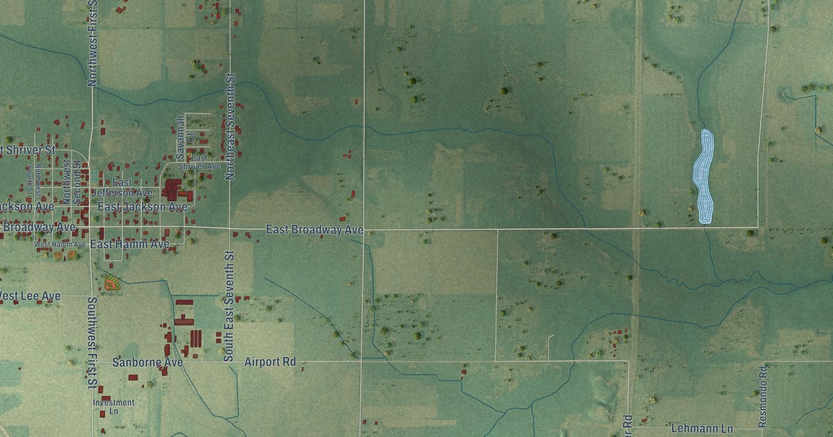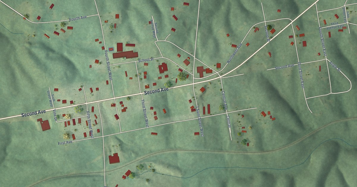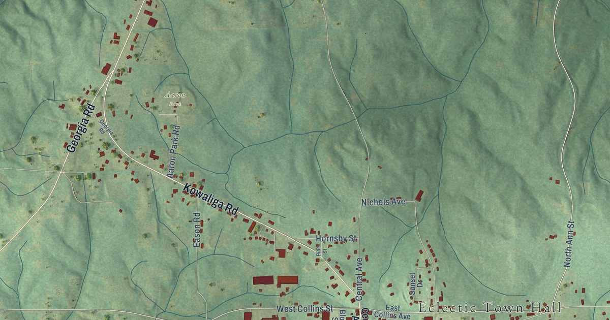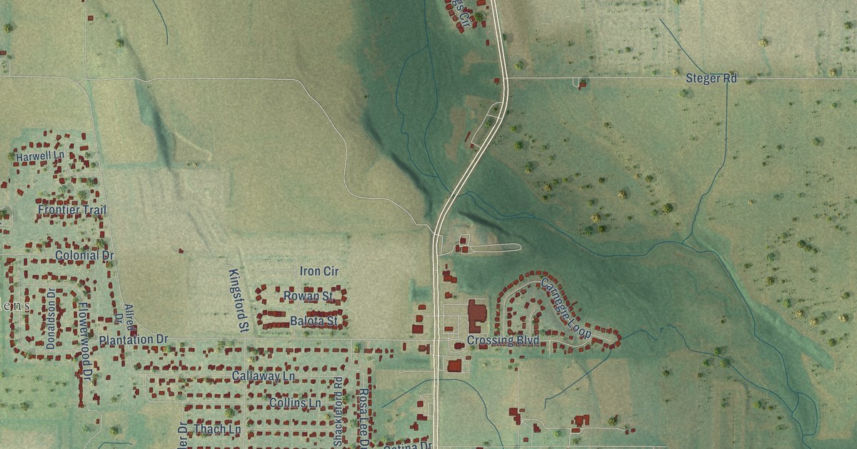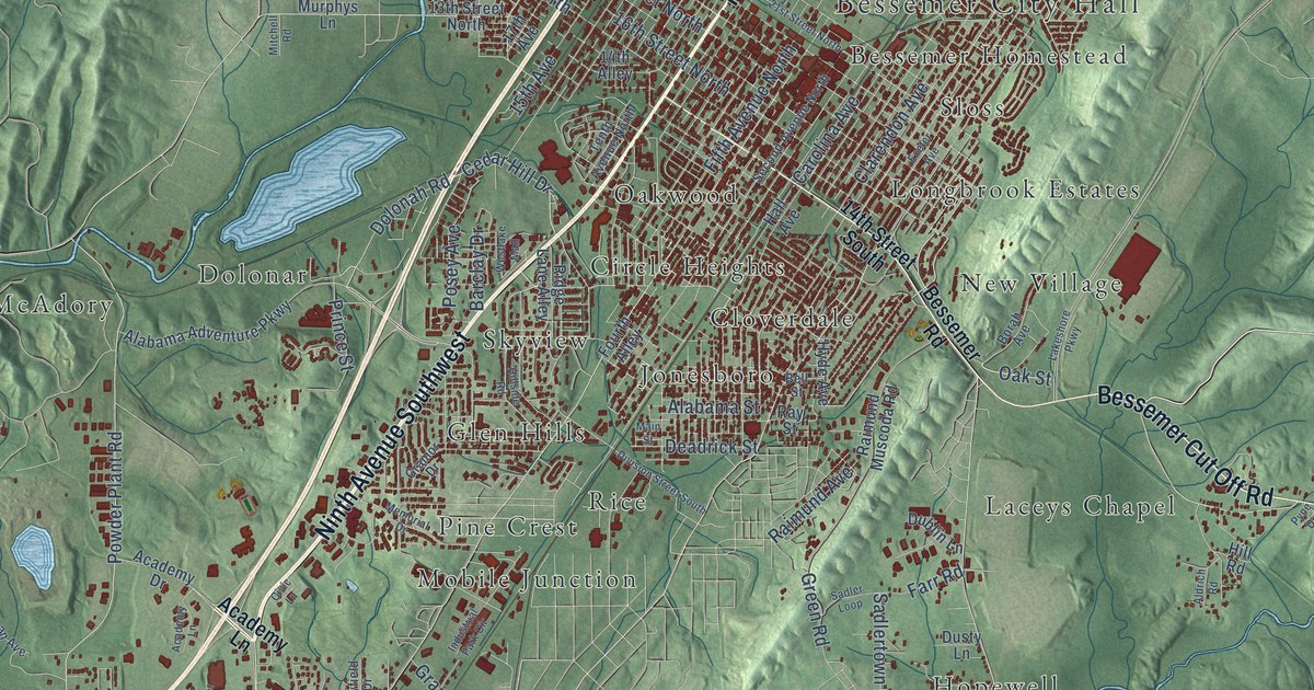
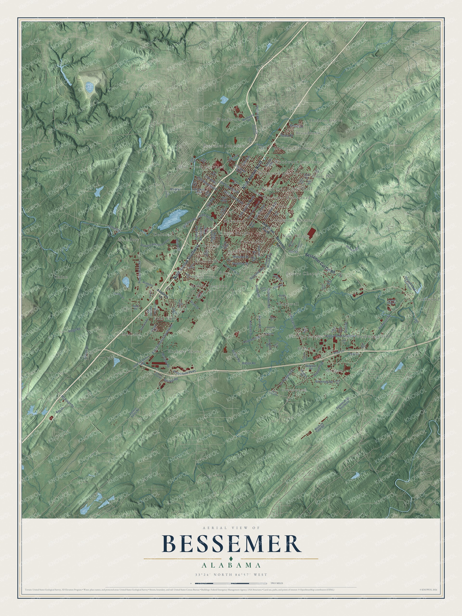
This beautifully detailed map of Bessemer, Alabama was created in 2026 using aerial imagery combined with modern topographical, census, street and landmark data. It's a modern aerial view of Bessemer in Jefferson County, Alabama, that combines modern data with a vintage aesthetic. The roads feature printed names, and if you look closely you can find your exact house accurately shown in its correct location.
Explore an aerial view of Bessemer, Alabama
On this map you'll find Bessemer City Hall, Bessemer Homestead, Bessemer Junction, Blue Creek Junction, Brickyard Junction, Broadmoor, Chinn, Circle Heights, Cloverdale, Dolonar, Flint Hill, Glen Hills, and more. Each red shape is a building, so zoom in on the preview and look for yours.
Here is a piece of Bessemer history, in the words of the record. The record at encyclopediaofalabama.org puts it this way: "In 1926, Pauline Fletcher , Alabama's first Black registered nurse, established Camp Margaret Murray Washington on 30 acres of land in Bessemer as a retreat for Black women and children to experience nature."
Bessemer is a city in Jefferson County. The Census Bureau counted 26,019 people here in 2020.
Take a closer look at the Bessemer map
Names on this map
These names are printed on this map.
Places: Bessemer City Hall, Bessemer Homestead, Bessemer Junction, Blue Creek Junction, Brickyard Junction, Broadmoor, Chinn, Circle Heights, Cloverdale, Dolonar, Flint Hill, Glen Hills, Greenwood, Hickory Grove, Hilltop, Hopewell, Hudson Gardens, Hudson Grove, Jonesboro, Laceys Chapel, Longbrook Estates, McAdory, McCalla, Mobile Junction, Morgan, New Village, Oakwood, Parkwood, Parkwood Hills, Pauls Hill, Phillips Estates, Pine Crest, Rice, Skyview, Sloss, Woodward and Woodward Junction.
Streets and roads: Ninth Avenue North, Ninth Avenue Southwest, Bessemer Cut Off Road, Parkwood Road, Greenmor Drive, Vulcan Road, Bell Hill Road, Cedar Hill Drive, Posey Avenue, Dolonah Road, Morgan Road, Fourth Avenue Southwest.
More street names, A to Z
13th Avenue, 13th Street North, 14th Alley, 14th Street South, 15th Avenue, 15th Street North, 16th Street North, 17th Alley, 17th Avenue, 18th Avenue, 18th Street North, 19th Alley, 20th Street North, 21st Alley, 21st Street North, 22nd Avenue, 24th Street North, 25th Avenue, 33rd Street, 34th Street North, Academy Drive, Academy Lane, Academy Road, Alabama Adventure Parkway, Alabama Street, Aldrich Road, Aviation Road Southeast, Barclay Drive, Batton Road, Bay Drive, Bell Street, Bessemer Road, Borah Avenue, Brewer Drive, Browning Road, Carolina Avenue, Civic Lane, Clarendon Avenue, Coach Lane, Cooley Road, County Highway 55, Deadrick Street, Dianes Drive, Dickey Springs Road, Division Street South, Dublin Lane, Dusty Lane, Eastern Valley Road, Edna Road, Exeter Avenue, Fairfax Avenue, Farr Road, Fifth Avenue North, First Place, First Street, Flint Hill Road, Fourth Alley, Freeman Avenue, Gaylewood Drive, Gramor Drive, Grant Street, Green Road, Greenwood Road, Griffin Drive, Hall Avenue, Headrick Road, Hill Road, Hillside Road, Hilltop Road Southeast, Hillview Drive, Hopewell Road, Hyde Avenue, Industrial Park Circle, Jaybird Road, Johns Road, Kimbrell Drive, Lakeshore Parkway, Laurel Oaks Drive, Lottie Drive, Main Street, Maple Street, Maxwell Road Southeast, McAdory School Road, McAshan Drive, McCalla Road, Memorial Drive, Mitchell Field Road, Mitchell Road, Murphys Lane, Nixon Road, Oak Street, Old Tuscaloosa Highway, Pack Drive, Park Lane, Parsons Road, Patewood Drive, Pine Lane, Powder Plant Road, Prince Street, Promenade Parkway, Pyne Drive, Quail Drive, Raimund Avenue, Raimund Muscoda Road, Rayfield Drive, Ray Street, Reds Road, Redwood Road, Ridge Lane Alley, Ridge Road, Roselyn Road, Ross Road, Sadler Loop, Sadlertown Road, Second Avenue North, Selma Road, Seventh Alley, Shannon Road, Sherry Drive, Tenth Avenue North, Virginia Way, Westchester Drive, Westlake Mall, Woodward Industrial Drive, Woodward Road.
Created by KNOWOL in 2026. The buildings are small red shapes, the roads carry their printed names, and shaded relief shows the shape of the land. The title panel reads "AERIAL VIEW OF BESSEMER ALABAMA" with 33°24' NORTH 86°57' WEST.
It suits a den, a classroom or a front hall, and it makes a gift for anyone with Bessemer roots. Open the preview and find the block you know. See sizes and frames for the Bessemer map.