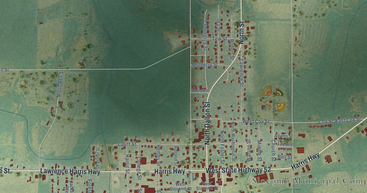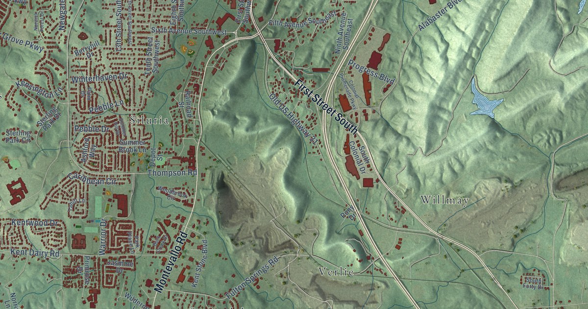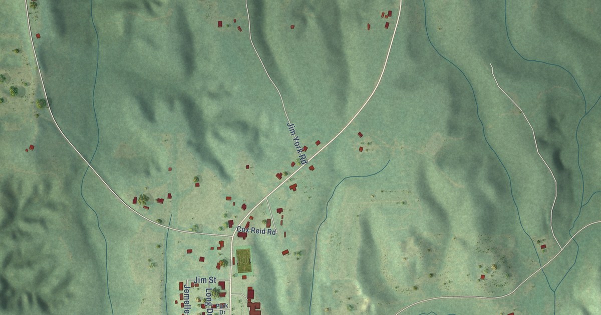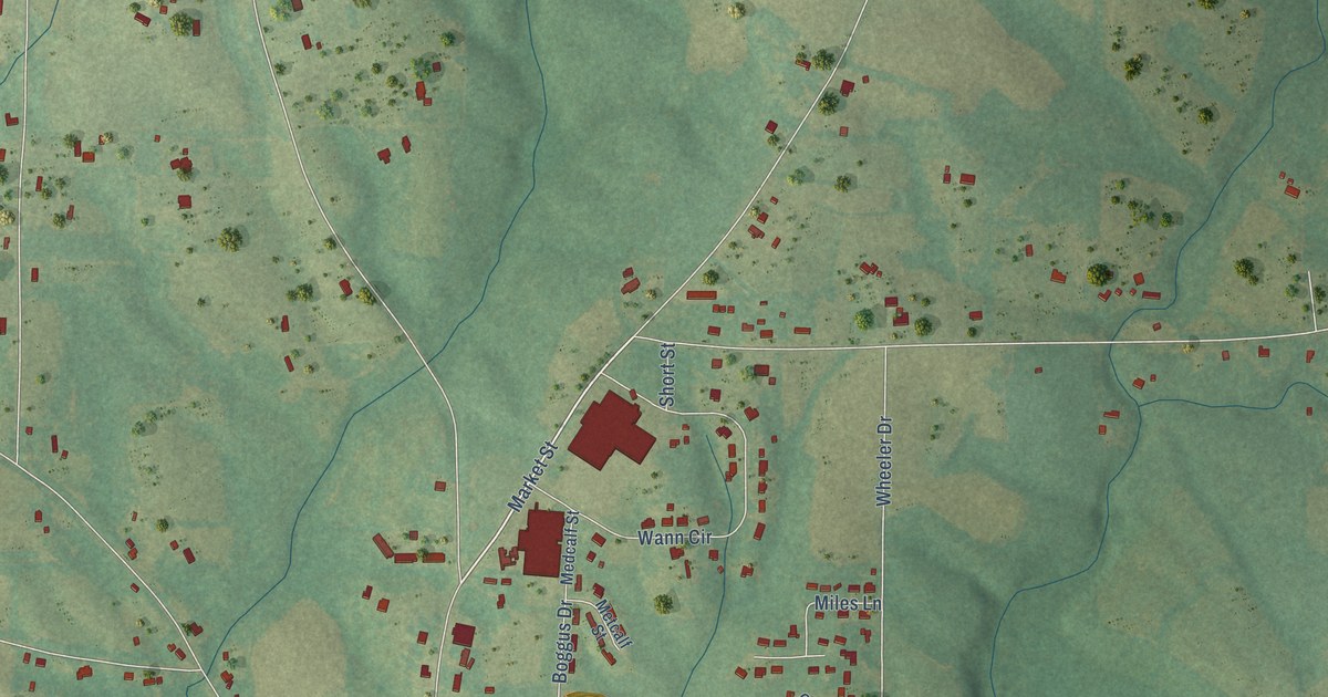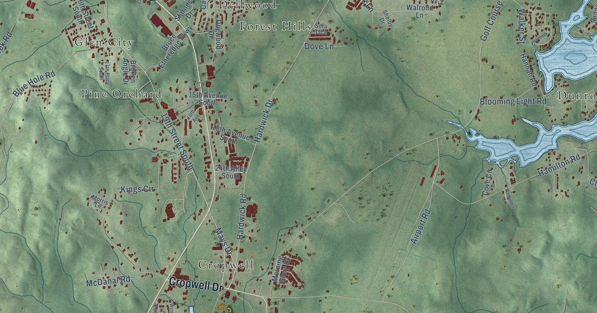
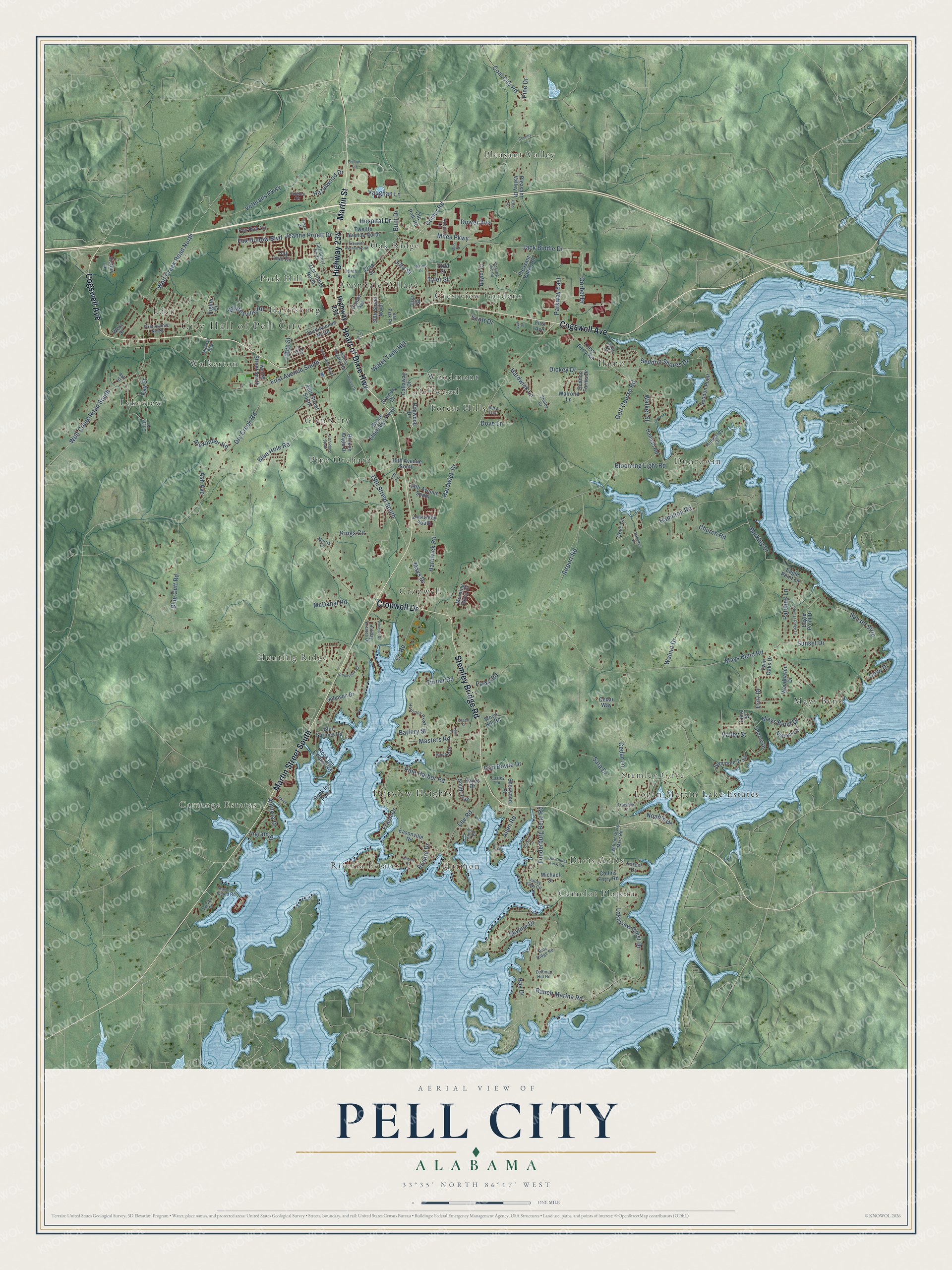
This beautifully detailed map of Pell City, Alabama was created in 2026 using aerial imagery combined with modern topographical, census, street and landmark data. It's a modern aerial view of Pell City in St. Clair County, Alabama, that combines modern data with a vintage aesthetic. The roads feature printed names, and if you look closely you can find your exact house accurately shown in its correct location.
Explore an aerial view of Pell City, Alabama
On this map you'll find City Hall of Pell City, Avondale Village, Camelot Plateau, Catatoga Estates, Crestview Gardens, Cropwell, Davis Acres, Dellwood, Dunrowin, Eden, Fairview Heights, Forest Hills, and more. Each red shape is a building, so zoom in on the preview and look for yours.
Every town has a first chapter, and Pell City is no exception. The record at encyclopediaofalabama.org puts it this way: "Clair County Courthouse in Pell City That same year, Cogswell gave 150 acres of land to the Pell City Manufacturing Company (which was bought out by Avondale Mills in 1919), and the city was designated the second county seat."
Pell City is a city in St. Clair County. The Census Bureau counted 12,939 people here in 2020.
Take a closer look at the Pell City map
Names on this map
These names are printed on this map.
Places: City Hall of Pell City, Avondale Village, Camelot Plateau, Catatoga Estates, Crestview Gardens, Cropwell, Davis Acres, Dellwood, Dunrowin, Eden, Fairview Heights, Forest Hills, Glen City, Harmon, Harrisburg, Hunting Ridge, Ilamo, Lakeview, Logan Martin Lake Estates, Mays Bend, Oak Ridge, Park Hill, Pine Orchard, Pleasant Valley, Riveria Estates, Stemley Cove, Walkerton and Woodmont.
Streets and roads: Martin Street, Heart of Dixie Highway, Highway 234, Cogswell Avenue, Martin Street South, Stemley Bridge Road, Cropwell Drive, 19th Street South, Jeanne Pruett Drive, Miles Parkway, Hospital Drive, Fritz Drive.
More street names, A to Z
15th Avenue South, 15th Street, 16th Avenue, 16th Street South, 17th Place South, 17th Street, 18th Avenue South, 20th Street South, 21st Street North, 23rd Street North, 24th Alley South, 30th Street North, 31st Street, 32nd Street, 33rd Street, 43rd Street, 44th Street, 231 Circle, Abbott Drive, Adcon Lane, Airport Road, Alexander Road, Allen Road, Amitola Drive, Annesley Drive, Ash Avenue, Ball Park Road, Ball Street, Battery Street, Bay Drive, Baylor Court, Berkley Drive, Blooming Light Road, Blue Cutt Road, Blue Hole Road, Blue Ridge Road, Blue Springs Road, Broken Angle Drive, Brookshire Road, Bruce Etheredge Parkway, Bunt Drive, Callaway Drive, Cedar Lane, Cedar Way, Church Road, Circle Drive, Coal City Road, Collins Ferry Road, Comer Avenue, Comer Road, Country Club Road, Country Lane, County Road, Cove Circle, Cove Drive, Dan Bowie Drive, Degaris Drive, Dickey Drive, Dogwood Drive, Dove Lane, Dower Avenue, Dry Creek Road, Eagle Point Drive, Eagle Point Lane, Easonville Road, Eighth Circle, Eleventh Avenue North, First Avenue, First Avenue North, First Avenue South, Forest Drive, Fox Hollow Boulevard, Fox Run Circle, Fraim Drive, Funderburg Bend Road, Golf Course Road, Gorbel Drive, Green Street, Hamilton Court, Hamilton Road, Hannah Road, Hardwick Drive, Hardwick Lane, Hardwick Road, Harmon Island Road, Hayden Drive, Hayes Drive, Hazelwood Drive, Hickorn Lane, Highway 231, Holiday Estates Drive, Horizons Parkway, Hunter Ridge Lane, Ilamo Circle, Ingram Lane, Ingram Street, Jack Biddle Drive, Johnny Degaris Road, Johnson Drive, Jubilee Circle, Kay Street, Kings Circle, Lakeview Crest Drive, Lane Drive, Lee Road, Lindy Circle, Lorel Street, Loxley Lane, Masters Road, Mays Bend Drive, Mays Bend Road, Mays Drive, McDanal Road, Mds Drive, Michael Street, Mimosa Row, Morning Glory Drive, Morris Lane, Nathan Lane, Nelson Drive, Ninth Avenue, Noah's Drive, Oak Leaf Circle, Old Collins Ferry Road, Old Polk Road, Osprey Drive, Parks Road, Parkway East, Patches Lane, Phillips Lane, Pine Drive, Pine Harbor Road, Plaza Drive, Pleasant Valley Drive, Pleasant Valley Road, Ranch Marina Road, Riviere Drive, Rock Inn Estates Road, Rock Inn Point, Sara Drive, Scott Drive, Seddon Farms Drive, Seddon Point, Seddon Shores Drive, Seminole Trail, Sera Trce, Shelby Drive, Sherwood Place, Skyline Drive, Smith Road, Smith Trail, Starnes Drive, Sunset Drive, Sunset Strip, Third Avenue North, Todd Street, Traweek Lane, Truss Ferry Road, Tucker Drive, Turner Road, Twelfth Avenue North, Twelfth Street South, Twin Oaks Drive, Tyler Street, Valley Street, Valley View Circle, Vaughan Lane, Veterans Parkway, Victory Lane, Walker Street, Walnut Drive, Walrond Lane, Water Tank Hill, West Street, Whitesville Road, Williamsburg Marc Road, Windsor Drive, Wolf Creek Road North, Wolf Creek Road South, Woodhaven Drive, Wood Hill Road, Zeltman Hill Road.
Created by KNOWOL in 2026. The buildings are small red shapes, the roads carry their printed names, and shaded relief shows the shape of the land. The title panel reads "AERIAL VIEW OF PELL CITY ALABAMA" with 33°35' NORTH 86°17' WEST.
Hang it in the hallway, the office or the cabin, or give it to someone who left Pell City and still calls it home. Open the preview and look for a street you know. See sizes and frames for the Pell City map.