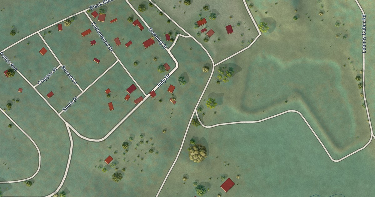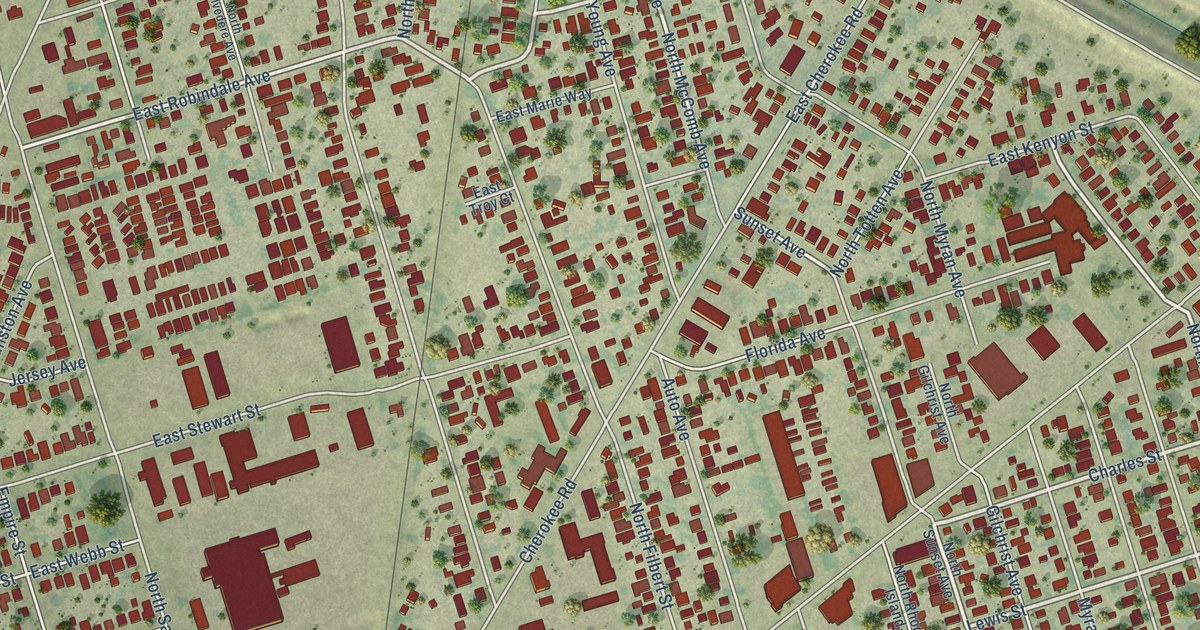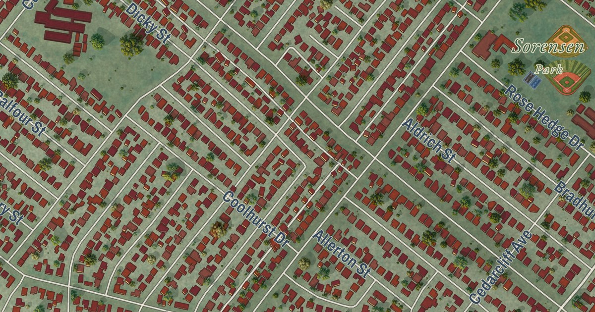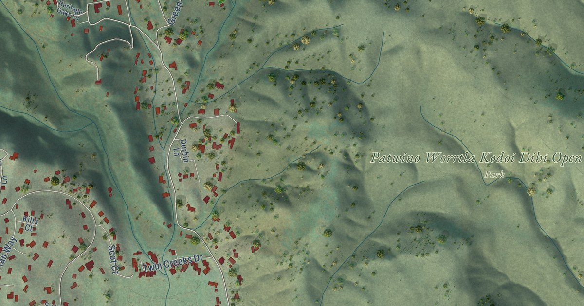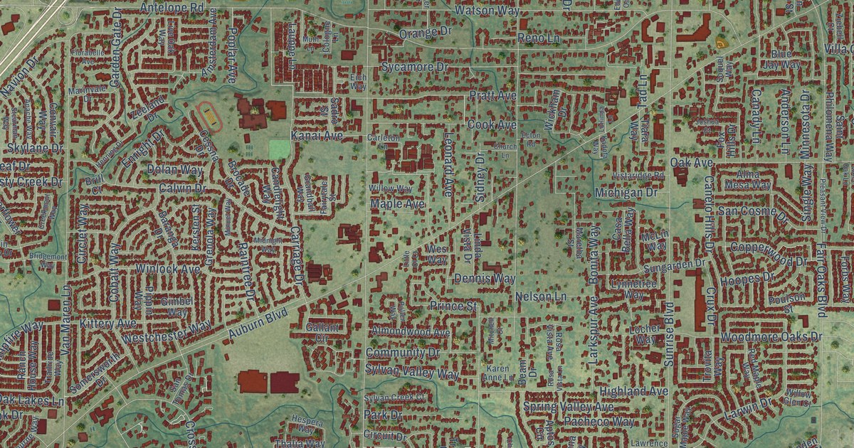
This beautifully detailed map of Citrus Heights, California was created in 2026 using aerial imagery combined with modern topographical, census, street and landmark data. It’s a one-of-a-kind view of Citrus Heights that combines accurate data with a vintage aesthetic. The map shows every building in its true location, many of the roads carry their names, and the shaded topographic relief shows the shape of the land.
Explore an aerial view of Citrus Heights, California
On the map you’ll find Citrus Heights City Hall, C-Bar-C Park, and Calvary Cemetery, along with Whyte Avenue, Bremen Drive, Roseville Road, Astronaut Lane, Auburn Boulevard, Mariposa Avenue, Sunrise Boulevard, Greenback Lane, Antelope Road, and more. If you look closely you can even find your house accurately drawn in its correct location. Zoom in on the preview to look for yours.
Did you know this piece of Citrus Heights, California history?
From the City of Citrus Heights: "In 1910, the quiet pastoral life of the rural Sylvan district underwent a marked change when the real estate firm Trainor & Desmond bought up large tracts of idle land and subdivided them into ten acre lots. As a promotional ploy to attract buyers, the firm replaced the name Sylvan with the more euphonious sounding name of Citrus Heights, and it has remained so."
Take a closer look at the Citrus Heights map
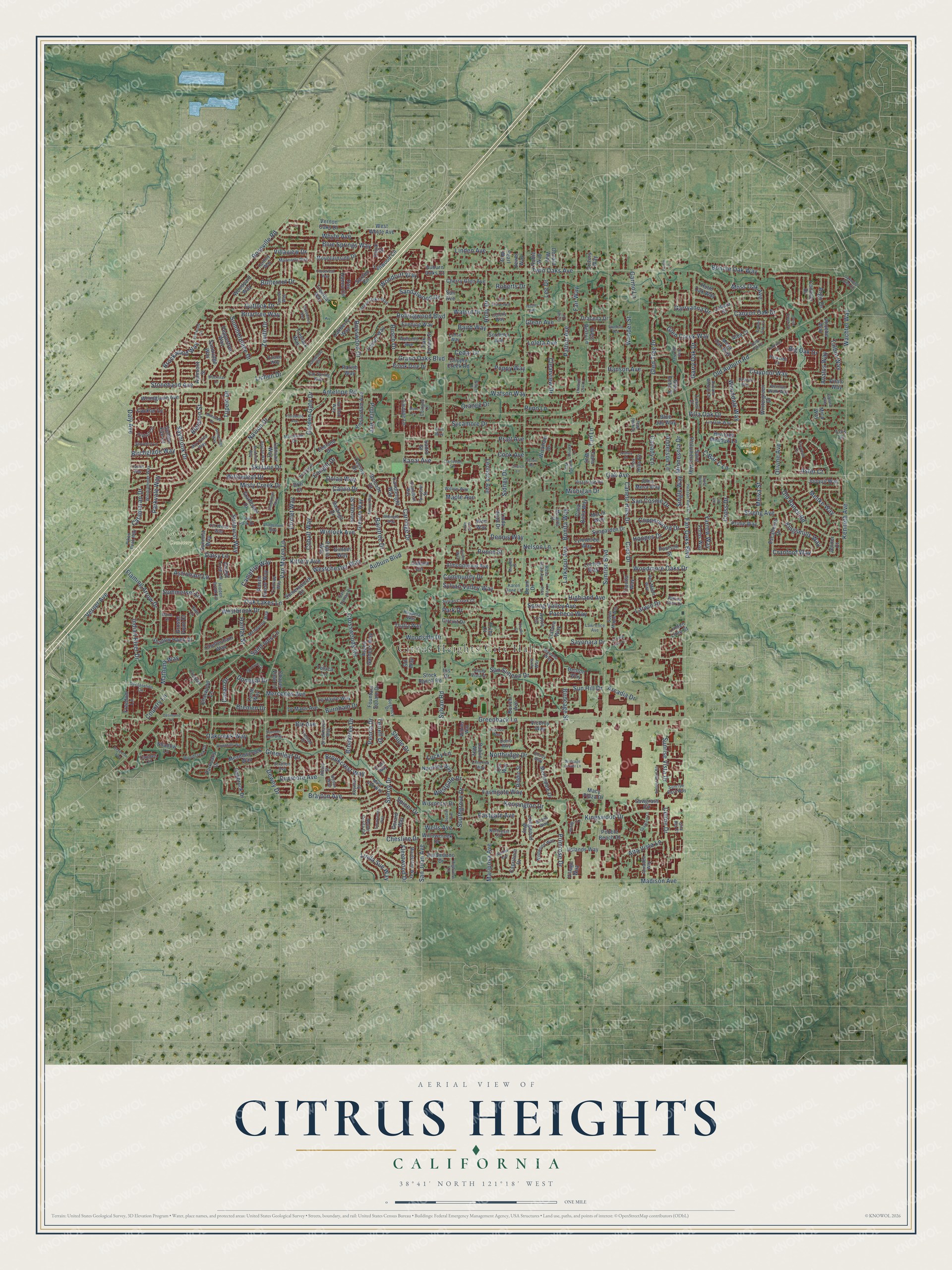
Street and place names on the Citrus Heights, California map
These names are printed on the map of Citrus Heights, California.
Places: Citrus Heights City Hall, C-Bar-C Park and Calvary Cemetery.
Streets and roads: Whyte Avenue, Bremen Drive, Roseville Road, Astronaut Lane, Auburn Boulevard, Mariposa Avenue, Sunrise Boulevard, Greenback Lane, Antelope Road, Old Auburn Road, Fair Oaks Boulevard, Twin Oaks Avenue.
More street names, A to Z
Alba Court, Albury Street, Almaden Way, Alma Mesa Way, Almondwood Avenue, Alta Vista Lane, Amsterdam Avenue, Anderson Lane, Apache Way, Aptos Circle, Arcade Lake Lane, Arcadia Drive, Argo Drive, Ashmont Street, Aspen Gardens Way, Aster Court, Auburn Oaks Court, Auburn Woods Drive, Autumn Avenue, Avalos Way, Baird Way, Baranga Drive, Basswood Way, Beam Drive, Berman Walk Way, Bierston Street, Big Oak Drive, Birchglade Way, Birdcage Center Lane, Birdcage Street, Bix Avenue, Black Oaks Way, Blackstar Drive, Bloom Way, Blue Jay Way, Blue Springs Way, Bonita Way, Bonnie Oak Way, Brayton Avenue, Briartree Way, Bridgemont Way, Brill Court, Brocade Drive, Brockwood Way, Brookcrest Way, Brook Dale Drive, Brookhaven Way, Brooktree Drive, Burich Avenue, Burnham Drive, Butternut Drive, C-Bar-C Lane, Cackler Lane, Cailin Circle, Calvin Drive, Camden Circle, Campfire Way, Canady Lane, Candlelight Way, Canelo Hills Drive, Canyon Oak Drive, Capricorn Drive, Carleton Lane, Carriage Drive, Casa Bella Way, Catamaran Drive, Cavan Drive, Cedar Drive, Celine Drive, Cessna Drive, Challis Court, Chapel View Lane, Charwood Lane, Cheltenham Way, Cherry Glen Avenue, Chesline Drive, Chula Vista Drive, Church Lane, Circlet Way, Circuit Drive, Claypool Way, Clearview Drive, Cloverleaf Way, Cobalt Way, Cologne Lane, Colony Way, Community Drive, Conover Drive, Convair Way, Cook Avenue, Copperwood Drive, Country Lane, Cranford Way, Creekbed Lane, Creekmont Way, Cripple Creek Road, Cross Drive, Crosswoods Circle, Crux Drive, Daffodil Way, Daisy Lane, Daly Avenue, Declaration Circle, Deedie Avenue, Denio Way, Dennis Way, Denton Way, Desimone Lane, Devecchi Avenue, Dewey Drive, Dolan Way, Donald Way, Donegal Drive, Dracena Drive, Dublin Way, Dunmore Avenue, Duval Street, Eastgate Avenue, Ecton Road, Edwards Oak Court, Eich Way, El Sol Way, Enright Drive, Envoy Way, Ericwood Court, Escallonia Drive, Evening Way, Fair Way, Fairytale Street, Farmgate Way, Fireweed Circle, Flaming Arrow Drive, Fleetwood Drive, Florabelle Avenue, Forbs Way, Fountain Square Drive, Fox Hills Drive, Freedom Lane, Galena Way, Gallant Circle, Garden Gate Drive, Garino Lane, Garryanna Drive, Garry Oak Drive, Gerard Way, Gimbel Way, Gita Ria Court, Glen Alta Way, Glen Creek Way, Glen Echo Street, Glenn Avenue, Glen Tree Drive, Golden Eye Lane, Grandball Way, Grand Oaks Boulevard, Grand Tree Lane, Greenleaf Drive, Grenola Way, Grosse Point Court, Gumwood Circle, Halifax Street, Hanson Avenue, Henning Drive, Heritage Meadow Lane, Hespera Way, Hidden Brook Lane, Highland Avenue, Highview Lane, Hill Drive, Holly Drive, Holly Oak Court, Holm Oak Way, Hoopes Drive, Hosac Way, Indian River Drive, Iris Drive, Jenner Court, Jessie Avenue, Jewel Way, Jonquil Way, Joshua Court, Kadota Way, Kalamazoo Drive, Kanai Avenue, Karen Anne Lane, Kate Lane, Kenneth Avenue, Kensington Drive, Kersten Street, Keyntel Street, Kingsmills Way, Kingswood Drive, Kittery Avenue, Larkspur Avenue, Larwin Drive, Lauppe Lane, Lawrence Avenue, Lee Drive, Le Havre Way, Le Mans Avenue, Leonard Avenue, Lesser Way, Lialana Way, Lichen Drive, Limerick Way, Linda Sue Way, Linda Vista Drive, Linden Avenue, Linden Lime Court, Lin Oak Way, Little Ol Court, Live Oak Way, Lobata Street, Locher Way, Lohse Way, Loilinda Lane, Lois Lane, Loleta Avenue, Longwood Way, Louth Way, Lucky Lane, Lynnetree Way, Macy Plaza Drive, Madison Avenue, Maidstone Way, Mame Court, Mannerly Way, Maple Avenue, Maretha Street, Marinvale Drive, Mar Vista Way, Mary Ann Way, Matheny Way, Mauana Way, McLin Way, Meadowcreek Way, Melbourne Way, Melva Street, Menke Way, Mercedes Avenue, Merlindale Drive, Mesa Oak Way, Mica Way, Michigan Drive, Midnight Way, Millwood Drive, Minnesota Drive, Minuet Way, Misty Creek Drive, Mitchell Court, Monte Corita Circle, Moss Oak Avenue, Mountainside Drive, Muth Lane, Navion Drive, Nelson Lane, Northeast Circle, Northlea Way, Northridge Drive, Oak Avenue, Oakberry Way, Oakbrook Drive, Oakcreek Way, Oak Forest Street, Oakfront Lane, Oak Grove Avenue, Oak Lakes Lane, Oak Spring Way, Oakwood Hills Circle, Old Ranch Road, Olivine Avenue, Orange Drive, Orelle Creek Court, Our Way, Outlook Drive, Pacheco Way, Parish Way, Park Drive, Parkoaks Drive, Parkside Lane, Parkvale Way, Patton Avenue, Pau Hanna Circle, Pearl Way, Pebble Beach Drive, Peoria Drive, Peppertree Way, Phoebe Way, Pikes Peak Way, Pintail Circle, Pippin Way, Pitalo Way, Pleasant View Drive, Pleides Avenue, Pollen Way, Poplar Avenue, Poppy Way, Posten Way, Poulson Street, Pratt Avenue, Prime Way, Primrose Drive, Prince Street, Putcie Lane, Quiet Oak Lane, Raintree Drive, Ranch House Way, Red Maple Way, Regency Drive, Reno Lane, Riddio Street, Rita Lou Way, Roberts Drive, Robie Way, Rollingwood Boulevard, Rosa Vista Avenue, Rosa Vista Lane, Rosswood Drive, Rusch Drive, Sadro Street, Saint Ives Lane, Saint Philomena Way, San Cosme Drive, Sandalwood Drive, Sandridge Way, San Juan Avenue, San Simeon Drive, San Tomas Drive, Sawgrass Circle, Saxton Circle, Saybrook Drive, Sayonara Drive, Scarlet Oak Circle, Scribner Avenue, Shadow Hawk Drive, Shadow Lane, Shovelers Lane, Shupe Drive, Sidney Drive, Silver Drive, Single Way, Skylane Drive, Sol Way, Somersworth Drive, Soquel Way, Southgrove Drive, Sperry Drive, Spicer Drive, Spring Valley Avenue, Spyglass Lane, Stanford Avenue, Starflower Drive, Stearman Way, Stock Ranch Road, Stonehand Avenue, Stoneridge Way, Stratton Avenue, Streng Avenue, Sugar Maple Way, Summerplace Drive, Summer Rain Way, Summerset Lane, Sun Avenue, Sunburst Way, Sungarden Drive, Sun Hill Drive, Sunmist Way, Sunrise East Way, Sunrise Mall Road, Sunrise Vista Drive, Sycamore Drive, Sylvan Creek Court, Sylvan Road, Sylvan Valley Way, Tad Lane, Talbot Way, Tallwood Circle, Tanoak Way, Terra Way, Terrell Drive, Thalia Way, Tiara Way, Timmerman Way, Tin Wood Way, Toluca Lane, Trailride Way, Trawler Way, Treelark Way, Treeleaf Way, Tremain Drive, Trilby Court, Trovita Way, Tupelo Drive, Twin Park Drive, Uplands Way, Van Maren Lane, Verner Avenue, Vernon Oaks Drive, Viceroy Way, Victory Way, Village Way, Villa Oak Drive, Villaview Drive, Vistaridge Road, Wachtel Way, Walnut Drive, Watson Way, Wells Avenue, West Berry Lane, Westbrook Drive, Westchester Way, Westgate Drive, West Whyte Avenue, Wes Way, Wexford Circle, Wickham Drive, Wildwood Way, Wilkins Way, Willowcreek Drive, Willow Glen Court, Willowleaf Drive, Willow Way, Windjammer Way, Windsor Lane, Winlock Avenue, Wintergreen Drive, Wisconsin Drive, Wonder Street, Woodcreek Drive, Wooddale Way, Woodglade Avenue, Woodhills Way, Woodmore Oaks Drive, Woodruff Way, Woodside Drive, Woodyard Way, Yardley Way, Yarrow Way, Zeeland Drive, Zenith Drive, Ziebell Court.
See the Citrus Heights, California map on a wall
The Citrus Heights map as an 18 x 24 inch print in a black frame.

This beautifully detailed map of Citrus Heights makes an attractive addition to your office, library, or den, and it can even be used to teach children the geography and history of the area. It also makes a great gift for anyone who grew up in Citrus Heights or moved away. When you’re done exploring, click here to get your copy of the Citrus Heights map.