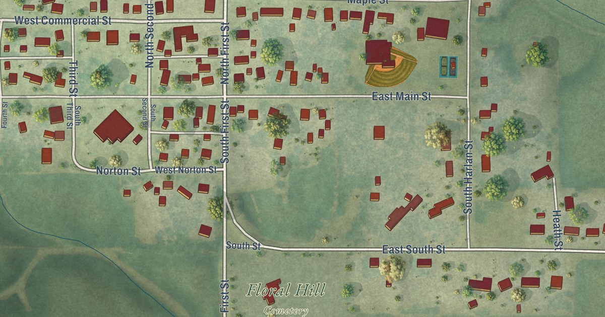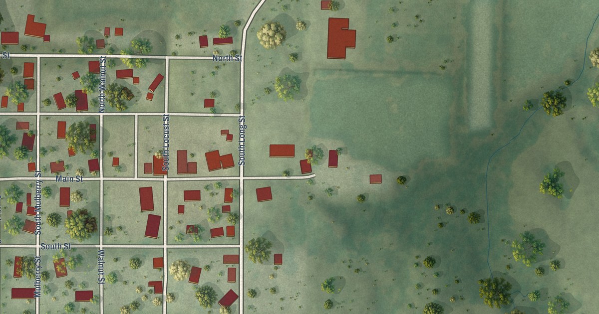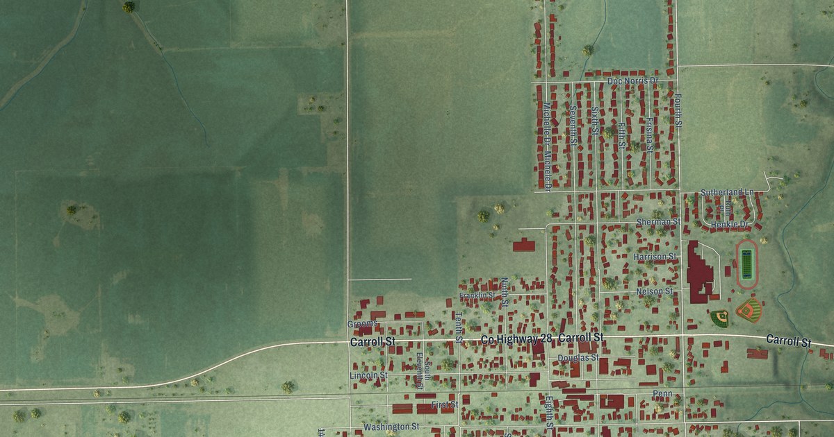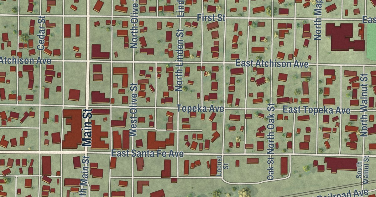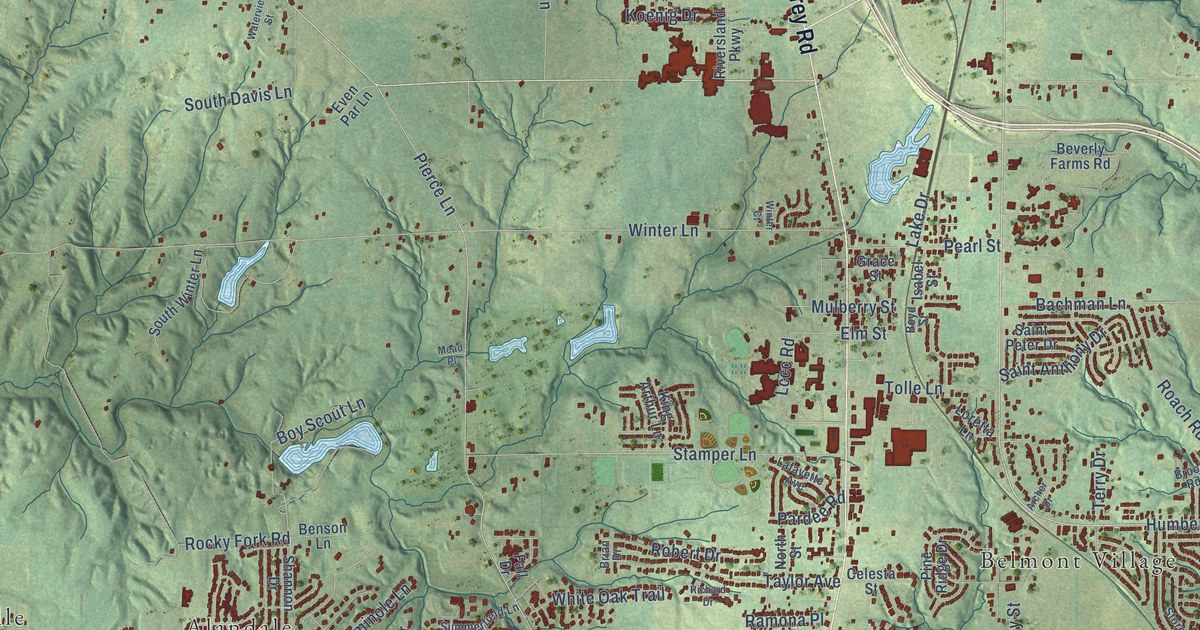
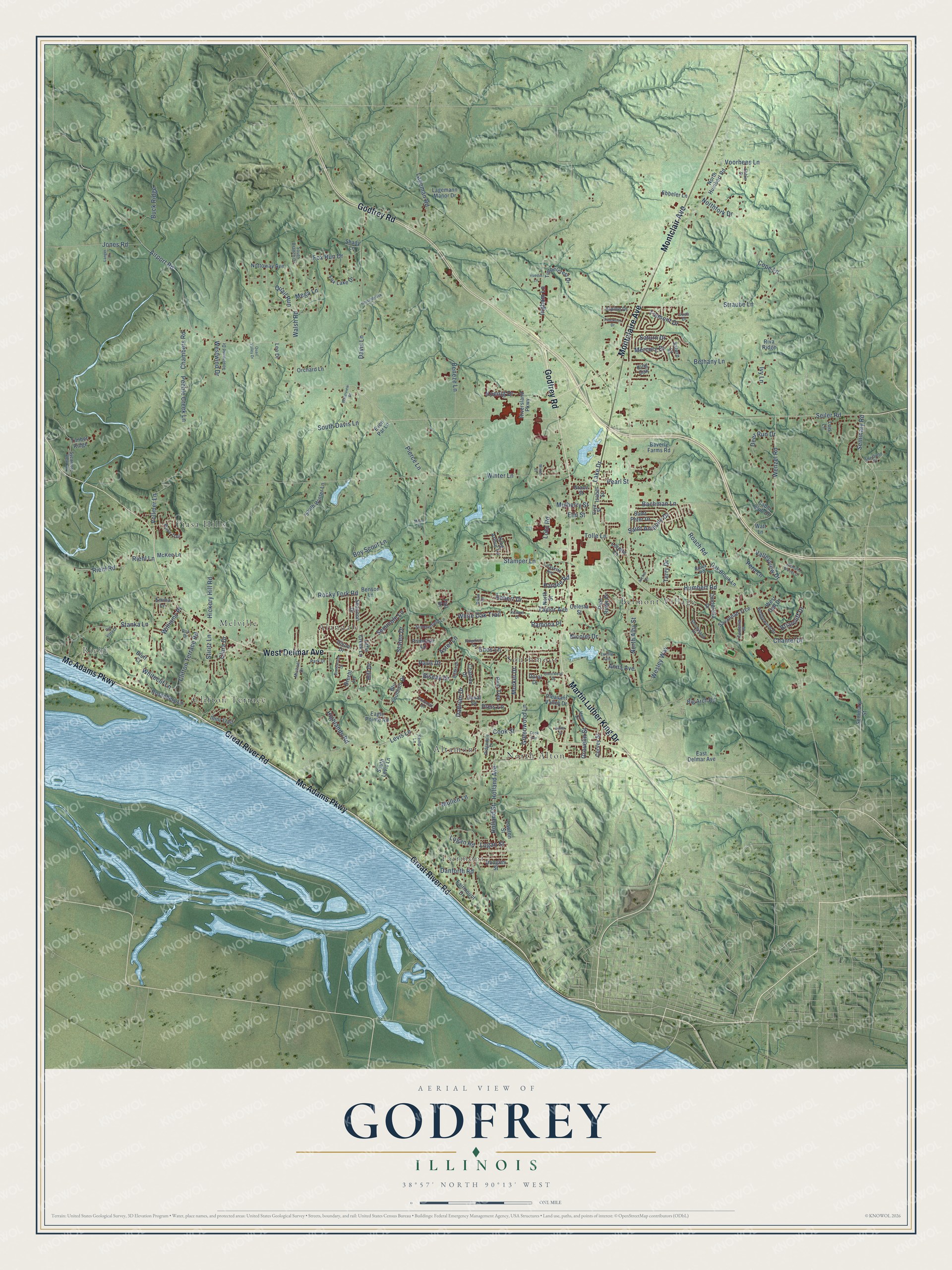
This beautifully detailed map of Godfrey, Illinois was created in 2026 using aerial imagery combined with modern topographical, census, street and landmark data. It’s a one-of-a-kind view of Godfrey that combines accurate data with a vintage aesthetic. The map shows every building in its true location, many of the roads carry their names, and the shaded topographic relief shows the shape of the land.
Explore an aerial view of Godfrey, Illinois
On the map you’ll find Riehl, Fairmont, Alandale, Altamont, Belmont Village, Melville, North Alton, Piasa Hills, and Southmoor, along with Clifton Terrace, Great River Road, Mc Adams Parkway, and more. If you look closely you can even find your house accurately drawn in its correct location. Zoom in on the preview to look for yours.
Did you know this piece of Godfrey, Illinois history?
From the Historical Encyclopedia of Illinois: "It is the seat of Monticello Female Seminary, and named for Capt. Benjamin Godfrey, an early settler who was chiefly instrumental in founding that institution."
Take a closer look at the Godfrey map
Street and place names on the Godfrey, Illinois map
These names are printed on the map of Godfrey, Illinois.
Places: Riehl, Fairmont, Alandale, Altamont, Belmont Village, Clifton Terrace, Melville, North Alton, Piasa Hills and Southmoor.
Streets and roads: Great River Road, Mc Adams Parkway, Godfrey Road, West Delmar Avenue, Montclair Avenue, Montclaire Avenue, Martin Luther King Drive, Humbert Road, Wenzel Road, Danforth Road, Logan Road, Airport Road.
More street names, A to Z
Alpine Drive, Anna Avenue, Archer Drive, Aster Lane, Bachman Lane, Beneze Lane, Benson Lane, Bethany Lane, Beverly Farms Road, Big Arch Road, Biscay Drive, Bluff Court, Blu Fountain Drive, Boyd Street, Boy Scout Lane, Brecht Lane, Brian Drive, Briarcliff Drive, Brook Road, Buck Ridge, Cabin Club Drive, Camellia Place, Celesta Street, Chambers Road, Chantel Drive, Chateau Drive, Cinderella Drive, Clara Drive, Clifton Terrace Road, Colonial Drive, Cook Avenue, Cook Street, Cope Lane, Crestwood Drive, Curvey Street, Dadrian Drive, Davis Lane, Deer Run Drive, Dixon Drive, Doral Drive, Douglas Street, Duval Drive, Eagle Pointe Road, East Delmar Avenue, Ebbeler Lane, Ebbie Drive, Eiffel Drive, Elm Street, Emma Lane, Enos Lane, Even Par Lane, Fairmount Drive, Fall Drive, Fox Lake Drive, Fox Run Drive, Grace Street, Greenwood Lane, Grovelin Street, Hand Drive, Herschbrook Lane, Hickory Hill Road, Highlands Road, Hill Drive, Holland Avenue, Holland Street, Illini Trail, Ingham Lane, Isabel Street, Ivy Lane, Jones Road, Josh Drive, Keller Street, Kemp Lane, King Arthur Lane, King Oak, Koenig Drive, Lafayette Avenue, Lagemann Manor Drive, Lageman Road, Lake Drive, Langer Lane, Lawton Street, Lccc Road, Leo Drive, Levis Lane, Little Creek Lane, Logan Street, Lois Lane, Loretta Lane, Luella Avenue, McKee Lane, Mead Place, Mega Lane, Mercury Drive, Michael Drive, Morkel Drive, Mulberry Street, Mullen Lane, Nicolet Drive, North Alby Street, Northfork Drive, North Humbert Road, North Street, Nottoway Avenue, Oak Brook Lane, Orchard Lane, Pardee Road, Paris Drive, Park Drive, Pearl Street, Pear Tree, Pebble Creek Lane, Peru Lane, Piasa Trail, Pierce Lane, Pine Ridge Drive, Pinewood Drive, Pleasant Valley Drive, Preis Lane, Primrose Lane, Quail Run, Quail Valley Drive, Ramona Place, Richard Drive, Richland Woods Drive, Ridgedale Drive, Ridgefield Drive, Riehl Lane, Riehl Road, Rio Vista Drive, Riva Ridge, Riversland Parkway, Roach Road, Robert Drive, Rocky Fork Road, Ron Drive, Rosenberg Lane, Ruedin Lane, Saint Anthony Drive, Saint Peter Drive, Saturn Court, Saturn Drive, Savannah Trce, Seiler Road, Seminary Road, Seminary Street, Seminole Lane, Shady Lane, Shannon Drive, Sheffield Place, South Branch Drive, South Davis Lane, South Levis Lane, Southwind Drive, South Winter Lane, Southwood Drive, Stamper Lane, Stanka Lane, Staten Drive, Stiritz Lane, Storeyland Drive, Straube Lane, Summerfield Lane, Sycamore View Lane, Taylor Avenue, Terry Drive, Timbercrest Drive, Timber Ridge, Tolle Lane, Tremont Drive, Valleyview Drive, Vollmer Lane, Voorhees Lane, Walsh Road, Waterview Street, Watt Lane, Wedgewood Drive, Wesley Way, West Dell Drive, Westwind Drive, Whiteclif Lane, White Oak Trail, Williams Place, Winter Court, Winter Lane.
See the Godfrey, Illinois map on a wall
The Godfrey map as an 18 x 24 inch print in a black frame.

This beautifully detailed map of Godfrey makes an attractive addition to your office, library, or den, and it can even be used to teach children the geography and history of the area. It also makes a great gift for anyone who grew up in Godfrey or moved away. When you’re done exploring, click here to get your copy of the Godfrey map.