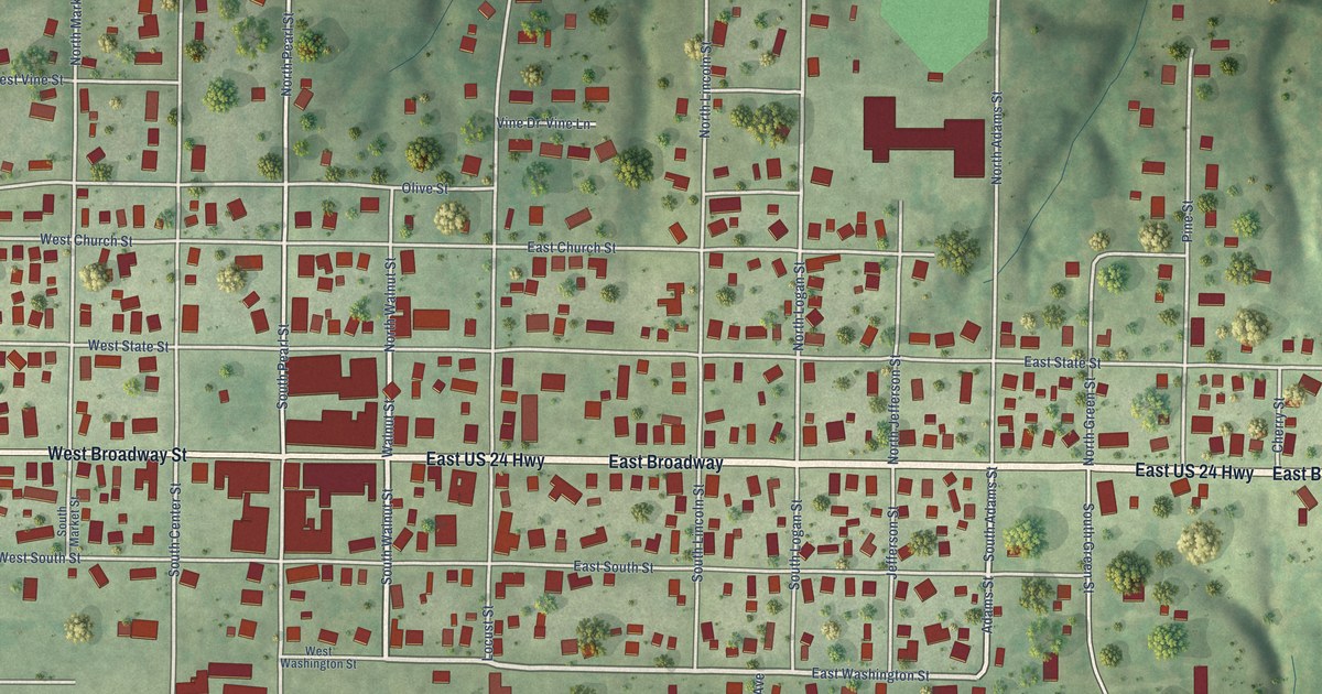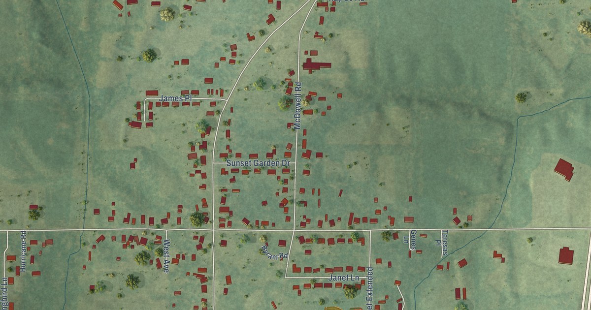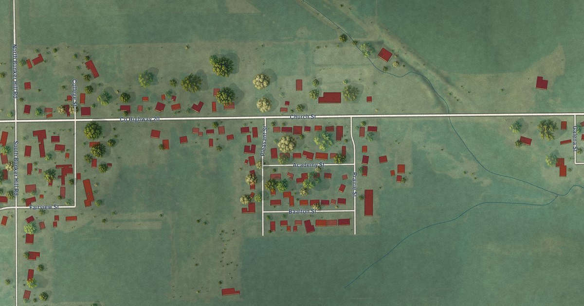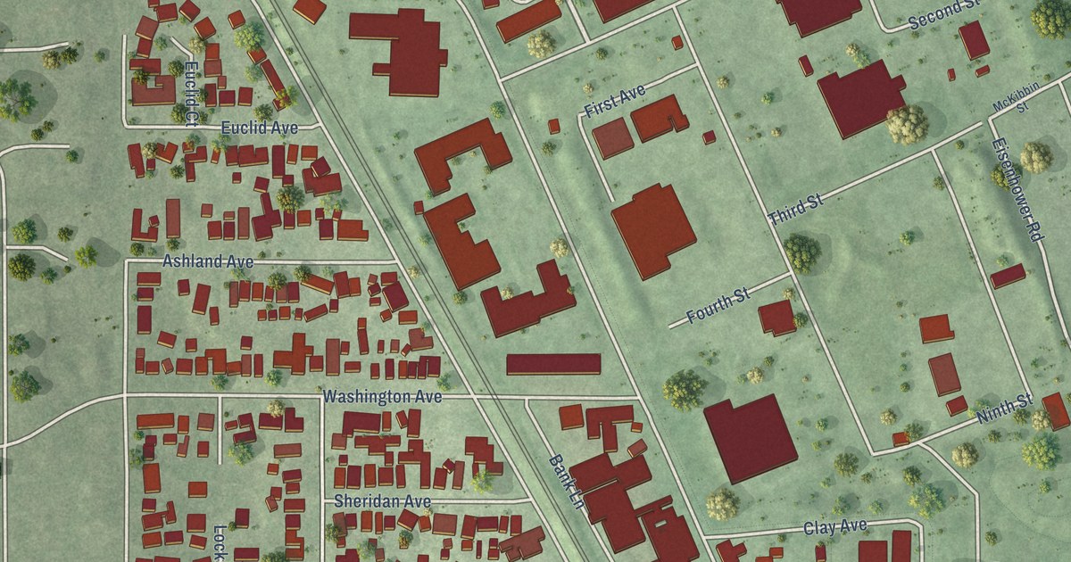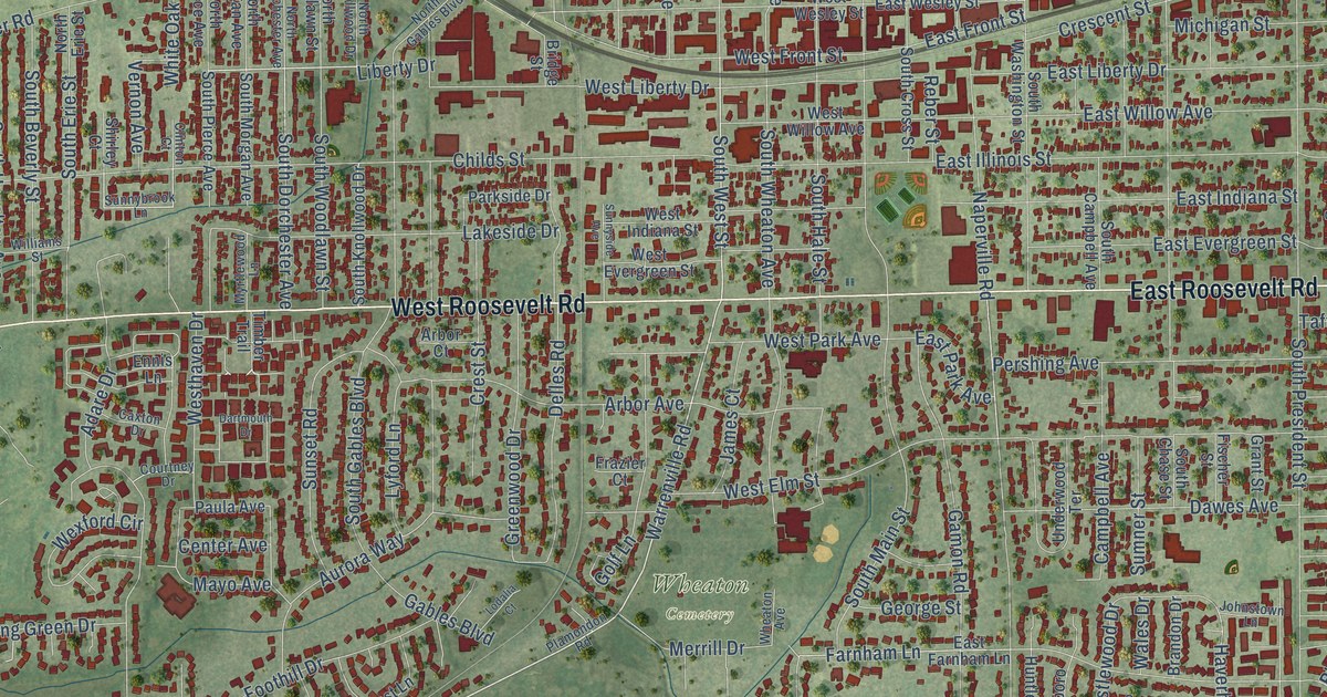
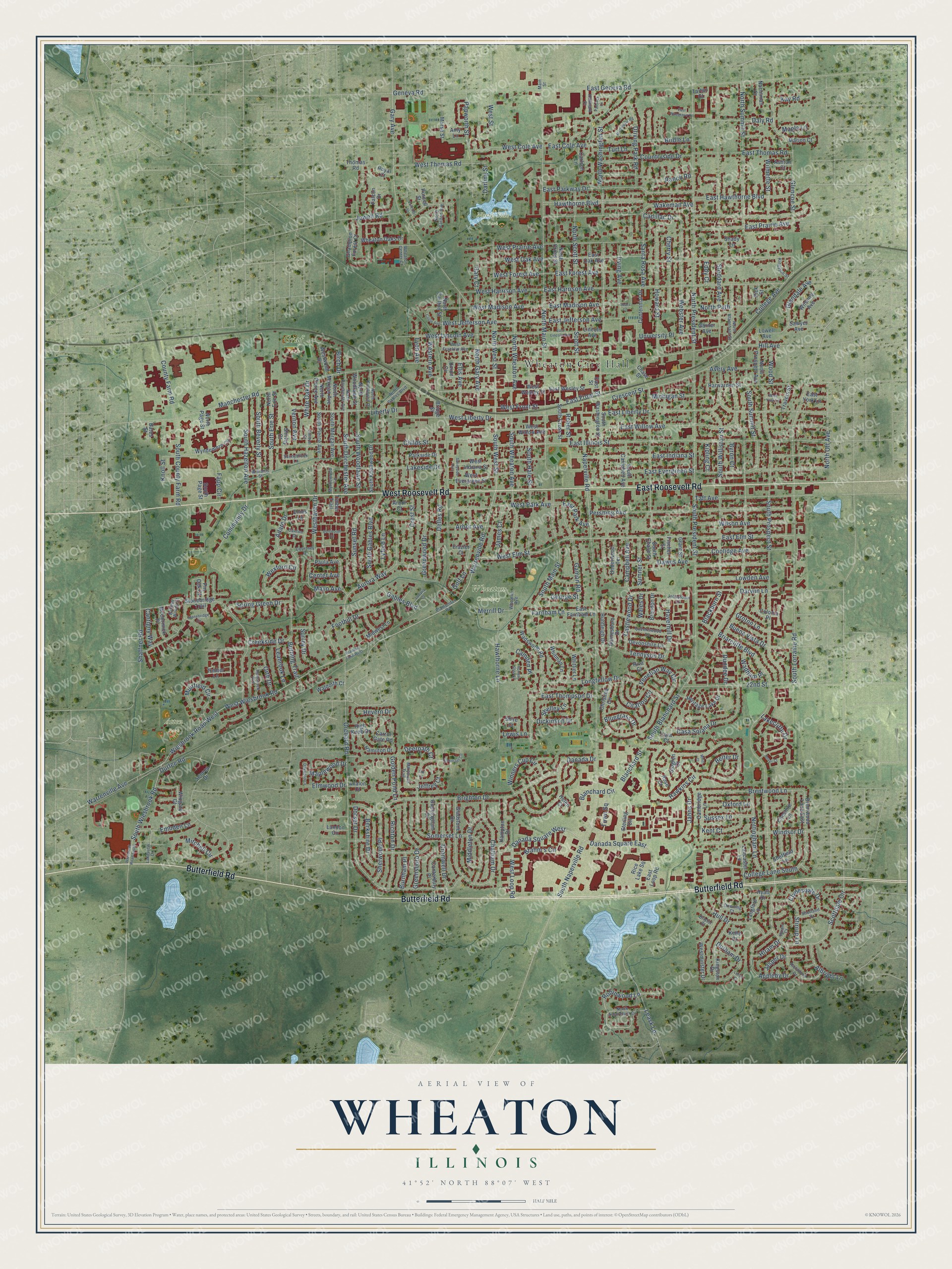
This beautifully detailed map of Wheaton, Illinois was created in 2026 using aerial imagery combined with modern topographical, census, street and landmark data. It’s a one-of-a-kind view of Wheaton that combines accurate data with a vintage aesthetic. The map shows every building in its true location, many of the roads carry their names, and the shaded topographic relief shows the shape of the land.
Explore an aerial view of Wheaton, Illinois
On the map you’ll find Wheaton City Hall, Atten Park, Graf Park, North Side Park, Wheaton Cemetery, and Toohey Park, along with Butterfield Road, West Roosevelt Road, East Roosevelt Road, Warrenville Road, South West Street, West Liberty Drive, and more. If you look closely you can even find your house accurately drawn in its correct location. Zoom in on the preview to look for yours.
Did you know this about Wheaton, Illinois?
From the Historical Encyclopedia of Illinois: "WHEATON, a city, the county -seat of Du Page County, situated on the Chicago & Northwestern Railway, 25 miles west of Chicago."
Take a closer look at the Wheaton map
Street and place names on the Wheaton, Illinois map
These names are printed on the map of Wheaton, Illinois.
Places: Wheaton City Hall, Atten Park, Graf Park, North Side Park, Wheaton Cemetery and Toohey Park.
Streets and roads: Butterfield Road, West Roosevelt Road, East Roosevelt Road, Warrenville Road, South West Street, West Liberty Drive, Robinwood Lane, Community Drive, Childs Street, Scottdale Circle, Danada Square West, West Loop Road.
More street names, A to Z
22nd Street, Academy Lane West, Adare Drive, Albright Lane, Amy Lane, Appleby Drive, Arbor Avenue, Arbor Court, Ashton Court, Aurora Way, Avalon Court, Avery Avenue, Bates Street, Belleau Woods Court, Belter Drive, Berkshire Drive, Birch Drive, Blackburn Street, Blanchard Circle, Blanchard Street, Bluegrass Drive, Brahm's Circle, Brandon Drive, Brentwood Lane, Brentwood Lane East, Briarcliffe Boulevard, Bridge Street, Bridle Lane, Brighton Drive, Bristol Court, Buckingham Drive, Buena Vista Drive, Burnham Place, Burning Trail, Byron Court, Cadillac Drive, Cambridge Lane, Camden Place, Campbell Avenue, Canterbury Place, Cantigny Way, Carlson Lane, Carrol Gate Road, Casa Solana Drive, Castlewood Drive, Caxton Drive, Centennial Drive, Center Avenue, Champion Forest Court, Chase Street, Chatham Drive, Cherry Street, Cheshire Lane, Christina Circle, Circle Avenue, Citation Circle, Clinton Court, Clydesdale Drive, College Avenue, College Lane South, Coloma Place, Coolidge Avenue, Countryside Drive, County Farm Road, Courtney Drive, Creekside Drive, Crescent Street, Crest Street, Cromwell Drive, Daly Road, Danada Drive, Danada Square East, Darling Street, Dartmouth Drive, Darwin Lane, Dawes Avenue, Deerpath Court, Delles Road, Devonshire Lane, Dickinson Drive, Dorset Drive, Dover Court, Downing Court, Driving Park Road, Dundee Drive, Durfee Road, Durham Drive, East Cole Avenue, East Elm Street, East Evergreen Street, East Farnham Lane, East Forest Avenue, East Front Street, East Geneva Road, East Harrison Avenue, East Hawthorne Boulevard, East Illinois Street, East Indiana Street, East Jefferson Avenue, East Liberty Drive, East Lincoln Avenue, East Loop Road, East Madison Avenue, East Oak Avenue, East Park Avenue, East Parkway Drive, East Pinegrove Court, East Prairie Avenue, East Street, East Thomas Road, East Thompson Drive, East Wesley Street, East Willow Avenue, East York Lane, Eddy Court, Elk Court, Ellis Avenue, Elmwood Drive, Embden Lane, Ennis Lane, Falcon Drive, Fanchon Street, Fapp Circle, Farnham Lane, Fischer Street, Foothill Drive, Frazier Court, Gables Boulevard, Gainesboro Drive, Gamon Road, Garner Avenue, Gary Avenue, Gary Court, Geneva Road, George Street, Gladstone Drive, Glencoe Street, Glendale Avenue, Golden Pond Lane, Golf Lane, Grant Street, Greensboro Drive, Greenwood Drive, Groton Lane, Hallmark Court, Hamilton Drive, Hampton Drive, Harwarden Street, Haverhill Drive, Hawkins Circle, Hawthorne Boulevard, Hawthorne Lane, Helen Court, Hemstock Avenue, Heritage Lake Drive, Hevern Drive, High Knob Drive, Hill Avenue, Hiram Court, Hiram Drive, Howard Street, Hull Drive, Hunters Glen Court, Huntleigh Drive, Hyatt Drive, Irving Avenue, Jahns Drive, James Court, Jasper Drive, Jeffrey Court, Jewell Road, Johnstown Lane, Kay Road, Kelle Court, Kent Court, Kingston Drive, Kingston Street, Kipling Court, Knoll Street, Lakecliffe Drive, Lakeside Drive, Lakeview Drive, Lancaster Lane, Landon Circle, Langford Lane, Leabrook Lane, Leask Lane, Leeds Court, Lewis Lane, Liberty Drive, Lincoln Avenue, Lodalia Court, Longfellow Drive, Lowden Avenue, Lowell Avenue, Lyford Lane, Lyon Avenue, Main Street, Manchester Road, Maple Lane, Maplewood Drive, Marion Court, Martingale Road, Marywood Trail, Mayo Avenue, McCormick Place, Merrill Drive, Michigan Street, Middleton Drive, Midwest Lane, Mitchell Circle, Morse Street, Muirfield Circle, Myrtlewood Lane, Nachtman Court, Naperville Road, North Arboretum Circle, North Blanchard Street, North Carlton Avenue, North Carlton Street, North Cross Street, North Dorchester Avenue, North Erie Street, North Gables Boulevard, North Gary Avenue, North Knollwood Drive, North Main Street, North Morgan Avenue, North Ott Avenue, North Page Street, North Path, North Pierce Avenue, North President Street, North Prospect Avenue, North Scott Street, North Summit Street, North Washington Street, North West Street, North Wheaton Avenue, North Woodlawn Street, Nottingham Lane, Oakwood Court, Orchard Road, Orth Drive, Oxford Lane, Paddock Lane, Papworth Street, Parkside Drive, Paula Avenue, Pershing Avenue, Pick Street, Pin Oak Court, Plamondon Road, Purnell Street, Queenswood Lane, Ranch Road, Reber Street, Rice Lake Square, Richmond Drive, Richton Drive, Riva Court, Rose Court, Royal Court, Santa Rosa Avenue, Sawyer Avenue, Scott Street, Sears Lane, Seneca Drive, Shady Lane, Shaffner Road, Sheffield Lane, Shelley Lane, Sherwood Place, Shetland Drive, Shire Court, Shirley Court, Sjogren Court, Somerset Circle, Somerset Lane, South Beverly Street, South Blanchard Street, South Campbell Avenue, South Chase Street, South County Farm Road, South Cross Street, South Dorchester Avenue, South Erie Street, South Gables Boulevard, South Hale Street, South Hazelton Avenue, South Knollwood Drive, South Lorraine Road, South Main Street, South Morgan Avenue, South Naperville Road, South Page Street, South Pierce Avenue, South President Street, South Prospect Street, South Summit Street, South Washington Street, South Wheaton Avenue, South Wiesbrook Road, South Williston Street, South Woodlawn Street, Spring Green Drive, Sterling Circle, Stirrup Lane, Stoddard Avenue, Stonebridge Circle, Stonebridge Trail, Sumner Street, Sunnybrook Lane, Sunnyside Avenue, Sunset Road, Surrey Drive, Sussex Lane, Taft Avenue, Tara Court, Tartan Court, Tennyson Drive, Thomas Road, Timber Lane, Timber Trail, Town Square, Travers Street, Turf Lane, Underwood Terrace, Union Circle, University Place, Venetian Way Circle, Vernon Avenue, Wadham Place, Wadsworth Road, Wakeman Avenue, Waldorth Court, Wales Drive, Warrenville Avenue, Webster Avenue, West Cole Avenue, West Elm Street, Western Avenue, West Evergreen Street, West Forest Avenue, West Franklin Avenue, West Front Street, West Harrison Avenue, Westhaven Drive, West Indiana Street, West Jefferson Avenue, West Lincoln Avenue, West Madison Avenue, Westminster Drive, West Oak Avenue, West Park Avenue, West Prairie Avenue, West Street, West Thomas Road, West Wesley Street, West Wiesbrook Road, West Willow Avenue, Westwood Drive, West York Lane, Wexford Circle, Wheaton Avenue, Wheaton Center Court, Wheaton Oaks Drive, White Oak Drive, Whitman Lane, Whitt Court, Whittier Lane, Wiesbrook Road South, Wiesbrook Road West, Williams Street, Wilmette Street, Wilshire Avenue, Wilson Avenue, Windsor Drive, Wingate Court, Winners Cup Circle, Wood Street, Wyndemere Circle.
See the Wheaton, Illinois map on a wall
The Wheaton map as an 18 x 24 inch print in a black frame.

This beautifully detailed map of Wheaton makes an attractive addition to your office, library, or den, and it can even be used to teach children the geography and history of the area. It also makes a great gift for anyone with Wheaton roots. When you’re done exploring, click here to get your copy of the Wheaton map.