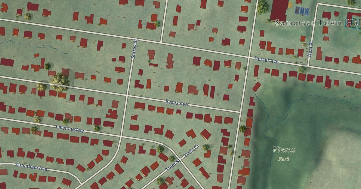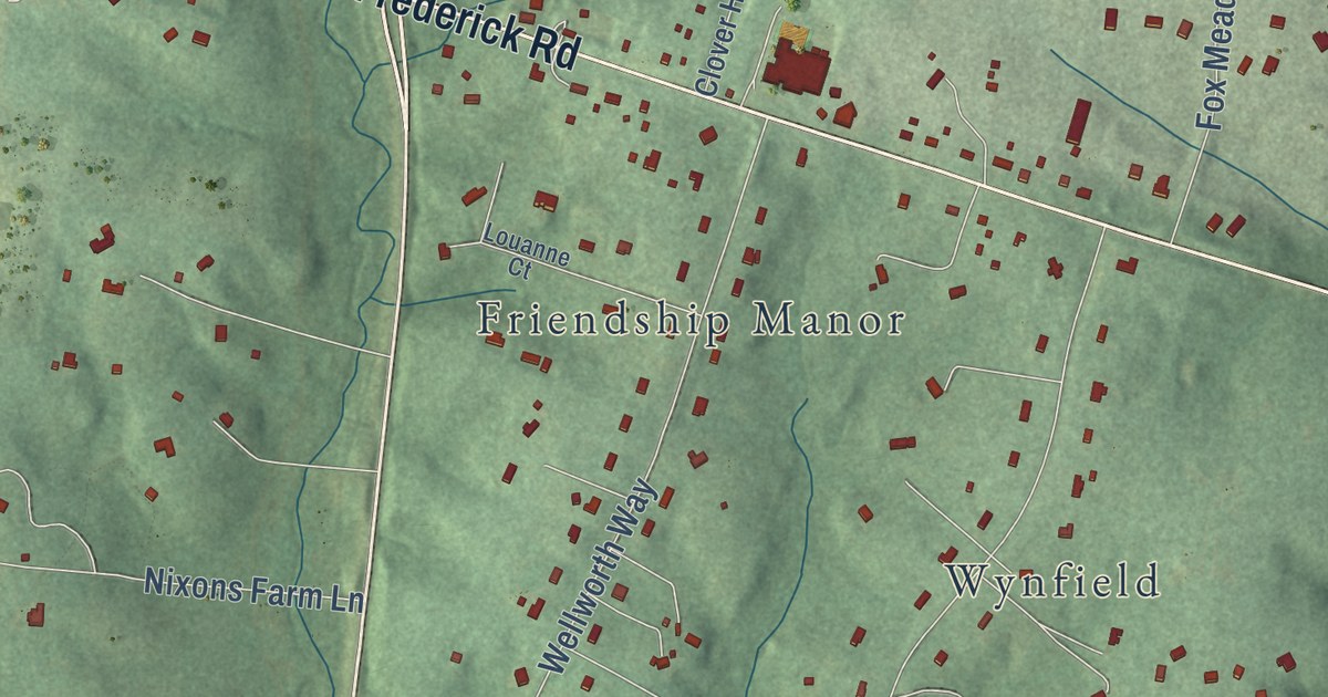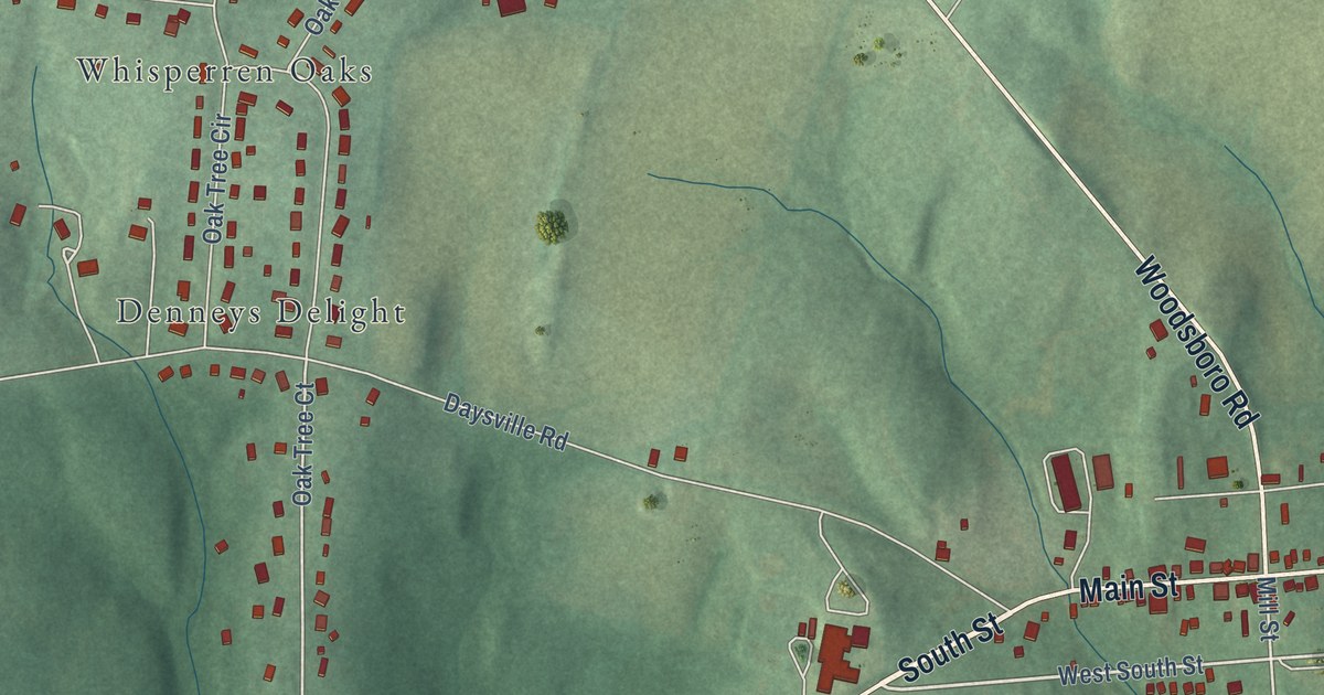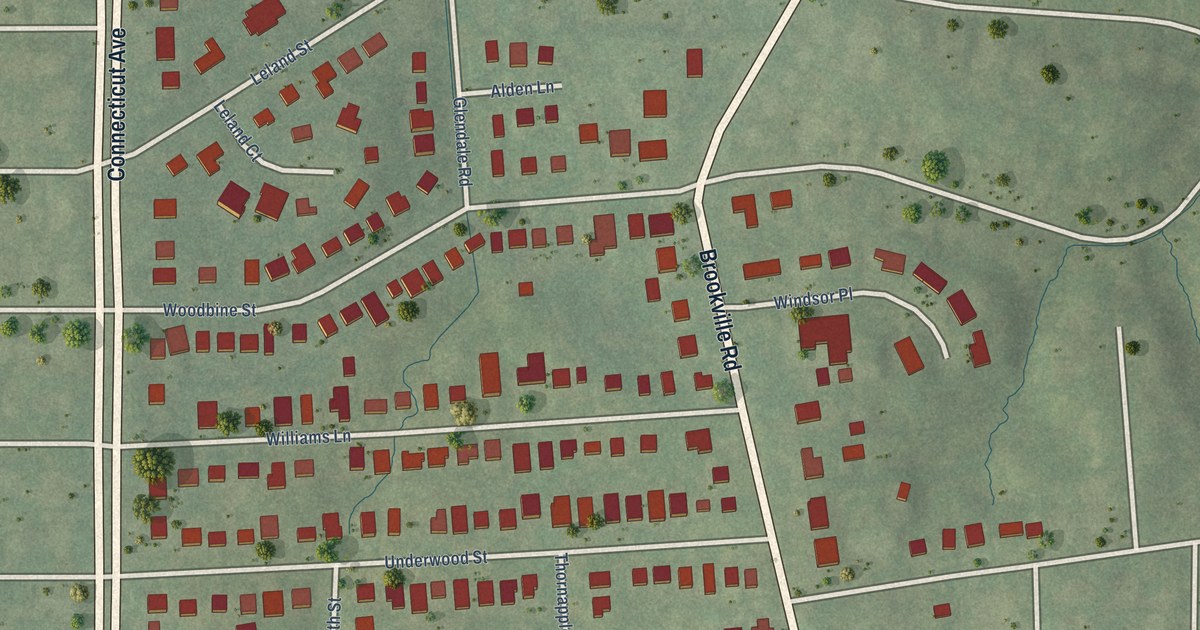
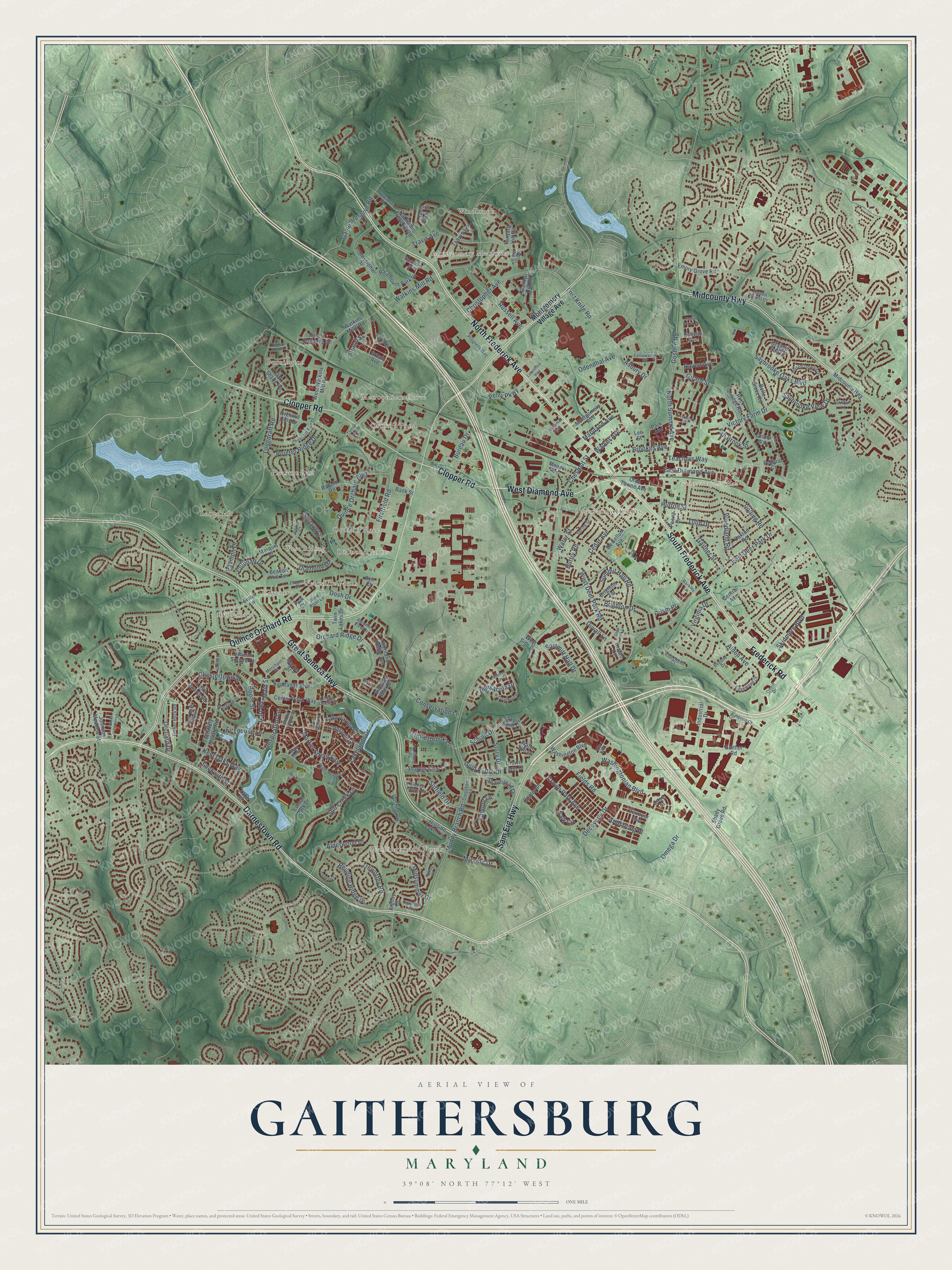
This beautifully detailed map of Gaithersburg, Maryland was created in 2026 using aerial imagery combined with modern topographical, census, street and landmark data. It’s a one-of-a-kind view of Gaithersburg that combines accurate data with a vintage aesthetic. The map shows every building in its true location, many of the roads carry their names, and the shaded topographic relief shows the shape of the land.
Explore an aerial view of Gaithersburg, Maryland
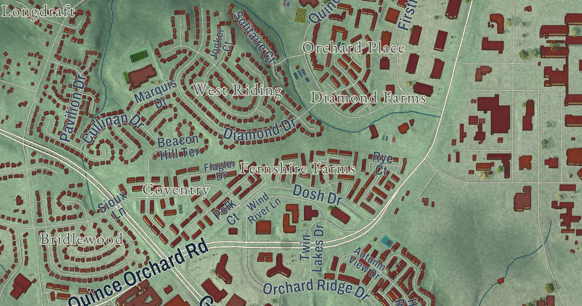
On the map you’ll find Gaithersburg City Hall, Blohm Park, Bohrer Park, Morris Park, Bennington, Bridlewood, Brown, Coventry, Diamond Farms, Dorsey Estates, Fernshire Farms, Longdraft, and more. If you look closely you can even find your house accurately drawn in its correct location. Zoom in on the preview to look for yours.
Did you know this about Gaithersburg, Maryland?
From the History of Western Maryland: "Gaithersburg is increasing in trade and population faster than any other place in the county, and is attracting many business men from other parts."
Take a closer look at the Gaithersburg map
Street and place names on the Gaithersburg, Maryland map
These names are printed on the map of Gaithersburg, Maryland.
Places: Gaithersburg City Hall, Bohrer Park, Morris Park, Longdraft, Bennington, Washingtonian Woods, Diamond Farms, Bridlewood, Metropolitan Grove, Fernshire Farms, Pleasant Run, Montgomery Meadows, Observatory Heights, Coventry, Orchard Pond, West Riding, Orchard Place and Windbrook.
Streets and roads: North Frederick Avenue, South Frederick Avenue, West Diamond Avenue, Darnestown Road, Frederick Road, Quince Orchard Road, Great Seneca Highway, Midcounty Highway, Clopper Road, Sam Eig Highway, Fields Road, Omega Drive.
More street names, A to Z
Alden Avenue, Alderwood Drive, Apple Seed Lane, Argosy Circle, Argosy Drive, Armstrong Place, Arrowsmith Court, Asbury Drive, Autumn View Drive, Bank Street, Barkley Lane, Beacon Hill Terrace, Beacon Square Court, Beckwith Street, Belle Grove Road, Bookham Lane, Booth Street, Bralan Court, Bright Meadow Lane, Brighton Drive, Brighton Terrace, Bristol Downs Drive, Brookes Avenue, Bureau Drive, Buttry Road, Case Street, Cedar Avenue, Center Point Way, Central Avenue, Chestertown Street, Chestnut Street, Chevy Chase Street, Christopher Avenue, Comprint Court, Conservation Lane, Copley Place, Coral Reef Drive, Crestwood Drive, Crossbow Lane, Cross Green Street, Crown Farm Drive, Crown Park Avenue, Cullinan Drive, Dalamar Street, Decoverly Drive, Deer Park Lane, De Sellum Avenue, Diamond Drive, Dosh Drive, Duvall Lane, East Deer Park Drive, East Diamond Avenue, Edgewood Court, Edgewood Drive, Edison Park Drive, Elmira Lane, Emory Grove Road, Englefield Drive, Eugene Drive, Fall Brook Street, Federal Court, Fellowship Circle, Firehouse Lane, Firstfield Road, Flagler Drive, Fleece Flower Drive, Flower Center Lane, Forest Preserve Drive, Gaither Road, Gaither Street, Gallop Hill Road, Game Preserve Road, Gatestone Street, Girard Street, Gloria Way, Gold Kettle Drive, Goshen Road, Grand Street, Grange Hall Drive, Hart Road, Hidden Forest Court, Hidden Marsh Street, High Gables Drive, Highland Ridge Avenue, Hillside Lake Terrace, Honey Brook Lane, Hutton Street, Industrial Drive, Inspiration Lane, Johnson Meadow Street, Jonker Court, Kendrick Place, Kentlands Boulevard, Kent Oaks Mews, Kent Oaks Way, Lakeforest Boulevard, Lakelands Drive, Lake Street, Lake Varuna Drive, Lamont Lane, Lee Street, Liriope Place, Little Quarry Road, Longdraft Road, Lost Knife Road, Main Mews, Main Street, Market Street, Market Street East, Market Street West, Marquis Drive, Maryland Avenue, Meem Avenue, Merchant Place, Midsummer Drive, Mission Drive, Montgomery Avenue, Montgomery Village Avenue, Muddy Branch Road, North Summit Avenue, Oak Shade Road, Oakton Road, Odendhal Avenue, Olde Towne Avenue, Old Game Preserve Road, Oneill Drive, Orchard Drive, Orchard Hills Drive, Orchard Ridge Drive, Palmtree Drive, Paramount Park Drive, Park Avenue, Pavilion Drive, Pelican Avenue, Pensacola Drive, Peony Drive, Perry Parkway, Pheasant Run Drive, Pointer Ridge Drive, Polk Court, Prism Place, Professional Drive, Progress Way, Quince Orchard Boulevard, Rabbitt Road, Raven Avenue, Redding Ridge Drive, Rio Boulevard, Rock Lodge Road, Rolling Road, Russell Avenue, Rye Court, Salk Circle, Saybrooke Oaks Boulevard, Saybrooke View Drive, School Drive, Shadow Glen Court, Shady Grove Road, Sharpstead Lane, Sioux Lane, Skidmore Boulevard, Solitaire Court, Spectrum Avenue, Spring Street, Still Creek Lane, Story Drive, Suffield Drive, Summer Walk Drive, Summit Hall Road, Summitt Hall Drive, Tanyard Hill Road, Teachers Way, Thurgood Street, Timberbrook Lane, Timber Rock Road, Travis Avenue, Travis Lane, Travis View Court, Treworthy Road, Tschiffely Square Road, Tulip Drive, Turnham Court, Twelve Oaks Drive, Twin Lakes Drive, Upshire Circle, Urban Avenue, Vermeer Avenue, Victory Farm Drive, Virginia Drive, Walker Avenue, Washington Boulevard, Washingtonian Boulevard, Watch Hill Lane, Water Street, Watkins Mill Road, Watkins Mills Road, West Deer Park Road, West Side Drive, West Watkins Mill Road, Wind River Lane, Woodland Road, Wye Mill Court.
See the Gaithersburg, Maryland map on a wall
The Gaithersburg map as an 18 x 24 inch print in a black frame.

This beautifully detailed map of Gaithersburg makes an attractive addition to your office, library, or den, and it can even be used to teach children the geography and history of the area. It also makes a great gift for anyone with Gaithersburg roots. When you’re done exploring, click here to get your copy of the Gaithersburg map.