If you grew up in Sheppton or Oneida, or you still drive Main Boulevard down to Brandonville, this map will look like home. It's a modern aerial view of East Union Township in Schuylkill County, Pennsylvania, made from modern data with a soft, vintage look. Long green ridges run across the sheet from west to east. Sheppton and Oneida sit near the middle and top, and Brandonville is down near the bottom. Each small red shape is a building, and many of the roads are named. Explore the print options for East Union.
Center Street, Sheppton and Main Boulevard
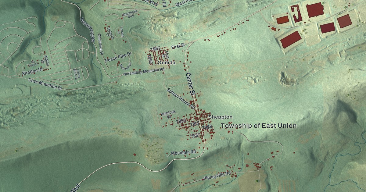
Start at Sheppton, near the middle of the map, where the red buildings crowd along Center Street. The Township of East Union label sits just to the right. Now follow Center Street north. School House Road splits off to the left, and both roads climb toward Oneida. At Oneida, First Street runs through a small grid of houses. Keep going up and you'll reach Summit Road, Adobe Way and Corral Road, then East Players Way and Golfwood Drive near the top. To the left, Peace Pipe Drive has side streets named Chippewa Drive, Mohawk Drive and Lenape Lane. Farther west, Cove Mountain Drive runs out toward the hills and meets Stratton Drive.
Now go back to Sheppton and take Mountain Road south to Main Boulevard. Main Boulevard curves down and to the left across the valley. Phineyville Road branches off to the east. A little farther down, Pole Road heads east toward Girard Manor, in the bottom right. Main Boulevard runs on through Brandonville, near the bottom middle. Rattlin Run Road comes in from the west there, and Hills Terrace Road sits just below. Creek Road follows a blue creek down the left side of the sheet, though the creek isn't labeled. Zoom in on the preview and look for your road.
The 1963 Sheppton mine rescue
Sheppton has a story people all over the country once followed. A state historical marker on School House Road tells it. Two coal miners were trapped 320 feet below ground after a shaft caved in. They were down there for nearly two weeks. On August 27, 1963, rescuers used a new way to drill a borehole, and it freed them. One miner was lost. The rescue drew national attention. It also led to tougher safety rules for small independent mines. Rescuers have used the same borehole method around the world since then, at Quecreek in 2002 and in Chile in 2010. The map doesn't mark the mine or the marker, but you can find School House Road running north from Center Street at Sheppton.
Brandonville is about a hundred years older than the rescue. The 1881 History of Schuylkill County says East Union was formed from Union Township in 1867. It says Nelson Brandon laid out Brandonville in 1864 on land he owned. He built a hotel and a store, then sold them. The village was a post office and a stop on the Catawissa Valley Railroad. The book counts three hotels, a public hall, two stores, a blacksmith shop and twenty-five homes there. The same book says parts of a hamlet called Torbert were once named Girard Manor. Torbert isn't labeled, but Girard Manor is, near Girard Manor Road and Pole Road.
A gift for families from Sheppton, Oneida and Brandonville
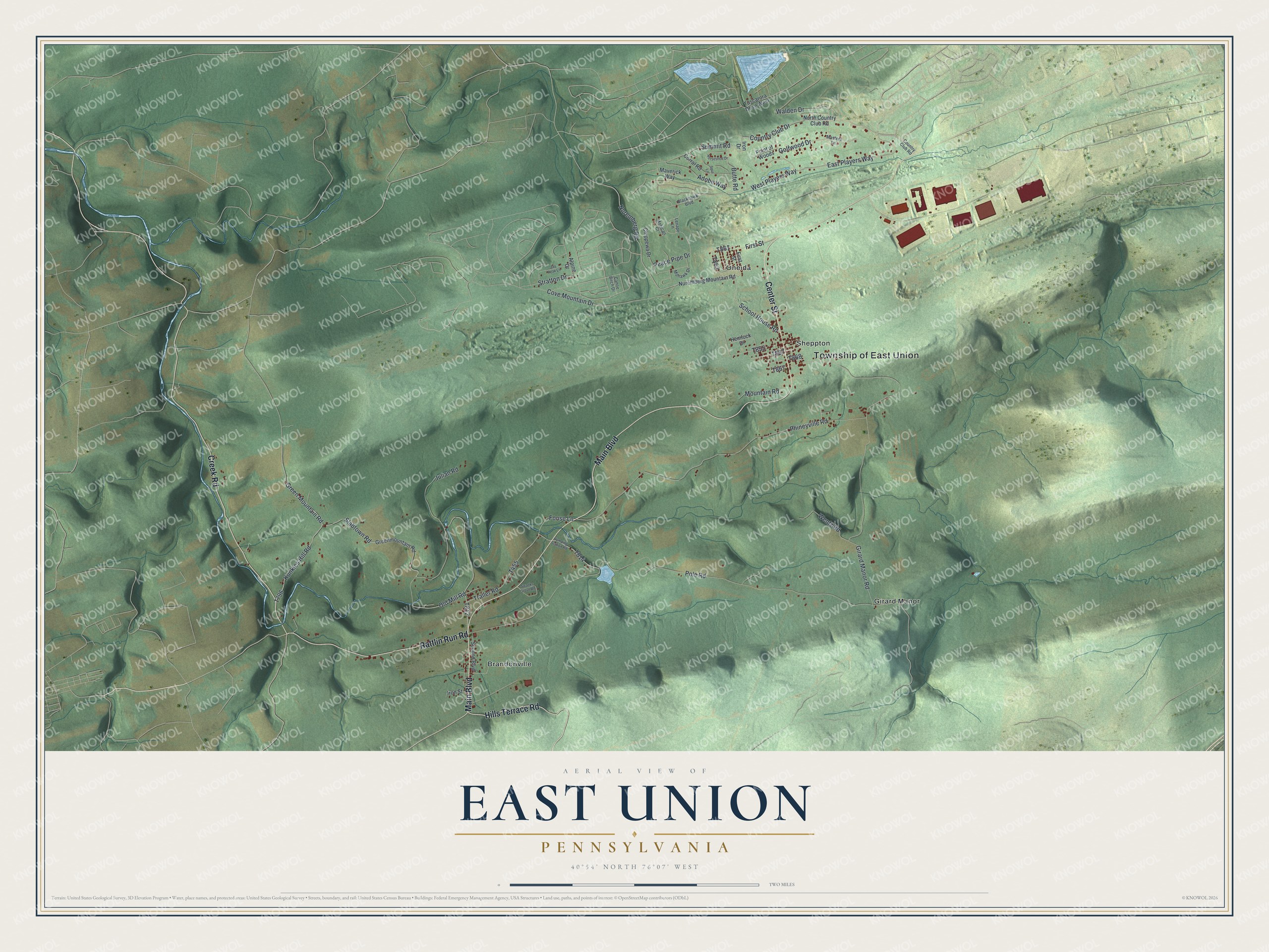
Created by KNOWOL in 2026, this East Union map shows long ridges in shaded green, with red buildings gathered at Sheppton, Oneida and Brandonville. The shaded hills come from USGS elevation data. The title panel reads "Aerial View of East Union, Pennsylvania," with 40°54' North 76°07' West and a two-mile scale bar.
It fits a den, a kitchen or an office wall. It's a good gift for someone who grew up in Sheppton and moved away, or for a family with roots along Main Boulevard. Open the preview, find Center Street, and follow it to the roads you know. Shop the East Union, Pennsylvania map.