If you grew up in Johnstown, or still have family in Cambria City, Hornerstown or Moxham, this map gives you a lot to find. It's a modern aerial view of Johnstown, a city in Cambria County, Pennsylvania, made from modern data with a vintage look. More than 17,000 buildings are drawn in deep red on shaded green hills. Blue rivers meet near the middle of the sheet, and the neighborhoods follow them up the valleys.
From Main Street to Cambria City and Moxham
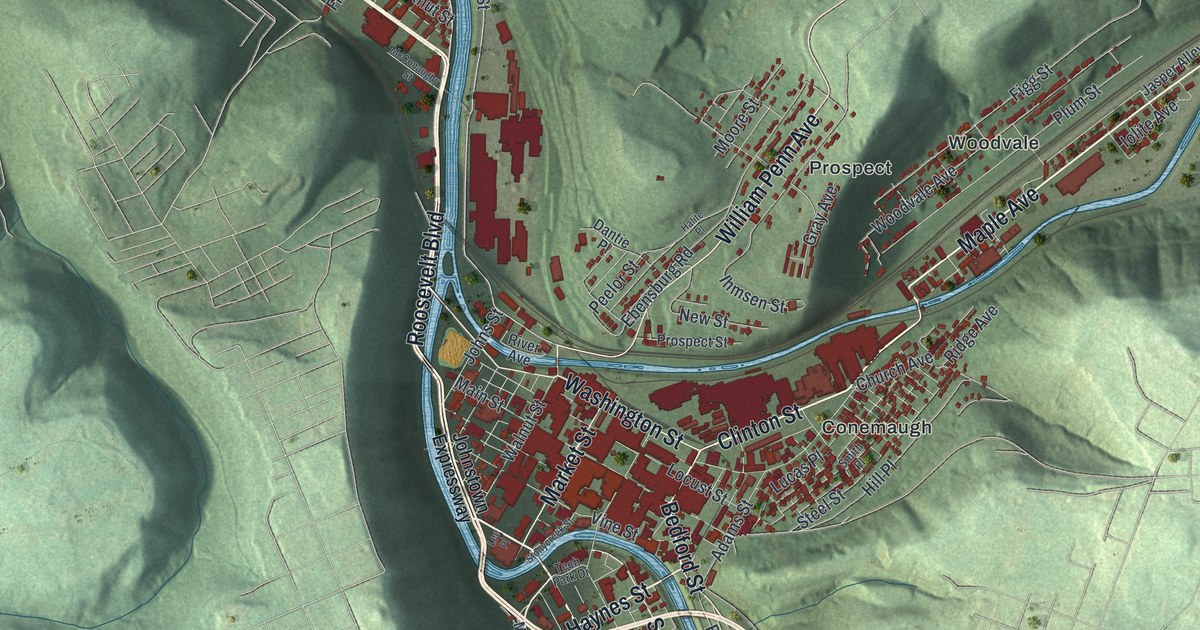
Start downtown, near the middle of the sheet where the rivers meet. Main Street, Locust Street and Washington Street run side by side there. Franklin, Market and Walnut Streets cross them. Clinton Street heads east into Conemaugh. Now follow Franklin Street south. In Hornerstown, Hickory Street and Somerset Street cross it. Keep going past Valley Pike and down into Roxbury near the bottom of the sheet. Across the river from Roxbury, Moxham fills a tight grid between Ohio Street and Village Street.
Back downtown, take Roosevelt Boulevard north toward Minersville. Broad Street runs west from it through Cambria City to Fairfield Avenue. Iron Street runs up through Minersville. Farther up the river, Cooper Avenue leads into Coopersdale, and Oakhurst sits in the top left corner. To the east, William Penn Avenue goes up to Prospect, and Maple Avenue follows the valley into Woodvale. Many roads carry their names, and every red shape is a building. Zoom in on the preview and find your block.
First Cambria AME Zion Church and the Woodvale Tannery
Find Haynes Street where it meets Menoher Boulevard, a little south of downtown. First Cambria AME Zion Church stands there. A state historical marker tells how it began. In 1873, workers at the Woodvale Tannery started the church in the tannery's loft. In 1874 they organized as Cambria Chapel A.M.E. Zion Church at Napoleon and Dibert Streets. Both streets are printed on the map, and Napoleon Street meets Haynes Street. About 1877 the church moved to Haynes Street. The 1889 flood washed it off its foundation. It was later restored, and in 2025 it was added to the National Register.
That flood came on May 31, 1889. The South Fork Dam broke, and a wall of water and wreckage 35 feet high traveled 14 miles to Johnstown. It destroyed more than 1,600 homes and took 2,209 lives. Clara Barton and the American Red Cross arrived on June 5. Over five months, they helped 25,000 people. Markers for both stories stand on Johns Street, near where the rivers meet. From 1938 to 1943, the Army Corps of Engineers built 9.2 miles of concrete channels along Johnstown's three rivers. Follow the blue rivers through town on the map and you're following those channels.
For anyone from Cambria City, Hornerstown or Moxham
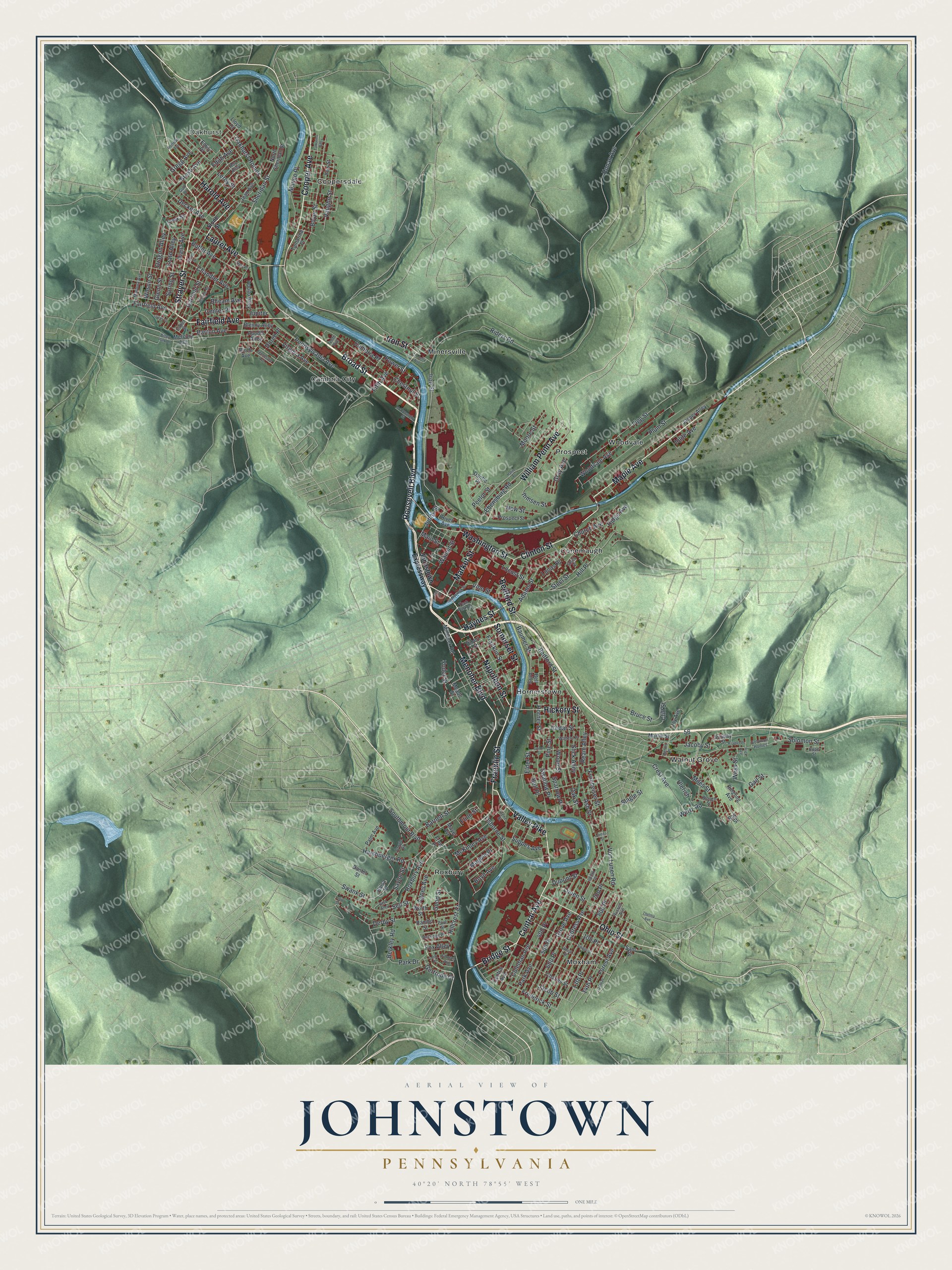
Created by KNOWOL in 2026, this Johnstown map shows the city and the steep hills around it, with the hills shaded from USGS elevation data and buildings in deep red. The title panel reads "Aerial View of Johnstown, Pennsylvania," with the coordinates 40°20' North, 78°55' West and a one-mile scale bar.
It fits a den, an office or a kitchen wall. It makes a thoughtful gift for someone who grew up in Cambria City and moved away, or for a family with roots near Main Street. Open the preview, start where the rivers meet and find your street. See sizes and frames for the Johnstown map.