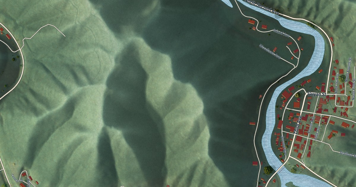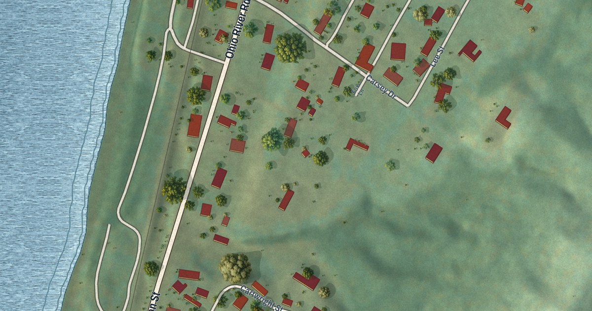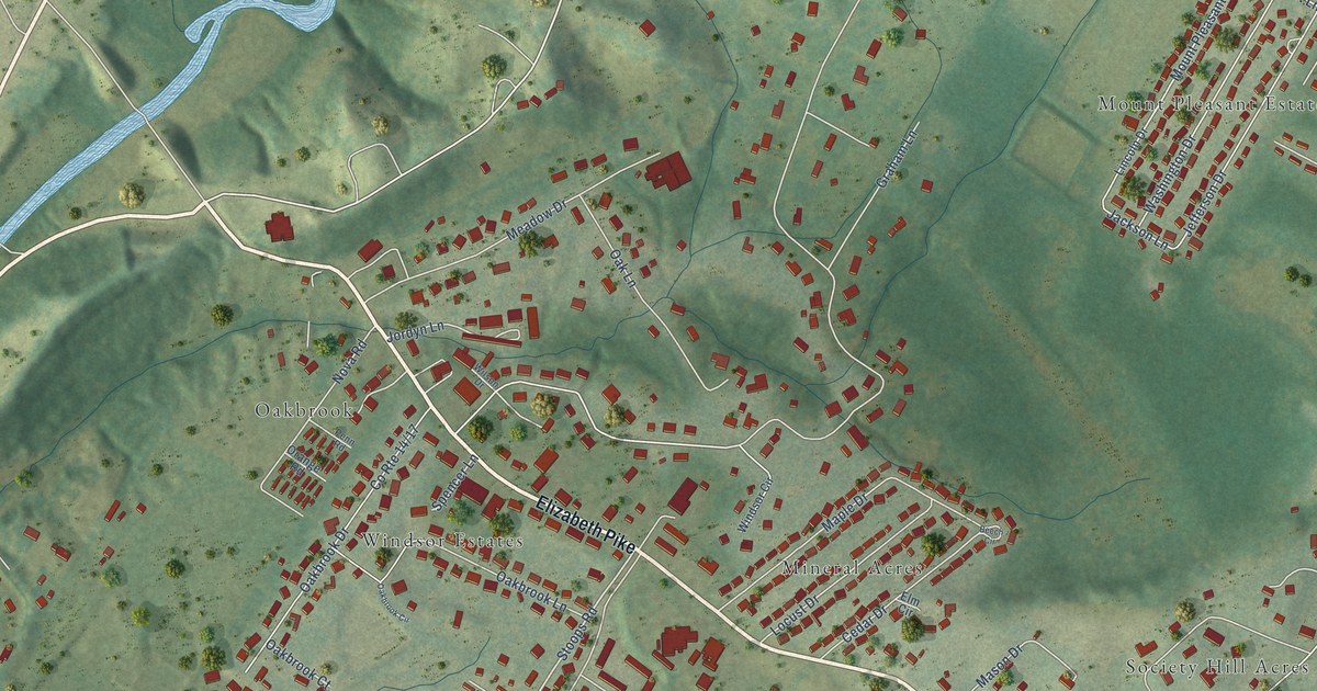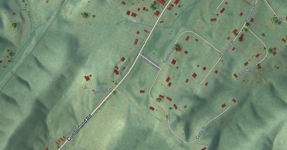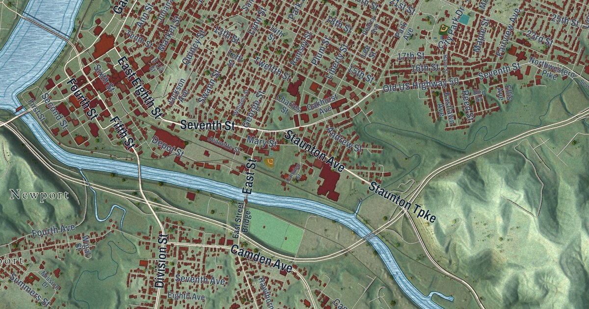
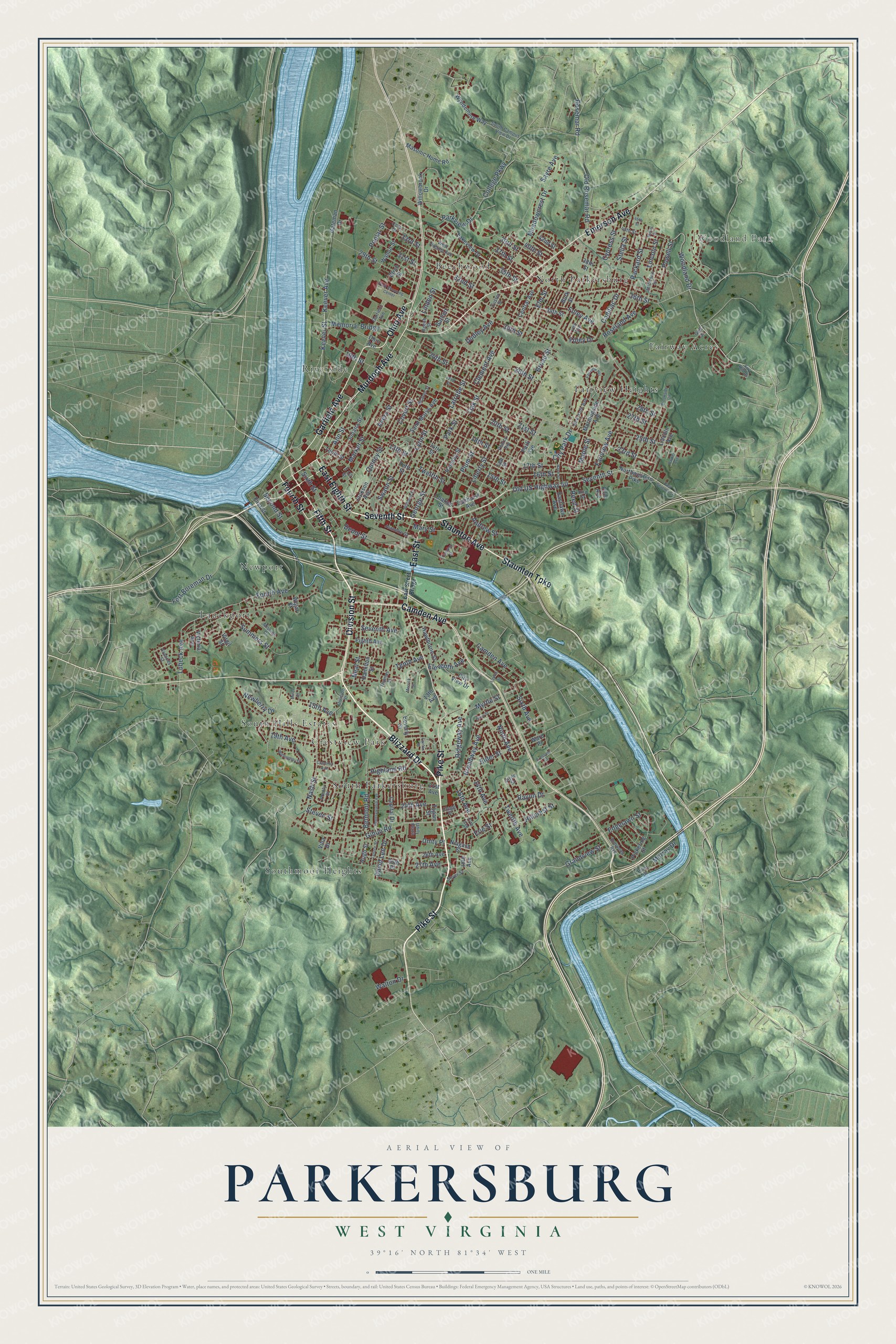
This beautifully detailed map of Parkersburg, West Virginia was created in 2026 using aerial imagery combined with modern topographical, census, street and landmark data. It’s a one-of-a-kind view of Parkersburg that combines accurate data with a vintage aesthetic. The map shows every building in its true location, many of the roads carry their names, and the shaded topographic relief shows the shape of the land.
Explore an aerial view of Parkersburg, West Virginia
On the map you’ll find Woodland Park, Beechwood, Crestview Park, Fairview Heights, Fairway Acres, Lauckport, Newport, North Parkersburg, Riverside, South Hills Estates, South Parkersburg, Southmoor Heights, and more. If you look closely you can even find your house accurately drawn in its correct location. Zoom in on the preview to look for yours.
Did you know this piece of Parkersburg, West Virginia history?
From the West Virginia Encyclopedia: "In 1795, Harman and Margaret Blennerhassett purchased what had previously been called Backus Island, two miles below Parkersburg. Aaron Burr, gaining the Blennerhassetts’ trust in 1804, made Blennerhassett Island a rendezvous for his disastrous proposed expedition to Spanish-held lands in the southwest."
Take a closer look at the Parkersburg map
Street and place names on the Parkersburg, West Virginia map
These names are printed on the map of Parkersburg, West Virginia.
Places: Woodland Park, Beechwood, Crestview Park, Fairview Heights, Fairway Acres, Lauckport, Newport, North Parkersburg, Riverside, South Hills Estates, South Parkersburg and Southmoor Heights.
Streets and roads: Pike Street, Blizzard Drive, Division Street, Garfield Avenue, Seventh Street, East Eighth Street, Fourth Street, Ohio Avenue, Murdoch Avenue, Emerson Avenue, Camden Avenue, Fifth Street.
More street names, A to Z
13th Avenue, 13th Street, 14th Avenue, 14th Street, 15th Avenue, 15th Street, 16th Avenue, 16th Street, 17th Avenue, 17th Street, 18th Avenue, 18th Street, 19th Avenue, 19th Street, 20th Street, 21st Avenue, 21st Street, 22nd Street, 23rd Street, 24th Avenue, 24th Street, 25th Street, 26th Avenue, 26th Place, 26th Street, 27th Avenue, 27th Street, 28th Street, 29th Street, 30th Street, 31st Street, 32nd Street, 33rd Street, 34th Street, 35th Street, 36th Street, 37th Street, 38th Street, 39th Street, 40th Street, 42nd Street, 45th Street, 46th Street, Andrew Street, Ann Street, Avery Street, Bartlett Street, Beaver Street, Beech Street, Belmont Road, Beverly Street, Birch Street, Bird Street, Broad Street, Broadway Avenue, Brookside Circle, Burk Street, Butler Street, Cadillac Drive, Camden Street, Cameron Avenue, Capital Drive, Central Avenue, Charles Street, City Park Drive, City View Drive, Clegg Street, Clement Avenue, Clyde Street, College Parkway, Cora Drive, Covert Street, Crescent Street, Custer Street, Cypress Street, David Lee Drive, Depot Street, Dudley Avenue, Eastlawn Avenue, East Seventh Street, East Street, East Street Bridge, Edgelawn Street, Eighth Avenue, Elder Street, Eleventh Avenue, Ellis Avenue, Elm Street, Elmwood Avenue, Erie Street, Fairfax Street, Fairview Avenue, First Street, Foley Avenue, Foley Drive, Fort Boreman Drive, Fourth Avenue, Fox Hill Drive, Frances Street, Gateman Drive, George Street, Gihon Road, Golf Drive, Grandview Street, Hamilton Street, Hawthorne Street, Highland Road, Hillcrest Street, Hugh Street, Jackson Avenue, Jeanette Street, Jefferson Street, Juliana Street, Keever Avenue, Keever Street, Lakeview Drive, Latrobe Street, Laurel Street, Lee Street, Lenore Street, Liberty Street, Lincoln Avenue, Lincoln Street, Linden Street, Lubeck Avenue, Lynn Street, Maple Street, Market Street, Mary Street, Masonic Home Road, Meadowcrest Drive, Memorial Bridge, Merrick Street, Miner Street, Mission Drive, Morningside Avenue, Murray Drive, Myrtle Street, Nash Street, Neal Street, Newberry Drive, New York Avenue, Niagara Street, Ninth Avenue, Northwestern Pike, Oakhurst Avenue, Oak Street, Old Rosemar Road, Old US Highway 50, Olive Street, Packard Street, Park Avenue, Parker Avenue, Park Shopping Center, Park Street, Parkview Drive, Pearcy Avenue, Pennsylvania Avenue, Pickering Street, Plum Street, Point Drive, Poplar Street, Powell Street, Prunty Street, Quincy Street, Race Street, Ramsey Street, Rayon Drive, Reed Street, Ridgeway Avenue, Roseland Avenue, Rosemar Road, Saint Marys Avenue, Sayre Avenue, Second Street, Seventh Avenue, Sixth Avenue, Sixth Street, South Campus View Drive, Soyer Street, Staunton Avenue, Staunton Turnpike, Stella Street, Steven Street, Summers Street, Swann Street, Tefft Street, Tenth Avenue, Tenth Street, Thomas Street, Twelfth Avenue, Twelfth Street, Tygart Street, Unity Place, Unity Plaza, Vair Avenue, Victoria Avenue, Villa Drive, Virgil Street, Walnut Street, Walton Drive, Ward Place, West Virginia Avenue, Wigal Street, Williams Street, Willoughby Drive, Willowbrook Drive, Woodland Drive, Wyndemere Way.
See the Parkersburg, West Virginia map on a wall
The Parkersburg map as an 18 x 24 inch print in a black frame.

This beautifully detailed map of Parkersburg makes an attractive addition to your office, library, or den, and it can even be used to teach children the geography and history of the area. It also makes a great gift for anyone who grew up in Parkersburg or moved away. When you’re done exploring, click here to get your copy of the Parkersburg map.