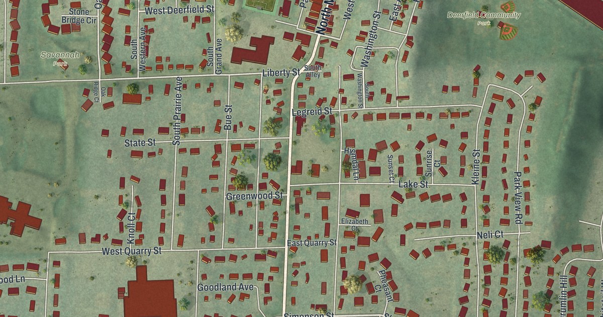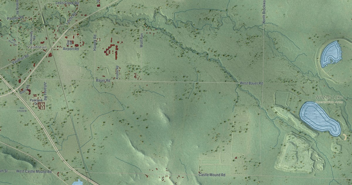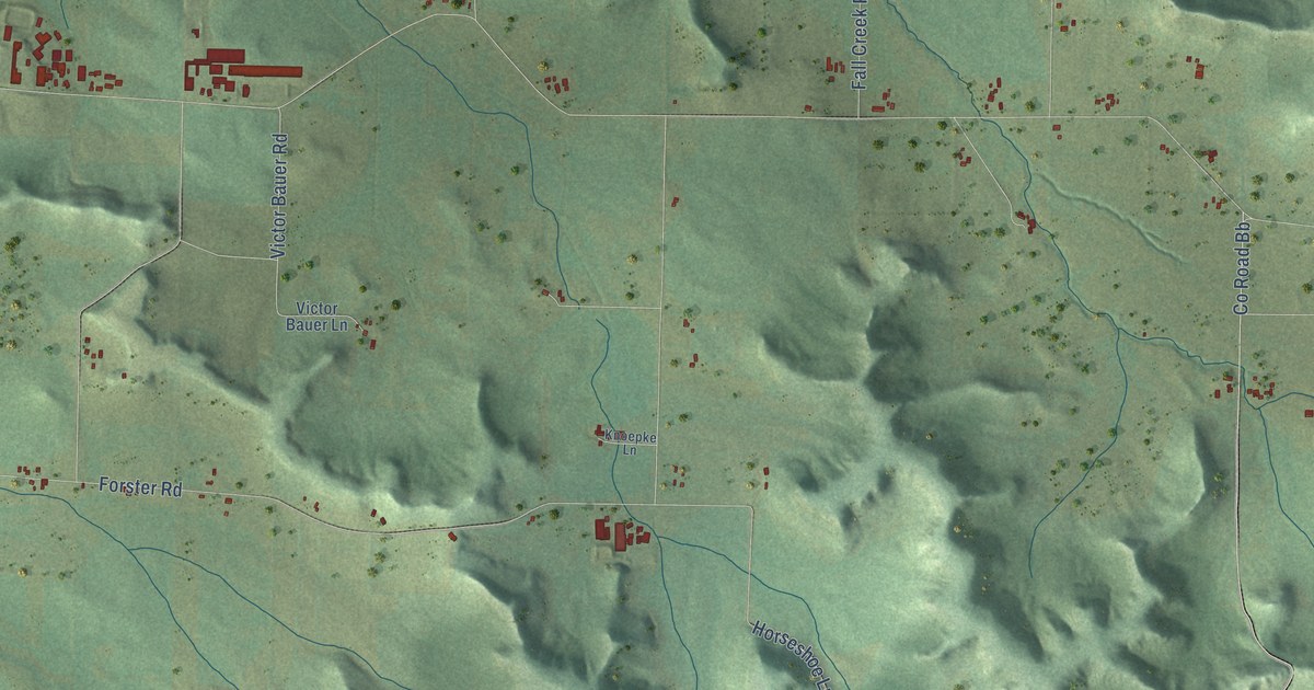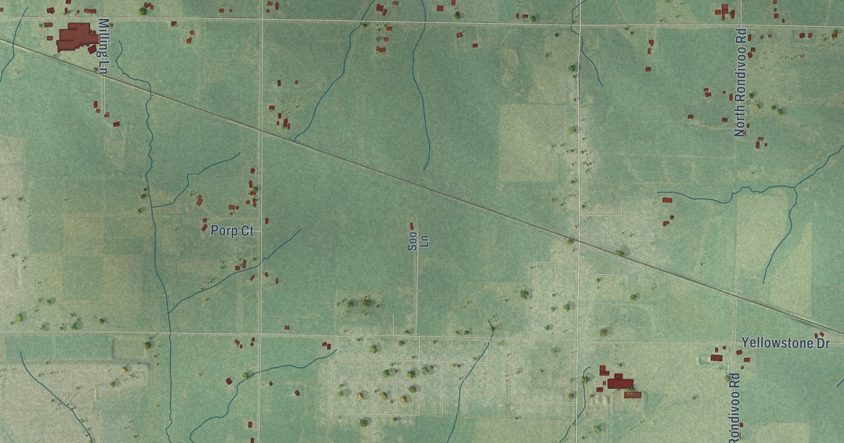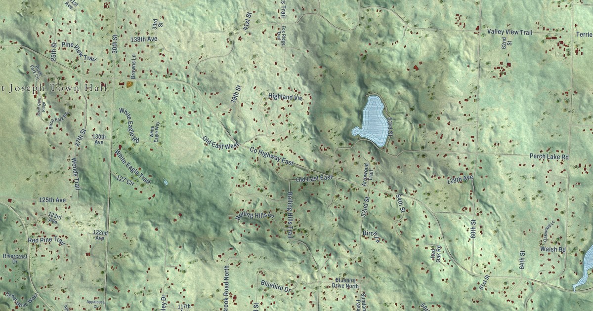
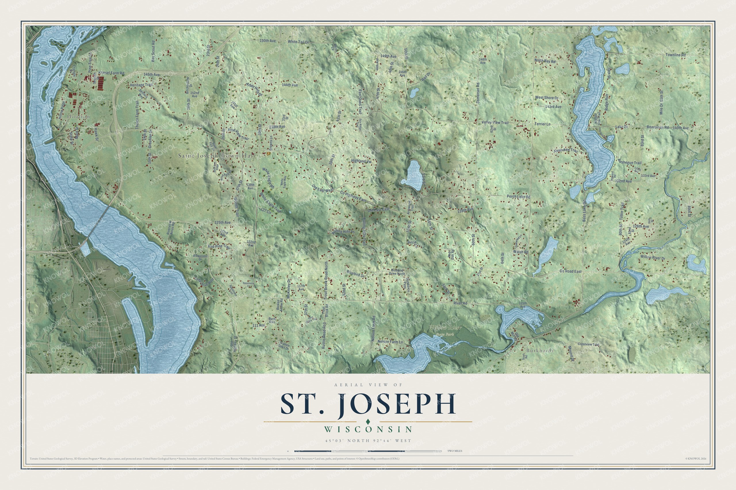
This beautifully detailed map of St. Joseph, Wisconsin was created in 2026 using aerial imagery combined with modern topographical, census, street and landmark data. It's a modern aerial view of St. Joseph in St. Croix County, Wisconsin, that combines modern data with a vintage aesthetic. The roads feature printed names, and if you look closely you can find your exact house accurately shown in its correct location.
Explore an aerial view of St. Joseph, Wisconsin
On this map you'll find Saint Joseph Town Hall, Houlton, Burkhardt, Willow River State Park, Co Highway East, Main Street, 150th Avenue, White Tail Drive, 83rd Street, Lake Drive, 132nd Avenue, 145th Avenue, and more. Each red shape is a building, so zoom in on the preview and look for yours.
St. Joseph has a story worth telling. The Pioneer Press Company puts it this way: "St. Joseph was organized in 1858. The North Wisconsin railroad passes through the southeast corner of the town."
St. Joseph is a town in St. Croix County. The Census Bureau counted 4,178 people here in 2020.
Take a closer look at the St. Joseph map
Names on this map
These names are printed on this map.
Places: Saint Joseph Town Hall, Houlton, Burkhardt and Willow River State Park.
Streets and roads: County Highway East, Main Street, 150th Avenue, White Tail Drive, 83rd Street, Lake Drive, 132nd Avenue, 145th Avenue, County Road East, River Road, Valley View Trail, 30th Street.
More street names, A to Z
14th Street, 15th Street, 20th Street, 23rd Street, 24th Street, 25th Street, 27th Street, 33rd Street, 37th Street, 39th Street, 41st Street, 42nd Street, 46th Avenue, 47th Street, 48th Street, 50th Street, 52nd Street, 53rd Street, 54th Street, 56th Street, 60th Street, 61st Street, 62nd Street, 64th Street, 78th Street, 80th Street, 82nd Street, 84th Street, 85th Street, 89th Street, 111 Avenue, 115th Avenue, 117th Avenue, 122nd Avenue, 123rd Avenue, 124th Avenue, 125th Avenue, 126th Avenue, 127 Circle, 128th Avenue, 130th Avenue, 133rd Avenue, 134th Avenue, 138th Avenue, 140th Avenue, 141st Avenue, 142nd Avenue, 143rd Avenue, 144th Avenue, 146th Avenue, 148th Avenue, 149th Avenue, Appalousa Court, Appalousa Trail, Arbor Hills Drive, Arrowood Trail, Aushegun Trail, Awatukee Trail, Bass Lake Road, Birchhollow Drive, Birch Lane, Birch Park Circle, Birch Park Ridge, Birch Park Road, Bluebird Drive, Bluebird Drive North, Boardman Road, Boy Scout Road, Broken Arrow Road, Browns Lane, Buck Run, Cedar Drive West, Crestview Trail, Drechler Drive, East Oaks Trail, Fox Ridge Trail, Frog Pond Lane, Golden Oaks Drive, Hawk Street, Heritage Trail, Heron Lane, Hidden Oak Trail, Highland Vw, Hilltop Ridge, Howard Road, Kriesel Farm Road, McKinley Drive, Mile Drive, Mound Drive, Nelson Farm Lane, Nelson Farm Road, North Bay Road, Oakwood Lane, Old East East, Old East West, Old Highway 35, Old Mill Road, Perch Lake Road, Pine Tree Lane, Pine View Trail, Rail Drive, Red Oak Road, Red Pine Trail, Ridge Run, Rivercrest Drive, Riverview Acres Road, Rolling Hills Lane, Rolling Hills Trail, Rustic Road R13, Scott Road, Settlers Way, Seventh Street, Somerset Road, State Street, Sundance Pass, Terrier Lane, Thelen Farm Trail, Tobin Trail, Townline Road, Triangle Drive, Trout Brook Road, Trout Brook Road North, Trout Brook Trail, Walsh Road, West Shore Drive, White Eagle Road, White Eagle Trail, White Eagle Way, Willow River Drive, Woods Trail.
Created by KNOWOL in 2026. The buildings are small red shapes, the roads carry their printed names, and shaded relief shows the shape of the land. The title panel reads "AERIAL VIEW OF ST. JOSEPH, WISCONSIN" with 45°03' NORTH 92°44' WEST.
It looks right in a kitchen, an office or a den, and it's a gift for anyone who grew up in St. Joseph or moved away. Open the preview and find your street. See sizes and frames for the St. Joseph map.