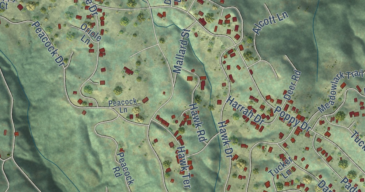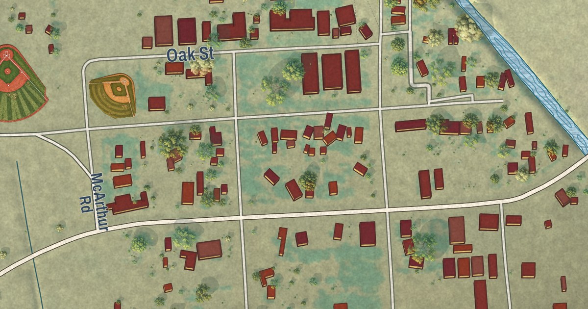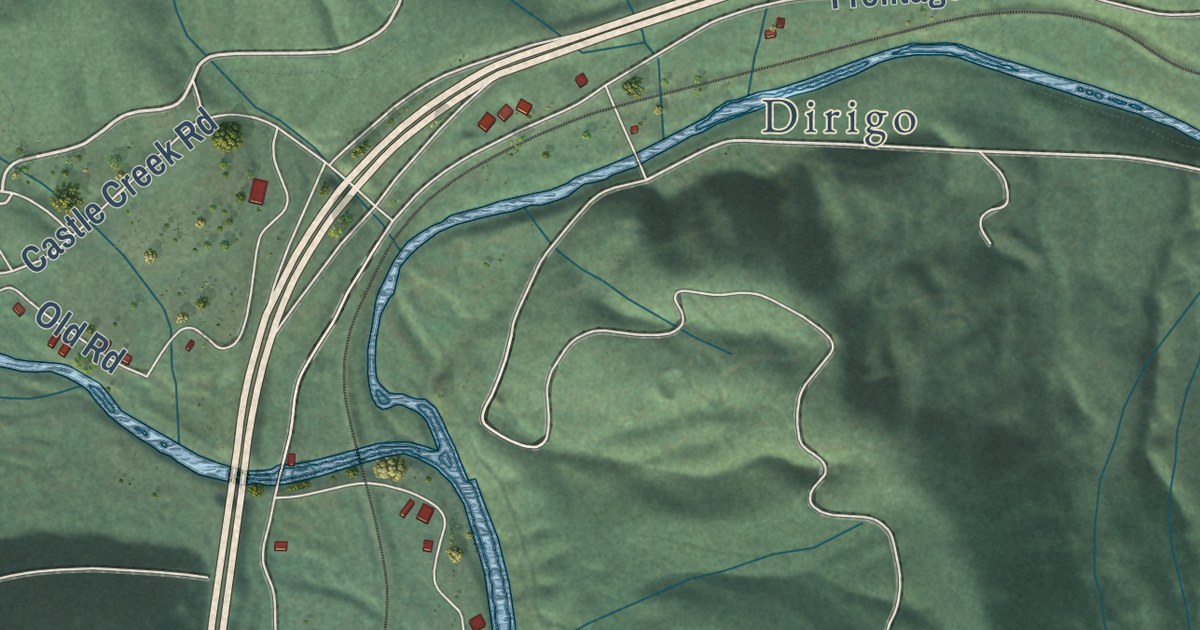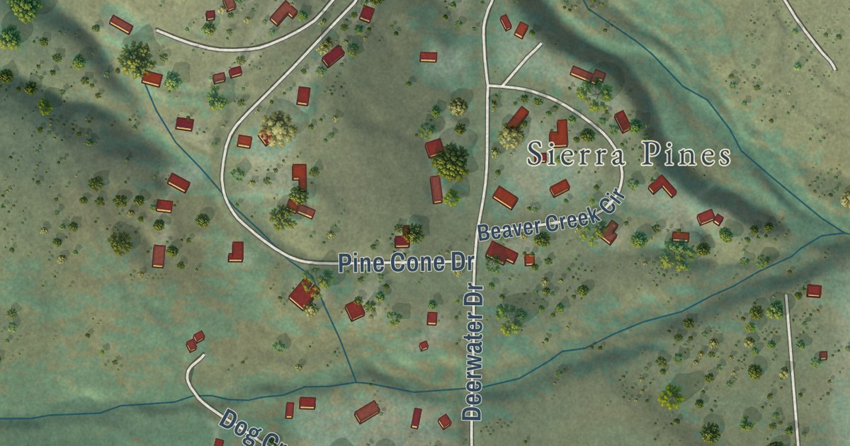
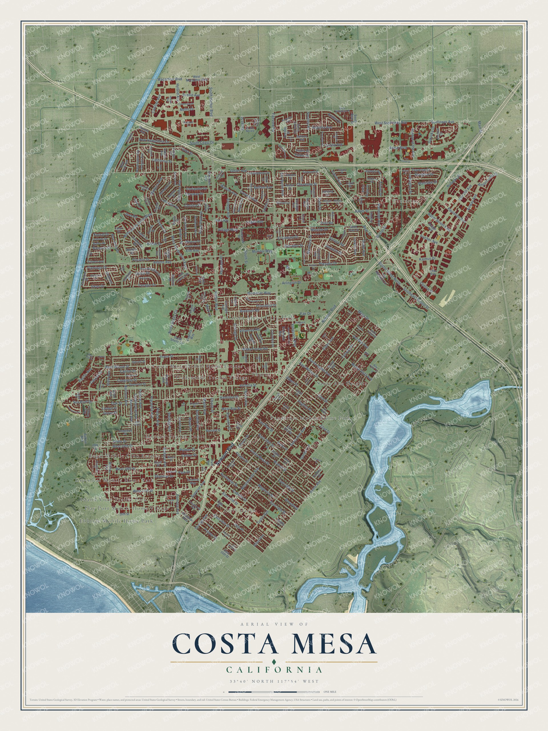
This beautifully detailed map of Costa Mesa, California was created in 2026 using aerial imagery combined with modern topographical, census, street and landmark data. It’s a one-of-a-kind view of Costa Mesa that combines accurate data with a vintage aesthetic. The map shows every building in its true location, many of the roads carry their names, and the shaded topographic relief shows the shape of the land.
Explore an aerial view of Costa Mesa, California
On the map you’ll find Costa Mesa City Hall, Paularino, Fairview Park, Lions Park, TeWinkle Park, Cliff Haven, Costa Mesa Mobile Home Estates, Ebbtide Mobile Home Park, Greenleaf Mobile Home Park, Island View Trailer Park, and Play Port Mobile Home Village, along with Hoosier Trailer Court, and more. If you look closely you can even find your house accurately drawn in its correct location. Zoom in on the preview to look for yours.
Did you know this piece of Costa Mesa, California history?
From Ohp.parks.ca.gov: "This adobe house was built as a station of Mission San Juan Capistrano."
Take a closer look at the Costa Mesa map
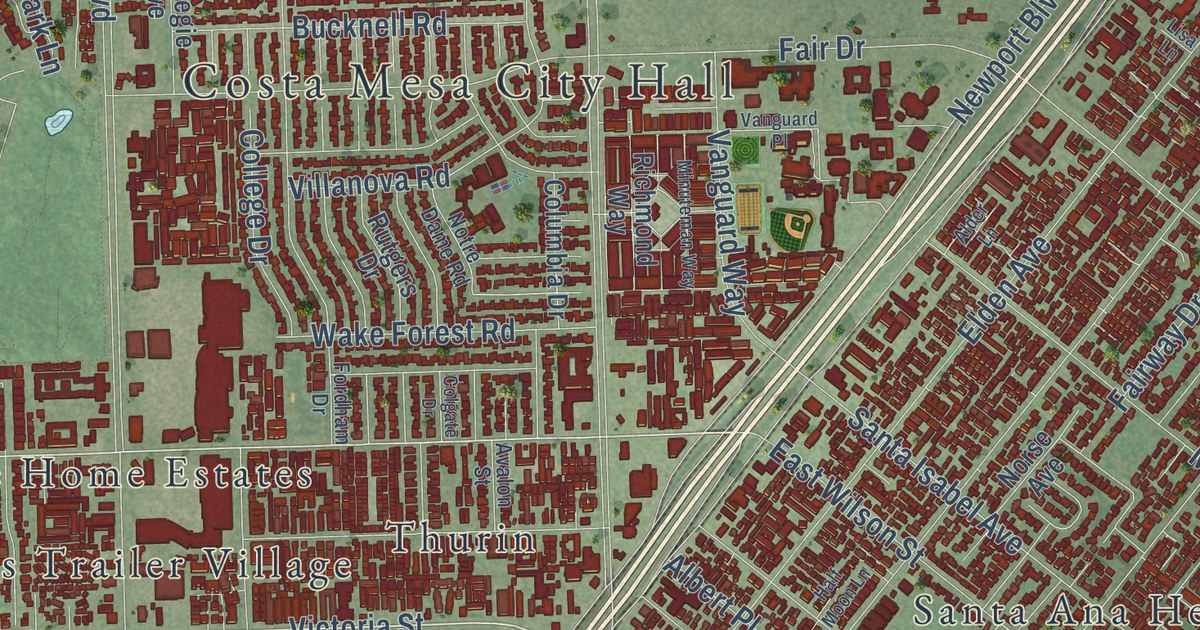
Street and place names on the Costa Mesa, California map
These names are printed on the map of Costa Mesa, California.
Places: Costa Mesa City Hall, Paularino, Fairview Park, Lions Park, TeWinkle Park, Island View Trailer Park, Thurin, Ponderosa Mobile Home Park, Regal Mobile Club Estates, Cliff Haven, Santa Ana Heights, Tradewinds Trailer Village, Hoosier Trailer Court, Ebbtide Mobile Home Park, Greenleaf Mobile Home Park, Costa Mesa Mobile Home Estates and Play Port Mobile Home Village.
Streets and roads: Newport Boulevard, Bristol Street, Victoria Street, Southeast Bristol Street, 22nd Street, West 19th Street, Continental Avenue, West Wilson Street, Arbor Street, Susan Street, North Shelly Circle, Superior Avenue.
More street names, A to Z
16th Place, 16th Street, 19th Street, 23rd Street, Adams Avenue, Airport Loop Drive, Airway Avenue, Alabama Circle, Albatross Drive, Albert Place, Alder Lane, Aliso Avenue, Allegheny Avenue, Alta Lane, Alva Lane, American Avenue, Anaheim Avenue, Andros Street, Anton Boulevard, Arlington Drive, Arnold Avenue, Ashwood, Austin Street, Avalon Street, Avenue of the Arts, Aviemore Terrace, Azalea Drive, Babb Street, Baker Street, Baker Street East, Balboa Boulevard, Balearic Drive, Baltra Place, Barbados Place, Bay View Terrace, Bear Street, Begonia Avenue, Belfast Avenue, Bernard Street, Bimini Place, Boa Vista Drive, Bowling Green Drive, Briggs Avenue, Bristol Street North, Broadway, Buckingham Drive, Bucknell Road, Cabrillo Street, Cadillac Avenue, California Street, Calvert Avenue, Canyon Drive, Capitol Street, Capri Lane, Caraway Drive, Cardinal Drive, Carnegie Avenue, Carson Street, Cecil Place, Center Street, Century Place, Ceylon Drive, Ceylon Road, Charle Street, Chemin de Fer Way, Cheyenne Street, Church Street, Cinnamon Avenue, Citrus Place, Clinton Street, Clubhouse Road, Colgate Drive, College Avenue, College Drive, Columbia Drive, Commercial Way, Concord Street, Congress Street, Conway Avenue, Coolidge Avenue, Coriander Drive, Cork Lane, Corporate Drive, Corsica Place, Corte Cassis, Costa Mesa Street, Country Club Drive, County Route Novara, Dahlia Avenue, Dakota Avenue, Dale Way, Darrell Street, Debra Drive, Deedee Drive, Del Mar Avenue, Denver Drive, Deodar Avenue, Dogwood Street, Dorset Lane, Drake Avenue, East 15th Street, East 16th Street, East 17th Street, East 18th Street, East 19th Street, East 20th Street, East 21st Street, East Bay Street, East Wilson Street, El Camino Drive, Elden Avenue, Ellesmere Avenue, Elm Avenue, El Rio Circle, Emerson Street, Enclave Circle, Esther Street, Eugenia Way, Europa Drive, Fair Drive, Fairview Road, Fairway Drive, Fairway Place, Farad Street, Federal Avenue, Fischer Avenue, Flamingo Drive, Flower Street, Fordham Drive, Ford Road, Fremont Lane, Fuchsia Street, Fullerton Avenue, Garden Lane, Garfield Avenue, Gibraltar Avenue, Gisler Avenue, Golf Course Drive, Governor Street, Grace Lane, Gregory Way, Grove Place, Half Moon Lane, Hamilton Street, Harbor Boulevard, Harla Avenue, Helena Circle, Howard Way, Hummingbird Drive, Hyland Avenue, Idaho Place, Industrial Way, Iowa Street, Irvine Avenue, Jacaranda Avenue, Jamaica Road, James Street, Java Road, Jeffrey Drive, Joann Street, Junipero Drive, Kalmus Drive, Killybrooke Lane, Kincaid Drive, Kinglet Court, Knowell Place, Knox Street, Kornat Drive, Labrador Drive, Lanai Drive, Lansing Lane, La Perle Place, Larkspur Street, Lear Avenue, Lemnos Drive, Liard Place, Linden Place, Lisa Lane, Logan Avenue, Londonderry Street, Loren Lane, Lorenzo Avenue, Loreto Avenue, Ludington Street, Macarthur Boulevard, Madeira Avenue, Madison Avenue, Magnolia Street, Main Street, Mandarin Drive, Manistee Drive, Maple Avenue, Maple Street, Mark Lane, Mendoza Drive, Merrimac Way, Mesa Bluff Drive, Mesa Drive, Mesa Verde Drive East, Mesa Verde Drive West, Metro Drive, Meyer Place, Michigan Avenue, Milbro Street, Minnesota Avenue, Minorca Drive, Minuteman Way, Mission Drive, Monitor Way, Monrovia Avenue, Monte Vista Avenue, Murray Lane, Nancy Lane, National Avenue, Nevada Avenue, New Hampshire Drive, New York Avenue, Norse Avenue, Notre Dame Road, Oak Street, Ogle Street, Olympic Avenue, Orange Avenue, Oregon Avenue, Oriole Drive, Oxford Lane, Pacific Avenue, Palace Avenue, Palau Place, Palmer Street, Paloma Drive, Park Avenue, Park Center Drive, Park Drive, Park Place, Parsons Street, Paularino Avenue, Pemba Drive, Peninsula Place, Peterson Place, Pierce Avenue, Pinecreek Drive, Pitcairn Drive, Placentia Avenue, Platte Drive, Plumer Street, Pomona Avenue, Ponderosa Street, Post Road, Presidio Drive, Presidio Square, Princeton Drive, Pullman Street, Raleigh Avenue, Ramona Place, Randolph Avenue, Red Hill Avenue, Redwood Avenue, Rhodes Drive, Richmond Way, Rochester Street, Royal Palm Drive, Royce Lane, Rural Lane, Rutgers Drive, Saint Clair Street, Sakioka Drive, Salinas Avenue, Salvador Street, Samar Drive, Samoa Place, Sandpiper Drive, San Juan Lane, Santa Ana Avenue, Santa Catalina Drive, Santa Clara Circle, Santa Isabel Avenue, Santo Tomas Street, Scenic Avenue, Scott Place, Sea Bluff Drive, Sea Cove Lane, Senate Street, Shady Lane, Shalimar Drive, Shasta Lane, Sicily Avenue, Sierks Street, Smalley Road, Sonora Road, South Bear Street, South Coast Drive, South Harbor Boulevard, South Shelly Circle, South Street, Starbird Drive, State Avenue, Sterling Avenue, Sturgeon Drive, Sunflower Avenue, Sunland Lane, Swan Drive, Tabago Place, Tahiti Drive, Tanager Drive, Tanana Place, Tara, Terminal Way, Tern Circle, The Masters Circle, Thurin Avenue, Traverse Drive, Trinity Drive, Tulare Drive, Tulip Lane, Tustin Avenue, Union Avenue, Valencia Street, Valley Road, Van Buren Avenue, Vanguard Place, Vanguard Way, Velasco Lane, Village Way, Villanova Road, Virginia Place, Visalia Drive, Vis Baya, Wake Forest Road, Wallace Avenue, Walnut Street, Warren Lane, Washington Avenue, Watson Avenue, Weelo Drive, West 17th Street, West 18th Street, West 20th Street, West Bay Street, West Macarthur Boulevard, Westminster Avenue, West Sunflower Avenue, West Wakeham Place, Whittier Avenue, Wimbledon Way, Wintergreen Place, Yukon Avenue.
See the Costa Mesa, California map on a wall
The Costa Mesa map as an 18 x 24 inch print in a black frame.

This beautifully detailed map of Costa Mesa makes an attractive addition to your office, library, or den, and it can even be used to teach children the geography and history of the area. It also makes a great gift for anyone who grew up in Costa Mesa or moved away. When you’re done exploring, click here to get your copy of the Costa Mesa map.