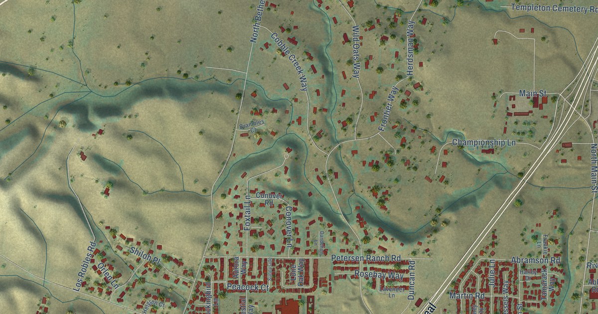
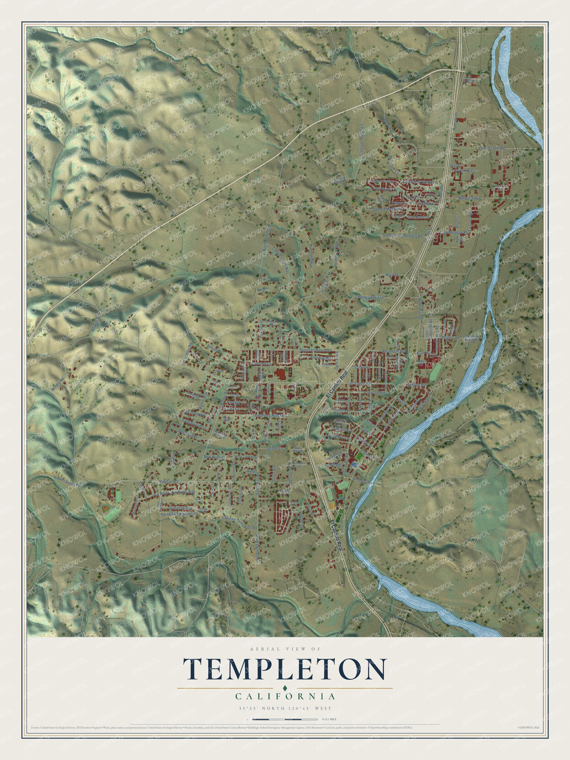
This beautifully detailed map of Templeton, California was created in 2026 using aerial imagery combined with modern topographical, census, street and landmark data. It's a modern aerial view of Templeton in San Luis Obispo County, California, that combines modern data with a vintage aesthetic. The roads feature printed names, and if you look closely you can find your exact house accurately shown in its correct location.
Explore an aerial view of Templeton, California
On this map you'll find El Camino Real, Via Rojas Way, North Main Street, Nutwood Circle, Theater Drive, Via Santa Barbara, Sixth Street, Bennett Way, Cayucos Templeton Road, Peacock Court, Vineyard Drive, Las Tablas Road, and more. Each red shape is a building, so zoom in on the preview and look for yours.
Every town has a first chapter, and Templeton is no exception. The San Luis Obispo County History puts it this way: "The first paper published in the town was the Templeton Times, edited by Captain Haley but financed by the West Coast Lumber Company."
Templeton is a community in San Luis Obispo County. The Census Bureau counted 8,386 people here in 2020.
Take a closer look at the Templeton map
Names on this map
These names are printed on this map.
Streets and roads: El Camino Real, Via Rojas Way, North Main Street, Nutwood Circle, Theater Drive, Via Santa Barbara, Sixth Street, Bennett Way, Cayucos Templeton Road, Peacock Court, Vineyard Drive, Las Tablas Road.
More street names, A to Z
Abby Road, Abramson Road, Ag Hill Road, Allen Court, Amber Drive, Arroyo Drive, Ashley Lane, Ashton Way, Aurora Way, Bison Court, Booker Road, Brambles Court, Brewer Street, Briarwood Place, Burlwood Lane, Burning Hills Lane, Casper Court, Casteel Lane, Cattail Road, Cayucos Avenue, Celestial Way, Championship Lane, Chianti Court, Claassen Ranch Lane, Cll Propano, Cobble Creek Way, Concrete Court, Conover Lane, Conover Road, Country Brook Lane, Cow Meadow Place, Creekside Ranch Road, Creekview Avenue, Crocker Street, Cynthia Lane, Dandelion Lane, Del Sol Place, Dolores Lane, Donelson Place, Duncan Road, Easy Street, Eddy Street, Eighth Street, Elizabeth Court, Eric Lane, Fifth Street, First Street, Florence Street, Forest Avenue, Foxtail Lane, Frankie Lane, Frontier Way, Gibson Road, Godell Street, Golden Meadow Drive, Gough Avenue, Granache Way, Granite Road, Grapevine Way, Harley Drive, Hawley Street, Headwaters Road, Heather Court, Helgren Court, Herdsman Way, Hidden Valley Road, Hilltop Drive, Holly Avenue, Honey Way, Hopkins Street, Horstman Street, Ironwood Place, Jordan Lane, Julie Lane, La Cruz Way, Laguna Way, Laura Court, Lavender Lane, Lawton Lane, Lily Pad Lane, Limestone Way, Lincoln Avenue, Lone Oak Way, Los Robles Road, Main Street, Malvasia Court, Marbella Lane, Marquita Avenue, Martin Road, Meadow View Lane, Mockingbird Lane, New Wine Place, North Bethel Road, Oak Knoll Drive, Old County Road, Orlen Lane, Paloma Drive, Pamela Court, Paradise Meadows Lane, Petersen Ranch Road, Phillips Road, Plum Orchard Lane, Posada Lane, Pso Excelsus, Puffin Way, Quicksilver Way, Ramada Drive, River Run Road, Rolfe Lane, Rosebay Way, Rossi Road, Roya Avenue, Rumi Circle, Ruth Way, Salinas Avenue, Sandalwood Lane, Santa Rita Road, Second Street, Semillion Lane, Seventh Street, Shane Lane, Shiloh Place, South Bethel Road, South Main Street, Sunnyside, Syrah Court, Tamarack Way, Tanager Court, Templeton Cemetery Road, Templeton Hills Road, Templeton Road, Theatre Drive, Tishlini Lane, Turkey Ranch Place, Via Robles, Via Rojas, Via San Carlos, Via San Miguel Drive, Volpi Ysabel Road, Waterfall Road, Well Road, Wessels Way, Wild Oats Way, Willhoit Lane, Wine Country Place, Winery Road.
Created by KNOWOL in 2026. The buildings are small red shapes, the roads carry their printed names, and shaded relief shows the shape of the land. The title panel reads "AERIAL VIEW OF TEMPLETON CALIFORNIA" with 35°33' NORTH 120°43' WEST.
Hang it in the hallway, the office or the cabin, or give it to someone who left Templeton and still calls it home. Open the preview and look for a street you know. See sizes and frames for the Templeton map.