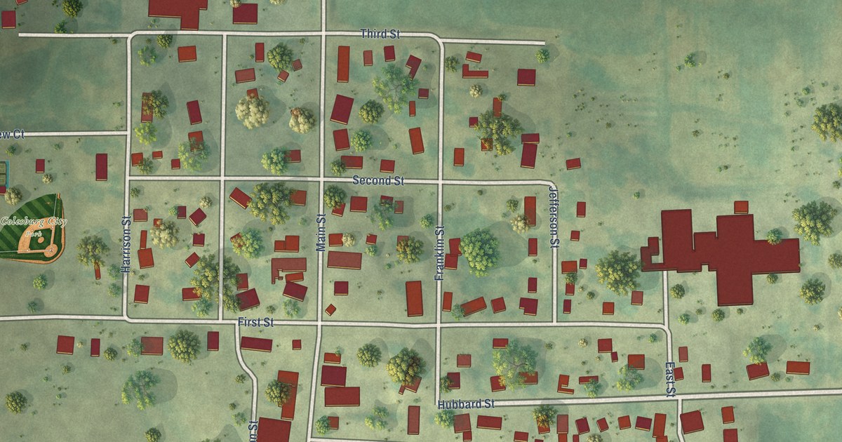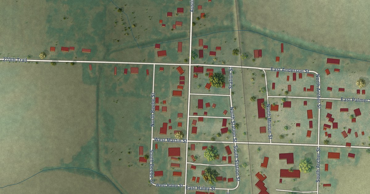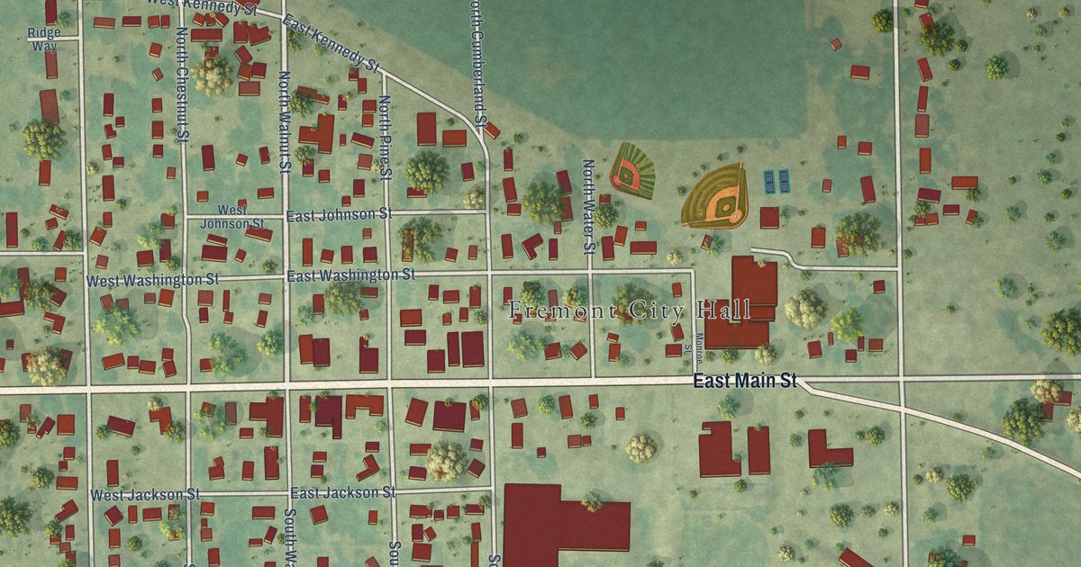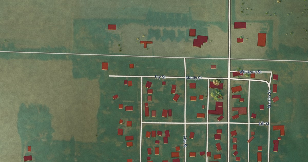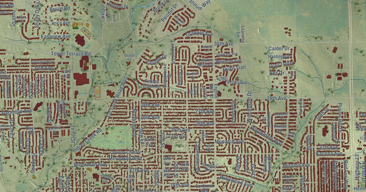
This beautifully detailed map of Marion, Iowa was created in 2026 using aerial imagery combined with modern topographical, census, street and landmark data. It’s a one-of-a-kind view of Marion that combines accurate data with a vintage aesthetic. The map shows every building in its true location, many of the roads carry their names, and the shaded topographic relief shows the shape of the land.
Explore an aerial view of Marion, Iowa
On the map you’ll find Marion City Hall, Lindale Manor, Boyson Park, Legion Park, Lowe Park, Wanatee Park, and Taube Park, along with Seventh Avenue, Tenth Avenue, Collins Road, Marion Boulevard, Dubuque Road, and more. If you look closely you can even find your house accurately drawn in its correct location. Zoom in on the preview to look for yours.
Did you know this piece of Marion, Iowa history?
From the History of Linn County: "Ordered, That the county seat of Linn County be and is hereby called and shall hereafter be known and designated by the name of Marion. The name was chosen in honor of Gen. Marion of Revolutionary fame."
Take a closer look at the Marion map
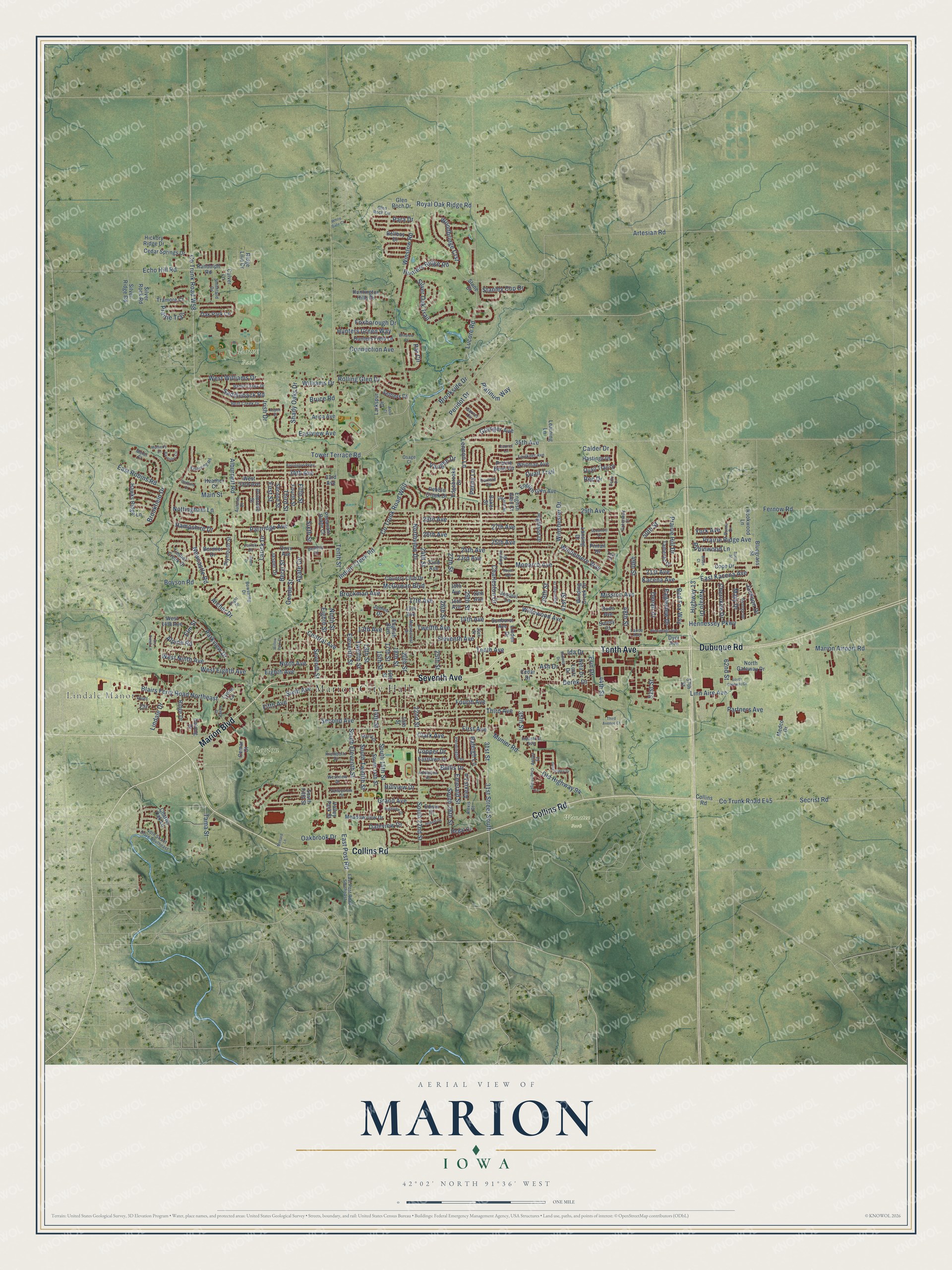
Street and place names on the Marion, Iowa map
These names are printed on the map of Marion, Iowa.
Places: Marion City Hall, Lindale Manor, Boyson Park, Legion Park, Lowe Park, Wanatee Park and Taube Park.
Streets and roads: Seventh Avenue, Tenth Avenue, Collins Road, Marion Boulevard, Dubuque Road, East Post Road, 31st Street, Winslow Road, South 22nd Street, South Eleventh Street, Central Avenue, Tower Terrace Road.
More street names, A to Z
13th Avenue, 13th Street, 14th Avenue, 14th Street, 15th Avenue, 15th Street, 16th Avenue, 16th Street, 17th Avenue, 17th Street, 18th Avenue, 18th Street, 19th Avenue, 19th Street, 20th Street, 21st Avenue, 22nd Avenue, 22nd Street, 23rd Avenue, 24th Avenue, 24th Street, 25th Avenue, 25th Street, 26th Avenue, 26th Street, 27th Avenue, 27th Street, 28th Avenue, 29th Avenue, 29th Street, 30th Street, 31st Street South, 33rd Avenue, 34th Avenue, 35th Avenue, 35th Street, 39th Street, 40th Street Drive Southeast, 41st Street, 44th Street, 48th Street, 49th Street, 50th Street, 51st Street, 57th Street, 62nd Street, Addalynn Drive, Agate Circle, Alburnett Road, Alexis Court, Alexis Lane, Alpine Road, Antler Court, Archer Drive, Arica Avenue, Artesian Road, Ash Drive, Aspen Drive, Aster Court, Autumn Drive, Baker Street, Barnsley Circle, Barrington Parkway, Battle Creek Drive, Bedford Court, Bellboy Drive, Bent Creek Drive, Bentley Drive, Bermier Drive, Beryl Street, Bison Court, Blairs Ferry Road Northeast, Bluegrass Street, Bowstring Drive, Boyson Road, Brockman Avenue, Brookfield Drive, Brookside Drive, Bruce Road, Bullis Drive, Burns Drive, Calder Drive, Carlisle Circle, Cedar Drive, Cedar Springs Drive, Cemar Court, Chapelridge Circle, Charleston Drive, Charter Oak Lane, Cherokee Drive, Circle, Clark Avenue, Connection Avenue, Cope Drive, Copper Drive, Co Trunk Road E45, Co Trunk Road W58, Co Trunk Road W60, Country Club Drive, Culver Lane, Daleview Drive, Deer Valley Drive, Delong Drive, Denali Drive, Derby Drive, Derek Drive, Dry Creek Lane, Dunn Avenue, Dyer Avenue, Eagleview Drive, East Kacena Avenue, Eastlawn Drive, East Post Road Southeast, East Robins Road, Eastview Avenue, Echo Hill Road, Edgebrooke Drive, Edwin Drive, Eighth Avenue, Eighth Street, Eleventh Avenue, Eleventh Street, Elm Street, Emerald Street, Empire Street, English Boulevard, English Glen Avenue, English Glen Court, Erin Drive, Faulkner Avenue, Fernow Road, Fifth Avenue, Fifth Street, First Avenue, First Street, Flight Drive, Fourth Avenue, Fourth Street, Foxborough Drive, Garnet Circle, Geode Street, George Drive, Glen Roch Circle, Glen Roch Drive, Grand Avenue, Granger Avenue, Greenway Court, Hampshire Drive, Hastings Drive, Hawks Ridge Lane, Heather Court, Hennessey Parkway, Hickory Ridge Drive, Highland Drive, Highview Drive, Highway 13, Hillview Drive, Hunters Field Lane, Hunters Green Way, Hunters Ridge Road, Huntington Hills Drive, Ida Drive, Indian Creek Road, Industrial Avenue, Irish Drive, Isham Drive, Jackson Drive, James Drive, Jasper Drive, Jonquil Lane, Kacena Avenue, Kettering Road, Keyes Court, Krumboltz Drive, Lance Avenue, Lansing Drive, Larick Court, Larick Drive, Larkspur Drive, Laurel Lane, Learning Lane, Lennon Lane, Lindale Drive, Linden Drive, Linn Aire Avenue, Lortz Drive, Lucore Road, Lyons Lane, Main Street, Maplecrest Drive, Marion Airport Road, Mary Drive, McGowan Boulevard, Meadowview Drive, Medco Drive, Menard Lane, Midway Drive, Mission Avenue, Monarch Avenue, Morel Court, Mulberry Drive, Munier Road, Navajo Drive, Neta Drive, Newcastle Road, Ninth Avenue, Ninth Street, North Gateway Drive, Northview Drive, Nottingham Lane, Oakbrook Drive, Oak Park Circle, Old Highway 94, Onyx Avenue, Osage Court, Oxford Street, Para Drive, Par Circle, Parkview Drive, Partners Avenue, Partridge Avenue, Pebble Creek Drive, Pennington Drive, Penny Lane, Peridot Drive, Pheasant Ridge Court, Pintail Drive, Platinum Way, Plymouth Street, Prairie Bend Circle, Prairie Hill Drive, Prairie Ridge Avenue, Prairie Trail, Primrose Street, Quail, Quail Trail, Quail Trail Drive, Raleigh Lane, Randolph Road, Rec Drive, Red Fox Way, Regal Court, Ridge Drive, Ridge Line Drive, Robert Drive, Robinwood Lane, Rolling Glen Drive, Rookwood Lane, Royal Avenue, Royal Oak Ridge Road, Saddleback Road, Scott Street, Second Avenue, Second Street, Secrist Road, Settlers Drive, Seventh Street, Shady Oaks Drive, Silver Oak Trail, Silver Ridge Road, Silver Rock Road, Sixth Avenue, Sixth Street, Smithland Drive, South 14th Street, South 15th Street, South 26th Street, South Fifth Street, South Gateway Drive, South Twelfth Street, Spoonbill Drive, Stanley Cup Drive, Starry Drive, Stone Court, Sugaridge Drive, Sunburst Avenue, Surrey Court, Tama Street, Tamerac Drive, Teal Court, Tenth Street, Third Avenue, Third Avenue Court, Third Street, Timber Creek Drive, Tramore Court, Twelfth Avenue, Twelfth Street, Valley Park Street, Valleyview Drive, Vaughn Drive, West 14th Avenue, West 33rd Avenue, West Eighth Avenue, West Ninth Avenue, Westview Drive, West Williams Drive, White Gate Court, Whitman Avenue, Williams Drive, Willowood Avenue, Willow Park Court, Winchester Drive, Windemere Way, Winding Creek Drive, Winnebago Avenue, Winslow Court, Woodbridge Crst, York Avenue.
See the Marion, Iowa map on a wall
The Marion map as an 18 x 24 inch print in a black frame.

This beautifully detailed map of Marion makes an attractive addition to your office, library, or den, and it can even be used to teach children the geography and history of the area. It also makes a great gift for someone who left Marion and still calls it home. When you’re done exploring, click here to get your copy of the Marion map.