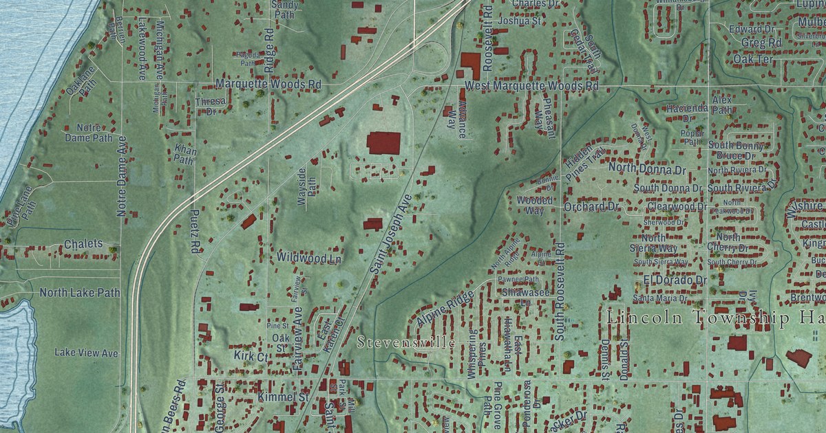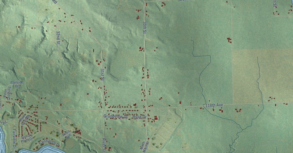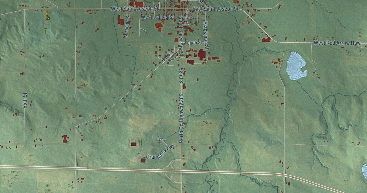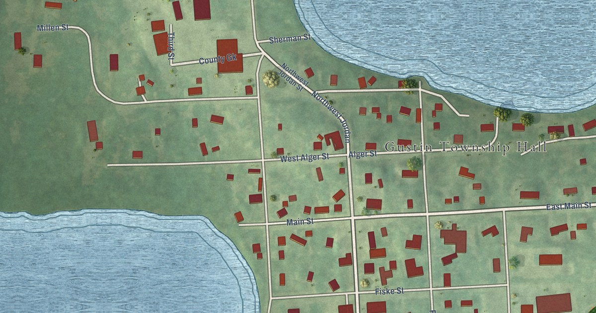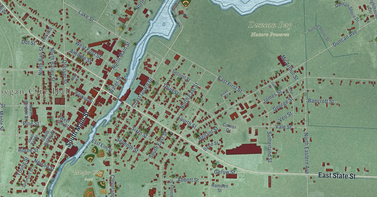
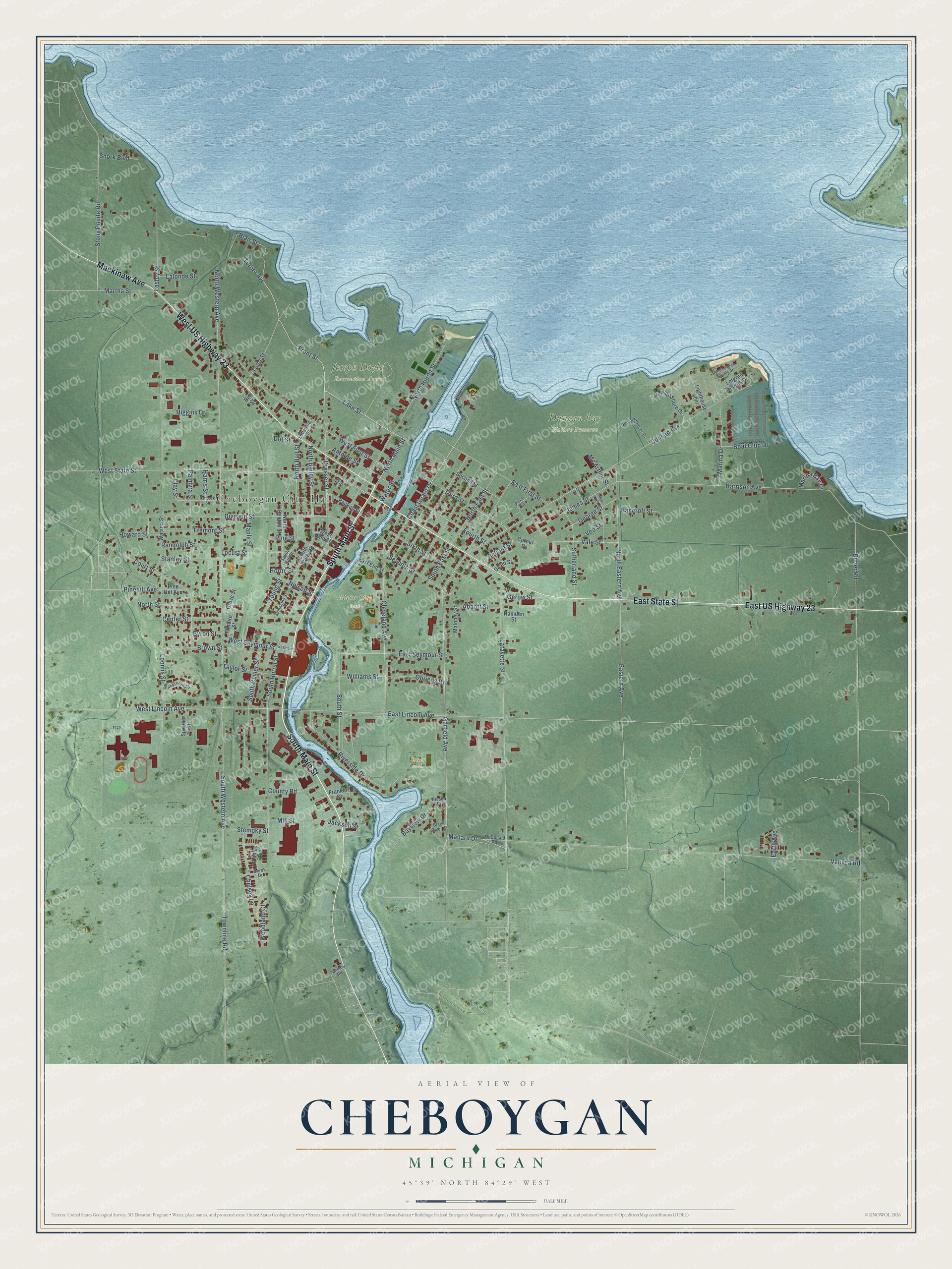
This beautifully detailed map of Cheboygan, Michigan was created in 2026 using aerial imagery combined with modern topographical, census, street and landmark data. It's a modern aerial view of Cheboygan in Cheboygan County, Michigan, that combines modern data with a vintage aesthetic. The roads feature printed names, and if you look closely you can find your exact house accurately shown in its correct location.
Explore an aerial view of Cheboygan, Michigan
On this map you'll find Cheboygan City Hall, Duncan Bay Nature Preserve, Joseph Doyle Recreation Area, Major City Park, Soccer Fields, South Main Street, East State Street, East US Highway 23, West US Highway 23, Mackinaw Avenue, Lake Street, Front Street, and more. Each red shape is a building, so zoom in on the preview and look for yours.
Here is a piece of Cheboygan history, in the words of the record. The History of Northern Michigan and Its People puts it this way: "The year 1846 was full of events for Cheboygan; for during that year the first mail route (dog trains) in the county was established from Saginaw to the Soo, via Cheboygan, which had just been named as Duncan postoffice from J. W. Duncan, a new arrival and enterprising sawmill man."
Cheboygan is a city in Cheboygan County. The Census Bureau counted 4,770 people here in 2020.
Take a closer look at the Cheboygan map
Names on this map
These names are printed on this map.
Places: Cheboygan City Hall, Duncan Bay Nature Preserve, Joseph Doyle Recreation Area, Major City Park and Soccer Fields.
Streets and roads: South Main Street, East State Street, East US Highway 23, West US Highway 23, Mackinaw Avenue, Lake Street, Front Street, North Main Street, West State Street, Turner Avenue, Garfield Avenue, Cleveland Avenue.
More street names, A to Z
Abbott Street, Antoine Street, Ashley Avenue, Backus Street, Bancroft Street, Bayview Drive, Bellant Street, Bell Street, Black River Court, Blackthorn Drive, Blair Street, Boat Club Drive, Brown Street, Butler Road, Byron Street, Cedar Street, Center Street, Chelsey Lane, Clay Street, Coast Guard Drive, Corner Drive, County Road, Court Street, David Street, Derek Drive, Division Street, Dot Street, Dresser Street, Duncan Avenue, Duncan Shore Drive, Duncan Shores Drive, Earth Avenue, East Elm Street, Eastern Avenue, East First Street, East Lincoln Avenue, East Seymour Street, Filmore Street, Fourth Street, Franklin Street, Fremont Street, George Street, Gerow Street, Grove Street, Hamden Street, Hancock Street, Harrison Avenue, Harris Street, Higgins Drive, Horne Street, Howard Street, Jackson Street, James Street, Lafayette Street, Lalonde Street, Lasley Street, Lighthouse Lane, Linn Street, Littlefield Street, Locust Street, Lofgren Shores Drive, Loomis Street, Mallard Drive, Maloney Street, Maple Street, Marina Bay Drive, Marina Drive, Martha Street, May Street, Mc Arthur Street, McDonald Road, Mill Street, Nelson Street, Niesen Drive, North Bailey Street, North Ball Street, North Benton Street, North Eastern Avenue, North East Street, North Huron Street, North Lofgren Shores Drive, North Street, North Western Avenue, Obriens Drive, Palmyra Street, Pinehill Avenue, Pine Hill Avenue, Pine Street, Piret Street, Randolph Street, Riverside Drive, Sammons Street, Second Street, Seventh Street, Seymour Street, Shork Boulevard, Sixth Street, South Bailey Street, South Ball Street, South Cuyler Street, South East Street, South Huron Street, South Street, South Western Avenue, Spooner Street, Stanley Street, Stempky Street, Stony Pointe Road, Sutherland Street, Tannery Road, Taylor Street, Third Street, Todd Street, Townline Road, Vale Street, Vanyea Road, Veo Street, Water Street, Watson Street, West Elm Street, West First Street, West Lincoln Avenue, West Seymour Street, Williams Street, Woodland Court, Young Street.
Created by KNOWOL in 2026. The buildings are small red shapes, the roads carry their printed names, and shaded relief shows the shape of the land. The title panel reads "AERIAL VIEW OF CHEBOYGAN, MICHIGAN" with 45°39' NORTH 84°29' WEST.
It suits a den, a classroom or a front hall, and it makes a gift for anyone with Cheboygan roots. Open the preview and find the block you know. See sizes and frames for the Cheboygan map.