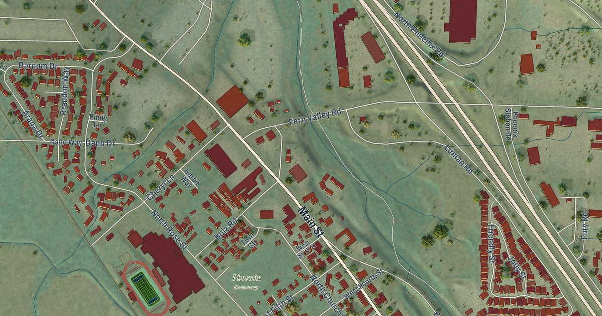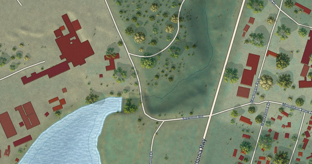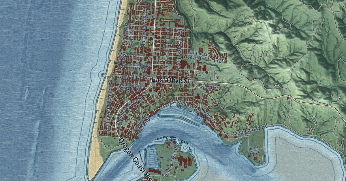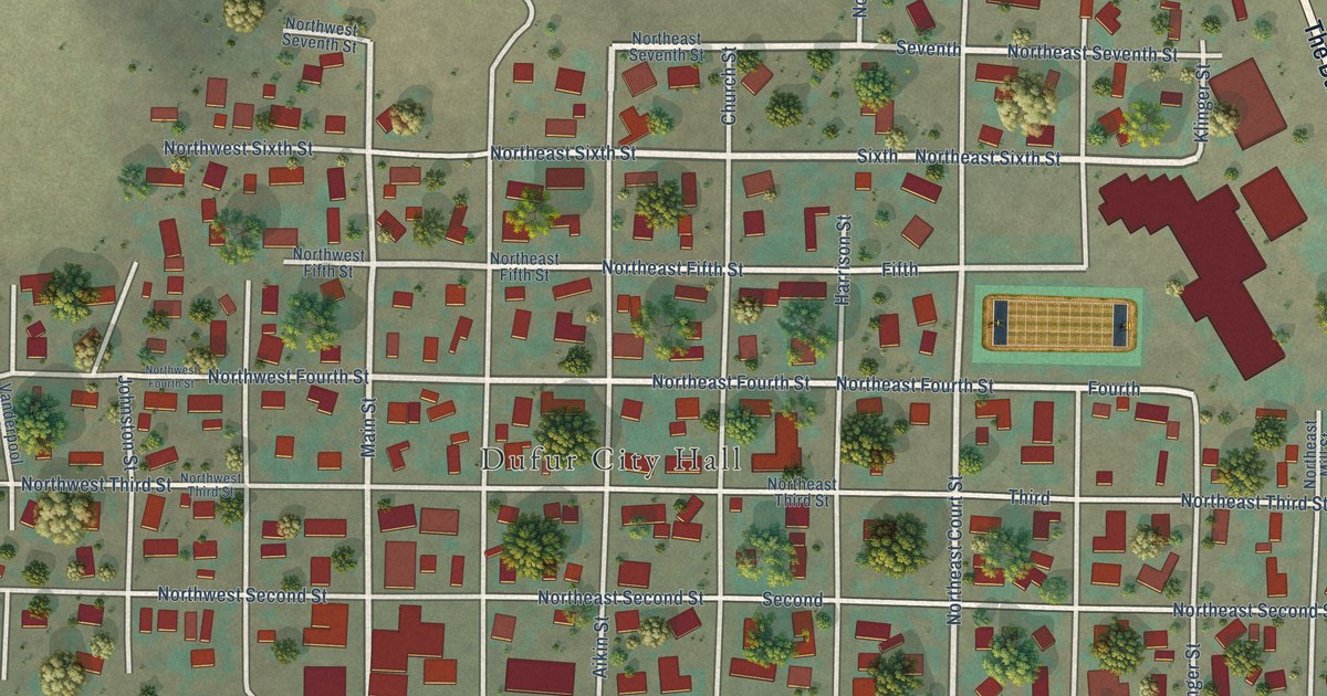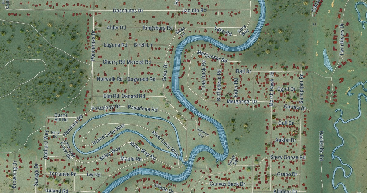
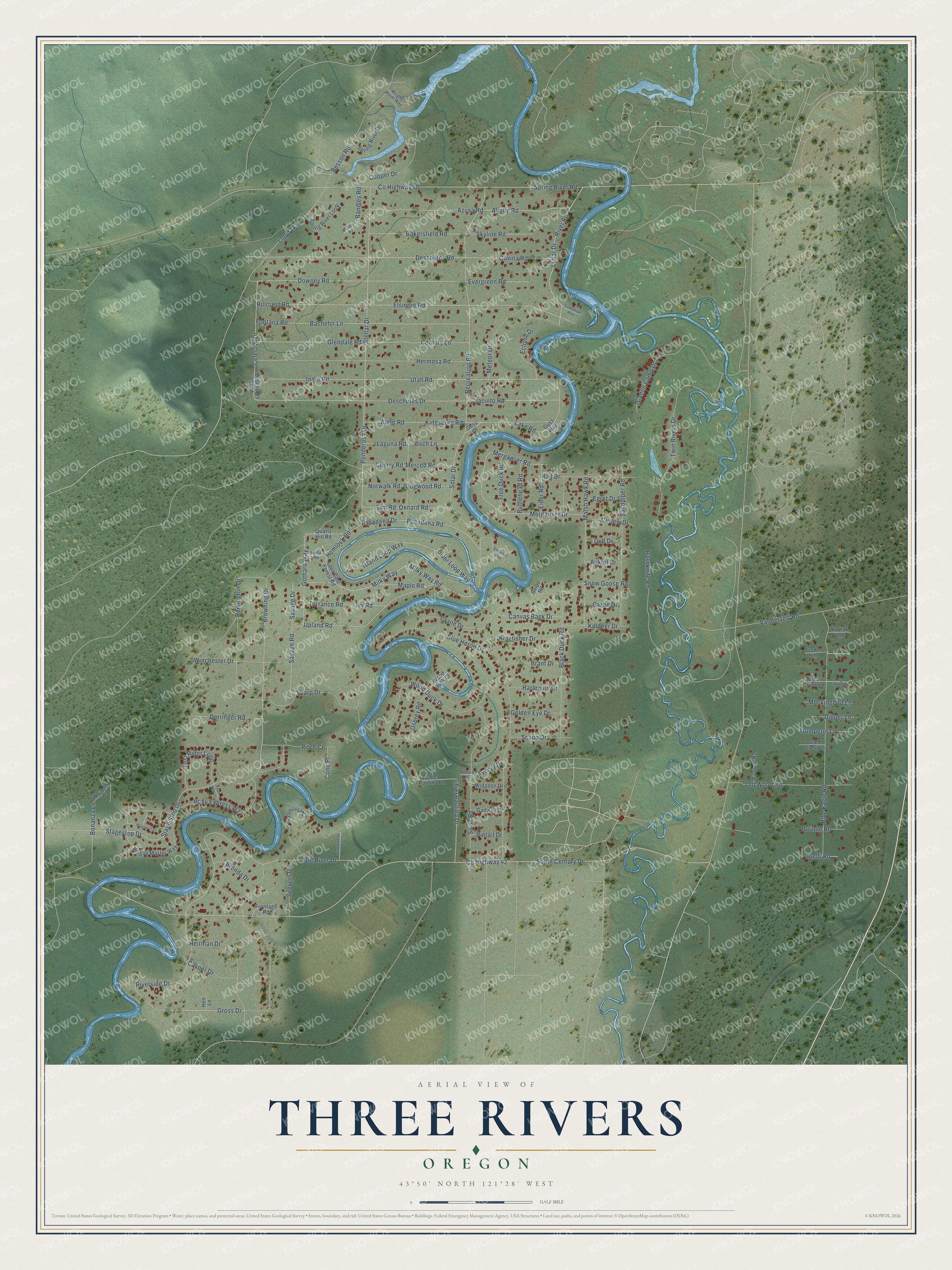
This beautifully detailed map of Three Rivers, Oregon was created in 2026 using aerial imagery combined with modern topographical, census, street and landmark data. It's a modern aerial view of Three Rivers in Deschutes County, Oregon, that combines modern data with a vintage aesthetic. The roads feature printed names, and if you look closely you can find your exact house accurately shown in its correct location.
Explore an aerial view of Three Rivers, Oregon
On this map you'll find Milky Way, Upland Road, Browning Drive, River Road, Lunar Drive, Lake Road, Milky Way Road, Ponderosa Drive, Pasadena Drive, South Century Drive, Co Highway 40, Gothard Way, and more. Each red shape is a building, so zoom in on the preview and look for yours.
Three Rivers is a community in Deschutes County. The Census Bureau counted 3,925 people here in 2020. Three Rivers sits about 3 miles southwest of Sunriver, 10 miles north of La Pine and 12 miles southwest of Deschutes River Woods. The map prints the town name in its title panel, with the coordinates below it.
Take a closer look at the Three Rivers map
Names on this map
These names are printed on this map.
Streets and roads: Milky Way, Upland Road, Browning Drive, River Road, Lunar Drive, Lake Road, Milky Way Road, Ponderosa Drive, Pasadena Drive, South Century Drive, County Highway 40, Gothard Way.
More street names, A to Z
Alder Road, Alpine Road, Auklet Drive, Avocet Drive, Azusa Road, Bachelor Lane, Bakersfield Road, Bandley Road, Bear Paw Lane, Besson Road, Big River Drive, Birch Lane, Bivouac Road, Black Duck Road, Blue Eagle Road, Blue Heron Drive, Bonanza Lane, Bradley Road, Brant Drive, Brenda Drive, Bufflehead Road, Canoe Camp Drive, Canvas Back Drive, Casper Drive, Celestial Drive, Century Lane, Cherry Road, Chief Paulina Drive, Chief Paulina Road, Cone Place, Cooper Drive, County Highway 42, Covina Road, Crane Drive, Curlew Drive, Derringer Road, Deschutes Bend, Deschutes Drive, Deschutes Road, Dipper Lane, Dogwood Road, Downey Road, Eclipse Drive, Egret Drive, Eider Road, Elm Road, Elsinore Road, Evergreen Road, Fontana Road, Fountainbleu Court, Frontage Road, Gadwall Drive, Gatehouse Lane, Glendale Road, Gold Crest Lane, Golden Eye Drive, Grebe Drive, Grimm Road, Gross Drive, Guadalupe Way, Guelfi Road, Gull Drive, Guss Lane, Guss Way, Harlequin Drive, Hashknife Road, Heirman Drive, Hemlock Road, Hen Lane, Hermosa Road, Hillcrest Road, Holly Road, Indio Road, Island Loop Way, Ivy Road, Jacinto Road, Killdeer Drive, Kingfisher Drive, Kingsburg Road, Kodiak Lane, Laguna Road, Lava Cast Forest Road, Lloyd Way, Log Cabin Lane, Lost Rider Loop, Mallard Drive, Maple Road, Marsh Hawk Road, Merced Road, Merganser Drive, Merganser Road, Meteor Drive, Mockingbird Lane, Norwalk Road, Old Wood Road, Osprey Road, Oxnard Road, Pasadena Road, Pintail Drive, Pitch Court, Pony Express Way, Quartz Hill Road, Rail Drive, Recreation Road, Remington Drive, River Loop Way, Riverside Drive, Sandpiper Road, Satterlee Way, Savage Drive, Savage Road, Scaup Drive, Seevers Drive, Sharp Drive, Skyline Road, Snipe Road, Snow Goose Road, Solar Drive, Spring River Drive, Spring River Loop, Spring River Road, Stage Stop Drive, Stagestop Drive, Stellar Drive, Swan Road, Torrance Road, Trader Lane, Trail Scout, Tree Duck Road, Trumpeter Lane, Twin Rivers Drive, Utah Road, Vandervert Road, Wagon Master Way, Wagon Trail, Widgeon Drive, Winchester Drive, Winchester Road, Wood Duck Court, Wood Duck Drive, Wright Point Way.
See it on a wall
The Three Rivers map as a framed print. Swipe for more.


Created by KNOWOL in 2026. The buildings are small red shapes, the roads carry their printed names, and shaded relief shows the shape of the land. The title panel reads "AERIAL VIEW OF THREE RIVERS, OREGON" with 43°50' NORTH 121°28' WEST.
It looks right in a kitchen, an office or a den, and it's a gift for anyone who grew up in Three Rivers or moved away. Open the preview and find your street. See sizes and frames for the Three Rivers map.