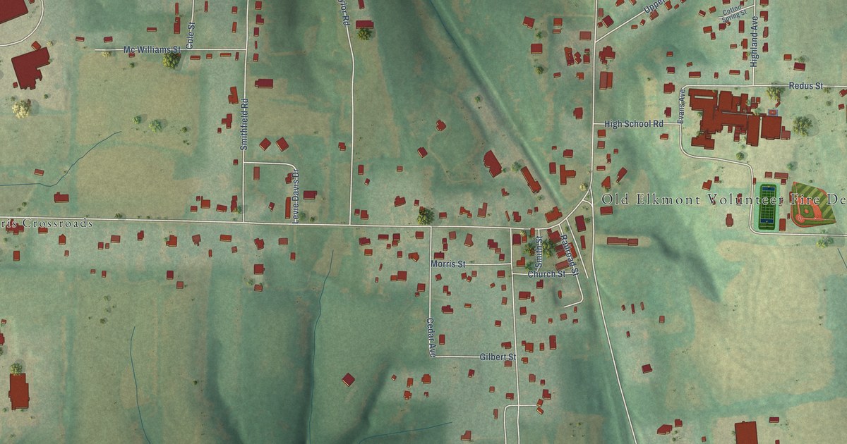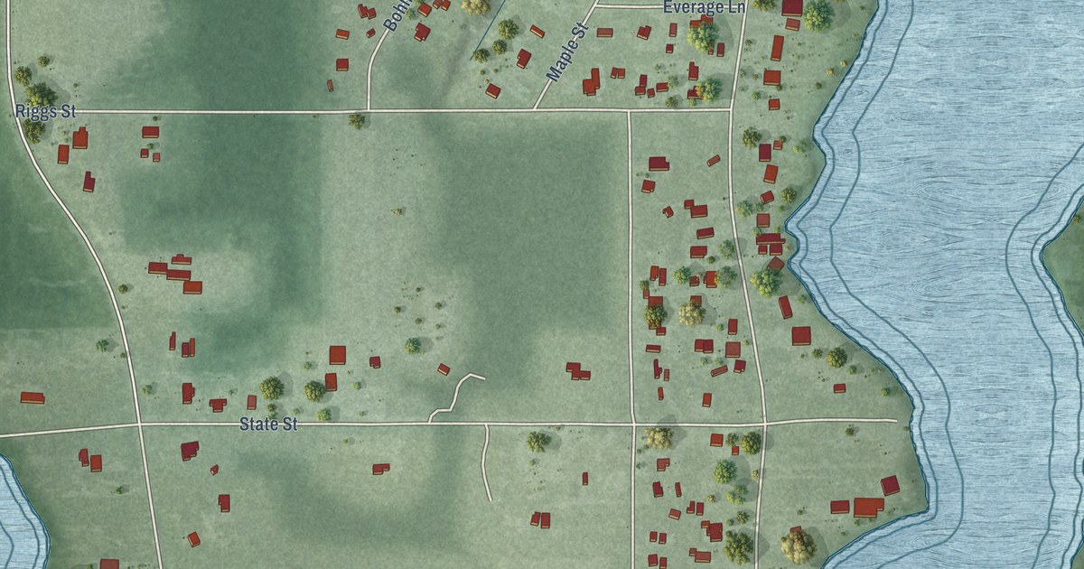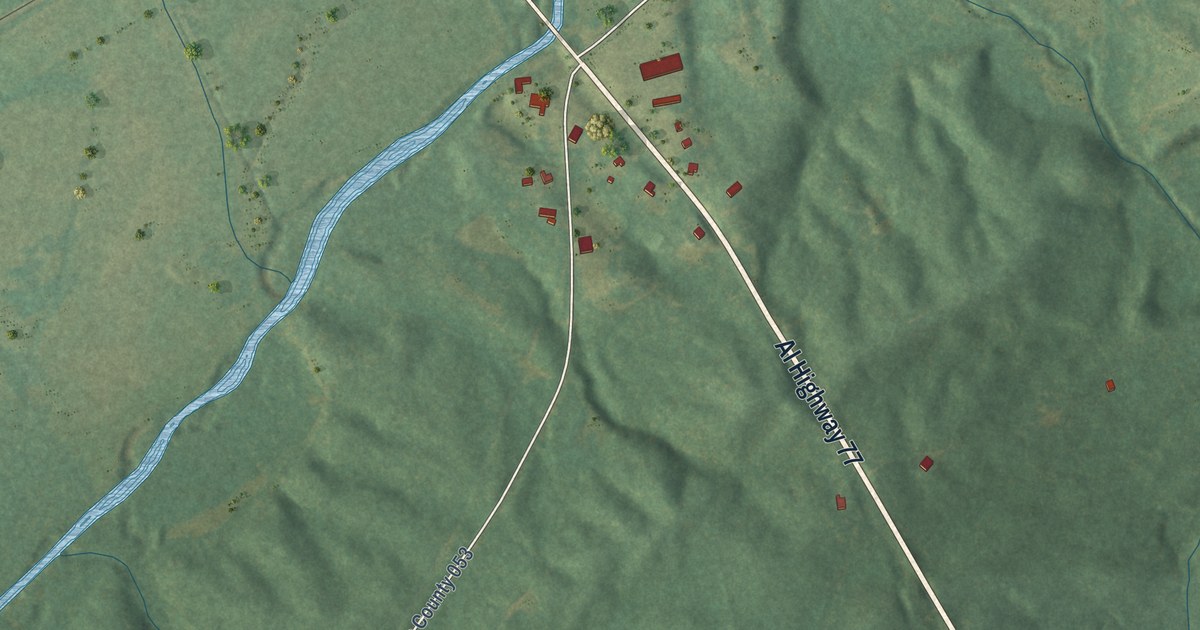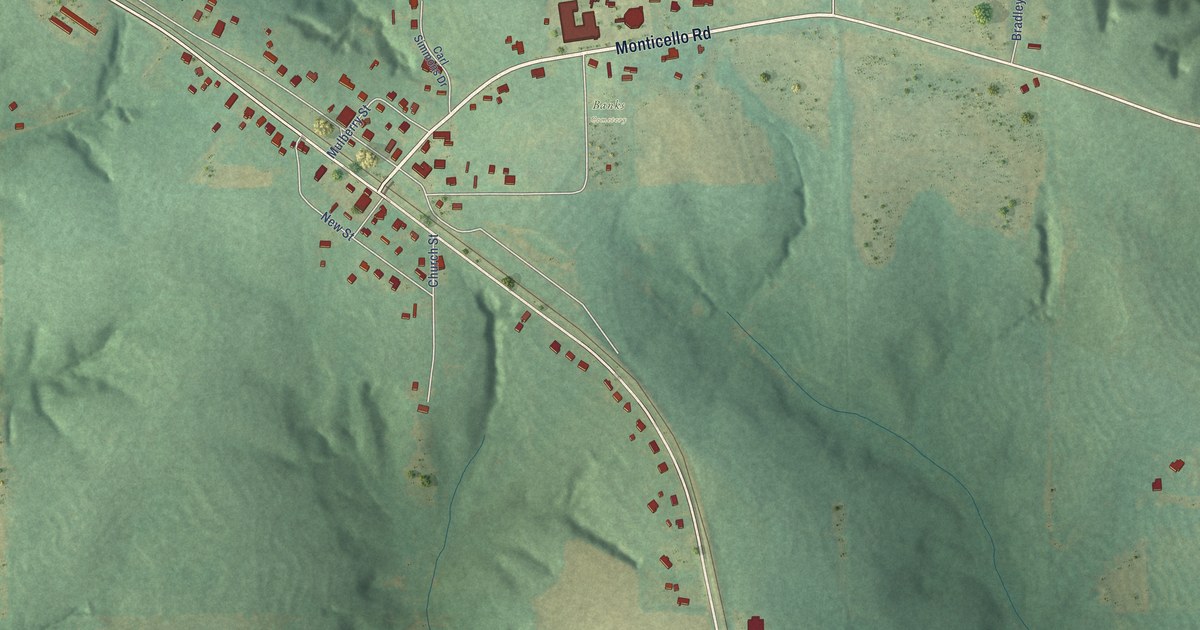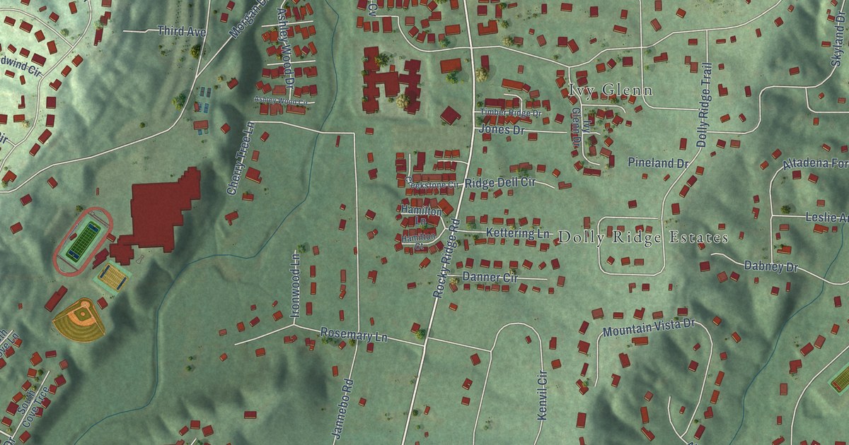
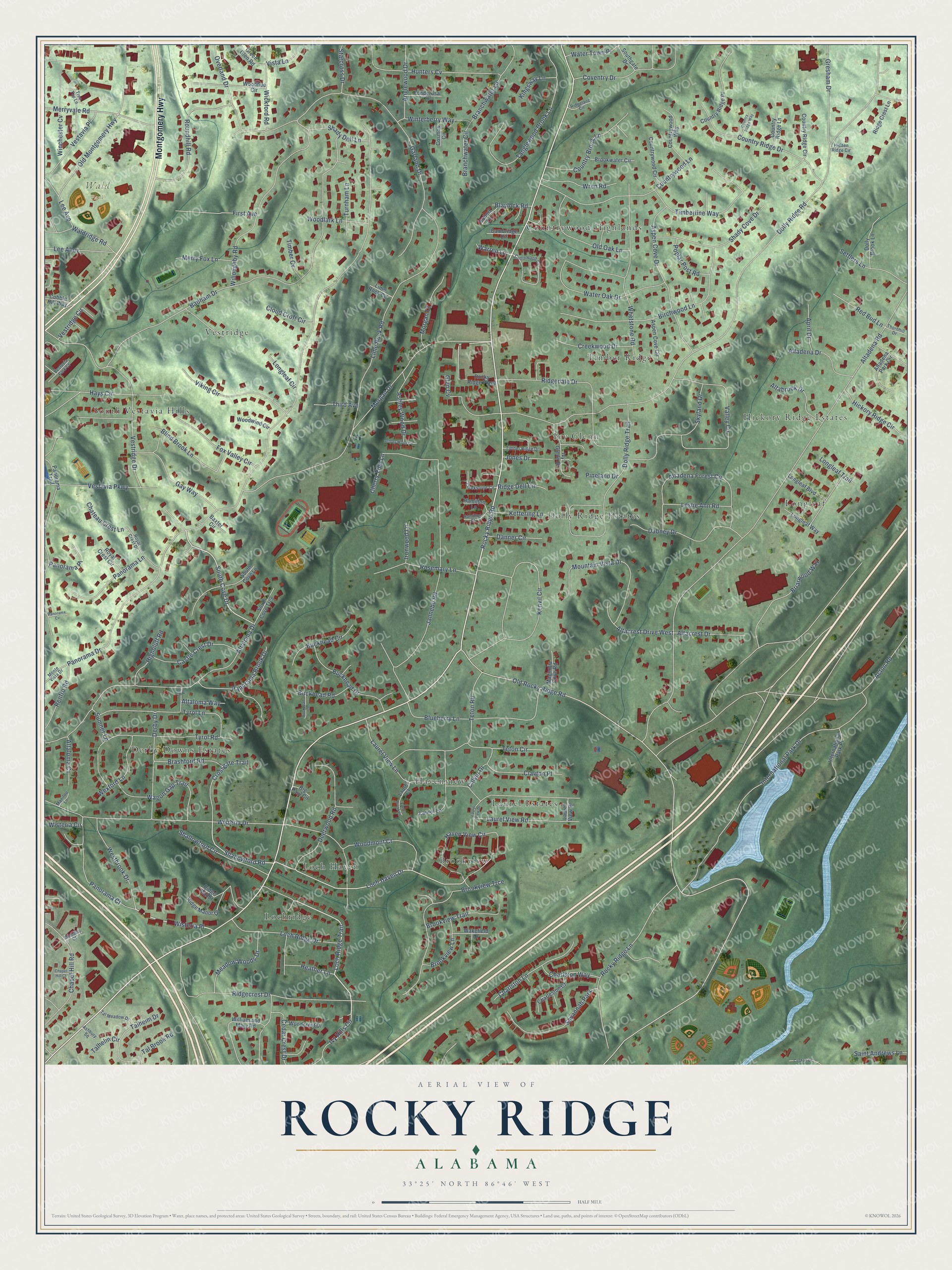
This beautifully detailed map of Rocky Ridge, Alabama was created in 2026 using aerial imagery combined with modern topographical, census, street and landmark data. It’s a one-of-a-kind view of Rocky Ridge that combines accurate data with a vintage aesthetic. The map shows every building in its true location, many of the roads carry their names, and the shaded topographic relief shows the shape of the land.
Explore an aerial view of Rocky Ridge, Alabama
On the map you’ll find Wald Park, Loch Haven, Countrywood Highlands, Dolly Ridge Estates, South Vestavia Hills, Laurel Estates, Longleaf, Hickory Ridge Estates, Timber Ridge, Vestridge, Derby Downs Estates, Brookview, and more. If you look closely you can even find your house accurately drawn in its correct location. Zoom in on the preview to look for yours.
Take a closer look at the Rocky Ridge map
Names on this map
These names are printed on this map.
Places: Wald Park, Loch Haven, Countrywood Highlands, Dolly Ridge Estates, South Vestavia Hills, Laurel Estates, Longleaf, Hickory Ridge Estates, Timber Ridge, Vestridge, Derby Downs Estates, Brookview, Lochridge, Ivy Glenn, Havenview and Savannah Park.
Streets and roads: Montgomery Highway, Rocky Ridge Road, Loch Ridge Trail, Wisteria Place, Westbrook Drive, Ivy Hills Circle, South Cove Drive, Loch Haven Drive, Shallowford Road, Old Rocky Ridge Road, Panorama Drive, Dolly Ridge Road.
More street names, A to Z
Acton Road, Altabrook Drive, Altacrest Drive, Altacrest Drive West, Altadena Drive, Altadena Forest Circle, Altadena Park Circle, Altadena Road, Altaloma Cv, Altaloma Drive, Altaloma Way, Anglewood Drive, April Drive, Ashbury Square, Ashley Wood Circle, Ashley Wood Drive, Aspen Cove Circle, Aspen Cove Drive, Badham Drive, Baxter Circle, Big Paul Circle, Birchwood Lane, Blaylock Road, Blind Brook Lane, Blueberry Lane, Branchwater Circle, Branchwater Lane, Brashford Road, Briarwood Way, Brookview Lane, Brookview Trail, Brookview Trce, Brookwater Circle, Buckhead Circle, Buckhead Drive, Buckhead Lane, Buckhead Road, Calvin Drive, Cambridge Circle, Castle Crest Drive, Cedar Crest Drive, Chapel Hill Court, Chapel Hill Road, Charleston Court, Charlston Lane, Charlston Way, Chateau Crest Lane, Cherry Tree Lane, Clayton Place, Cloud Croft Circle, Cobble Hill Way, Collinwood Court, Coshatt Drive, Cosmos Circle, Country Brook Lane, Country Ridge Circle, Country Ridge Drive, Country Ridge Lane, Country Ridge Place, Country Ridge Way, Countrywood Circle, Countrywood Lane, Countrywood Way, Coventry Drive, Creekstone Circle, Creekwood Drive, Crossgate Trail, Dabney Drive, Danner Circle, Deerwood Road, Derby Drive, Dolly Brook Lane, Dolly Ridge Trail, First Avenue, Fox Valley Circle, Garland Drive, Gay Way, Glen Cv, Green Glen Road, Gresham Drive, Hamilton Court, Hamilton Lane, Haven View Circle, Hays Circle, Heather Lane, Hickory Ridge Circle, Hidden Ridge Circle, Highbluff Road, Hunters Cv, International Park Drive, International Park Place, Ironwood Lane, Ivy Glenn Drive, Jannebo Road, Jones Drive, Kenvil Circle, Kettering Lane, Kingsway Lane, Laurel Brook Lane, Laurel Court, Laurel Lane, Laurel View Drive, Laurel View Lane, Laurel View Place, Laurel View Road, Lee Alley, Lee Avenue, Leslie Ann Road, Lime Rock Circle, Lime Rock Road, Loch Ridge Drive, Longleaf Boulevard, Longleaf Circle, Longleaf Trail, Longleaf Way, Magnolia Cove Road, Manitou Lane, Meadow Woods Drive, Merry Fox Lane, Merryvale Road, Monte Vista Drive, Morgan Court, Morgan Drive, Mountain Vista Drive, Old Montgomery Highway, Old Oak Lane, Overland Drive, Panorama Brook Drive, Panorama Court, Panorama Cv, Panorama Lane, Panorama Place, Panorama Trail, Pineland Drive, Ponderosa Circle, Poplar Post Road, Red Bud Lane, Renfro Road, Ridgecrest Drive, Ridge Crest Lane, Ridgedale Drive, Ridge Dell Circle, Ridgeland Circle, Ridge Manor, Ridge Manor Drive, Robert Lane, Rocky Ridge Lane, Rocky Ridge Plaza, Rosemary Lane, Roundhill Road, Royal Crest Circle, Royal Crest Drive, Saint Andrews Lane, Settlers Lane, Shady Cove Drive, Shady Dell Lane, Shallowford Circle, Skyland Drive, South Cove Lane, South Cove Trce, Southgate Drive, Starcross Drive, Sumner Lane, Tal Brook Road, Talheim Drive, Talhelm Circle, Tal Meadow Drive, Tanglewood Brook Lane, Teton Circle, Teton Road, Third Avenue, Thornhill Drive, Timber Cv, Timberline Way, Timber Ridge Drive, Tree Top Lane, Turnham Lane, Tyrol Lane, Tyrol Place, Tyrol Road, Valley Circle, Vestavia Park Court, Vestavia Parkway, Vestavia Place, Vestridge Circle, Vestridge Drive, Viking Circle, Vista Lane, Wagon Gap Trail, Wakefield Drive, Waldridge Road, Warren Lane, Water Oak Drive, Water Town Place, Wexford Lane, Whetstone Road, Wickford Road, William and Mary Road, Willoughby Road, Winchester Cv, Winterberry Way, Wisteria Circle, Wisteria Drive, Woodcrest Drive, Woodhue Circle, Woodlark Lane, Woodley Court, Woodmont Court, Woodwind Circle, Wren Road.
See it on a wall
The Rocky Ridge map as a framed print. Swipe for more.


This beautifully detailed map of Rocky Ridge makes an attractive addition to your office, library, or den, and it can even be used to teach children the geography and history of the area. It also makes a great gift for someone who left Rocky Ridge and still calls it home. When you’re done exploring, click here to get your copy of the Rocky Ridge map.