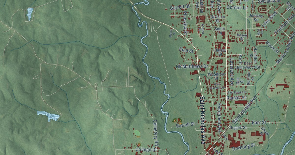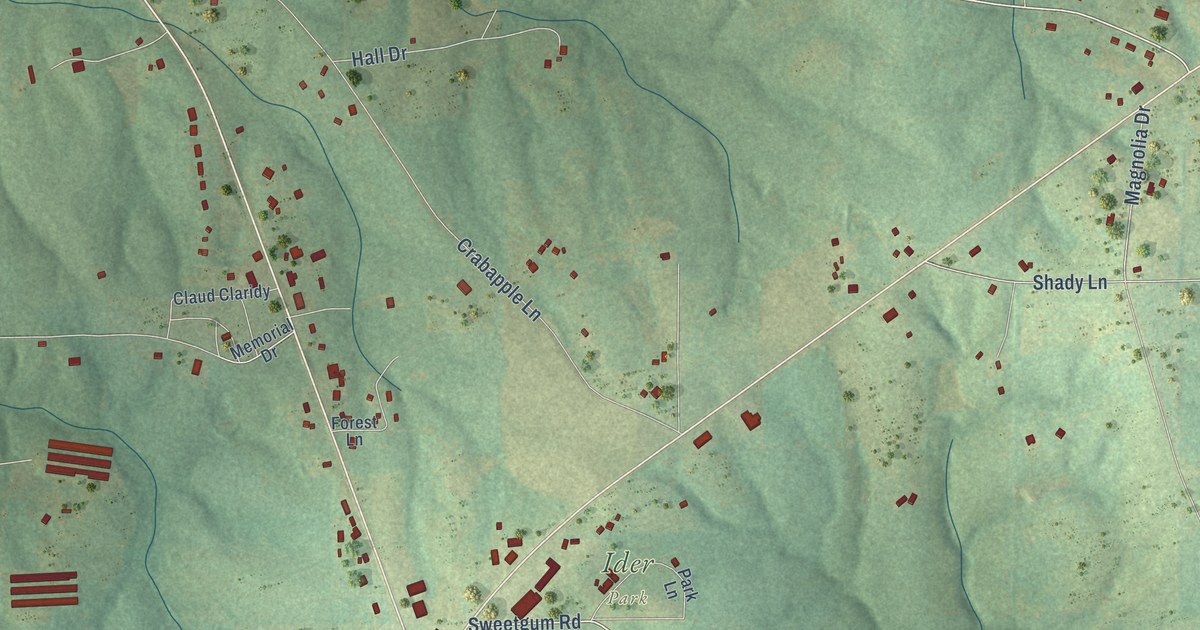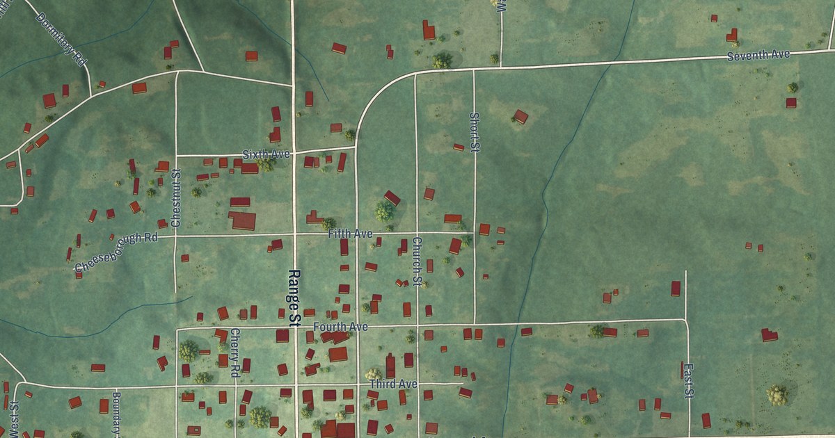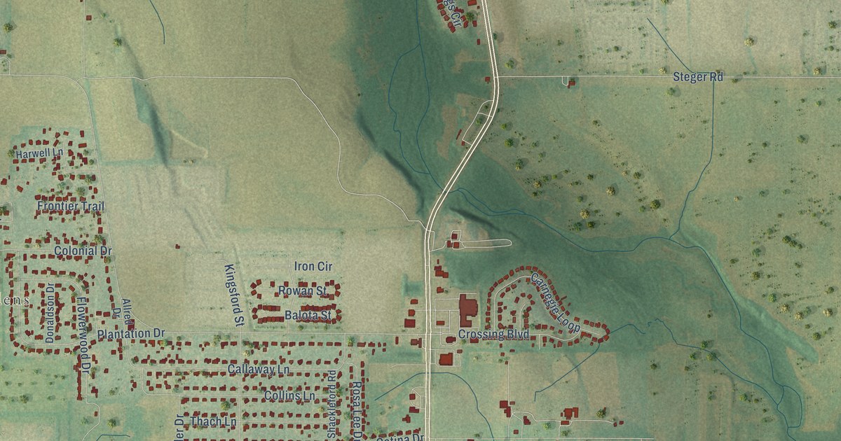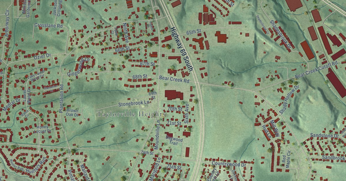
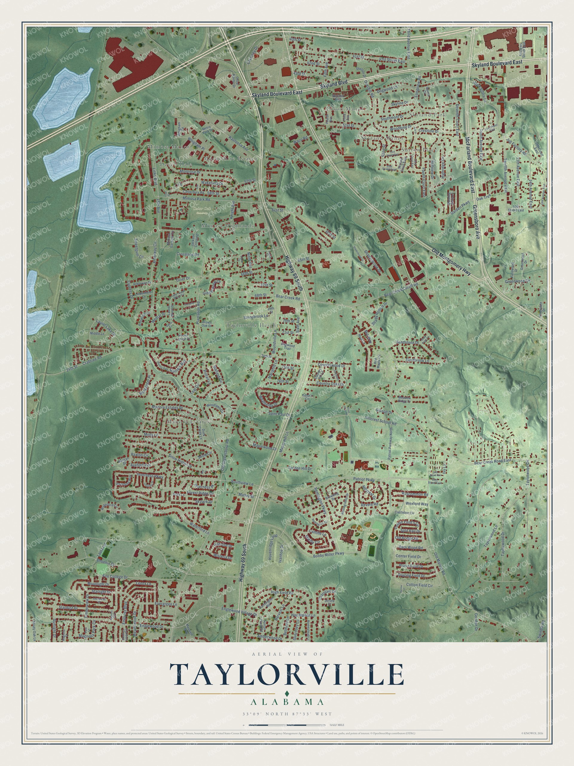
This beautifully detailed map of Taylorville, Alabama was created in 2026 using aerial imagery combined with modern topographical, census, street and landmark data. It’s a one-of-a-kind view of Taylorville that combines accurate data with a vintage aesthetic. The map shows every building in its true location, many of the roads carry their names, and the shaded topographic relief shows the shape of the land.
Explore an aerial view of Taylorville, Alabama
On the map you’ll find Cedar Oak Cemetery, Newt Hinton Park, Sutton Place, Manora Estates, Taylorville Heights, Morayshire Estates, Dixon Manor, Skyland Park, Mimosa Manor, Skyland Manor, Mimosa Highlands, Deven Dale, and more. If you look closely you can even find your house accurately drawn in its correct location. Zoom in on the preview to look for yours.
Take a closer look at the Taylorville map
Names on this map
These names are printed on this map.
Places: Cedar Oak Cemetery, Newt Hinton Park, Sutton Place, Manora Estates, Taylorville Heights, Morayshire Estates, Dixon Manor, Skyland Park, Mimosa Manor, Skyland Manor, Mimosa Highlands, Deven Dale and The Links.
Streets and roads: Skyland Boulevard East, Skyland Boulevard, Highway 69 South, Greensboro Avenue, McFarland Boulevard East, Old Montgomery Highway, Overhill Road, Hunters Run, Garden Parkway, Oak Tree, Starlight Drive, Laurel Lake Drive.
More street names, A to Z
13th Avenue East, 14th Avenue East, 14th Court East, 15th Avenue East, 17th Court, 18th Avenue, 19th Court, 24th Street, 40th Street, 41st Street, 41st Street East, 42nd Street, 43rd Street, 51st Street, 51st Street East, 52nd Street, 53rd Street East, 55th Street East, 57th Street, 58th Street, 59th Street East, 60th Street, 61st Street, 65th Street, 66th Street, 67th Street, 68th Street, 69th Street, 70th Street, 71st Street, 74th Street, 75th Street, 76th Street, 84th Street East, 85th Street East, Alexander Drive, Amberwood Drive, Andrews Street East, Arborway Circle, Arborway Drive, Arrowleaf Circle, Auxford Avenue, Balsa Circle, Barn Wood Road, Bavria Circle, Bear Creek Cutoff Road, Bear Creek Road, Bear Creek Road East, Bellview Drive, Belmont Lane, Bobby Miller Parkway, Browning Drive, Brown Oak Drive, Camille Lane, Canterbury Road, Castlebar Circle, Center Field Drive, Chandlers Crossing, Charolais Drive, Cotton Field's Circle, Cotton Field Circle, Country Hill Lane, Country Oaks Drive, Countrywood Drive, Courtney Drive, Crabtree Road, Crestline Drive, Crosslane Road, Cypress Drive, David Jones Road, Dogwood Lane, Dogwood Trail, Dove Lane, Duck Creek Lane, Edna's Circle, Eighth Court, Empress Boulevard, Englewood Drive, Englewood Village Drive, Evergreen Lane, Farmington Road, Fieldwood Drive, Fifth Avenue, Fire College Drive, Forestdale Drive, Forest Ridge Drive, Fourth Avenue, Fourth Court East, Garden Hill Drive, Gingerwood Lane, Gipson Drive, Gooden Drive, Grazing Field Drive, Greenwood Circle, Greenwood Drive, Guernsey Lane, Harrow Lane, Harvest Lane, Havenridge Loop, Hay Market Lane, High Field Road, Highridge Circle, Hillcrest Drive, Hillcrest School Road, Hinton Place Road, Homestead Lane, Honey Locust Drive, Hud Lane, Hunter Run, Inverness Drive, Inverness Parkway, Inverness Place, Inverness Way, Ivanhoe Drive, Ivy Lane, Jackson Crossing, Jersey Drive, Jug Factory Lane, Jug Factory Road, Kauloosa Avenue, Kew Lane, Knight Avenue, Lake Laurel Wood Circle, Laura Lane, Laurel Wood Drive, Lenox Lane, Lindenfield Lane, Links Boulevard, Longview Road, Mae Street, Magnolia Court, Magnolia Park Circle, Magnolia Vlg Drive, Mallard Circle, Malley Street, Manora Estates Drive, Maple Hill Lane, Maplewood Drive, Marigold Lane, Maxwell Way, Meadowood Drive, Meadow Ridge Drive, Medlar Drive, Merganser Place, Metro Park Drive, Middle Lane, Mill Way, Mimosa Gardens Circle, Mimosa Park Road, Misty Lane, Montrose Drive, Moonlight Drive, Morgan Drive, Morning Glory Lane, Moundville Lane, Ninth Avenue, Oak Drive, Oakmont Lane, Old Bridge Road, Old Greensboro Road, Old Marion Road, Oscar Baxter Drive, Ozier Drive, Park Lane, Patriot Parkway, Patriot Parkway North, Paxton Circle, Penrose Drive, Phoenix Drive, Pintail Lane, Plantation Lane, Plantation Road, Praire Field Drive, Red Maple Circle, Remington Circle, Remington Parkway, Revere Road, Rolling Hills Drive, Roscommon Road, Saint Paul Drive, Sandbrook Lane, Sandstone Drive, Sandy Ridge Circle, Second Court East, Seventh Court East, Shadesbrook Circle, Shadesbrook Drive, Shady Hollow Drive, Shady Oak Lane, Shelby Circle, Shelton Drive, Sixth Avenue, Skylark Drive, Skyline Drive, Snow Circle, Snow Hinton Drive, Southmont Drive, Southview Lane, Split Rail Drive, Stardust Drive, Stonebrook Lane, Sunlight Drive, Sweetgum Circle, Swindle Road, Taylorwood Circle, Taylorwood Drive, Taylorwood Lane, Teal Circle, Tenth Avenue East, Tenth Court, Third Avenue, Third Avenue East, Third Court East, Timberview Drive, Twelfth Avenue East, Waco Road, Wakefield Drive, Waterford Circle, Waterford Lane, Weatherby Drive, Wexford Way, Whigham Circle, Whigham Place, Wisteria Drive, Woodbine Drive, Woodlawn Circle.
See it on a wall
The Taylorville map as a framed print. Swipe for more.


This beautifully detailed map of Taylorville makes an attractive addition to your office, library, or den, and it can even be used to teach children the geography and history of the area. It also makes a great gift for someone who left Taylorville and still calls it home. When you’re done exploring, click here to get your copy of the Taylorville map.