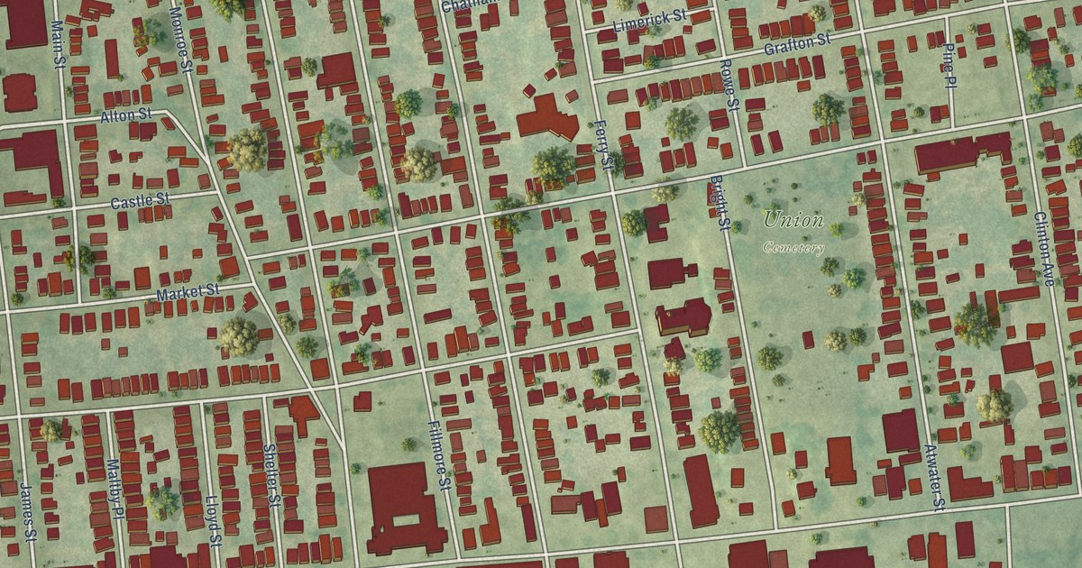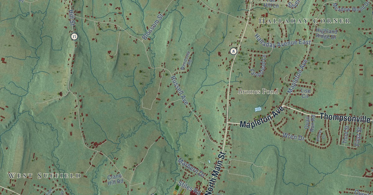
This beautifully detailed map of Suffield, Connecticut was created in 2026 using aerial imagery combined with modern topographical, census, street and landmark data. It’s a one-of-a-kind view of Suffield that combines accurate data with a vintage aesthetic. The map shows every building in its true location, many of the roads carry their names, and the shaded topographic relief shows the shape of the land.
See it on a wall
The Suffield map as an 18 x 24 inch print in a black frame.

Explore an aerial view of Suffield, Connecticut
On the map you’ll find Downtown, Ebbs Corner, Buck Hill, Duncaster Hill, Glovers Hill, Hastings Hill, Arnold Pond, Bromes Pond, Sunrise Park, Rising Corner, West Suffield, Halladay Corner, and more. If you look closely you can even find your house accurately drawn in its correct location. Zoom in on the preview to look for yours. Click here to learn more about the history of Suffield.
Take a closer look at the Suffield map
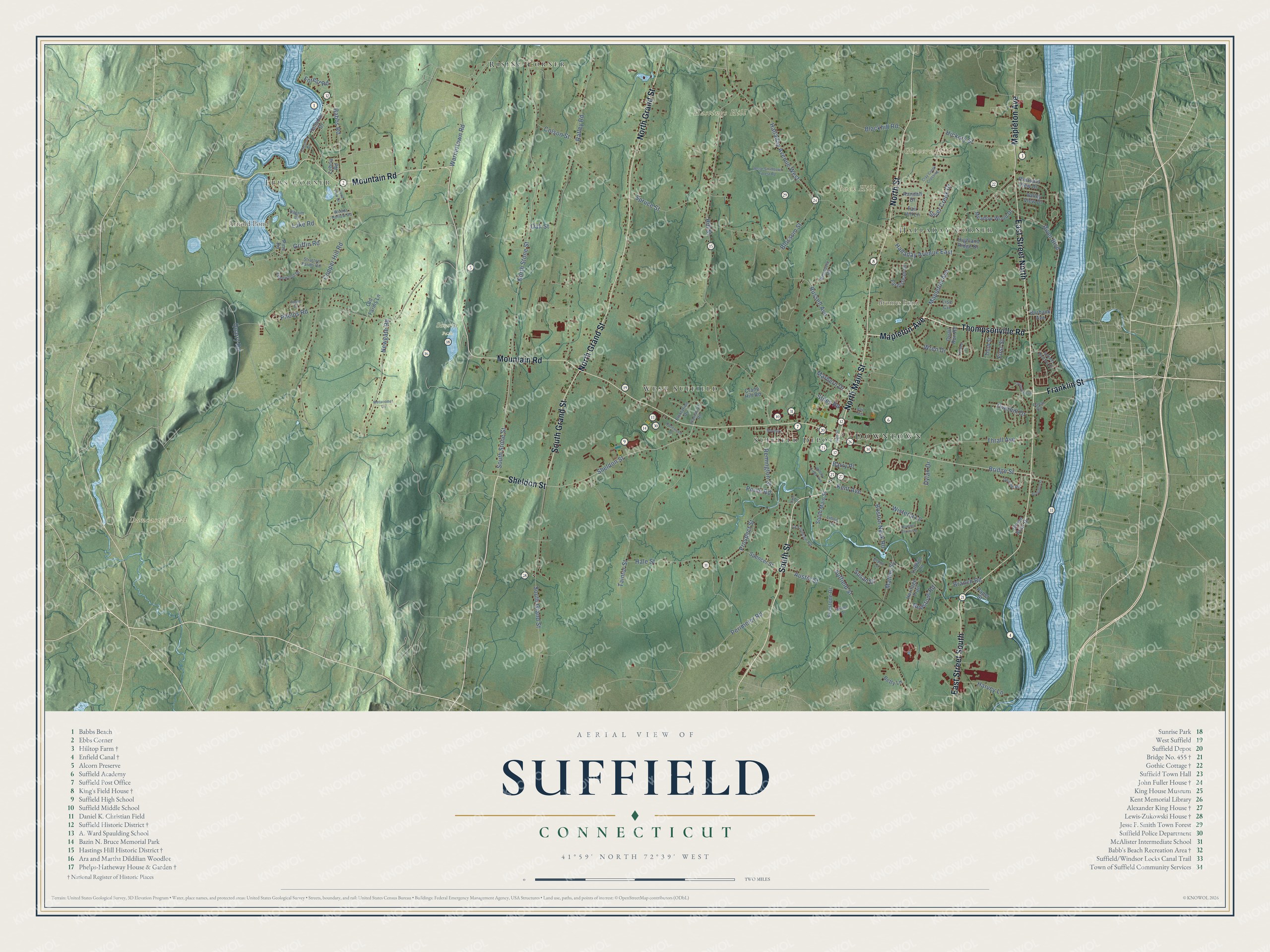
Click to explore a larger preview. The digital watermark does not appear on printed maps.
Names on this map
These names are printed on this map.
Places: Downtown, Ebbs Corner, Buck Hill, Duncaster Hill, Glovers Hill, Hastings Hill, Arnold Pond, Bromes Pond, Sunrise Park, Rising Corner, West Suffield, Halladay Corner and Suffield Depot.
Streets and roads: South Street, North Main Street, Mapleton Avenue, Sheldon Street, Thompsonville Road, East Street North, North Street, East Street South, Mountain Road, North Grand Street, South Grand Street, Franklin Street.
More street names, A to Z
Apple Lane, Audubon Street, Austin Street, Babbs Road, Barry Place, Betty Lane, Blackhill Road, Blossom Street, Boston Neck Road, Branch Road, Bridge Street, Burbank Avenue, Cain Street, Canal Road, Chestnut Circle, Clay Creek Crossing, Colson Street, Copper Hill Road, Crane Hill Road, Day Avenue, Devine Road, Diane Lane, Dylan Drive, Edgewood Drive, Fair Hill Lane, Farmstead Lane, Firestone Drive, First Street, Forest Road, Green Briar Drive, Greendale Drive, Griffin Road, Hale Street, Halladay Avenue East, Halladay Avenue West, Halladay Drive, Harvey Lane, Heritage Trail, Hickory Street, Highland Ridge Drive, High Street, Hill Street, Hunters Crossing, Jesse Smithtown Forest Road, Kent Avenue, Kildeer Lane, La Fountain Road, Lake Road, Latham Lane, Lebria Road, Limric Lane, Lise Circle, Marbern Drive, Mather Street, Maybury, Meadow Wood Drive, Metacomet Lane, Newgate Road, North Stone Street, Oak Street, Old Farms Lane, Overhill Drive, Paper Street, Perimeter Road, Phelps Road, Pilgrim Lane, Pine Road, Plantation Drive, Plantation Road, Pleasant View Drive, Pond View Drive, Poole Road, Prospect Street, Quail Run Road, Quarry Road, Randall Drive, Ratley Road, Redstone Road, Remington Street, River Boulevard, Rosewood Drive, Russell Avenue, Silver Creek Drive, South Main Street, South Stone Street, Spencer Street, Spruce Street, Stiles Road, Stratton Farms Road, Suffield Meadow Drive, Suffield Street, Susan Drive, Taintor Street, Third Street, Thrall Avenue, Valley View Drive, Warnertown Road, Wendover Road, Willow Creek Avenue, Winter Drive, Wisteria Lane, Woods Hollow Road, Wren Drive.
This beautifully detailed map of Suffield makes an attractive addition to your office, library, or den, and it can even be used to teach children the geography and history of the area. It also makes a great gift for anyone with Suffield roots. When you’re done exploring, click here to get your copy of the Suffield map.