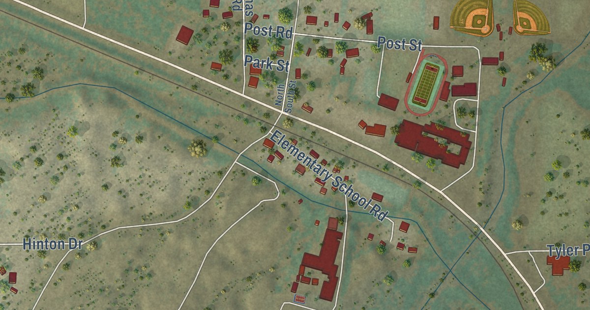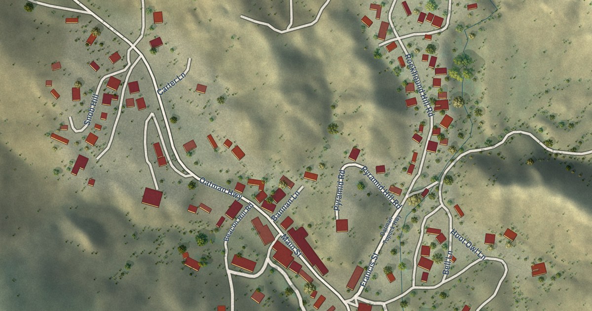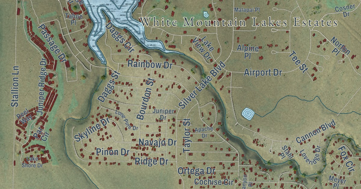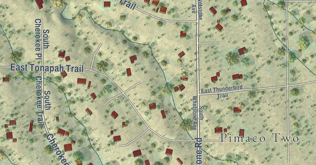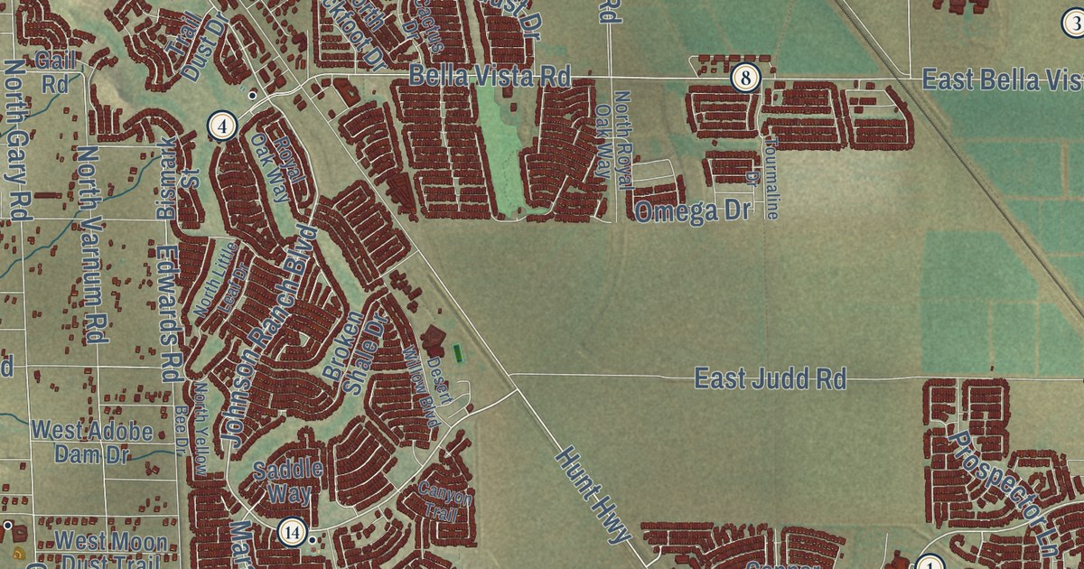
This beautifully detailed map of San Tan Valley, Arizona was created in 2026 using aerial imagery combined with modern topographical, census, street and landmark data. It’s a one-of-a-kind view of San Tan Valley that combines accurate data with a vintage aesthetic. The map shows every building in its true location, many of the roads carry their names, and the shaded topographic relief shows the shape of the land.
See the San Tan Valley, Arizona map on a wall
The San Tan Valley map as an 18 x 24 inch print in a black frame.

Explore an aerial view of San Tan Valley, Arizona
On the map you’ll find Magma and San Tan Mountain Regional Park, along with North Gantzel Road, North Sierra Vista Drive, East Ocotillo Road, Johnson Ranch Boulevard, Gantzel Road, Ironwood Road, Empire Road, Empire Boulevard, East Pima Road, Hunt Highway, and more. If you look closely you can even find your house accurately drawn in its correct location. Zoom in on the preview to look for yours.
Did you know this piece of San Tan Valley, Arizona history?
This Pinal County town took its name from the nearby San Tan Mountains. For years the area had no official name, so residents used Queen Creek mailing addresses. In 2009, a proposed name, Bella Vista, angered some locals. Residents picked San Tan Valley in a public poll instead. Voters approved making it a town in 2025.
Take a closer look at the San Tan Valley map
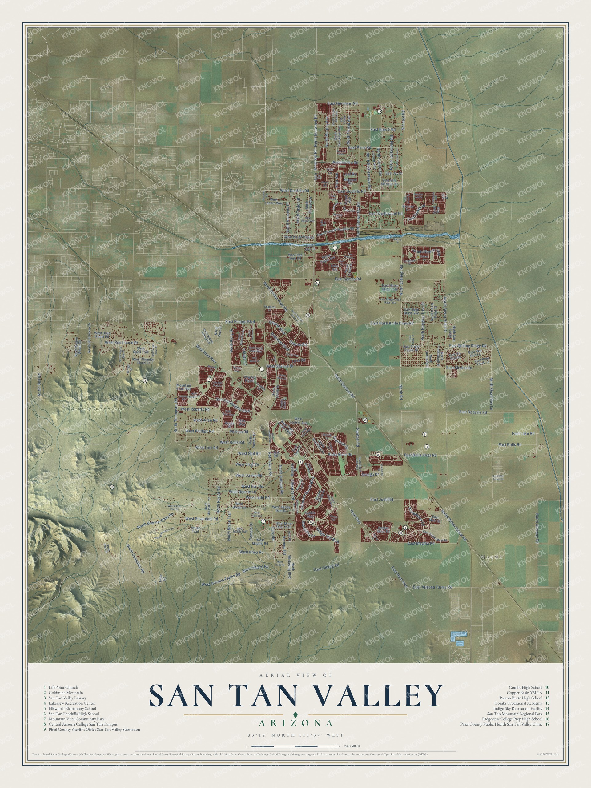
Click to explore a larger preview. The digital watermark does not appear on printed maps.
Street and place names on the San Tan Valley, Arizona map
These names are printed on the map of San Tan Valley, Arizona.
Places: Magma and San Tan Mountain Regional Park.
Streets and roads: North Gantzel Road, North Sierra Vista Drive, East Ocotillo Road, Johnson Ranch Boulevard, Gantzel Road, Ironwood Road, Empire Road, Empire Boulevard, East Pima Road, Hunt Highway, West Ocotillo Road, East Rolling Ridge Road.
More street names, A to Z
Bartlett Way, Bella Vista Road, Bismark Street, Brahman Boulevard, Broken Shale Drive, Cactus Drive, Cambria Drive, Canyon Trail, Cape Wrath Drive, Cassara Drive, Castlegate Boulevard, Charbray Drive, Copper Mine Road, Cresent Road, Desert Basin Drive, Desert Willow Boulevard, Dexter Way, Dustin Avenue, East Arizona Farms Road, East Bella Vista Road, East Bowie Place, East Chandler Heights Road, East Combs Road, East Copper Mine Road, East Empire Boulevard, East Germann Road, East Gila Monster Drive, East Hash Knife Draw Road, East Horse Mesa Trail, East Hunt Highway, East Jeanne Lane, East Joy Drive, East Judd Road, East Lake Road, East Magma Road, East Main Street, East Olberg Road, East Pony Track Lane, East Ranch Road, East Red Bird Lane, East Roberts Road, East Rolls Road, East Sage Brush Avenue, East Skyline Drive, East Southwood Road, East Stagecoach Pass Avenue, East Tee Street, East Triple Crown Drive, East Via Sicilia, East Vis Grande, East Wild Turkey Drive, Edwards Road, Five Mile Peak Drive, Foothills Drive, Friend Avenue, Gail Road, Gary Road, Gold Dust Avenue, Half Moon Circle, Holly Road, Indigo Sky Boulevard, Jodi Drive, Josiah Trail, Kelsi Avenue, Laredo Ranch Loop, Leaf Road, Lizzard Way, Lone Star Lane, Longhorn Street, Love Road, Luke Lane, Magnum Road, Maravillia Drive, Meadow Land Drive, Meridian Road, Mila Way, Mirage Court, Morgan Lane, Mountain Vista Boulevard, North Attaway Road, North Bandolier Drive, North Bell Road, North Blackfoot Drive, North Bonanza Lane, North Brenner Pass Road, North Bryce Trail, North Cam Largo, North Coyote Road, North Donnaloy Road, North Donovan Drive, North Drifter Pass Road, North Ellen Place, North Friend Avenue, North Gary Road, North Ghost Rider Street, North Grande Valley Boulevard, North Hanging Tree Street, North Ironwood Road, North Jackpot Road, North Jackrabbit Road, North Kelly Drive, North Kennedy Drive, North Kenworthy Road, North Larkspur Drive, North Little Leaf Drive, North Marchant Trce, North Murphy Avenue, North Painted Desert Drive, North Pamela Drive, North Peace Pipe Place, North Prince Avenue, North Quail Run Lane, North Rattlesnake Road, North Ritten House Road, North Road, North Royal Oak Way, North Royce Road, North Schnepf Road, North Suburban Avenue, North Taylor Street, North Terrace View Avenue, North Thompson Road, North Tombstone Street, North Valley View Road, North Varnum Road, North Wagon Wheel Road, North Whitewing Boulevard, North Wild Horse Drive, North Yellow Bee Drive, North Zinc Drive, Odessa Drive, Omega Drive, Pamela Drive, Paso Fino Way, Pebble Creek Drive, Pecan Creek Avenue, Pecan Creek Drive, Peggy Drive, Phillips Road, Press Road, Prospector Lane, Quartz Drive, Quick Draw Lane, Rousay Drive, Royal Oak Way, Saddle Way, Salix Drive, San Tan Heights Boulevard, Schnepf Road, Scott Way, Shari Street, Sherry Lane, Stardust Drive, Stirrup Lane, Stone Creek Drive, Tourmaline Drive, Trail Dust Drive, Trica Road, Varnum Road, Vernoa Street, Vidlak Drive, Village Lane, Vine Avenue, Vinyard Plains, Volk Lane, West Adobe Dam Drive, West Adobe Dam Road, West Alexis Lane, West Allen Road, West Arizona Farms Road, West Bonnie Lane, Westbrooke Road, West Butterfield Trail, West Daniel Road, West Dixie Road, West Dixon Lane, West Dove Roost Road, West Gail Road, West Hunt Highway, West Ivar Road, West Josiah Trail, West Judd Road, West Lenora Way, West Lind Road, West Locklin Avenue, West Maggie Drive, West Magma Road, West Marilyn Way, West Moon Dust Trail, West Olberg Road, West Phillips Road, West Quail Trail, West Quick Draw Way, West Red Fern Road, West Rhea Road, West Roberts Road, West Rolls Road, West Silverdale Road, West Skyline Drive, West Sun Dance Drive, West Thunder Cloud Drive, West Twin Peaks Parkway, West Via de Palmas, West Virgil Drive.
This beautifully detailed map of San Tan Valley makes an attractive addition to your office, library, or den, and it can even be used to teach children the geography and history of the area. It also makes a great gift for anyone who grew up in San Tan Valley or moved away. When you’re done exploring, click here to get your copy of the San Tan Valley map.