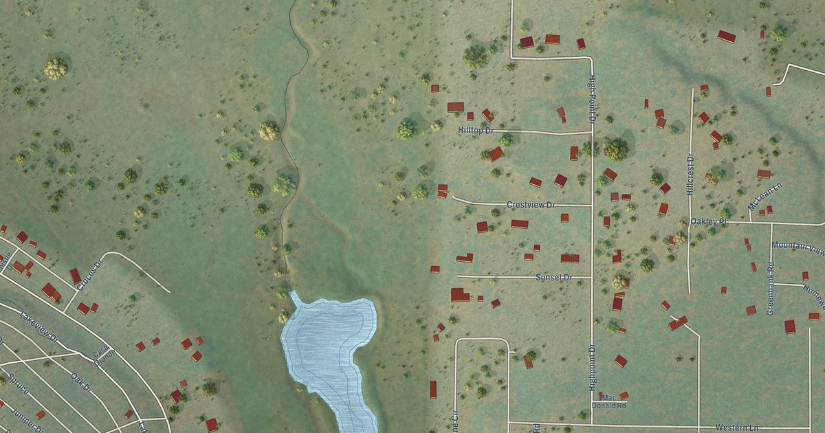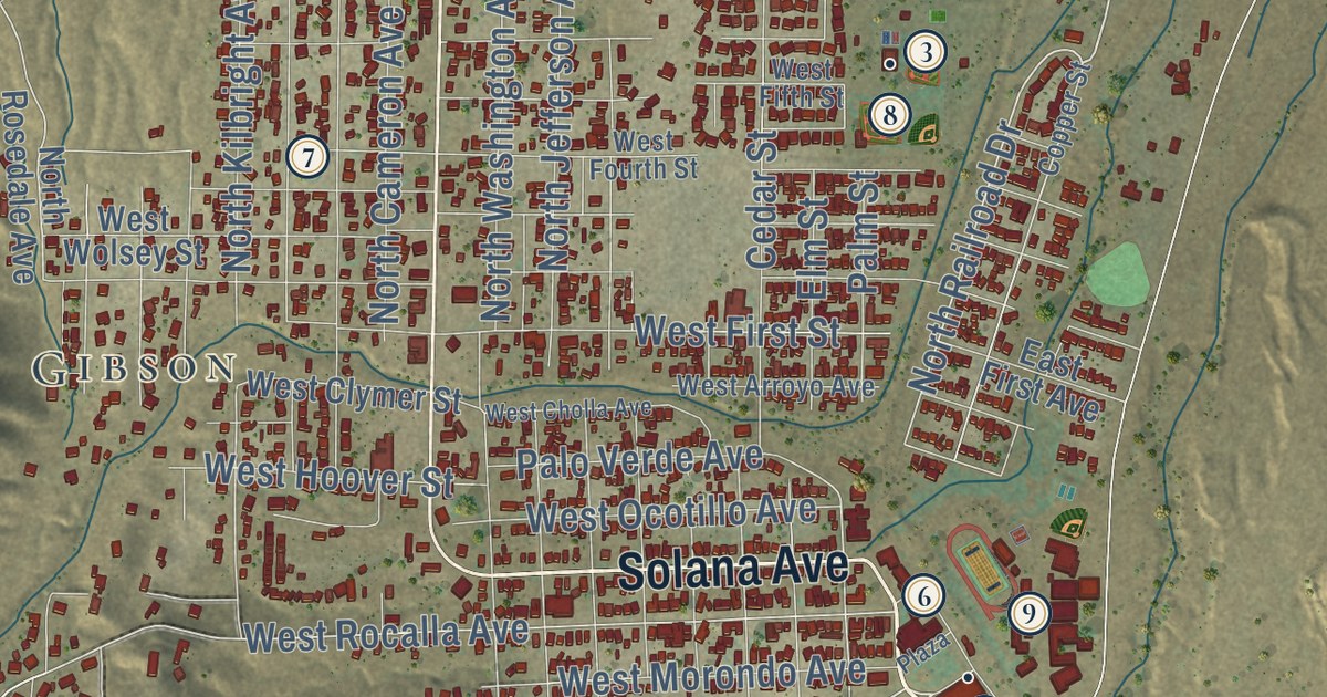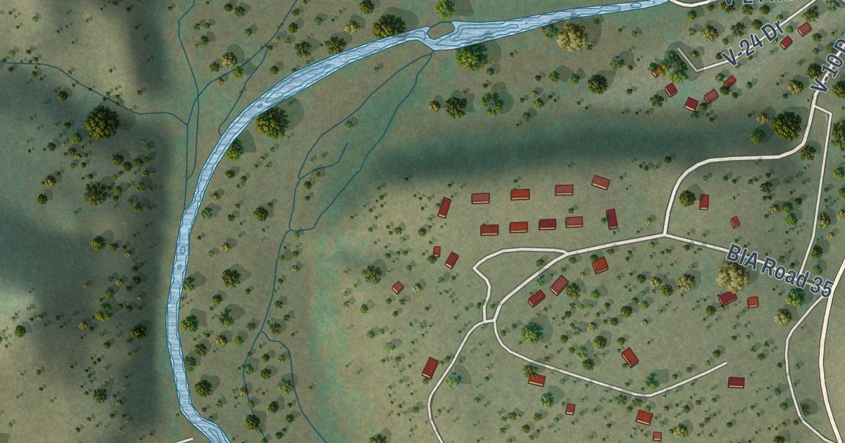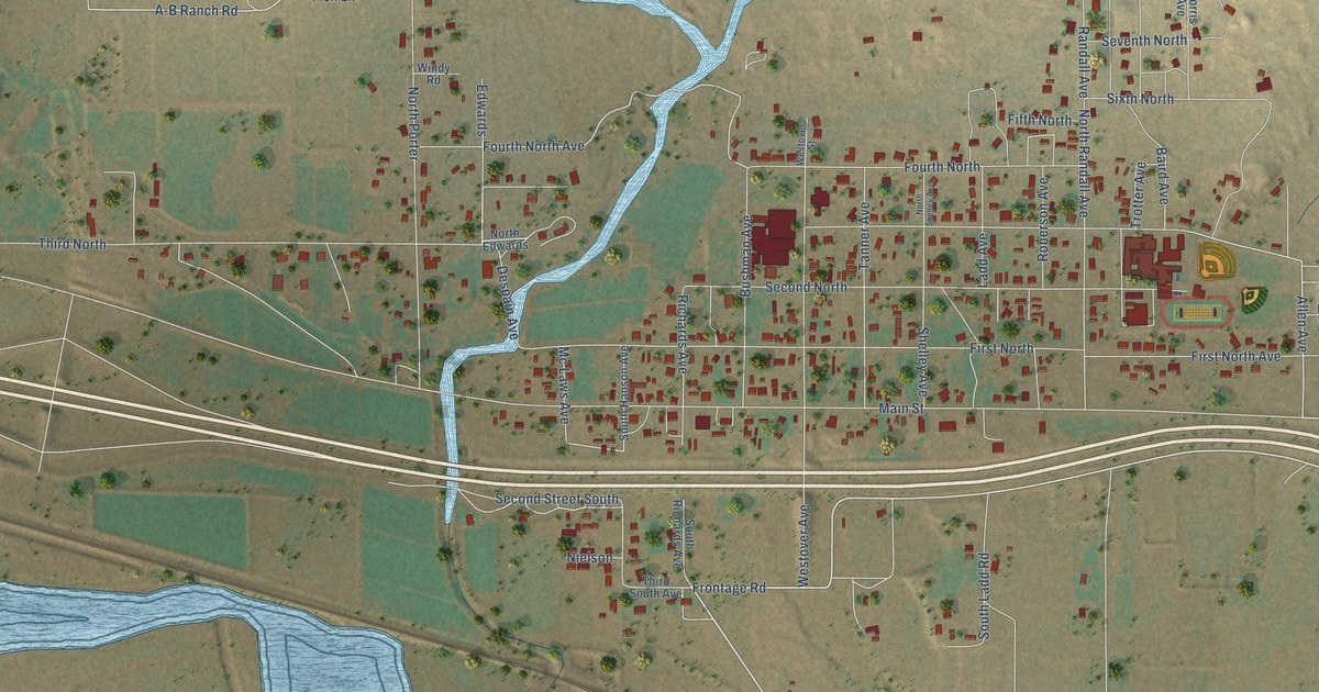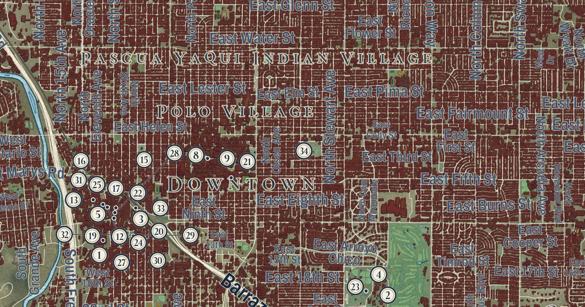
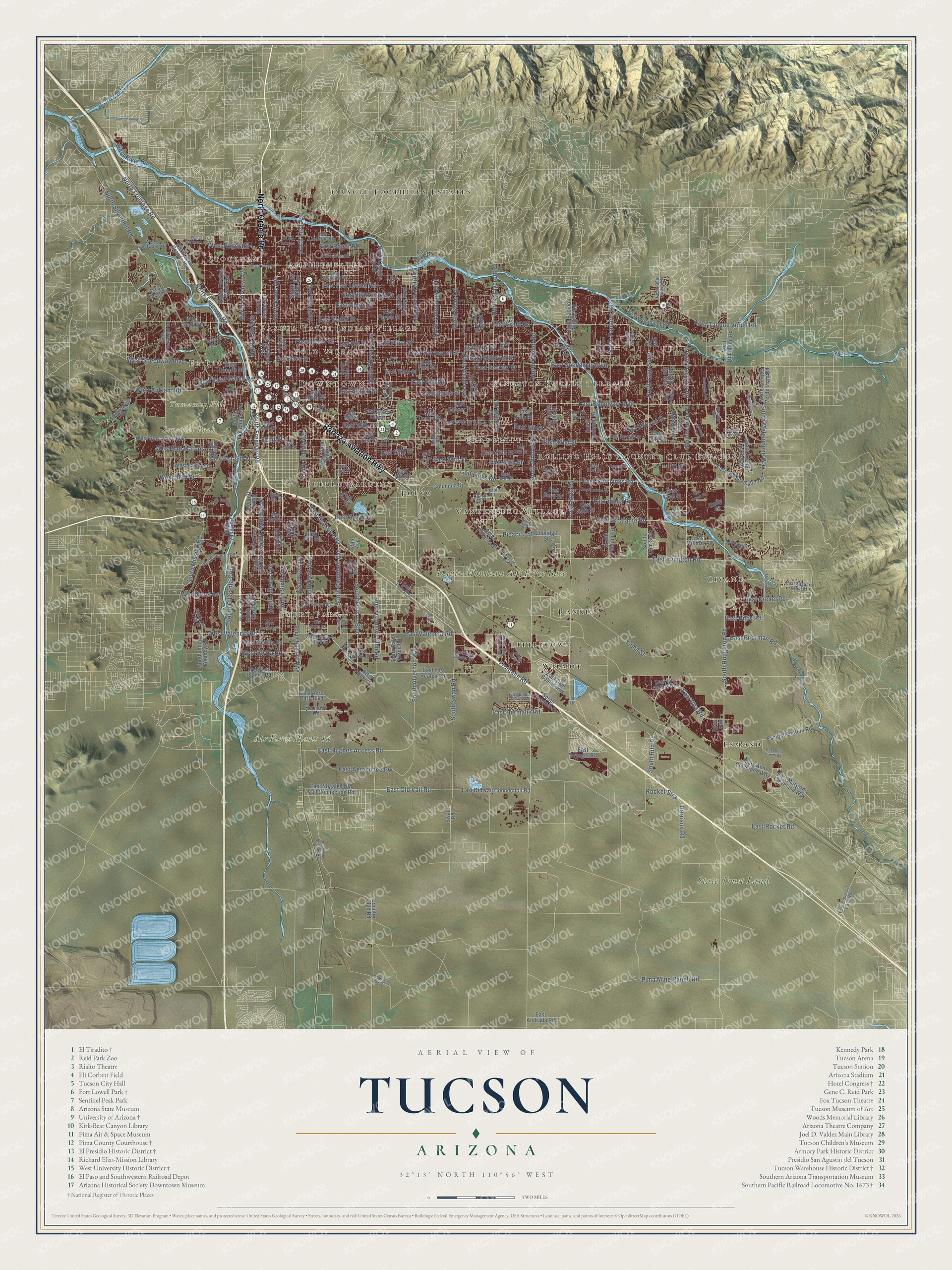
This beautifully detailed map of Tucson, Arizona was created in 2026 using aerial imagery combined with modern topographical, census, street and landmark data. It’s a one-of-a-kind view of Tucson that combines accurate data with a vintage aesthetic. The map shows every building in its true location, many of the roads carry their names, and the shaded topographic relief shows the shape of the land.
See the Tucson, Arizona map on a wall
The Tucson map as an 18 x 24 inch print in a black frame.

Explore an aerial view of Tucson, Arizona
On the map you’ll find Downtown, Stockham, Amphitheater, Pascua Yaqui Indian Village, El Rio, Sentinel Peak, Tumamoc Hill, State Trust Land, Davis-Monthan Air Force Base, Air Force Plant 44, Rolling Hills Country Club Estates, Littletown, and more. If you look closely you can even find your house accurately drawn in its correct location. Zoom in on the preview to look for yours.
Did you know this piece of Tucson, Arizona history?
The city began in 1775 as a Spanish fort, Presidio San Agustin del Tucson, ordered by Hugo O’Conor. Its name comes from an O’odham phrase meaning the base of the hill is black. It refers to basalt rock on what is now Sentinel Peak. From 1867 to 1877, Tucson was the capital of Arizona Territory.
Take a closer look at the Tucson map
Click to explore a larger preview. The digital watermark does not appear on printed maps.
Street and place names on the Tucson, Arizona map
These names are printed on the map of Tucson, Arizona.
Places: Downtown, Stockham, Amphitheater, Pascua Yaqui Indian Village, El Rio, Sentinel Peak, Tumamoc Hill, State Trust Land, Davis-Monthan Air Force Base, Air Force Plant 44, Rolling Hills Country Club Estates, Littletown, Esmond, Emery Park, Oracle Foothills Estates, Civano, Polvo, Craycroft, Kingston Knolls Terrace, Vandenberg Village, Rankin, Pueblo Gardens, Polo Village and Wilmot.
Streets and roads: Barraza Aviation Highway, North Oracle Road, South Houghton Road, East 22nd Street, South Wilmot Road, East Speedway Boulevard, East Broadway Boulevard, East Valencia Road, East Old Vail Road, East Irvington Road, South Country Club Road, East Fifth Street.
More street names, A to Z
22nd Street, Alamo Avenue, Anizola Road, Cll del Arizona, Columbia Drive, Coolidge Street, Country Club Road, Day Road, East 13th Street, East 14th Street, East 15th Street, East 16th Street, East 17th Street, East 18th Street, East 20th Street, East 21st Street, East 23rd Street, East 24th Street, East 25th Street, East 26th Street, East 28th Street, East 29th Street, East 30th Street, East 31st Street, East 33rd Street, East 34th Street, East 35th Street, East 42nd Street, East 45th Street, East Aero Park Boulevard, East Aerospace Pw, East Airport Drive, East Ajo Way, East Allen Road, East Alvord Road, East Andrada Road, East Arroyo Chico, East Bellevue Street, East Benson Highway, East Beverly Street, East Bilby Road, East Blacklidge Drive, East Burns Street, East Cam Boleadoras, East Cll Arturo, East Cll del Estate, East Cll Luna, East Cody Street, East Colossal Cave Road, East Cooper Street, East Creek Street, East Deer Trail, East Diablo Sunrise Road, East Drexel Road, East Eighth Street, East Elida Street, East Eli Street, East Elm Street, East Elvira Road, East Escalante Road, East Fairmount Street, East Fair Street, East Fairy Duster Drive, East Felix Boulevard, East First Street, East Flower Street, East Fort Lowell Road, East Ginter Road, East Glenn Street, East Golf Links Road, East Grant Road, East Helen Street, East Hermans Road, East Hughes Access Road, East Kenyon Drive, East Kleindale Road, East La Palma Drive, East Lee Street, East Lester Street, East Limberlost Drive, East Los Reales Road, East Lurlene Drive, East Mary Ann Cleveland Way, East Mary Drive, East Millmar Road, East Ninth Street, East Nogales Old Vail Connection Road, East Old Spanish Trail, East Old Vail Connection Road, East Pima Street, East Poorman Road, East Rita Ranch Road, East Rita Road, East River Road, East Rocket Road, East Roger Road, East Saguaro Crest Place, East Second Street, East Sellarole Street, East Stella Road, East Super Sabre Drive, East Tanque Verde Road, East Third Street, East Timrod Street, East Voyager Road, East Water Street, East Woodland Road, Emily Drive, Entry, Esmond Station Road, Fifth Street, Frontage Road, Golf Links Road, Hadar Street, Harrison Road, Hermans Road, Ibm Road, Keystone Road, Lind Road, Los Santos, Lucinda Drive, Mary Ann Cleveland Way, Melpomene Way, North 15th Avenue, North Alvernon Way, North Arcadia Avenue, North Bear Canyon Road, North Bonanza Avenue, North Cam Miramonte, North Cam Seco, North Casa Grande Highway, North Columbus Boulevard, North Country Club Road, North Craycroft Road, North Eleventh Avenue, North Fairview Avenue, North First Avenue, North Flowing Wells Road, North Freeway Road, North Frontage Road, North Gollob Road, North Grady Avenue, North Greasewood Road, North Harrison Road, North Houghton Road, North Igo Way, North Kolb Road, North Los Altos Avenue, North Olsen Avenue, North Pantano Road, North Park Avenue, North Richey Boulevard, North Ridgeside Drive, North Rosemont Boulevard, North Sabino Canyon Road, North Sarnoff Drive, North Silverbell Road, North Sixth Avenue, North Stewart Avenue, North Stone Avenue, North Swan Road, North Tanque Verde Loop Road, North Wilmot Road, North Wyatt Drive, Old Nogales Highway, Otis Drive, Picacito Street, Pima Mine Ranch Road, Ramsgate Road, Rees Loop, Research Loop, Rocket Stra, Safford Street, South 13th Avenue, South 15th Avenue, South 16th Avenue, South Aleppo Drive, South Alvernon Way, South Avenue Los Reyes, South Brown Avenue, South Campbell Avenue, South Cam Seco, South Cll Pinta, South Cll Santa Cruz, South Columbus Boulevard, South Cottonwood Lane, South Craycroft Road, South Egret Drive, South Euclid Avenue, South First Avenue, South Freedom Drive, South Freeway Road, South Grande Avenue, South Harrison Road, South Indian Agency Road, South Irving Avenue, South Kino Parkway, South Kolb Road, South Leland Road, South Liberty Avenue, South Mann Avenue, South Melpomene Way, South Mission Road, South Naco Vis, South Nogales Highway, South Oak Tree Drive, South Old Nogales Highway, South Palo Verde Road, South Pantano Road, South Park Avenue, South Phoenix Street, South Players Club Drive, South Plumer Avenue, South Prudence Road, South Rita Road, South San Antonio Drive, South Santa Clara Avenue, South Sears Boulevard, South Seventh Avenue, South Sixth Avenue, South Swan Road, South Third Avenue, South Tucson Boulevard, South Twelfth Avenue, South Valley Road, South Van Buren Avenue, State Avenue, Swan Road, West 18th Street, West 29th Street, West 36th Street, West 44th Street, West Ajo Way, West Anklam Road, West Drexel Road, West Drive, West El Rio Drive, West Elvira Road, West Fresno Street, West Gardner Lane, West Goret Road, West Grant Road, West Hatfield Street, West Irvington Road, West King Avenue, West Los Reales Road, West Medina Road, West Ontario Street, West Prince Road, West River Road, West Roger Road, West Saint Marys Road, West San Marcos, West Speedway Boulevard, West Starr Pass Boulevard, West Sweetwater Drive, West Valencia Road, Yuma Street.
This beautifully detailed map of Tucson makes an attractive addition to your office, library, or den, and it can even be used to teach children the geography and history of the area. It also makes a great gift for anyone who grew up in Tucson or moved away. When you’re done exploring, click here to get your copy of the Tucson map.