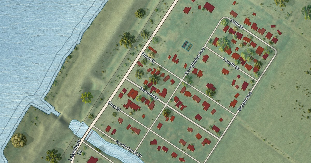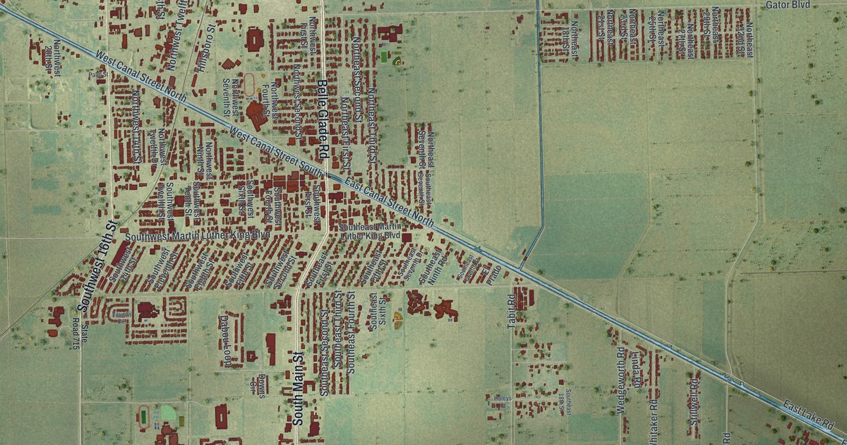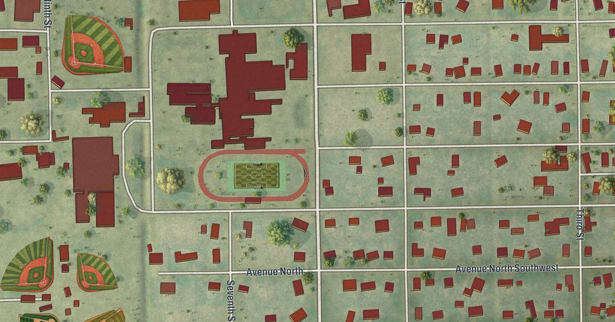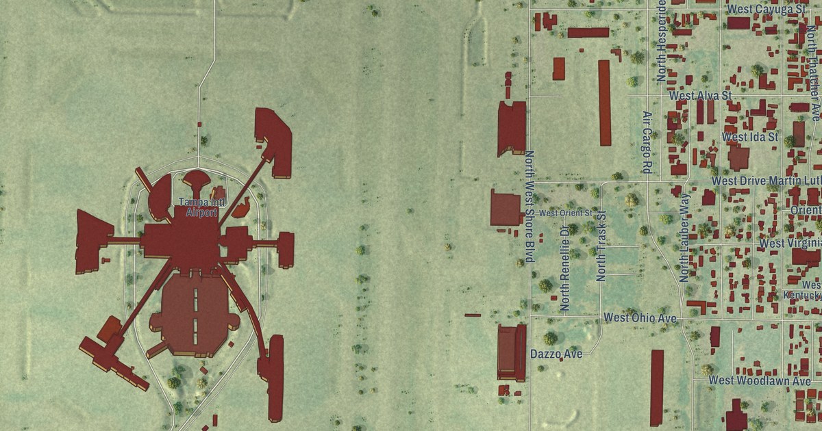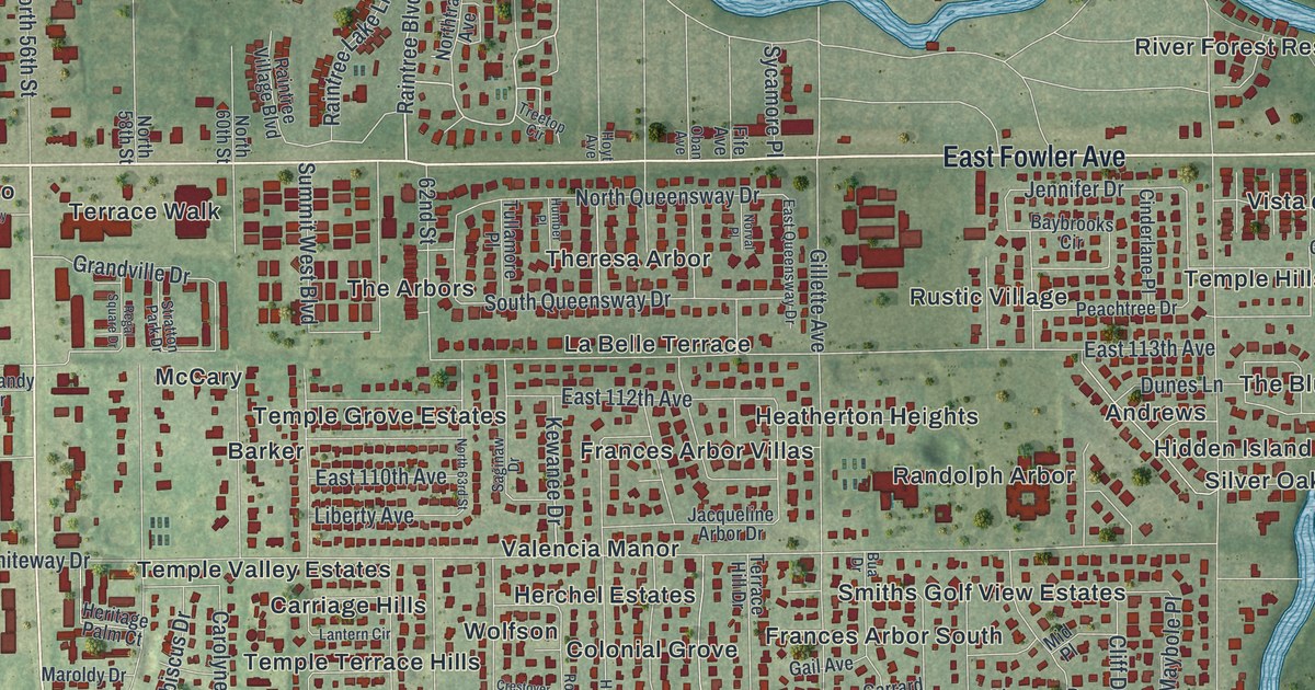
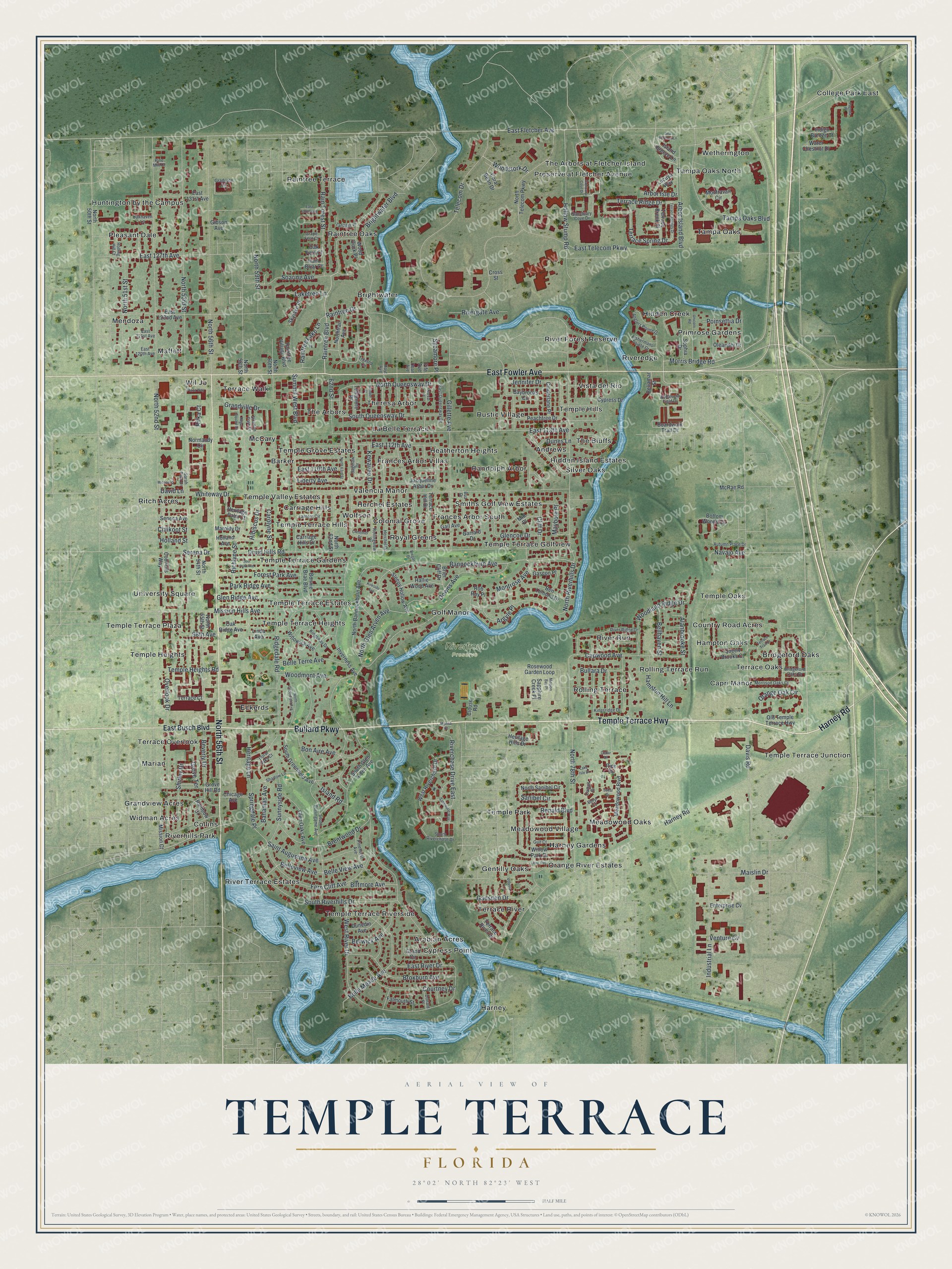
This beautifully detailed map of Temple Terrace, Florida was created in 2026 using aerial imagery combined with modern topographical, census, street and landmark data. It’s a one-of-a-kind view of Temple Terrace that combines accurate data with a vintage aesthetic. The map shows every building in its true location, many of the roads carry their names, and the shaded topographic relief shows the shape of the land.
Explore an aerial view of Temple Terrace, Florida
On the map you’ll find Andrews, Arabian Acres, Barker, Bridgeford Oaks, Brightwater, and Riverfront Preserve, along with Temple Terrace Highway, Bullard Parkway, Harney Road, Fowler Avenue, Busch Boulevard, and more. If you look closely you can even find your house accurately drawn in its correct location. Zoom in on the preview to look for yours.
Did You Know?
Temple Terrace was named for the Temple orange, a new hybrid at the time. That fruit honored William Chase Temple, who once owned the Pittsburgh Pirates and led the Florida Citrus Exchange. The word terrace came from the stepped land by the river. This was the first place in America to grow Temple oranges in large numbers.
Take a closer look at the Temple Terrace map
Names on this map
These names are printed on this map.
Places: Riverfront Preserve, Andrews, Arabian Acres, Barker, Bridgeford Oaks, Brightwater, Capri Manor, Carriage Hills, College Park East, Collins, Colonial Grove, Country Road Acres, Cypress Point, Eckerds, Frances Arbor South, Frances Arbor Villas, Gentilly Oaks, Golf Manor, Grandview Acres, Hampton Oaks, Harney, Harney Gardens, Heatherton Heights, Herchel Estates, Hidden Creek, Hidden Island Estates, Huntington by the Campus, La Belle Terrace, Maffett, Marian, McCary, Meadowood Oaks, Meadowood Village, Mendoza, Orange River Estates, Pleasant Dale, Preserve at Fletcher Avenue, Primrose Gardens, Raintree Oaks, Raintree Terrace, Randolph Arbor, Ritch Acres, River Forest Reserve, River Run, River Terrace Estates, Riveredge, Riverhills Park, Rolling Terrace, Rolling Terrace Run, Royal Greens, Rustic Village, Silver Oaks, Smiths Golf View Estates, Tampa Oaks, Tampa Oaks North, Temple Grove Estates, Temple Heights, Temple Hills, Temple Oaks, Temple Park, Temple Terrace Estates, Temple Terrace Gardens, Temple Terrace Golfview, Temple Terrace Heights, Temple Terrace Hills, Temple Terrace Junction, Temple Terrace Plaza, Temple Terrace Riverside, Temple Valley Estates, Terrace Oaks, Terrace Overlook, Terrace River, Terrace Walk, The Arbors, The Arbors at Fletcher Island, The Bluffs, Theresa Arbor, University Square, Valencia Manor, Vista del Rio, Wetherington, Widman Acres, Wil Jo and Wolfson.
Streets and roads: Temple Terrace Highway, Bullard Parkway, Harney Road, East Fowler Avenue, North 56th Street, Morris Bridge Road, Arbor Isle Drive, Raintree Boulevard, Raintree Drive, Serena Drive, North 52nd Street, North 78th Street.
More street names, A to Z
62nd Street, 98th Avenue, Alanbrooke Street, Andalucia Field Drive, Anglers Pointe Drive, Arbor Island Boulevard, Argyle Place, Autumn Place Drive, Bahamas Avenue, Bannockburn Avenue, Baybrooks Circle, Bellamar Street, Belle Meade Avenue, Belle Terre Avenue, Belle View Avenue, Belleview Avenue, Bellhaven Street, Ben Lomond Drive, Berwick Avenue, Beverly Drive, Biltmore Avenue, Boardwalk Trail Drive, Bon Aire Avenue, Bonnie Brae Boulevard, Bottom Woods Circle, Bregar Drive, Brentwood Drive, Bridgeford Oaks Drive, Brier Cliff Drive, Brightwater Boulevard, Broxburn Avenue, Bua Drive, Bullara Drive, Buryl Court, Capwood Avenue, Carolyne Street, Carriage Hills Drive, Cattail Drive, Cedar Drive, Chicago Avenue, Chilkoot Street, Cinderlane Place, Cliff Drive, Clouse Road, Coral Bean Drive, Councils Way, Courtney Drive, Crestover Drive, Cross Street, Cypress Drive, David Lane, Davis Road, Deer Park Avenue, Donald Place, Doral Oaks Court, Downs Avenue, Druid Hills Road, Dunedin Avenue, Dunes Lane, East 110th Avenue, East 112th Avenue, East 113th Avenue, East 120th Avenue, East 121st Avenue, East 122nd Avenue, East 127th Avenue, East 130th Avenue, East 131st Avenue, East Busch Boulevard, East Fletcher Avenue, East Queensway Drive, East River Drive, East Telecom Parkway, Enterprise Cv, Falmouth Street, Fern Cliff Avenue, Fife Avenue, Fishermans Pointe Drive, Forest Park Avenue, Gadsden Drive, Gail Avenue, Garrard Drive, Gascon Place, Gibson Avenue, Gillette Avenue, Glencoe Drive, Glen Oaks Avenue, Glen Ridge Avenue, Graduate Circle, Grand Circle, Grandville Drive, Grape Fern Court, Grove Hill Road, Grove Terrace, Gulf Court, Hallie Wood Avenue, Hamilton Hill Lane, Herchel Drive, Heritage Hills Drive, Heritage Lane, Heritage Palm Court, Hibiscus Drive, Holland Avenue, Holland Street, Hollow Stump Road, Hoyt Avenue, Humber Place, Indigo Breeze Court, Industrial Lane, Inverness Avenue, Island Breeze Lane, Island Road, Jacqueline Arbor Drive, Jennifer Drive, Kewanee Drive, Kingsridge Drive, Kingsway Drive, Kirkside Avenue, Lake Isle Drive, Laketree Lane, Lantern Circle, Leon Avenue, Liberty Avenue, Linda Avenue, Lucuya Way, Maislin Drive, Marisa Court, Maroldy Drive, Maybole Place, McRae Road, Meadowood Boulevard, Michael Drive, Mid Place, Mission Bay Place, Mission Court, Mission Hills Avenue, Montravail Circle, Montrose Avenue, Morrison Oaks Court, Navajo Avenue, Normandy Circle, North 50th Street, North 51st Street, North 53rd Street, North 54th Street, North 55th Street, North 58th Street, North 59th Street, North 60th Street, North 62nd Street, North 63rd Street, North Bannockburn Avenue, North Glen Arven Avenue, North Greenfield Avenue, North Queensway Drive, North Riverhills Drive, North Sanibel Circle, North Telecom Parkway, Northtrail Avenue, Norval Place, Oak Fern Court, Oakhaven Lane, Oak Ridge Avenue, Oban Avenue, Old Temple Terrace Highway, Oleander Drive, Orange Oak Circle, Overlook Drive, Pagoda Place, Park Ridge Avenue, Peachtree Drive, Pine Drive, Pinehurst Avenue, Pine Mill Court, Plaza Way, Poinsettia Drive, Queen Brooks Court, Rainbow Drive, Rain Briar Court, Rain Forest Street, Raintree Lake Lane, Raintree Village Boulevard, Regal Square Drive, Renald Boulevard, Richlyne Street, Ridgedale Road, Rifka Court, Riverchase Drive East, Rivergate Avenue, River Ridge Drive, Rob Roy Place, Rolling Hill Court, Rollingview Drive, Rosewood Garden Loop, Sabal Drive, Saginaw Drive, Saint Augustine Avenue, Sanctuary Cove Drive, Sanibel Circle, Santuary Cove Drive, Sapphire Creek Place, Sarah Park Drive, Satinwood Way, Sea Harbour Lane, Seneca Avenue, Shadow Lane, Shirley Drive, Skylake Place, Sleepy Hollow Avenue, Soaring Avenue, Sophia Drive, South Burlingame Avenue, South Glen Arven Avenue, South Greenfield Avenue, South Queensway Drive, South Riverchase Drive, South Riverhills Drive, Springdale Place, Stratton Park Drive, Summit West Boulevard, Sunnyside Road, Sycamore Place, Tampa Oaks Boulevard, Tanager Place, Telecom Drive, Temple Heights Road, Terrace Brook Place, Terrace Court, Terrace Hill Drive, Terrace Ridge Drive, Terrace River Drive, Terrace Spring Drive, Terrace Springs Drive, Terrace Trail Lane, Treetop Circle, Tullamore Place, Unicorn Road, Venture Cv, Volusia Place, Water Chestnut Drive, West Riverchase Drive, West River Drive, Whiteway Drive, Willowick Avenue, Willow Park Drive, Wood Duck Place, Woodland Ridge Drive, Woodmont Avenue, Woodstork Drive.
See it on a wall
The Temple Terrace map as a framed print. Swipe for more.


This beautifully detailed map of Temple Terrace makes an attractive addition to your office, library, or den, and it can even be used to teach children the geography and history of the area. It also makes a great gift for someone who left Temple Terrace and still calls it home. When you’re done exploring, click here to get your copy of the Temple Terrace map.