If you grew up in Galeton, went to school here, or still have family on the streets south of the bridge, this map shows the whole town close enough to pick out houses. It's a modern aerial view of Galeton, a borough in Potter County, Pennsylvania, drawn from modern data with a vintage artistic feel. Two streams come together in the middle of town in a wide stretch of pale blue, nearly 600 buildings are marked in red, and the green hills rise on both sides of the valley. Explore the print options for Galeton.
Bridge Street, West Main Street and Germania Street
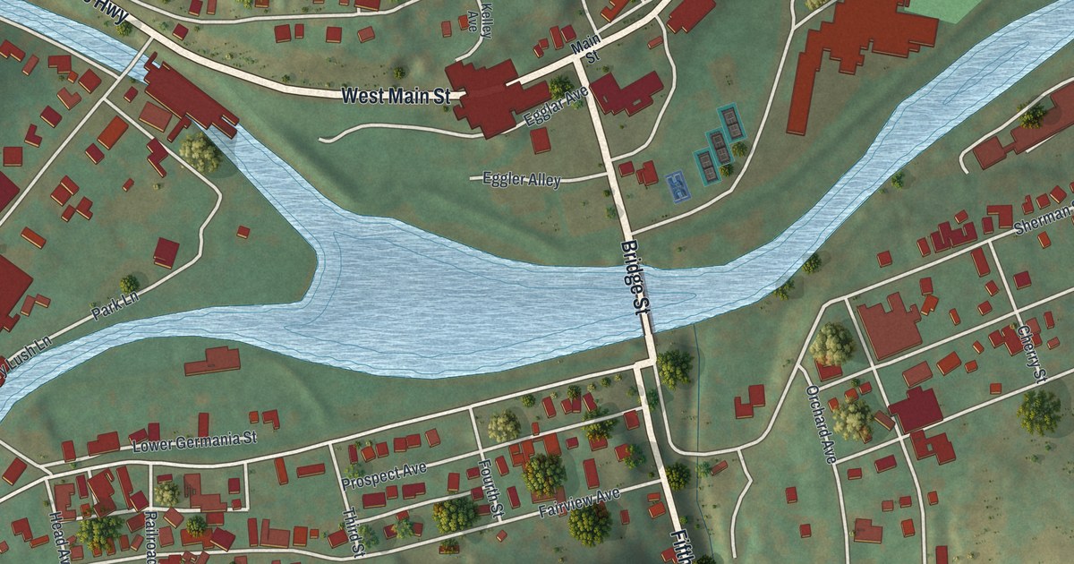
Start on Bridge Street, in the middle of the sheet, where it crosses the water. On the north bank it meets West Main Street, which also carries the Grand Army of the Republic Highway label and runs west along the creek toward the top left. East Main Street heads the other way, past a ball field and a cluster of large red buildings, and School Street, High Street and North Street climb the slope just above. Now cross to the south side. Bridge Street turns into Fifth Street and runs straight down to the bottom edge. West of it, Lower Germania Street, Prospect Avenue and Second Street fill in the blocks, and Germania Street follows the water off to the southwest. East of it, Sherman Street, Pine Street and Valley View Lane reach toward the hills. West Hill Cemetery is up the slope on the left side of the sheet. Many of the streets are labeled and each red shape is a house or other building, so zoom in on the preview and look for yours.
The streams aren't labeled, but they shape the whole town. One comes in from the top left and one from the bottom left, and they spread into a wide stretch of blue just west of Bridge Street before heading east out of the sheet. Main Street and a few hillside streets hold the north bank, and the tighter grid sits on the south side. The scale bar is a quarter mile, so this is a close view, and single houses are easy to count.
Galeton turns up in the life stories printed in an 1890 county history. One of them belongs to J.O. Edgcomb. He was born in Maine in 1846 and came to Potter County at seventeen. He worked in the lumber business on Kettle Creek until 1880. That year he moved to Galeton, and by 1890 he ran the Ansley House, a hotel the history calls "noted for the excellency of its cuisine."
For Galeton families on both sides of Bridge Street
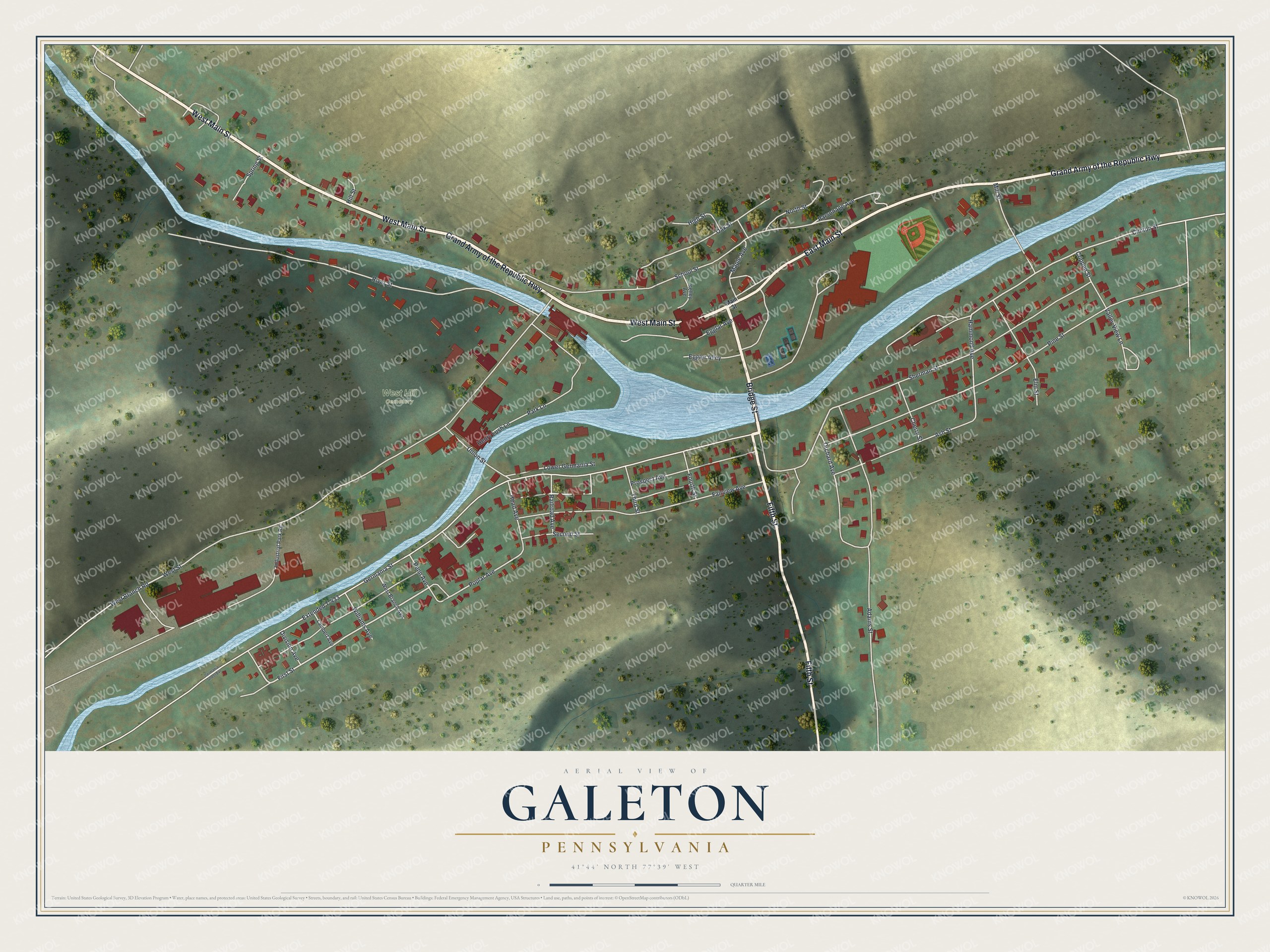
Created by KNOWOL in 2026, this Galeton map fits a kitchen, a front hall or an office. Streets come from Census Bureau records, and the hillsides are shaded from USGS elevation data. The title panel reads "Aerial View of Galeton, Pennsylvania," with the coordinates 41°44' North, 77°39' West and a quarter-mile scale bar.
It's the kind of gift that works for someone who grew up in Galeton and moved away, or whose parents still live in town. Open the preview, zoom in and find the house you know. Shop the Galeton, Pennsylvania map.