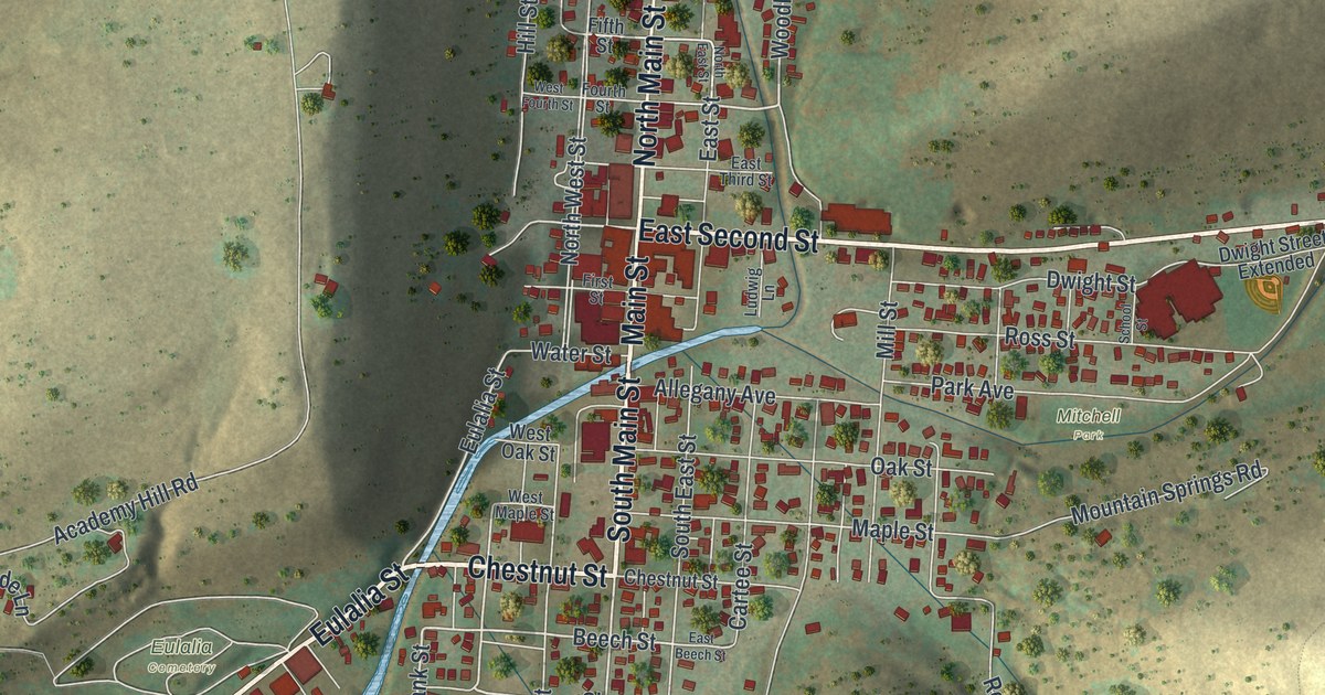
If you grew up in Coudersport, went to school here, or still drive past the courthouse on East Second Street, this map shows your town street by street. It's a modern aerial view of Coudersport, the county seat of Potter County, Pennsylvania, made from modern data and finished with a vintage feel. About 1,400 buildings are marked in red, the river winds through town in pale blue, and steep green hills close in on every side. Explore the print options for Coudersport.
Main Street, Cartee Street and East Second Street to Lymansville
Start at the corner of Main Street and East Second Street, in the middle of town. North Main Street heads up the valley past Sixth Street to Reese Hollow Road, where Alliance Avenue, Metzger Street and Abbott Street make a small grid near the top of the sheet. Just south of Second Street, South Main Street crosses the river, which isn't labeled, and runs down through a stack of tree-name streets: Chestnut, Beech, Cherry, Pine, Spruce and Locust. Two blocks east of South Main, past South East Street, Cartee Street runs from Allegany Avenue down to Chestnut Street. Back at the corner, follow East Second Street east past Mitchell Park and out along the valley to Lymansville, where it crosses Buffalo Street. Going the other way, Eulalia Street follows the river southwest and becomes Port Allegany Road, with the Eulalia Cemetery label up the slope. A lot of the streets are labeled and each red shape is a building, so zoom in on the preview and find your block.
Coudersport started small. In 1828, according to an 1890 history of the county, there were just three families in town: the Hinckles, Timothy Ives's family and the Cartees. That year the Cartee House was made a polling place. A pane of glass was taken out of one of its windows, and the voters' tickets were passed through the gap. Cartee Street is on the map today, two blocks east of South Main.
Lymansville, out East Second Street where it crosses Buffalo Street, has a story of its own. A state historical marker says Major Isaac Lyman, a land agent and Revolutionary officer, made the pioneer settlement there in 1808, and the first saw and grist mill, post office and court were there too. On March 20, 1834, a tornado came through, and Burrel Lyman wrote seven verses about it, which were printed in Hiram Payne's Forester at Smethport. One verse says the mill pond was thrown "full forty rods" and that big logs "were rolled to and fro like cobs on a floor."
Potter County's seat, from North Main Street to Lymansville
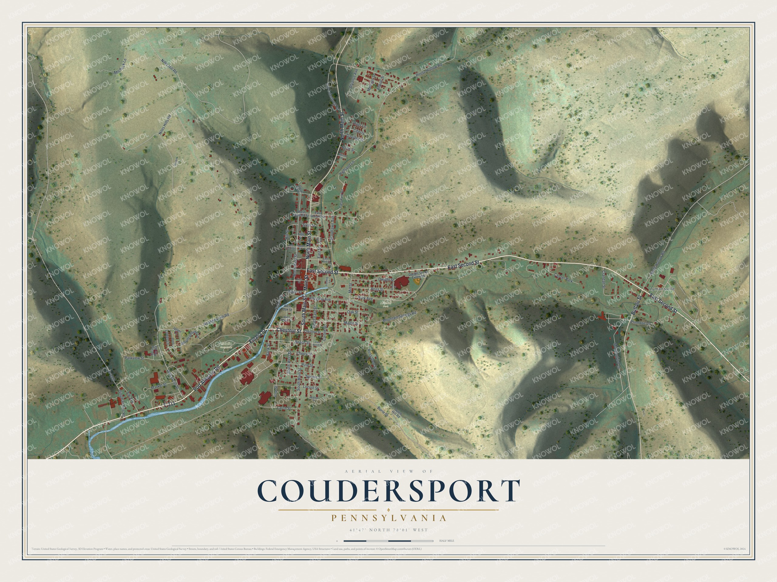
Created by KNOWOL in 2026, this map of Coudersport looks at home in a living room, a law office or a den. The street lines come from Census Bureau records, and the steep hills around town are shaded from USGS elevation data. The title panel reads "Aerial View of Coudersport, Pennsylvania," with the coordinates 41°47' North, 78°01' West and a half-mile scale bar.
It's a natural gift for someone who grew up in Coudersport and moved away for school or work, or who still has family on one of these streets. Open the preview, zoom in and find the block you know. Shop the Coudersport, Pennsylvania map.